Plastics in Paradise – Chantry Flats’ New Generation of Litterbugs

Posted on August 23, 2012 – Written by Chris Kasten

While out on a hike on the Upper Falls Trail just this last week, I happened upon more plastic refuse than usual.  Plastic water bottles and food packaging seem to be on the increase in and around the pools just above Sturtevant Falls.  It’s really getting crazy.  Sadly crazy.  What amazes me is that we’re not talking about the immediate trailhead and turnouts up and down the Chantry Road, this area is nearly two miles in from Chantry Flats.  To be a litterbug  this far in takes motivation.  Where is the disconnect in some people’s  thoughts to leave trash like this?

Trash along the Upper Winter Creek Trail, Big Santa Anita Canyon. This scene is just above Sturtevant Falls.

The Angeles National Forest’ annual operating budget continues to diminish as the years go by.  The entire U.S. Forest Service, an agency within the U.S. Dept. of Agriculture, is feeling the budget crunch across the country.  Essentially, the Angeles is a recreational forest, with no timber harvesting and very little mining going on.  The majority of funding received by this forest goes to fire suppression.  I recently saw a statistic up at the Big Pines Visitor Center that cited 96% of all fires that start on the Angeles are in some way caused by people.  I’m assuming that the remaining 4% is started by lightning, which primarily strikes in the high country areas of the San Gabriel mountains.  So, with that, the administrative emphasis will continue to be centered on reducing fire risks (hazard reduction) and responding to fire starts.

Plastic bottles floating in a pool just above Sturtevant Falls.

What’s left of budget, then,  is a thin slice of funding for recreation.  USFS staff assigned to maintaining and developing recreation sites are few and far between.  In fact, it would be fair to say that those staff continue to have larger and larger territories of the Angeles to maintain.  Taking care of campgrounds, picnic areas and trailheads has become daunting in the last couple of decades.  And while budgets for paid staff continue to fall, forest users continue to increase in number.  Day use in the Chantry Flat Recreation Area continues to climb and climb.  Five years back or more, one could more or less predict that a mid-week visit to Chantry might be rather quiet and unpeopled.  Now, especially since the Station Fire of 2009 and the ever expanding advent of the internet, any day of the week can find the parking areas at the Gabrielino and Upper Winter Creek trailheads filled with cars.  There might even be cars parked in turnouts a short distance down the road.  I’m talking about Tuesdays or Wednesdays!

Volunteers continue to help throughout the Angeles in the maintenance of trails, cleaning up trash, eradicating graffiti, taking care of campsites / picnic areas,  cleaning public toilets and much, much more.  Fortunately, much of the Angeles, including the Big Santa Anita Canyon, has had its’ hard working volunteers to fill in the wide gaps over the years.  However, there’s only so much volunteering can accomplish in the operation of any national forest.  We need more paid staff out on the trails around busy places like Chantry.  Some tasks, such as routinely cleaning restrooms and outhouses, should be paid.  Period.  Having a law enforcement presence in high-use areas on the forest is also necessary and requires funding.  There needs to be a Forest Service presence on the trails to help educate and model responsible outdoor practices for forest visitors and,ultimately, for the protection of the land.

If the wear and tear on our canyon and the rest of the Angeles’ front country is getting to you, pick up the phone, send a letter or e-mail your Forest Service.  Go to the Angeles National Forest website for contact information.  If you’re not satisfied with your progress within the Angeles N.F. bureaucracy, contact your local congress person and let them know your concerns.  In the end, Forest Service budgets are decided upon in Washington, DC.  On a much more local level, the Chantry Flats Recreation area is administered by the Los Angeles River Ranger District of the Angeles.  The phone number for the LARRD is:  (818) 899-1900.  While volunteering on our national forests will always be necessary, getting rangers hired and back out on the trails is imperative if we’re going to keep up with the influx of visitors to our mountains.  It’s all about priorities.

Chantry Flats to Mt Wilson X-Country via the Winter Creek

Posted on August 15, 2012 – Written by Chris Kasten

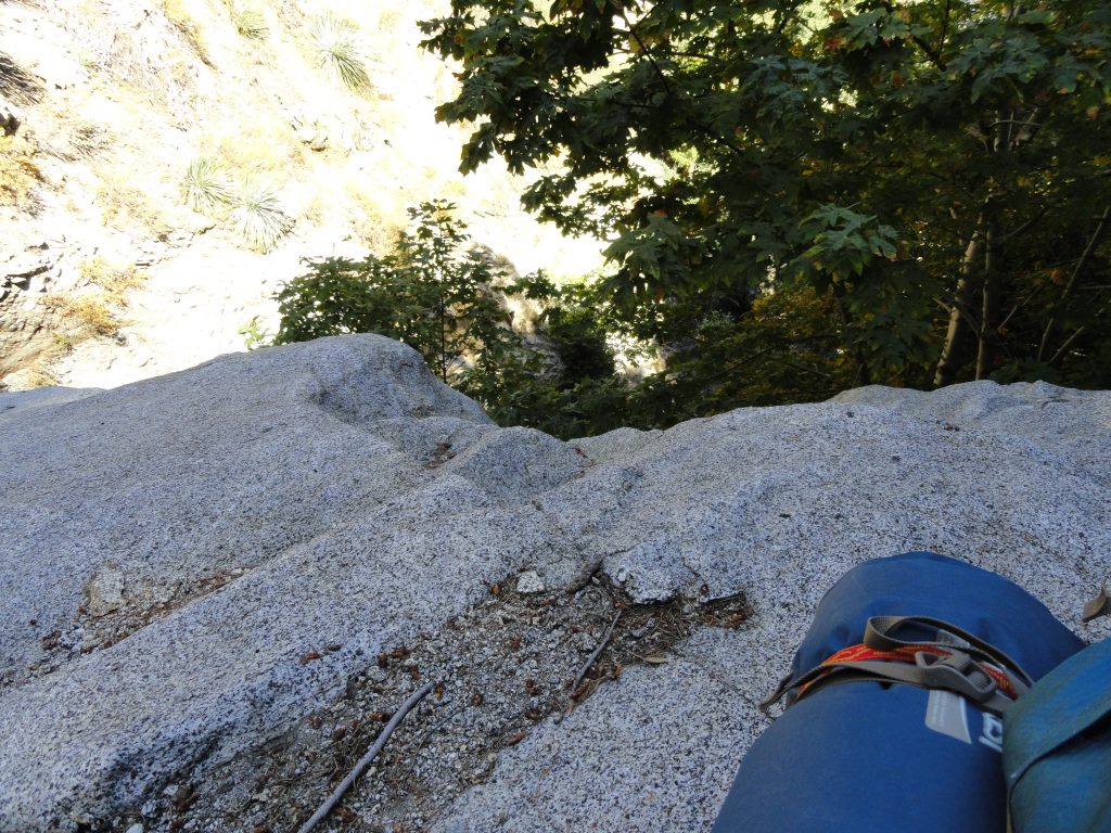
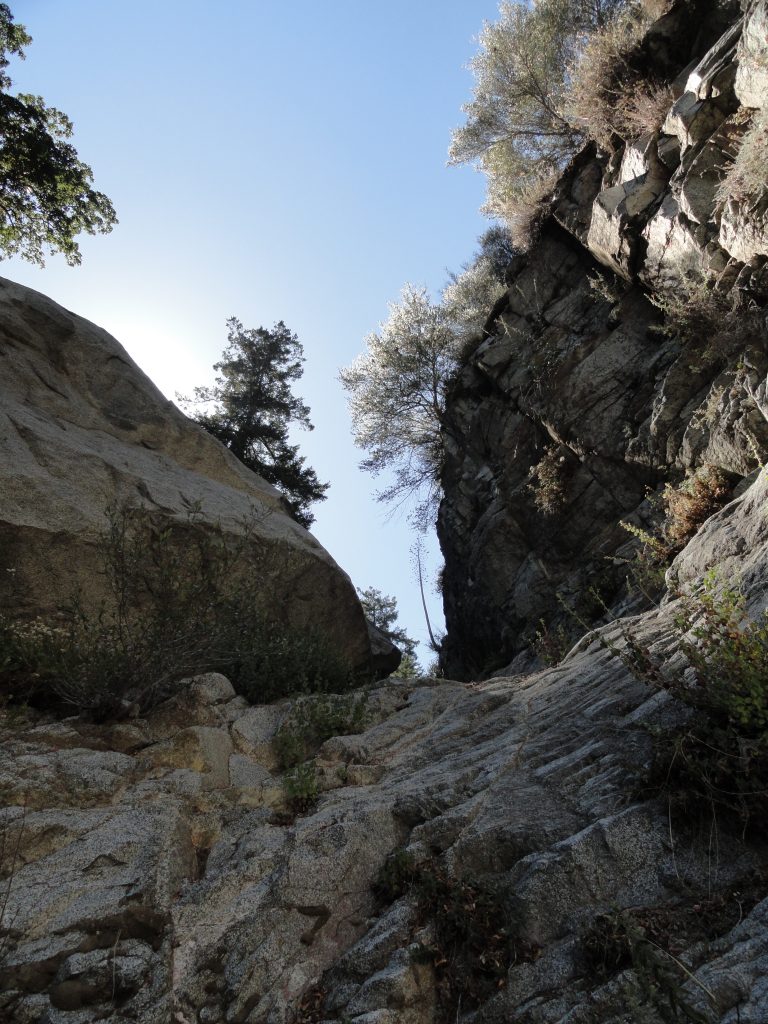
Chantry Flats to Mt. Wilson via the Winter Creek. Looking off a steep piece of granite from a ledge along the way.

Here’s another way to do Chantry Flats to Mt Wilson.    X-country via the Winter Creek Canyon is a seldom trod route.  You see, I’ve got this habit which will seem quite normal to some and quite unconventional to most.  I like to follow stream beds, canyon bottoms, in an upwards sort of way.  Never down canyon, oh no, just up – which seems to be a less clumsy way for me to do these things.  This way of hiking without the aid of trails or footpaths is often described as traveling x-country through the mountains.   It’s very leveling and calming for my mind.  Carefully stepping and watching for every detail makes me slow way down and find myself present to the world around me.  Some of my favorite x-country haunts are places like Bear Creek and Devils Canyon in the San Gabriel Wilderness.  The following describes a jaunt that I took four years ago from our little cabin at Fern Lodge to Mt. Wilson and back.  I have just gone through and updated this blog today on 10/17/2016.  A significant chunk of the day was spent traveling x-country up the Winter Creek to its’ farthest reaches.  These are my notes.

I said goodbye to my wife and left our little cabin at 10:20 a.m. on a warm summer morning this last Sunday.  Motes of light filled with the talc-like dust from hikers boots filled the air along the Gabrielino Trail to Roberts’ Camp.  From there my route followed the Lower Winter Creek Trail up past Hoegees Trail Camp.  Eventually, I got onto the trail that leads on to Manzanita Ridge and Sierra Madre.  Just near cabins 137-139 was where I cut down to the stream and then climbed up and over the last check dam in the Winter Creek.  I followed a precarious game trail along a loose, crumbly and nearly vertical slope to get around this man-made obstacle.

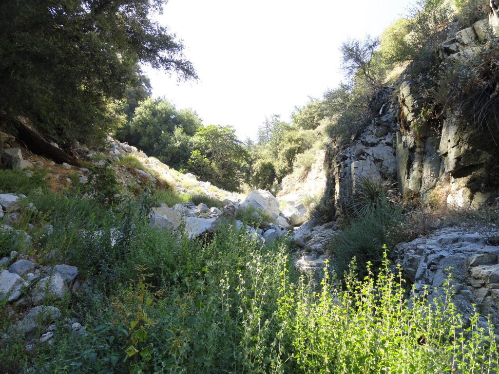
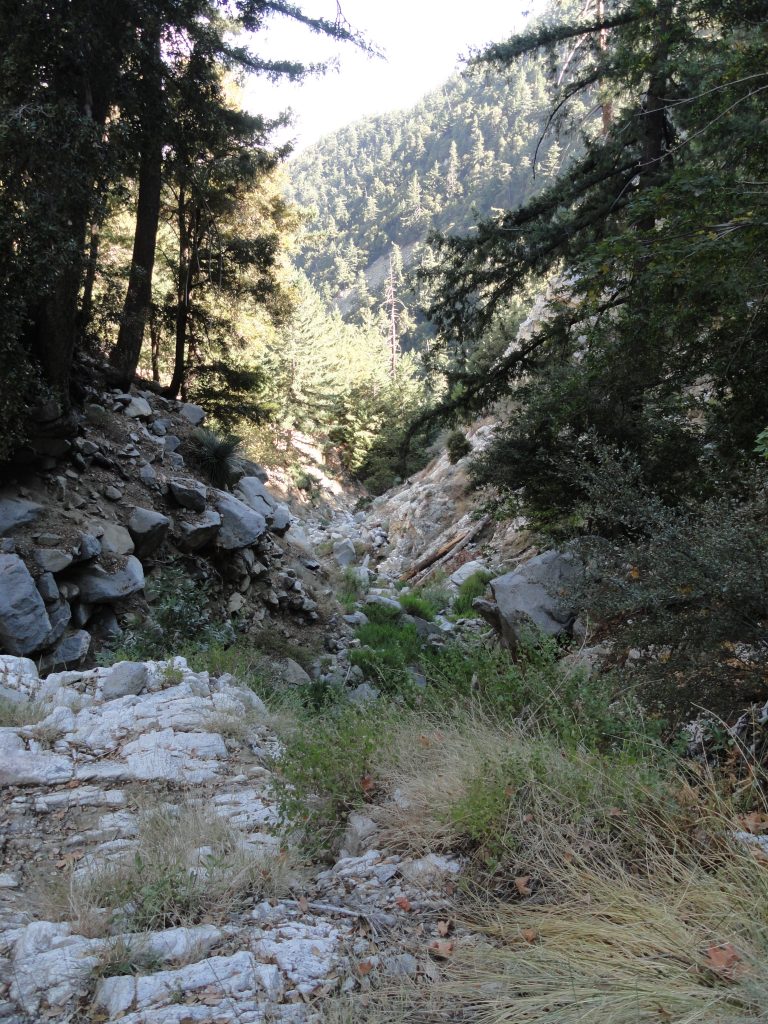
Looking up the Winter Creek stream bed about half-way between Hoegees and Mt. Wilson’s summit. This x-country route is basically non-technical, yet challenging on some of the steeper, narrower pitches.

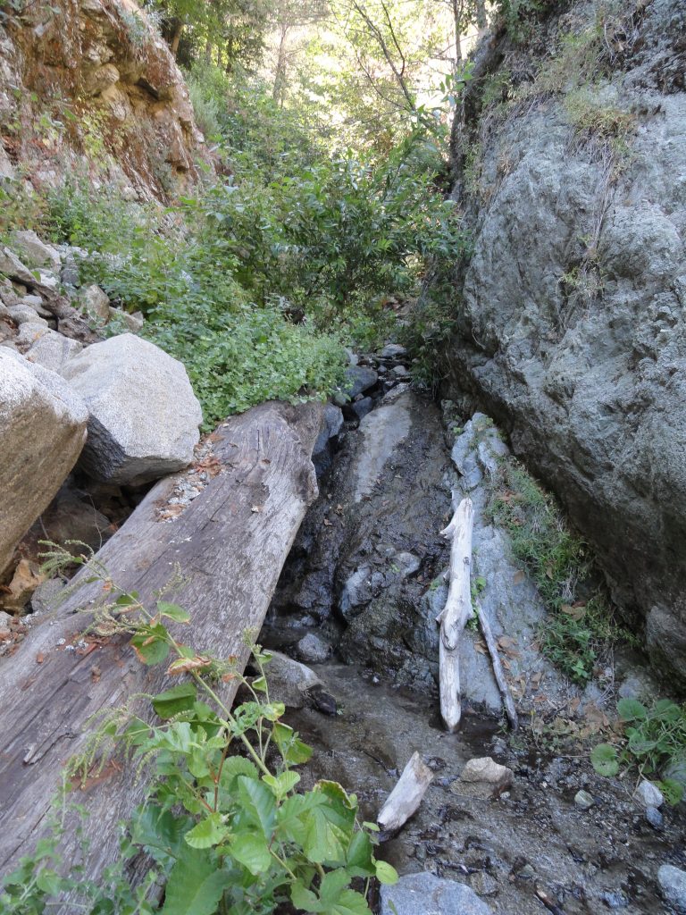
Walking on older fallen logs (Big Cone Spruce) is a good way to make your way up the Winter Creek stream bed. Notice the moisture found here even in the month of August.

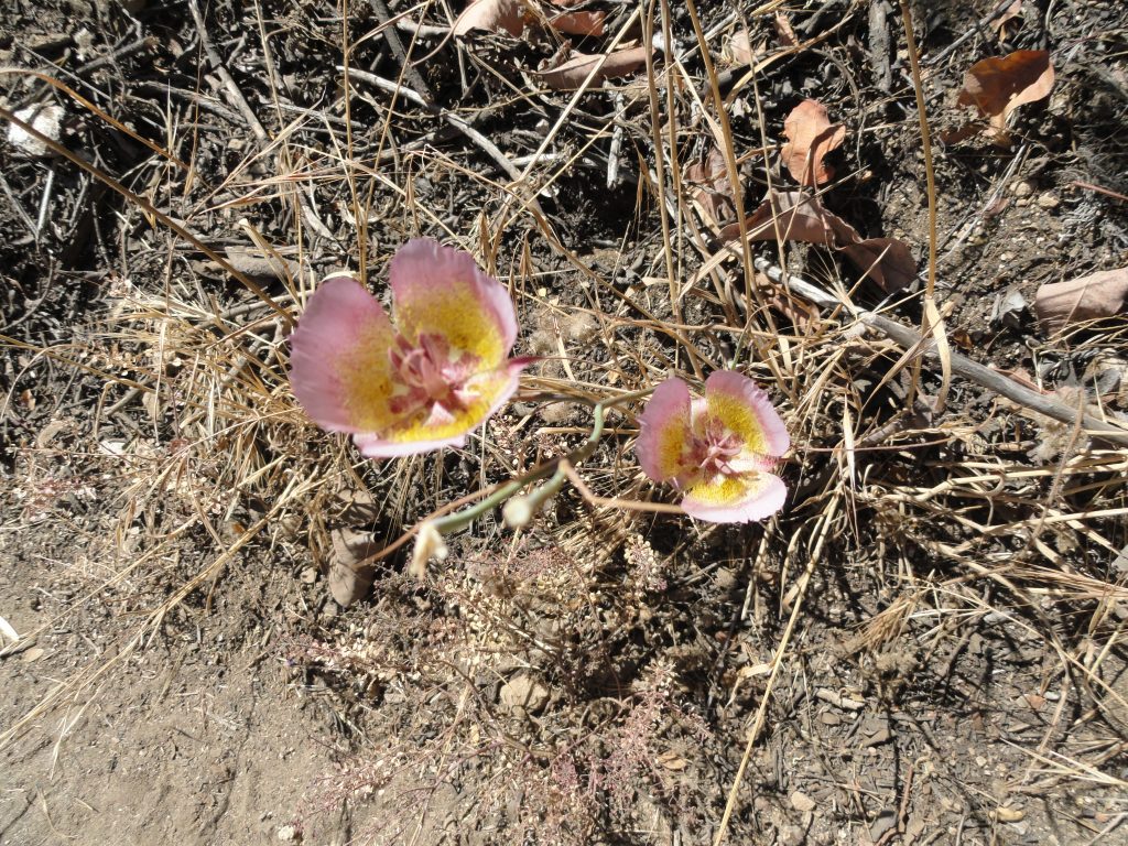
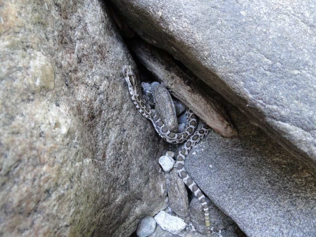
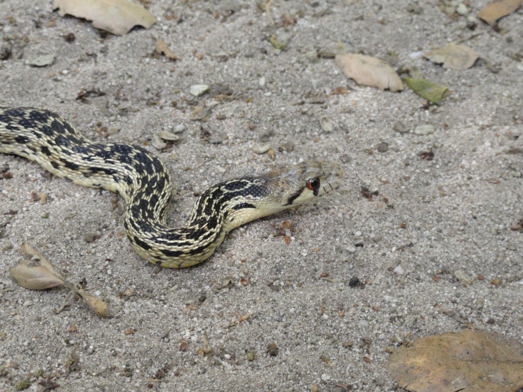
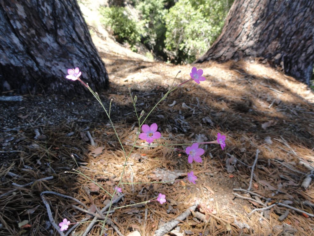
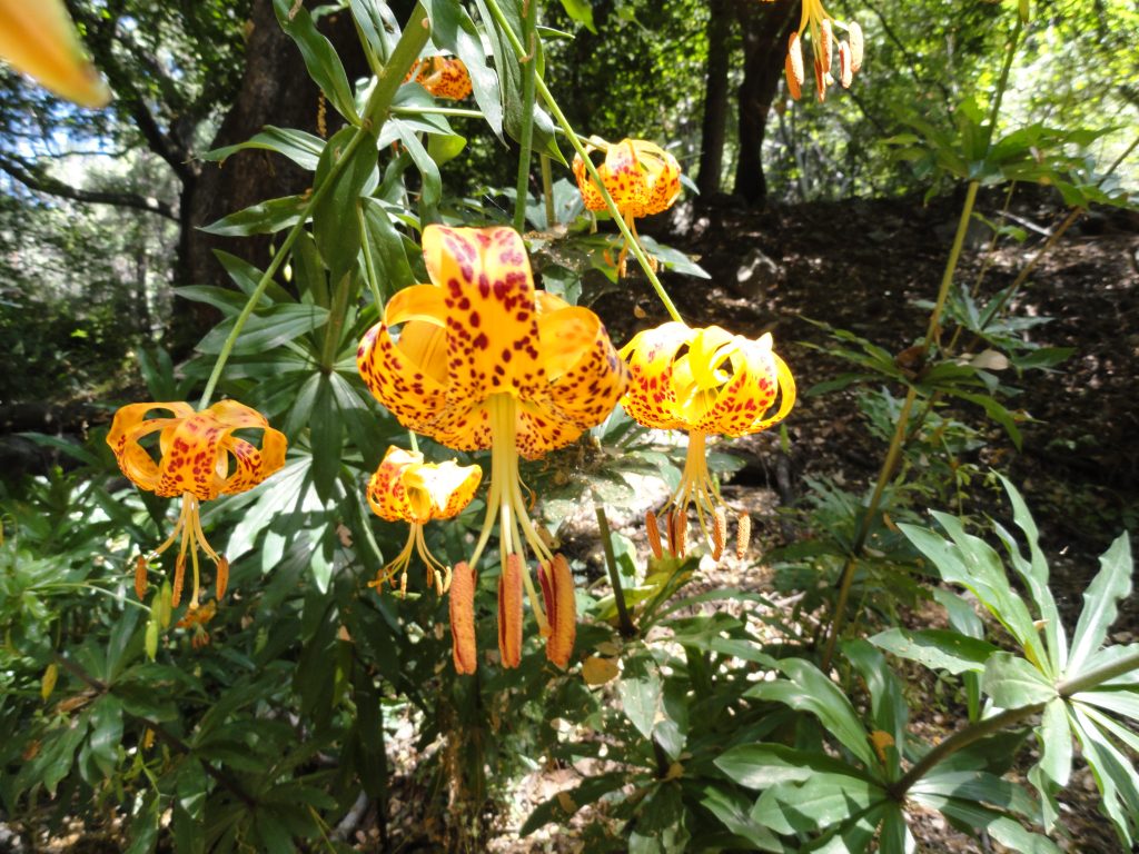
Once above the dam, my x-country experience began.  The steam bed was choked in places with log jams made up of Big Cone Spruce from way up high.  Found remnants of someone’s abandoned campsite not far above the last cabins.  Lots of stinging nettles grew lazily amongst the speckled gray boulders.  Scarlet and yellow monkey flowers began to make their appearance in damp sands.  At one point I stopped to take off my boots and soak my bare feet in a sparkling pool as electric blue dragon flies flew low along the water.  Further up a short distance I startled a rust colored hawk with a snake dangling from its’ talons.  The hawk then dropped the dangling narrow serpent about 8′ down into a bush where it wiggled off to safety.  Happy snake – bummed out bird.  Occasionally I climbed low cascades that had both wet and recently dried algal coatings on them.  Careful attention was needed for finding the right purchase for my feet and hand holds that would stay put.  At one point I reach for a hand hold while all my weight rests on my left foot.  Pretty soon I get that sewing machine action going in my calf muscle and the sweat pores down my forehead, stinging my eyes.  I got a bit dizzy.  Yes, Chris, you’ve got yourself into this predicament before.  Gently and nimbly I back out of my route alongside a dry waterfall as canyon wrens sing in their descending tones, laughing at this foolish human and his shock of white hair.  I climbed with an internal frame pack and was set up for overnight.  I was once, again reminded how much upper body strength it takes to climb up and over some of the rock pitches!  For the most part, the stream bed stayed narrow as its’ volume diminished with elevation gain.  There were seeps along the way that created damp, dark areas of soils and rock, often framed in ferns or grasses.  Gradually the stream gave out, the rocks and boulders became house size and the steepness increased.  Still, the angled sun-baked spruce logs lay lodged in the dry sand, sometimes creating a board walk of sorts.  The sun shifted gradually, putting me in welcome shade for a lot of my climbing.  The rocks, however, had retained the day’s heat and my mind was occasionally filled with the thoughts of basking serpents of all temperaments…

A smallish dry waterfall along the route to Mt. Wilson in the bottom of the deep and steep Winter Creek. I was able to climb up and over this choke point without too much challenge, with the exception of a lot of upper body workout!

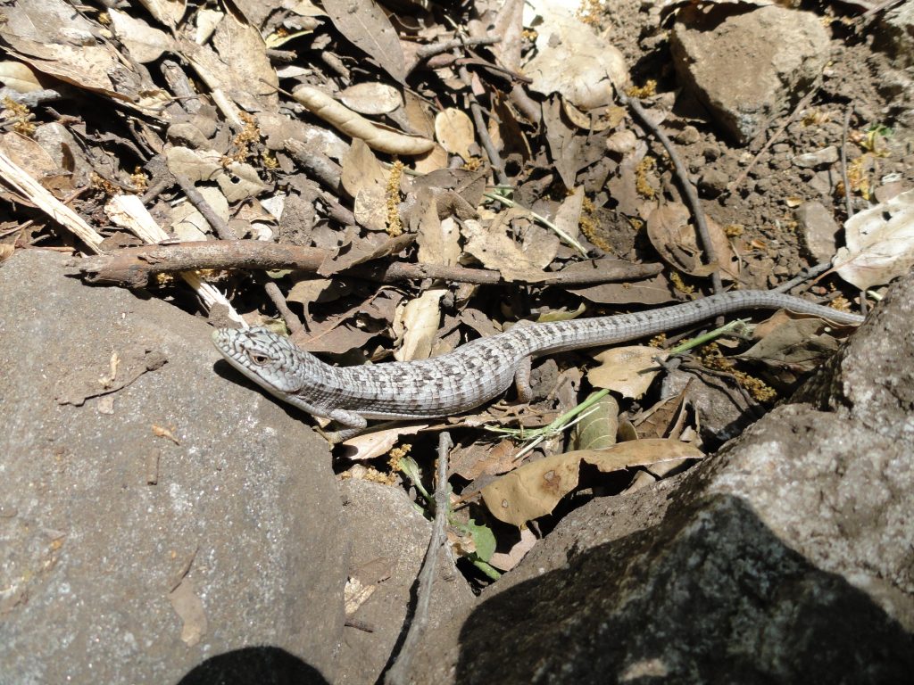
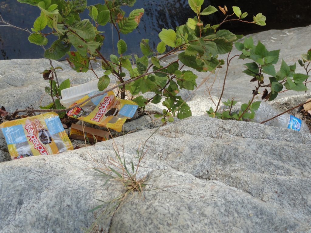
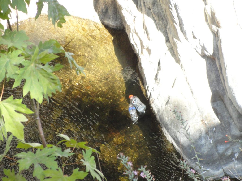
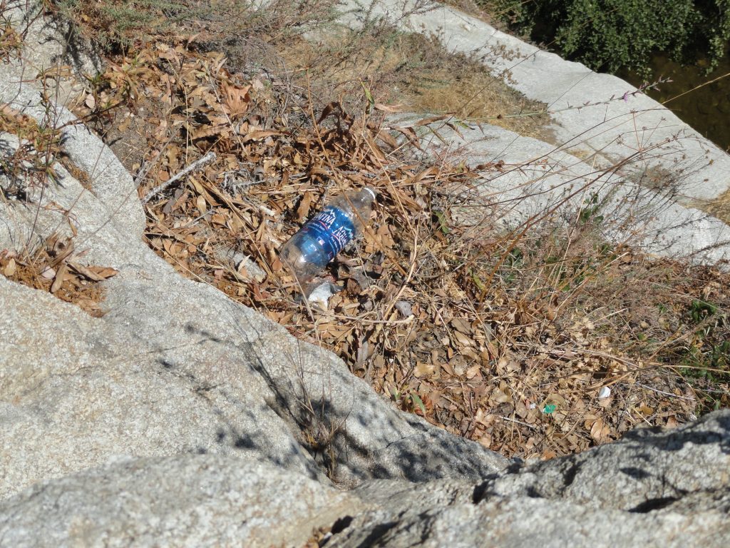
I passed a mountain lion track in a pocket of damp sand.  Broke through occasional thickets of alder and willow, while lizards flitted about on the speckled boulders and polished cliff surfaces.  I finally passed my last forlorn pocket of seedy dampness.  The standing water too shallow for my backpacking filter intake to take advantage of.  Yellow jackets covered every bit of muddy dampness they could.  The wing beat of seemingly hundreds of flying insects filled the hot, still air.  There were no flat spots to pitch my little one man tent and I was now working on my last liter of water.  Onward I climbed on pitches of loose soils and crumbling bedrock.  The view back down the canyon was startling.  My route was as steep as a ladder, yet without good rungs.  An antique cable of braided wire that I had been following for some time became my line to hold onto for some of the steepest, loosest slopes.  Broken glass, ceramic insulator fragments and sections of rusted steel frame work, even water pipes, made their appearance as I approached the summit.  Man’s trash always goes way downhill.

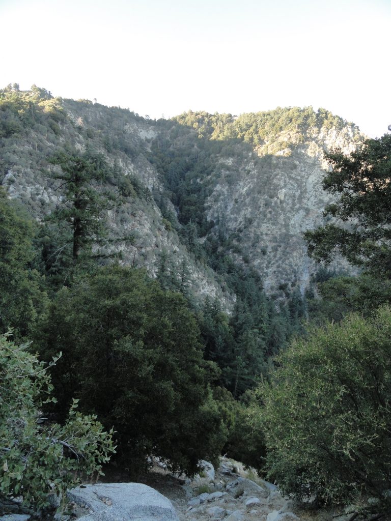
A view back down the Upper Winter Creek from a peaceful, grassy ledge. Photo taken in the shade of Mt. Harvard while heading toward Mt. Wilson.

Finally, I reached the top of the mountain at an old building that used to house some kind of electrical switching gear.  There were hundreds of pieces of welding rod laying about the place.  Soon I wandered into a sadly neglected house with its’ door swung wide open, just as it had appeared earlier on in the summer when I was last up on the mountain poking around.  Wandering into the fly infested kitchen I said out loud, “Honey, I’m home!”  Just silence, punctuated by the swarming of flies and golden streams of light angled down into the rooms.  A sadness began to flow through me as I fell deeper into a tired funk.  I’ve gotta get out of here and get some much needed water.  Wandering over to the Larry Cotter memorial drinking fountain, I plop down on the adjacent picnic table.  It’s hard to get enough water into this tired, middle-aged body of mine.  I even drink down an apple juice in record time and then onto more water.  About six liters have been absorbed, most of it leaving my body in the form of profuse sweat and breath.  I’ve barely peed all day, and when I do, it’s dark yellow and not a whole lot, either.  The day is still so hot and muggy, even at 5,700′ up.  Since I’m now safely out of the grasp of the Winter Creek, why even camp out now?  I ponder sleeping out on top of my down sleeping bag, eating a P&J sandwich (my third) and swatting mosquitos and no-see-ums all night long on some dry ridge top.  The hell with that!  I’m heading back to the bliss of Joanie and the cabin – Yeah!

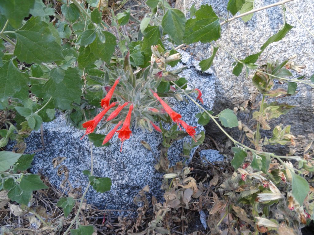
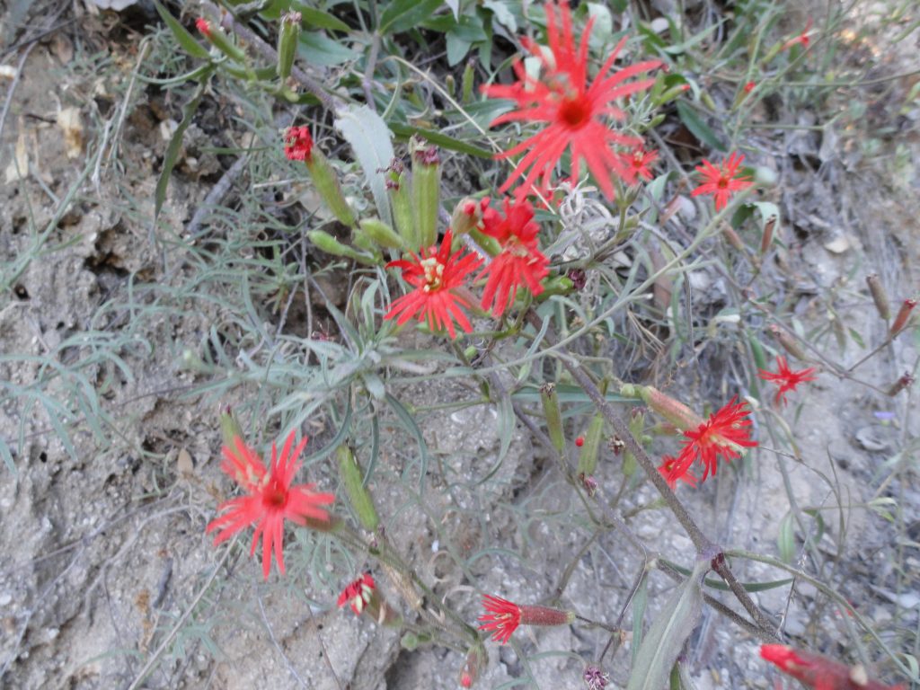
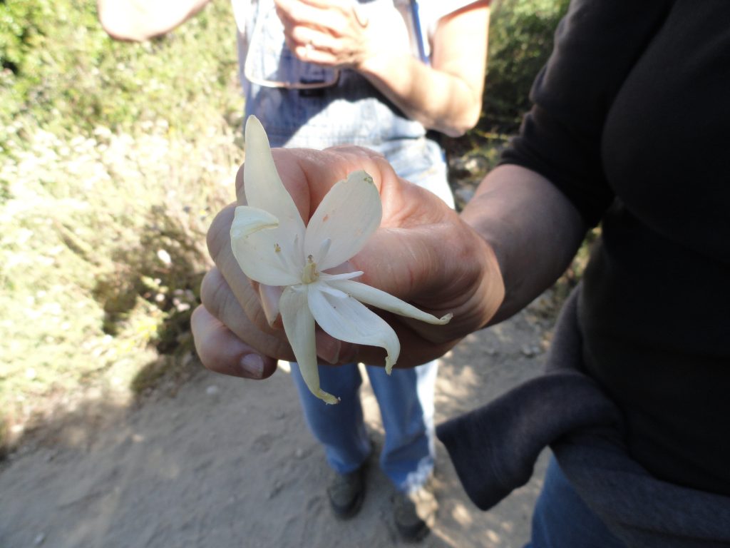
A cheerful cluster of California fuscia in the stream bed of the Winter Creek’s main fork. We are now very close to Mt. Wilson’s summit.

Looking across the upper Winter Creek from the Mt. Wilson Toll Road on my return back to our family cabin in the Big Santa Anita Canyon. That steep, wooded draw that you can see in Mt. Wilson’s cliff face is the route I took at the very end of the x-country adventure. Looking here at Mt. Wilson’s broad ridge top summit on the horizon, the historic astronomer’s “monastery” is near the tip to the right of the draw. Mt. Wilson’s 60″ and 100″ reflector telescopes are off to the left of the draw.

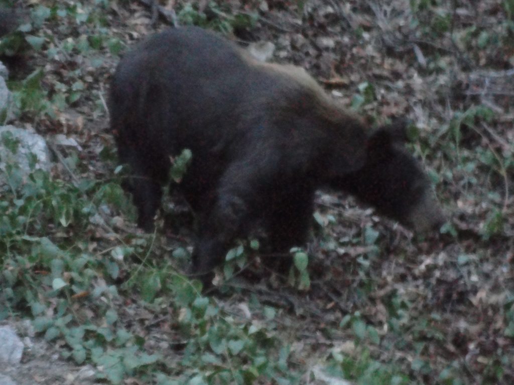
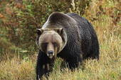
Eventually I drop down and down off the mountain to the David F. Drinkle memorial bench on Manzanita Ridge.  Our friend Bohdan built that bench years ago and did a beautiful  job on it.  It is solid and lasting.   I’m going to sit down on it as red ants swarm in their feverish way across the sun-baked sterile earth around me.  I make up some instant coffee with cold water in a tin cup, eat another tangerine, part of a P&J, cheese,nuts and soon I’m down the trail to the cabin in the gathering dusk.  In a bit of a happier, lighter way, I make up lyrics and sing songs that start me laughing.  I come up with the craziest lyrics and feel a bit drunk from the summer sun beating down on me earlier.  My voice spooks up a bear that crashes off the side of the mountain through thickets of God knows what.  At 9:20 p.m. I return home to Joanie in candle light.  She looks really clean!  Or I look…   I have a delicious tossed salad and wash it down with a high ball on the rocks.  My day begins to blur and I’m serenaded to sleep within minutes to the chorus of crickets.  A great day in the upper Winter Creek!

Chantry Flats Trails Lead to Sacred Places – Be Gentle On The Land…

Posted on August 10, 2012 – Written by Chris Kasten

Chances are that if you’re braving the parking up at Chantry or anywhere along the road, you’re hoping the trail that you pick will lead you to unblemished natural beauty.   Perhaps you’re even looking for some much needed solitude from the busyness that engulfs most of our lives.  The choice of natural environments that can be found on the Upper Winter Creek, Gabrielino, First Water, Upper Falls or Mt. Zion trails are close at hand.   One minute you can be in oak woodland, then out in the chaparral and only moments later be resting along a white alder tree in the riparian environment along the stream.  It seems that ever since the Station Fire of 2009, hundreds of hikers and mountain bikers who formerly spent their outdoor time in places like the Arroyo Seco, Big Tujunga, Mt. Gleason, the West Fork of the San Gabriel River or Charlton Flats to name a few – have now discovered the enchanting beauty of the Big Santa Anita Canyon.

Another source of the population increase in and around Chantry Flats is the internet.  Scores of people have discovered the YouTube video postings of people cliff jumping at Hermit Falls and on social media sites such as FaceBook and Twitter.  This, of course, does not even include some of the rating sites such as Yelp!

Mariposa Lillies.

Plainly put, the Big Santa Anita and Winter Creek canyons are beginning to show the scars of all the different types of visitors.  Just visit Hermit Falls and you’ll see a beautiful set of  plunge pools set in polished granite.  Mixed in with this scene are piles of garbage strewn down hillsides.  Graffiti is <marring the once pristine granite surfaces of boulders and cliff faces.  Trees are carved into as well.

Just last week I was down at Hermit Falls and it seemed to me that the human impact had actually gotten worse than the previous month of July.  The garbage that’s left behind consists primarily of plastic water bottles (the new litter of our time), cigarette packs, empty cans of cheap, mass-produced beer, various items of clothing covered with shit, toilet paper, human shit… and I’m saving the best for last.  Disposable baby diapers with a gift wrapped inside….  It is beyond appalling what people will leave behind.

If you happen to be on your way to Sturtevant Falls, don’t be surprised by the recent rash of colorful dog poop bags left along side the trail.  Of course, the owners of the dogs were halfway there in doing the right thing…  Yet, they didn’t want to carry their dog’s poop to the next trash can – so they left behind the little gift for someone else to deal with.  What are they thinking?  Yes, I get it, there’s the “poop police” waiting just around the corner to deal with the transport issue.  Yeah, that’s it!  On hot days when the sun is hitting these bags, their contents begin to cook and the resultant fumes inflate these bags the way a hot air balloon would fill up.  Lovely.

Indian paintbrush.

Last but not least, let’s not forget the garbage that some campers have left behind at Hoegees and Spruce Grove.  If the transgressor is really shy, he or she will just wait til no one is watching and throw their garbage into one of the pit toilets.   Last week I found four 13 gallon size bags of garbage stacked alongside one of the outhouses at Hoegees Campground.  Again, the attitude seems to be that someone else will deal with my mess.  I find this so sad that these types of habits are continuing to spoil our sacred spaces.

So, to put all this into perspective, it’s essential to believe -and- know that the vast majority of people who love our mountains are not part of this irresponsible and disconnected percentage doing the damage.  People are out in the canyon much of the time picking up someone else’s trash or doing their best to eradicate graffiti.  There is so much more care than there is harm.  The glass really is half full !   The earth’s soul is our soul.  When we’re gentle on the land, we’re nurturing our own soul.  Really.

Today, may I remind myself, that there’s the possibility our urban culture will continue to become more caring of the land.  That the health of the land is an indicator of the health within ourselves, or lack of it…    That I continue to grow and model myself as a steward of these sacred places.  That I gently encourage others to love this land.  That you and I heal as these canyons return to health.  Amen.

Mule Deer on Chantry Road

Posted on August 2, 2012 – Written by Chris Kasten

The accompanying photo was snapped from our car at the second hairpin turn up from the beginning of the Chantry Road.  These are mule deer, named for their unusually large ears.  Mule deer are often quite prevalent along the lower stretches of the road and can also be a routine challenge for homeowners’ plantings in the foothill areas of the San Gabriel mountains.  Mule deer can often be seen browsing on the deliciously, delicate flowers and tender grasses in the landscaped yards of homes in the Highland Oaks area of Arcadia and, of course,  Sierra Madre.

A doe and two fawns in Lannon Canyon on the Chantry Road.

This doe and her young occasionally travel up and down the actual drive lanes of this narrow, windy road.  So, take your time driving up to the trailhead and keep an eye out for deer darting out in front of your car, especially during the early morning and evening hours.

California Black Bears Coming Further Downslope For Water, Big Santa Anita Canyon is Getting Dry

Posted on August 1, 2012 – Written by Chris Kasten

The San Gabriel mountains provide habitat for black bears (Ursus americanus californiensis) throughout the year.  The accompanying photo was taken through the screen door of a cabin at Fern Lodge just before dark.  These elusive animals are seldom seen along the trails that radiate out from Chantry Flats.  As a rule, bears will avoid contact with humans if given the chance.  However, in the aftermath of a light winter, streams in many of the smaller side canyons are now drying up.  This causes much wildlife, including bears, to drop down to lower elevations in search of water.  The Big Santa Anita and Winter Creek flow throughout the driest months (September-October-November), becoming the primary source of drinking water for all creatures.

A resident black bear makes his / her way down the slope directly behind cabin #63 in the Fern Lodge area.

Bears are omnivorous, seeking both plants, insects (grubs and ants) and occasionally small game for food.  Right now, their scat can be seen alongside the hiking trails.  One of the black bear’s mainstays is manzanita berries, which can be seen abundantly throughout their scat.

Black bears although shy, are very powerful.  They are tree climbers and can quickly scale the steepest hillsides if necessary.   On the descent, they’re a bit slower and clumsy.  As for shelter, bears den in naturally occurring voids of rock and soil.   Winter conditions in the San Gabriel mountains are quite mild in contrast to other North American mountain ranges, so deep hibernation is not a part of the local black bear’s lifecycle as it might be further north.  Therefore, it’s possible to see a bear any month of the year!

An adult grizzly bear far, far away from Big Santa Anita Canyon. The San Gabriel mountains had a grizzly population up until the last one was shot in Little Tujunga Canyon in 1919.

There was a time once when another species of bear roamed the San Gabriels.  This was the Grizzly, (Ursus arctos horribilis) now extinct throughout California.  Grizzly bears were known to many backcountry travelers of the 19th century as X bears, due to the hourglass shape of lighter colored fur on their backs.  When the grizzly bear was aggravated, the light colored fur would stand straight up, sort of the way that dogs do when upset.  You can read more about this time of grizzly bears roaming the San Gabriels in John W. Robinson’s “The San Gabriels, Southern California Mountain Country.”

If you are fortunate enough to see a bear in the Big Santa Anita Canyon or Winter Creek, keep your distance and calmness.  Should one approach you, stand tall and hold your ground.  Clap your hands together and yell as loud as you can to scare it off.  Chances are he or she just didn’t see you until your closing distance narrowed way down.  Although a bear’s eyesight is not terribly keen, its’ sense of smell is acute.  While camping up at Spruce Grove or Hoegees campgrounds, hang your food well out on a tree limb at night.   Generally, try to keep your food bag at least 8′ up from the ground and 8′ out from the main trunk of the tree.  A bear-proof food storage canister is really the best way to go and a lot easier than finding the perfect tree.    Keep your campsite clean and wash your dishes well.  No food should ever be stored inside your tent!  Remember, bears are afraid of humans, yet will do just about ANYTHING for food.

Brown Trout in Big Santa Anita Creek

Posted on July 20, 2012 – Written by Chris Kasten

Here’s an image of a brown trout in Big Santa Anita Creek.  While hiking along the Big Santa Anita Creek or Winter Creek, occasionally you might happen upon a fly fisherman working one of the pools that dot our beautifully shady canyon.  This picture was taken just last Tuesday at the base of a check dam between Roberts’ Camp and Fern Lodge Junction.  After being caught, this Brown trout was safely released back to its’ pool without any harm to it at all.  Brown trout, Salmo trutta, are not native to the Big Santa Anita Canyon.  It’s close cousin, the German Brown, can be found in the east and midwest sections of the United States.  This species of trout tolerates water temps between 60-65 degrees, so is especially well suited for our canyon’s stream.  Brown trout were introduced to the canyon years ago and continue to still survive the endless cycles of drought, interspersed by occasional El Nino induced deluges during winter months.

Brown Trout in Big Santa Anita Creek

From the Chantry Flats’ Gabrielino trailhead, just head down the paved fire road to Roberts’ Camp or take the First Water trail to down to the stream midway between Roberts’ Camp and Hermit Falls.  Following any of the stream side trails, watch for Brown trout in some of the deeper, protected pools that offer some form of overhanging protection for fish.  Brush growing up to and over a pool’s surface, submerged logs and dark, rocky underwater hiding places are types of habitat that these fish can be found.

As Summer Heats Ramps Up At Chantry Flats – Watch For Reptiles

Posted on July 11, 2012 – Written by Chris Kasten
A western fence lizard near Slider Rock, Big Santa Anita Canyon.
A young rattlesnake between the boulders. East Fork of Big Santa Anita Canyon.

It’s July and summer temps continue to ramp up into the triple digits in the San Gabriel Valley.    What a great time to head up into the cooling depths of the Big Santa Anita Canyon!  This time of year, it’s often possible to experience temperatures reaching up into the 90′s, especially where you park your car up at Chantry Flats.  Out in the open sun it can feel more like a 100 degrees, especially when you’re out hiking up or down the paved fire road between Chantry Flats and Roberts’ Camp.  The summer sun not only bears down on you from above, but heat then is re-radiated back up off the pavements and light colored expanses of rock along the mountainside.  This is a scene that requires thinking ahead for your next trip out of Chantry Flats.  Bring plenty of water for each person.  Two liters per person is really not too much when it’s hot.  Wear a good sun hat and consider the benefits of applying sunscreen as well.

During the height of the summer sun, the warmest hours are quite often between 12:00 noon and 3:00 p.m.  While the sun’s up high, we seek the welcome of shade and so do the reptiles.  Of the myriad forms of wildlife to be found in the Big Santa Anita Canyon, it’s the reptiles who are in their season between March and November, with the high point of sightings taking place in late June through August.

Because reptiles cannot regulate their body heat, such as humans can, snakes and lizards are utterly dependent on the temperature of the air.  To regulate their internal body temps, snakes and lizards must seek shade during the middle of the day when the sun’s bearing directly down into the canyon.  As the sun’s angle shifts later on in the day, these animals will venture back out from their hiding places.  During summer evenings, it’s not uncommon to see the occasional snake out on a road surface, which still emits stored heat from the baking day.  When traveling back down the Chantry Road on a summer evening, try to slow down so as to avoid running over these defenseless animals.  They’re just trying to seek a little warmth against the cooling night.  As the morning sun begins to make its’ presence, watch for snakes and lizards sunning themselves out in the open as they attempt to warm back up from the evening’s coolness.  This pattern of seeking, avoiding and then seeking heat is an endless pattern in the life of any reptile.

In Big Santa Anita Canyon, most of the species of snakes are non venomous.  Our only venomous snake is the Southern Pacific Diamondback.  Probably one of the most misunderstood creatures of all times, rattlesnakes are by their very nature shy and secretive, avoiding human contact if at all possible.  Rattlesnakes should not be approached or provoked.  Their rattling and coiled stance is a defensive behavior.  If given the chance, any rattlesnake will eventually retreat and seek to create as much distance between itself and humans as possible!   All lizards in the Big Santa Anita are non venomous.

As for snakes and lizards in our canyon, there’s quite a variety.   For more images of these amazing animals, go to http://herp-pix.org/As you hike on any of the trails out of Chantry Flats, it’s quite likely you’ll see lizards of all sizes and coloring, flitting alongside rock faces and down sandy stretches of trail.  Snakes often tend to be a bit more elusive, yet if you’re quiet and keep a constant watch into the shady hollows under brush, trees and rocks, you might just get to see one.   Like all creatures, reptiles have their part to do in the natural landscape.  These creatures feed mainly on insects, small amphibians, rodents and occasionally on one another.  The hiking trails out of Chantry Flats are a fantastic place to see these wonderful creatures.

Gabrielino Trailhead at Chantry Flats is a Portal to Yuccas in Bloom

Posted on June 27, 2012 – Written by Chris Kasten
An elegant yucca flower as found along the Gabrielino Trail near Tin Can Point.

It’s late June and a number of  yuccas along the trail are in beautiful bloom.  These photos were taken along the Gabrielino National Riding and Hiking Trail which originates at Chantry Flats in the Big Santa Anita Canyon of the Angeles National Forest.  The specific location of the yucca photograph is a place called Tin Can Point, a switchback located just upslope from Fern Lodge Junction which is about a mile and a half in from Chantry Flats.  From Tin Can Point, one can see the inverted triangular view of the San Gabriel Valley, bounded left and right  by the lower Big Santa Anita’s steep slopes.

Blossoms on Stalk

Yuccas as we know them in the San Gabriel mountains and most of southern California are known botanically as yucca whipplei.  Two common names that many hikers know this plant by are Spanish Bayonet or Our Lord’s Candle.  Regardless of your preference, the bloom of this sharp-spined plant is enough to cause you to stop and ponder its’ beauty.  The yucca blooms but once in its’ lifetime.  After the flowers have gone to seed, the base spines which are in a rosette pattern will wither and die.  This beautiful floral stalk is the culmination of a life’s work.

A blossoming yucca stalk in full glory. The summit in the background is White Horse Mountain. Photo taken at Tin Can Point on the Gabrielino Trail, Big Santa Anita Canyon.

Mt. Wilson Trails Hike from Chantry Flats – Details of Rim Trail Section

Posted on June 16, 2012 – Written by Chris Kasten
Trailhead for Rim Trail atop Mt. Wilson.
The delicate beauty of Gilia graces a section of the Rim Trail below Mt. Wilson.

Last week I hiked the upper section of the Rim Trail, just below the summit of Mt. Wilson.  As for its’ connection to other Chantry Flats trails, the solitude and peace that you will experience here is unforgettable.The day was warm and bright, as it should be at this elevation of 5,700′ in the month of June.  I expected the deer flies and black flies to be swarming, as they were the previous weekend, yet to my surprise there were hardly any!

A doe finds peaceful rest in the shade near Mt. Wilson’s summit. Photo taken from Rim Trail.

The Rim Trail is just over 3 1/2 miles in length and connects the summit of Mt. Wilson with Newcomb Pass to the east.  With Newcomb Pass being 4,115′ in elevation, the elevation difference between the two points is about 1,600′.  The grade is fairly mild and the route follows forested north facing slopes just below the ridge that separates the upper Big Santa Anita Canyon from the West Fork of the San Gabriel River.  While on the Rim Trail, you’ll pass through miles of miles of shady oak forests intermixed with ferns and Big Cone Spruce.  Near the summit, the trail takes on an almost “Sierra-like” appearance with black (mica) and white (quartz) speckled granite outcroppings, views toward the San Gabriel mountain high country peaks and the occasional stately sugar pines with their bunches of narrow and sap dripping cones.   Feel the cooling, dry breezes that brush over the ridge top.

Gray tree squirrel nibbling on a pine cone.

Spring, summer and fall are the times to make the Rim Trail a part of your hike.  In the winter, lingering ice patches cling to the precipitous north facing slopes above steep chutes that drop down into the West Fork.  The chance for an accident, especially toward the summit is possible without the proper footwear and ice axe.   There have been fatalities as well, so reconsider taking this trail between December and March, unless you’re well-prepared.  Every location in the Angeles National Forest has its’ shadow side,  so plan accordingly.

If you’re looking for relative solitude, great views, or a chance at spotting wildlife; then this trail’s for you.

Humboldt Tiger Lilies are in Full Bloom Along Chantry Flats’ Stream Side Trails

Posted on June 6, 2012 – Written by Chris Kasten

Hiking on the trails that originate out of the Chantry Flats trailhead, you are bound to see the magnificent Humboldt Tiger Lilly (Lilium humboldtii) in all its’ splendor .     This bloom was photographed on the Lower Winter Creek trail this last Saturday.  This tiger lilly  can be found growing along moist canyon stream beds throughout the front country of the Angeles National Forest.     Late May through the month of June tends to be the time for these beautiful flowers to make their annual appearance.  This native can be enjoyed on your next hike at Chantry Flats, whether it be the Big Santa Anita Canyon or in this case, the Winter Creek.

Humboldt Tiger Lillies, Lower Winter Creek Trail. Winter Creek, Big Santa Anita Canyon.