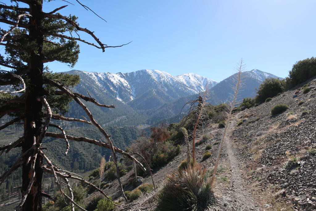
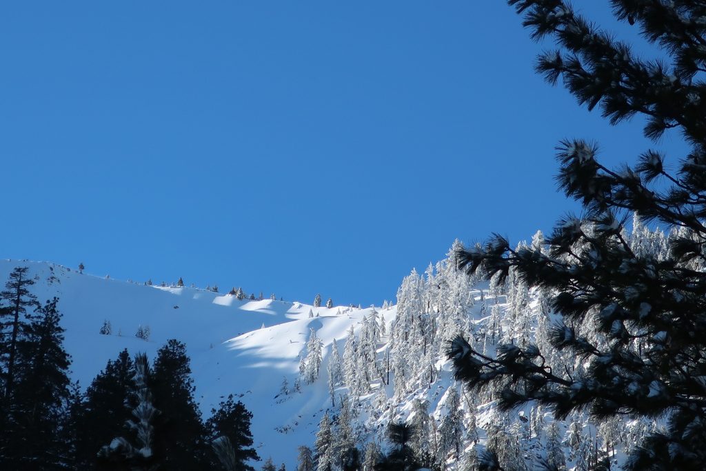
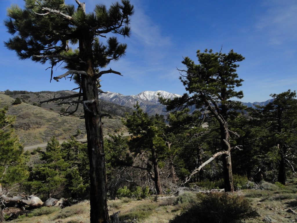
Mt. Baldy and Dawson Peak as seen from the PCT. This view is looking across upper Lytle Creek and still some miles below East Blue Ridge.
Vincent Gap trailhead is once, again, open to vehicles coming in through Wrightwood. Highway 2 continues to be gated to any driving west of the trailhead. If you’re looking to hike up to Mt. Baden Powell or drop down into the East Fork, all this is possible now and through the summer and autumn months.
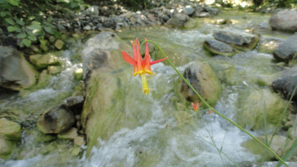
Looking out across the East Fork of the San Gabriel River to Pine Mountain, Dawson Peak and Mt. Baldy. This view is from a spur ridge just below summit of Mt. Baden-Powell. A native Columbine graces the East Fork just downstream from Mine Gulch Campsite .
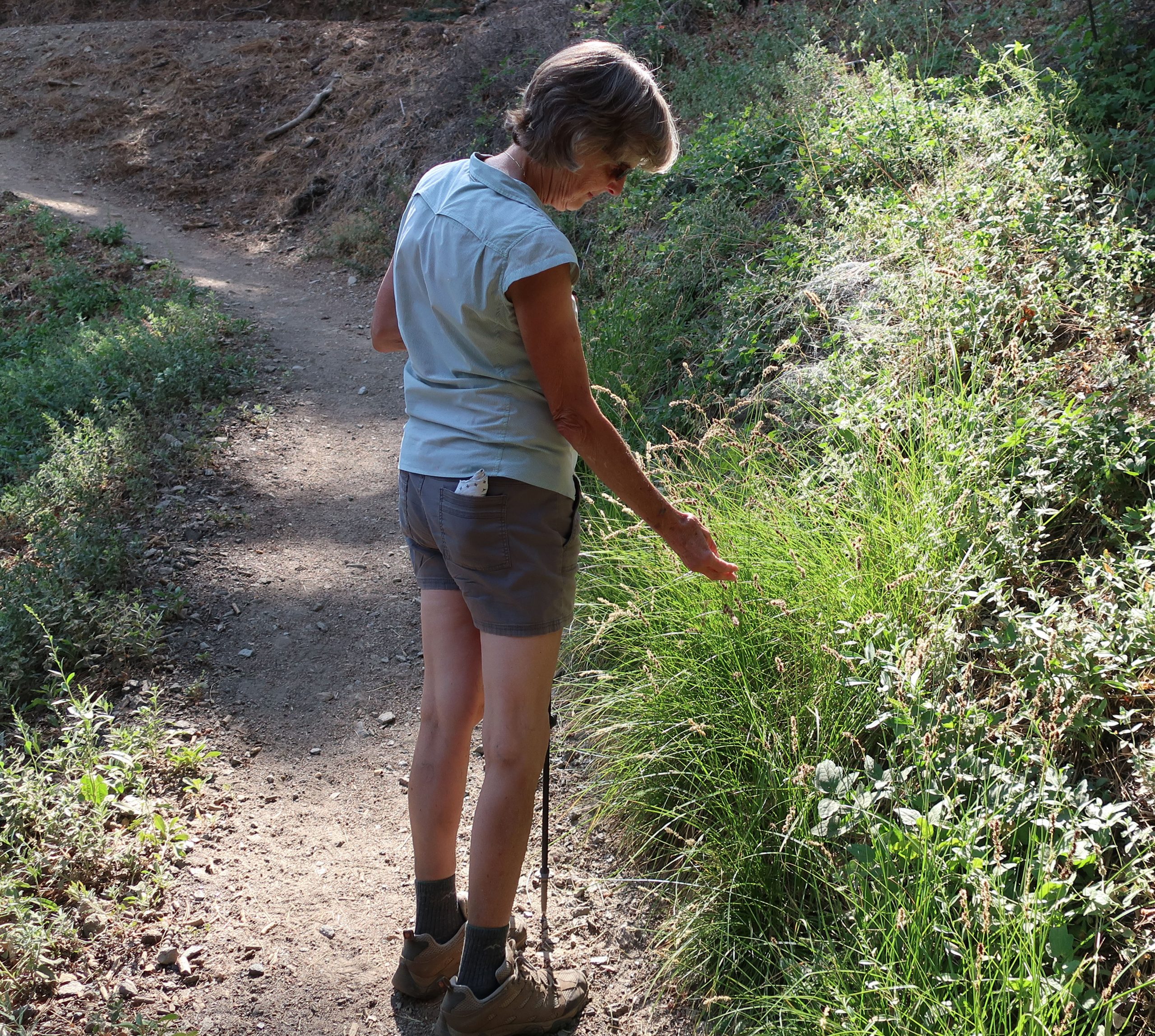
Joanie pauses alongside the Blue Ridge Trail to check out some dried flower stalks of grass in the fading light.
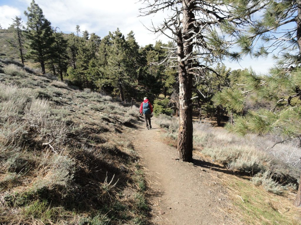
Wrightwood’s Blue Ridge Trail hike, located just three miles west of this scenic mountain village, is a good place to get some shade and maybe even a little cooler weather, this time of year. The trail runs between Big Pines and Blue Ridge Campground, traversing richly forested mountainsides. Total elevation gain is only 1,100′ in the two miles spent under the canopy of expansive white fir, black oaks, Jeffrey, ponderosa and sugar pine. Starting at 6,800′ , the trailhead is located just across Highway 2 from the old Big Pines Lodge. There’s also a U.S. Forest Service information station here, which incidentally, is closed for the meantime due to Covid cutbacks throughout the Forest Service. Park in the paved lot adjacent to the restrooms. Walk down a worn trail through the brush that’ll cross the Mountain High West parking lot’s exit road. Look for the brown painted trail sign.
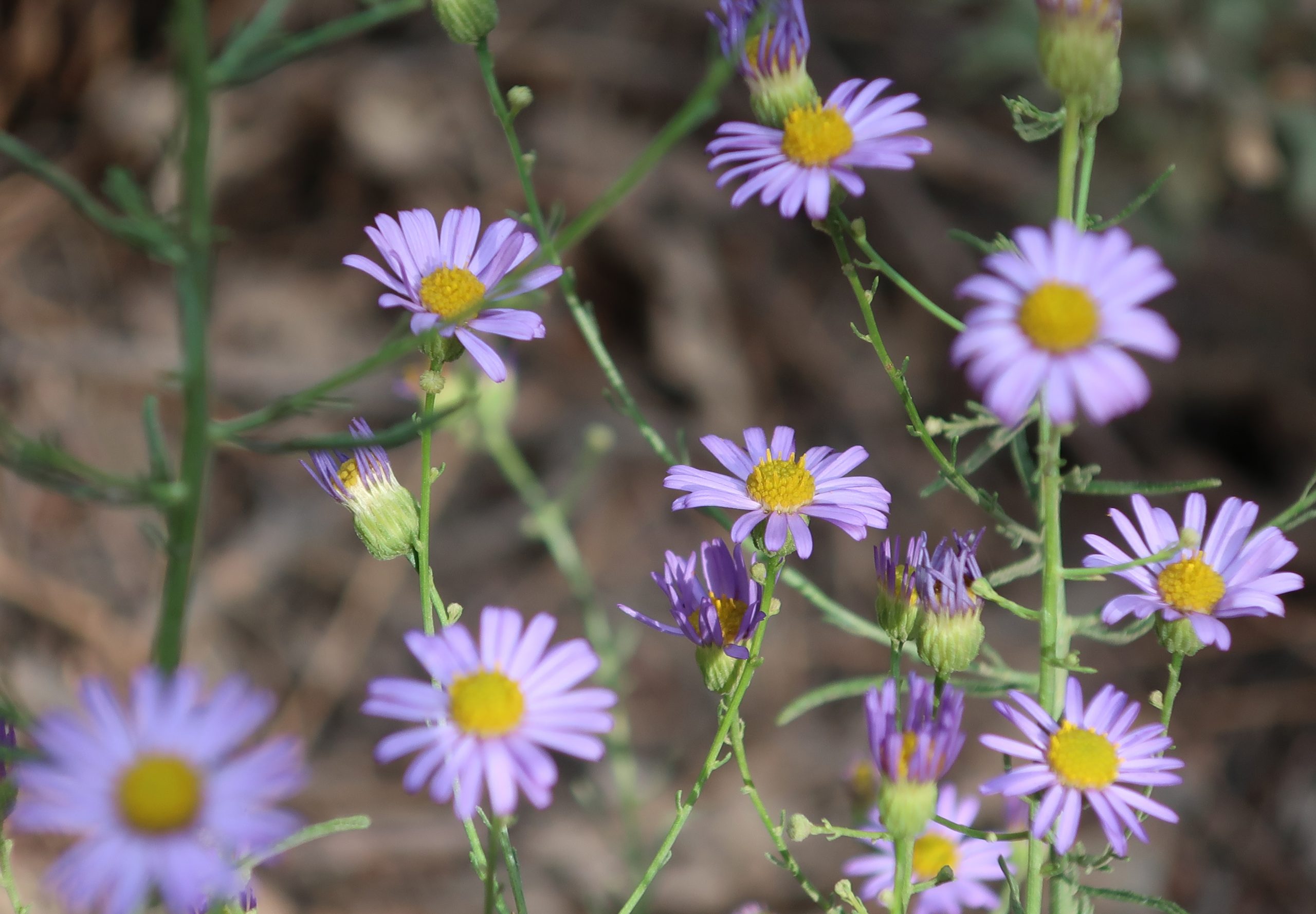
Clusters of asters are found growing along much of the Blue Ridge Trail, Wrightwood, CA. Also, look for them along the Lightning Ridge Trail as well as the Pacific Crest Trail where it runs along both East and West Blue Ridge.
Halfway up the trail is, true to its’ name, the Half Way rest. It’s a nice log bench indicating that you’re only a mile from Blue Ridge Campground and a mile from where you began. You’ll pass by some gentle draws along the mountainside where glades of gentle green squaw currant, dogwood and willow grow lushly. There’s the smell of moist plants and earth dropping down from these quiet places. The terrain is gentle, especially for the San Gabriel mountains. Take the time to breathe all this beauty in. Return the way you came.
Late afternoon sun works its’ way through layers of smoke and cumulus clouds while the Ranch Fire burns way down below in the mouth of San Gabriel Canyon. That’s Mt. Williamson in the background, just right of center.
Hike the Dawson Saddle Trail for cooler temps and beautiful views of canyons and desert. A few days ago, Joanie and I drove up to Dawson Saddle for a late afternoon hike. Located approximately 13 miles west of Wrightwood, Dawson Saddle is the highest spot along the Angeles Crest Highway. At an elevation of 7,901′ , this trailhead starts you out at about the coolest temps possible this time of year. While the Front Country of the San Gabriel mountains smolders during the occasional heat waves of summer, high country hikes, or walks, are well worth considering for a refreshing getaway.
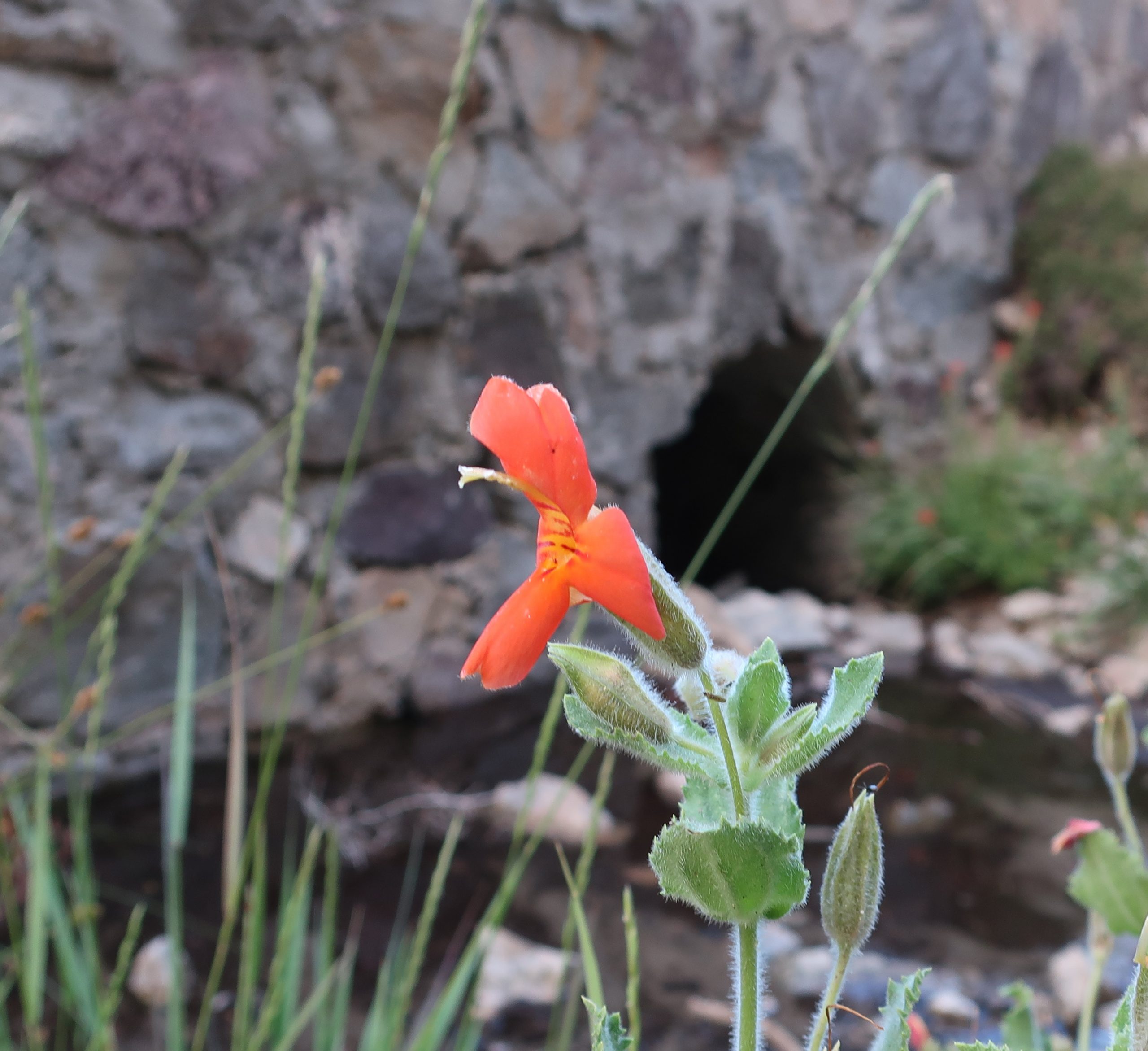
Scarlet monkey flowers are in full bloom along this small unnamed stream flowing off of Mt. Burnham. The location of the photo was taken along Highway 2 (Angeles Crest Highway) just east of Dawson Saddle. In the background is a culvert running underneath and through the old rock work of the highway.
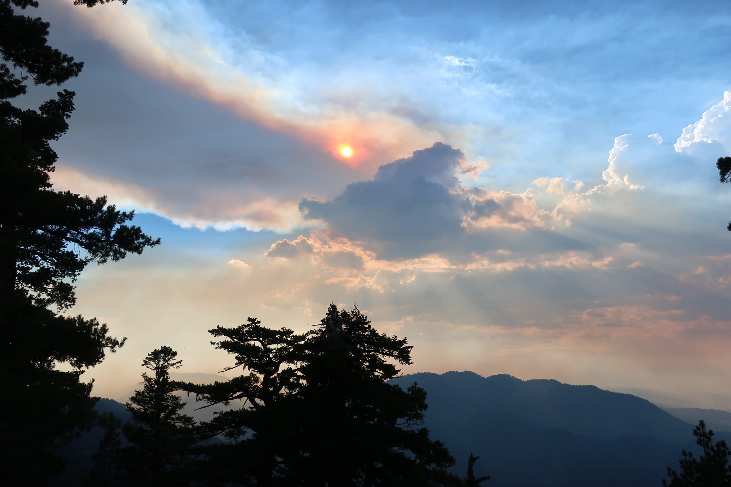
About a mile up the trail, while heading toward Throop Peak, we caught this scene of smoke and cumulus clouds out over San Gabriel Canyon. The Ranch Fire II was still out of control a short distance up Highway 39 near Azusa. Up above 8,000′ , the breeze coming in from the Pacific was cooling, yet tinged with the acrid scent of burning chaparral from miles away. Our light was beginning to fade and we turned back around for the trailhead. While driving back home, we stopped at a spot alongside the highway, where an unnamed stream flowed down the north slope of Mt. Burnham and then under the road. Clusters of Crimson Monkey Flower and Columbine graced the stream bed. Scooping up the icy water and splashing our faces and arms under a darkening summer sky revived us for the twilight drive back.
Distance and elevation gain / loss: Approximately one mile (one way) with 400′ of elevation gain.
Follow the gated dirt road that runs atop levee on north side of Heath Creek stream bed.
Hike begins on Thrush Rd, just east of the tee intersection with Victorville St. Walk up the dirt road just west of Heath Creek bridge. There’s a silver colored pipe gate just a short distance above Thrush.
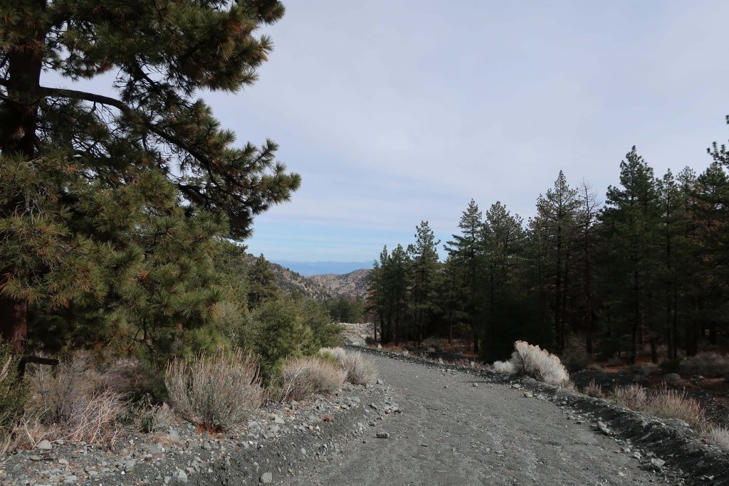
Looking toward the desert on the levee road. This spot is about half-way between the lower and upper pipe gates.
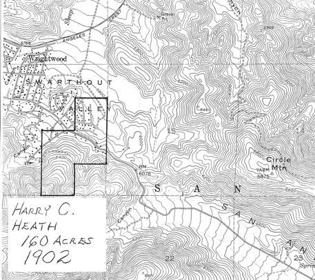
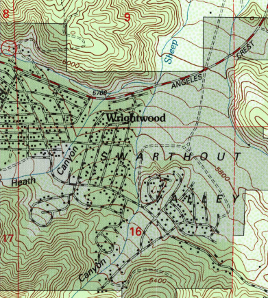
One of the major canyons dropping into Wrightwood’s Swarthout Valley is Heath Creek. It’s the canyon that begins as the large, conspicuous slide on Wright Mountain’s north side. The slide, dropping straight down from the summit is especially prominent from downtown Wrightwood. If you’re outside the post office or Mountain Hardware and looking southward, there’s a really good view of the slide, with Wright Mountain’s pine covered summit just to the left of it (elev. 8,505′). The canyon is named after Harry Heath who homesteaded the east end of the Swarthout Valley, near present day Pacific Crest Estates, back in 1886. Back then, Heath Ranch (circa 1900-1919) had a dairy, as well as boasting an orchard of apple and pear trees irrigated with water conveyed from a stream intake in the watercourse that today bears his name.
Outline of the former Heath Ranch. Purchased from Sumner Wright in 1902, Harry Heath received his deed for the land in 1910. You can see that some of Heath’s most suitable ranch land was in the area now known as Pacific Crest Estates. Oddly, his 160 acres do not extend to the watershed that bears his name. Map image courtesy of Wrightwood Historical Society.
Pat Krig, a long-time Wrightwood pioneer and historian, wrote down some notes about the Heath Ranch which she visited on horseback as a young girl. The Wrightwood Historical Society generously provided me a copy of her notes from 2006 which portrays what little is known of Harry Heath’s ranch. Unfortunately, there were no photos of either Heath or his ranch. One paragraph in Pat’s reminiscences that in particular stood out to me, was this: “A few of the gnarled apple trees still stand, bearing fruit and bringing memories of hot apple pies for tired travelers, and offers of a pitcher of fresh milk, thick cream for coffee, and butter to spread on warm, fragrant bread then slathered with pumpkin butter.” Pat wrote this back in 2006. Sadly, Pat passed away just this last year, taking with her memories of an earlier time in the mountains that we can only faintly imagine.
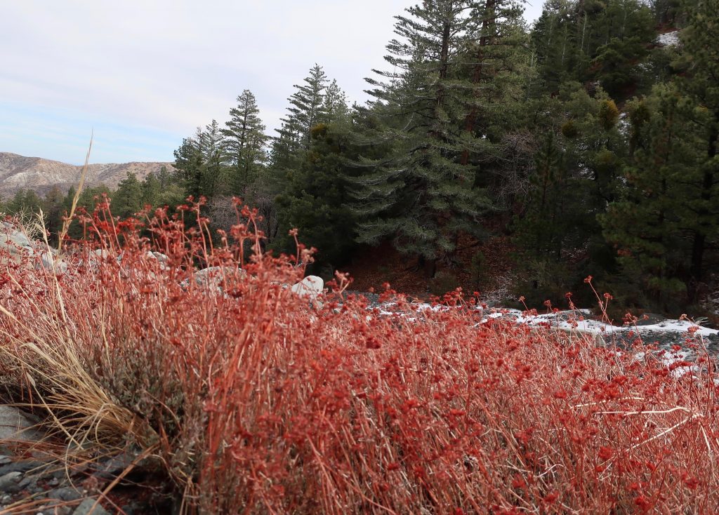
Last year’s dried flower stalks still draw your attention to clumps of buckwheat growing along Heath Creek.
Pearl Comfort Fisher, who wrote “The Mountaineers” back in 1972, provides a brief glimpse into a cowboy’s visit to the Heath Ranch back in 1907. The cowboy was Harvey Cheesman, hired to round up stray cattle from the nearby Lovejoy Springs Ranch. “So it happened that as I came over the divide from Lone Pine Canyon one cold February late afternoon I found the ranch or homestead of Harry Heath at the head of Sheep Creek. Upon knocking at the door I was met by a lady with a small baby in her arms. It was Mrs. Heath. She said, “‘My, am I glad to see some one. A mountain lion has been prowling around here for three nights and my husband is away working, and I am afraid the lion will get some of our pigs and chickens. “No lion showed up that night and I had to go on my way the next day.”
Today, it’s hard to imagine Wrightwood as wild and isolated as it must have been 112 years ago. The upper half of this hike will give you a taste of a quieter more forested Swarthout Valley.
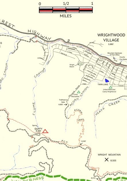
Here’s a small section of the Wrightwood – Big Pines map depicting part of Heath Creek. Access this hike by taking the dirt road that departs south, climbing upslope from Thrush Rd. between Victorville Street and Heath Creek Rd.
This walk is a great one if you just have a little time, say less than an hour and you’d like to get some hill climbing in, too. You’re walking on a flood control levee road. The beginning of your trip is a bit exposed to the sun and completely devoid of trees, much of the landscape down in the wash to your left has a sterile, bleak look due to constant grading from county bulldozers. Not that great at first. . . Hang in there, the bleakness soon ends. Your route soon encounters black oaks, Jeffrey and Ponderosa pines on both sides of the levee road. An enticing flat makes its’ presence across the stream on your left. On your right is a gentle, expansive alluvial slope covered in a healthy pine forest. Mostly private, undeveloped land, this terrain gives you a sense of what Wrightwood must have been like in the 19th century. On a warm day, the air is fragrant with pine and amazingly quiet, save the occasional song bird or acorn woodpecker tapping high above the forest floor.
Trailhead for the Heath Creek hike is where Thrush crosses Heath Canyon. Thrush is the straight, east-west trending road just above (north) the “n” in Canyon. Notice that this U.S.G.S. topographic map section still shows Lone Pine Canyon Road crossing Heath Canyon, as it once did prior to the 1969 flood.
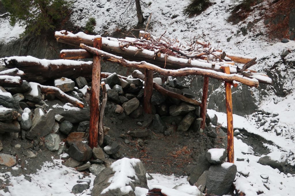
After a mile, you’ll encounter another silver painted pipe gate. This is your turnaround point. If you have the time, continue further up along the road to a set of four wooden benches set in a square configuration. Walk on past this gathering area, bearing left and staying with the canyon bottom. Follow a deeply eroded trace of a former jeep road. Essentially now a trail, continue on up the canyon for another 400′ feet of elevation to the trail’s end on a rocky berm above the stream bed. You will also see a little frame structure made from lashed together cedar trunks and limbs.
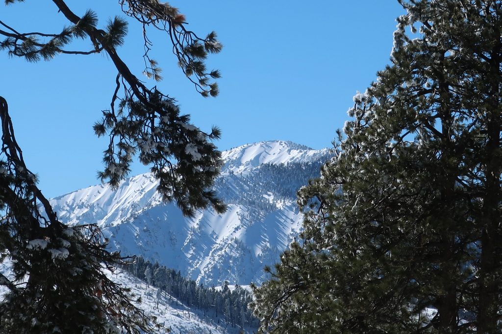
9,399′ high Mt. Baden-Powell’s massif dominates the southwest skyline from Table Mountain.
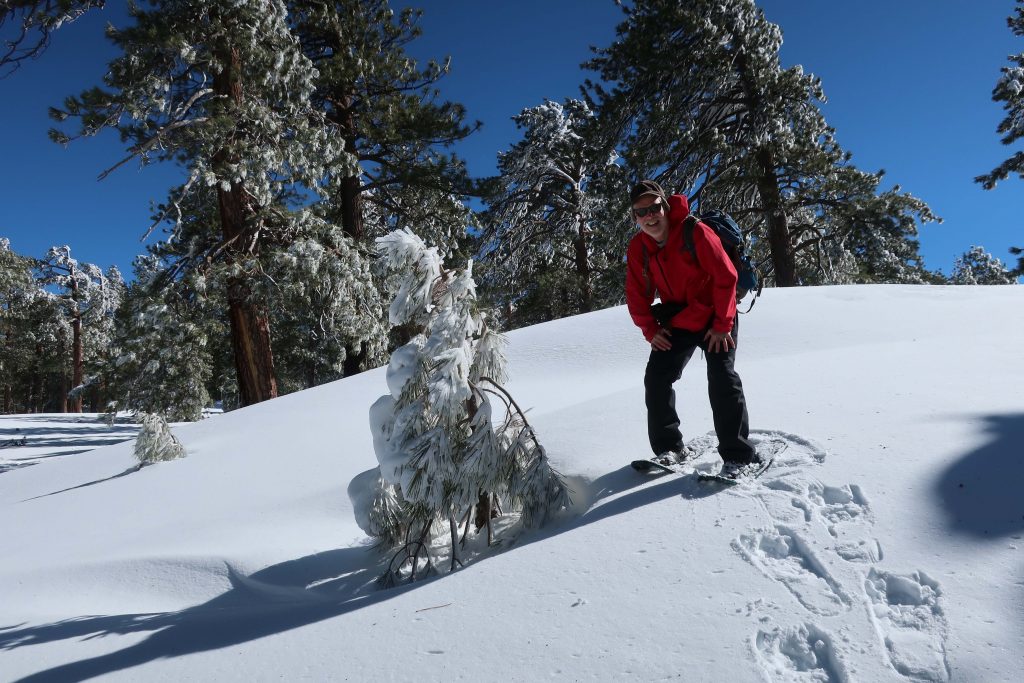
Joanie and I got out for a great afternoon of snowshoeing up on Wrightwood’s Table Mountain about a week and a half ago. Since then, more storms have dropped even more of the precious powder on our local mountains. Whether you like to cross-country ski or snowshoe, it’s a fantastic time to be out amongst our high country peaks, canyons and forests!
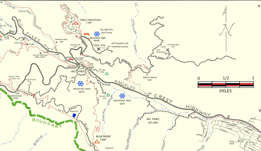
Inset of the Trails of Wrightwood – Big Pines map. The area we went snowshoeing is depicted as Table Mountain (with campground symbol) at an elevation of 7,200′. The west end of Wrightwood appears in the lower right corner of image.
Table Mountain is 7,516′ high and super easy to get to from Wrightwood. Just drive. You’re only looking at four miles from our village center. Make sure to turn off to the right on Table Mountain Road when you arrive at the three way split in the roads at Big Pines. Table Mountain Campground is where we did our snowshoeing on a quiet Friday, where we seemed to have the place to ourselves. The wind had sculpted the snow into pristine dunes along the gently sloping ridge top that the extensive campground straddles.
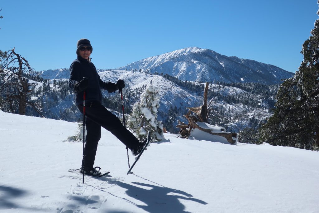
Joanie seems to almost float atop the powder on the sunny slopes of Table Mountain!
All the campsites were, of course, hidden under the snowy mantle, with just the picnic tabletops presenting themselves as a bit of a depth gauge. Most of the time, snow depth was around 24″ and in places well over three feet. The windward sides of the mammoth white fir and Ponderosas were coated in sparkling icicles that fell like shards of glass in the wind gusts that came out of the southwest. Mt. Baden-Powell kept constant watch over us from across the great gulf of the East Fork of the San Gabriel River. The Mojave Desert off to the north was a mosaic of tans, yellow sands and the right-angled patchwork of green winter crops scattered here and there. It looked and felt warmer down there. And high up on Table Mountain, that day was to be one of cobalt blue skies, bright white snows, wind and evergreens.
A small wind-bent snowy pine and Chris have a little visit amongst Table Mountain’s frozen forest.
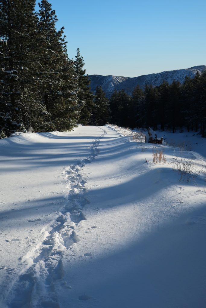
Yesterday, I headed up Heath Creek and got a quick snowshoe in to the upper gate. Only went about a mile up from Thrush Rd. However, it’s about 460′ of gain. It’s been so long since we’ve had this kind of snow. Forgot how much of a chug it would be with snowshoes on – ha! Good times.
Here’s a small section of the Wrightwood – Big Pines map depicting part of Heath Creek. Access this hike by taking the dirt road that departs south, climbing upslope from Thrush Rd. between Victorville Street and Heath Creek Rd.
Elevation Gain / Loss:
From the lower gate (just above Thrush Rd.) to upper gate = 460′. The elevation on Thrush Rd. at spot where you walk up the beginning of levee road is 5,840′. This gain takes place in approximately one mile along the levee road located on west side of Heath Creek. Elevation of upper gate is 6,300′.
If you have time, keep on going past the upper gate. Soon you’ll encounter some sawn log benches placed in a square configuration. Keep going further up along the stream bed on the old, steeply rutted jeep road which is in places barely a trace. It’s steeper going now than it was on the levee road between the two gates.
From upper gate to top end of old jeep road (abandoned) =400′. The top end of old road is where two canyons come together. There’s a forested canyon on the left side and small stream running between jagged walls on the right. The elevation here is 6,700′. Look for the little framework of limbs that have been lashed to some upright hand-hewn cedar poles.
Looking directly up Wright Mountain’s slide from the canyon bottom. This is the same slide you can view toward the south from the Wrightwood Post Office. Wright Mountain’s summit is at top of ridge on far left of photo at an elevation of 8,500′. Photo was taken at elevation of 6,300′ near upper gate.
Today, finally dragged out the dusty snow shoes!
Looking over my shoulder, this is all that’s being left behind.
Heath Creek, looking down canyon. That’s the Mojave Desert on the distant skyline.
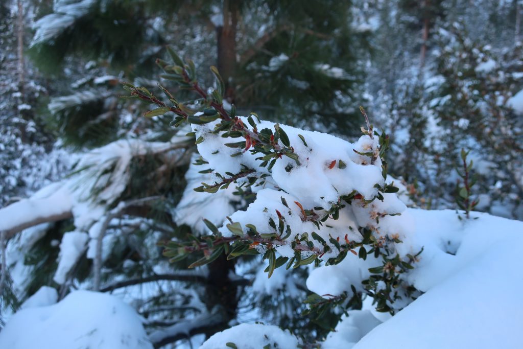
Snow covered mountain mahogany, Heath Creek.
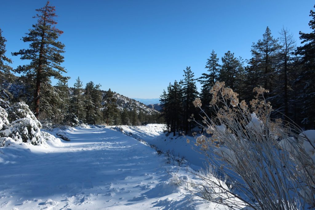
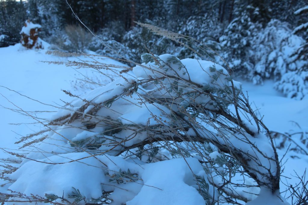
Snow bent Great Basin Sagebrush about a mile up Heath Canyon from Thrush Rd.
This little structure of lashed together branches and poles is up at the end of the hike. It’s up above the rocky stream bed at confluence of the two canyons.
The northwest side of Mount Baldy as seen from the Lightning Ridge Nature Trail ( summit is between the two pines in foreground). To the left of Mt. Baldy is Pine Mountain. It too, still has some snow on its’ slopes. Mount Baldy, officially known as Mount San Antonio, is the highest peak in the San Gabriel mountains at 10,064′ elevation. That’s the Angeles Crest Highway (Hwy. 2) coming up from the mountain village of Wrightwood on the left side of photograph.
Now that it’s May and the days have started to warm up and lengthen, consider walking the Lightning Ridge Nature Trail. It’s up 7,300′ on the spine of the San Gabriel mountains. This is high country with fabulous views in all directions. A short drive west of Wrightwood, approximately 5 miles, takes you to the trailhead just across Hwy. 2 (Angeles Crest Highway) from Inspiration Point.
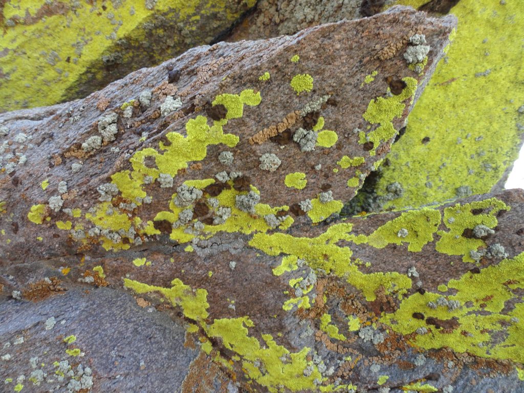
Colorful lichens make these wind swept boulders their home atop the San Gabriel mountains. Elevation is 7,400′ on an exposed ridge top. Lightning Ridge Nature Trail – Wrightwood, CA.
The trailhead is on the north side of Hwy. 2 in a wide turnout next to a backdrop of willows and shrubs. There’s a red metal picnic table there as well. Find your way through the little brushy opening and you’ll see a PCT (Pacific Crest Trail) signpost marking the trail to your left. You’ll take the trail directly in front of you, contouring the gentle slope. Sometimes you’ll find leaflets in the covered metal box at the trail’s beginning that describe the flora along the way. Whether you find them or not, there’s plenty to ponder and take in without knowing the names of all the plants along the way. This loop trail is only a bit over half a mile in length, climbs about a hundred feet from the start and perfect for all ages and abilities. The Lightning Ridge Nature Trail travels underneath mature Jeffrey pines and black oaks, at times switchbacking amongst whitethorn chaparral (buckthorn) and even ascending the slope by means of steps made of landscape timbers. Over the years, our family has often used these steps as little seats to look out over the nearby desert with its’ ever-changing palette of color and shadow. One of the unique qualities of this loop trail is the constant grand views of the Mojave Desert to the north, Mount Baden-Powell toward the west, the open canyon country of the East Fork of the San Gabriel River to the south and, of course, Pine Mountain, Dawson Peak and Old Baldy to the east.
A view of the beginning of the Lightning Ridge Nature Trail. This short loop trail is a wonderful introduction for all ages into the landscape and flora of the San Gabriel mountains high country.
As the trail circles back in on itself and joins the PCT for the return, take a little time to rest on the overlook bench, taking in the fine views of canyons and peaks. Much of the Sheep Mountain Wilderness area is directly out front of you from this ridge top perch. One of the range’s most isolated and challenging peaks, Iron Mountain (elevation 8,008′), can be seen straight out to the south at the end of lonesome West San Antonio Ridge, which comes off of Mt. Baldy to it’s right (west). Iron Mountain’s nipple shaped summit is easy to identify from this vantage point. When you’re ready, return back to the beginning by way of the PCT. You’ll pass by fallen giant tree trunks, bleached smooth by the high elevation sun and wind. A great trail to experience at sunset!
Posted on April 19, 2017 – Written by Chris Kasten
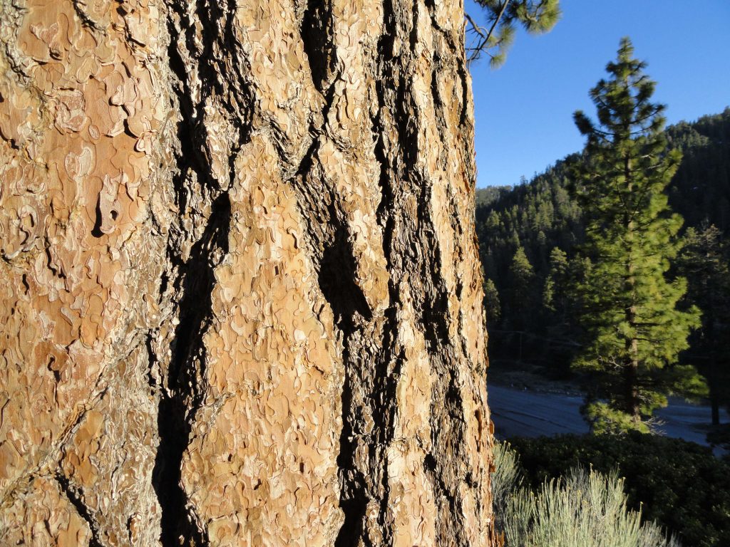
Close up of plate-like tree bark on Ponderosa Pine. The Big Pines Nature Trail travels among mature stands of Jeffrey and Ponderosa pines. The north-facing forested slope of Blue Ridge is off to the right.
Just went up to the Big Pines Nature Trail last week. It was late in the day and thick, gold light was drifting down through the pines and slopes. Located just three miles west of Wrightwood, this is a convenient spot to walk a gentle, half-mile loop up amongst some
Looking out at Wright Mountain on the far east end of Blue Ridge. Mature stands of Ponderosa and Jeffrey pine are in the foreground.
really large pines along with fine views of thickly forested Blue Ridge. The trail starts next to the old Big Pines Lodge. Look for a little parking lot on the north side of Highway 2, just before passing the old Big Pines Lodge. You start your loop hike by walking up a flight of beautiful stone stairs built back when Big Pines was developed as the jewel of the Los Angeles County parks. These stairs were tread upon by visitors to this mountain wonderland of four seasons. Not only was there a lodge here for dances, movies, plays and replete with fireplaces, but there were housekeeping cabins, a place to dine, sled runs, ice skating, camping, swimming and even a little zoo. Back then, the Angeles Crest Highway had not yet been finished, so one drove here from
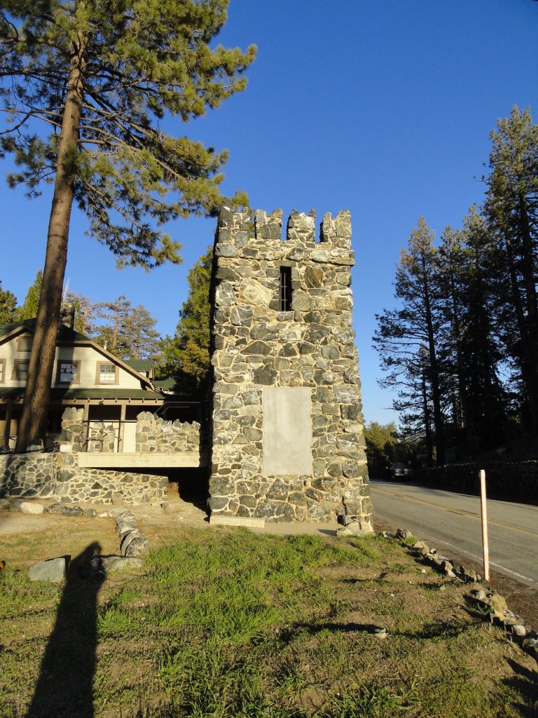
North Tower. This is what remains of Davidson Arch, built back in 1926. The arch spanned the highway, providing a pedestrian overpass for the many visitors to Big Pines. The arch was torn down in 1950 to accommodate the widening of the highway.
the desert side on County Route
N4 or up from Cajon Canyon by way of Lone Pine Canyon Road through Wrightwood. No freeways. The San Gabriel Mountains have always held an allure for people seeking beauty and peace. It’s no different today, and although the times and works of man pass slowly by, the beauty of these mountains remains. An easy walk for all ages, this self-guided nature trail does about a hundred feet of gain in just over a half mile before returning back down to its’ beginning. There are signs along the path that point out the native plants along the way. The slope you travel is south-facing and receives good light
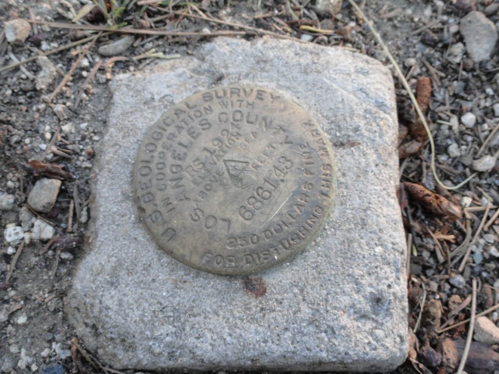
This benchmark, placed next to where the north tower of Davidson Arch is located, marks your elevation at 6,861 feet above sea level. As you can see, it was placed here 93 years ago by the surveyors!
and even in the winter and early spring can still be comfortably warm while snow still clings to the north slopes of Blue Ridge. Because of this slope’s southerly aspect, you’ll find sun loving plants such as Yerba Santa, Parry’s Manzanita and Fremontia (flannel bush) to name a few. Yet, you’ll still enjoy the welcome shade of Ponderosa, Jeffrey pine and leafy black oaks (Kellogg). There are some good spots to sit down and rest awhile and think about nothing. Upon your return, don’t forget to poke your head into the door of the visitor center, located on far right side of the porch of the old Big Pines Lodge. Presently, the center is staffed by the U.S. Forest Service Friday through Tuesday, providing information on local places to visit and hike.
Looking down into Sawmill Canyon while descending the Blue Ridge Trail. Photo taken just below Blue Ridge Campground. That’s Pinyon Ridge out in the distance.
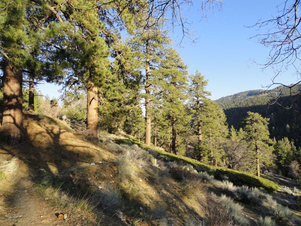
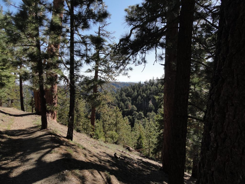
It’s already far enough into the Spring to do the Blue Ridge Trail hike in Wrightwood, CA. Yesterday, Joanie and I worked our way up the Blue Ridge Trail, which begins across the street from the old Big Pines Lodge just a few miles west of Wrightwood. The air was fresh (mid 40′s) as shredded white clouds blew fast to the north over Blue Ridge. The Blue Ridge Trail is 2 miles in length and climbs about 1,100′ between Big Pines and Blue Ridge Campground. This trail hike is a pleasant climb, in many places contouring shaded slopes and occasionally poking into quiet little side canyons filled with willows. Much of the view is of the Swarthout Valley which cradles the little mountain village of Wrightwood.
Half way up the mountainside is a wooden bench that performs double-duty as both a place to sit as well as a trail sign. The recessed lettering indicates that Blue Ridge Campground is one mile up and Big Pines one mile down. The trail continues on, contouring and climbing the mountainside above Sawmill Canyon. Eventually, the trail switchbacks just prior to reaching Blue Ridge Campground, a pretty little spot with eight campsites straddling piney Blue Ridge. The Pacific Crest Trail, spanning from the
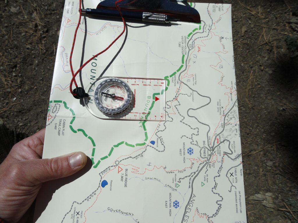
A section of the Trails of Wrightwood – Big Pines map is being oriented to the local landscape. This photo was taken on the lower end of the Blue Ridge Trail between Big Pines and Blue Ridge Campground.Mexican border all the way to Canada, is also met here at the campground.
Mexico border all the way to Canada passes through the campground.
You can return back down the mountainside, the same way you came up, or make a loop out of it by taking the PCT (Pacific Crest Trail) toward Inspiration Point and then cutting off onto a dirt access road which descends back toward Mountain High West ski area. This route can be seen on both the Trails of Wrightwood – Big Pines map or Tom Harrison’s Angeles High Country map.
Regardless of which way you do your return trip, you’re sure to enjoy passing through healthy and mature stands of black oak, jeffrey pine, ponderosa pine, sugar pine and white fir.
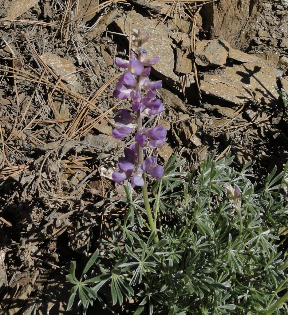
Morning light on flowering lupine. Photo taken about midway between Big Pines and Blue Ridge Campground.
Posted on September 14, 2016 – Written by Chris Kasten
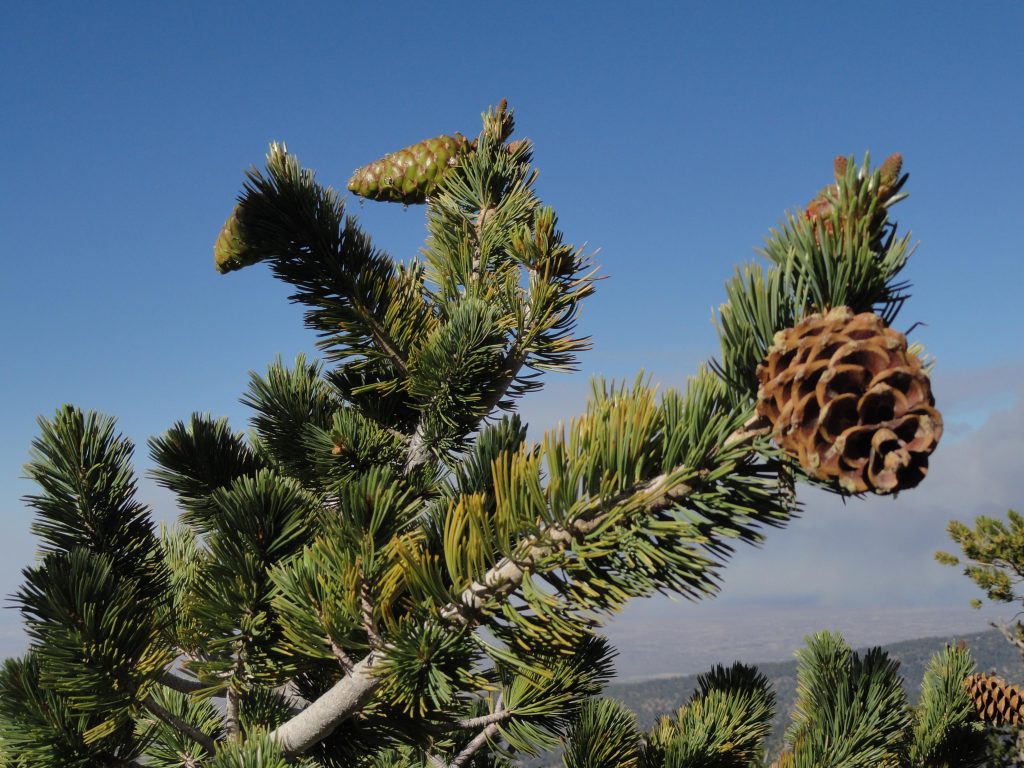
Here’s a close-up image of a bough of Limber Pine (pinus flexilis) taken near the summit of Mount Baden-Powell. Some of these trees found high, about 9,000′ elevation, on this mountain slope in the eastern San Gabriel mountains range in age from 1,500 – 2,500 years. Look for needles numbering five within each sheath, smallish cones and white, cordlike branches that are very flexible. The trees are not terribly tall and sometimes appear shrubby and very wind bent.
The Mount Baden-Powell hike is featured in the Trails of Wrightwood – Big Pines Map, as well as 19 other trail hikes in the surrounding area. The map is hand-drawn on weather-proof map paper. Unfolded, it measures 19″ x 28″, giving a clear sense of how many of the trails are laid out in this part of the eastern San Gabriel Mountains high-country. Contour lines have been purposely omitted, presenting a clear and uncluttered appearance. Just click on www.hikewrightwood.net to see details. Late summer and fall are both good times of the year to hike up this beautifully forested mountainside.
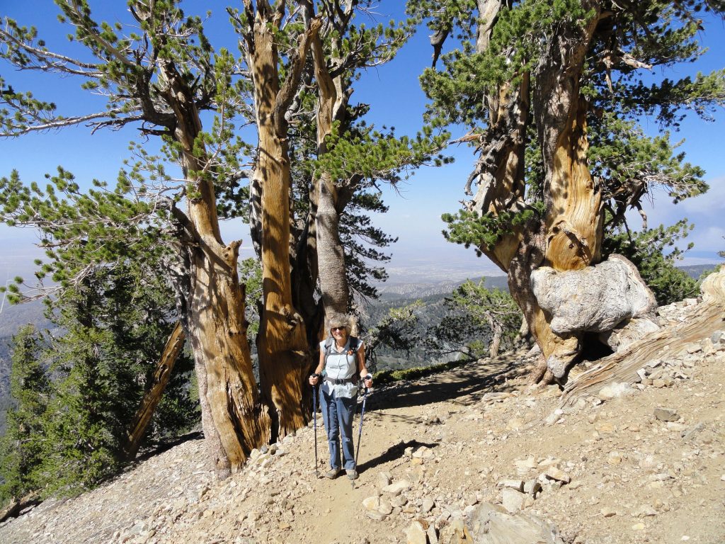
Joanie Kasten framed between two ancient limber pines as she nears the summit of Mt. Baden-Powell.
You start out at Vincent Gap on the Angeles Crest Highway in an area of red soil, sort of like a color you’d see in New Mexico. In 38 switchbacks you’ll climb 2,800′ to the top of the windswept summit. Less than half way up, make sure to stop at Lamel Spring and check out native wildflowers, such as Shooting Stars and Crimson Monkey flowers.
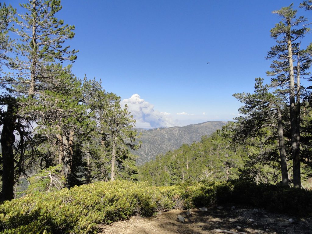
About 2/3 of the way up to Mount Baden-Powell, you can see a smoke cloud behind East Blue Ridge. We thought that the fire might be near Wrightwood, however, it was way down on the I-15 Freeway in the Cajon Pass. Notice the deer brush and Lodgepole pines in the foreground.
One of the great reasons to do this hike is to experience forest transition the whole way up. Start your hike out in scrub oak and lots of jeffrey pine. Soon, you’ll be experiencing stately sugar pines with their long, glistening cones hanging from the tips of broad horizontal branches. Next, you’ll travel through stands of lodgepole, nearly perfectly straight in stature, with a myriad of tiny cones covering the forest floor at their base. As you near the summit, start to look for the ancient limber pines, which have been buffeted by the storms of wind, rain and snow for centuries. In some cases, 2,500 years! Whatever your reasons for doing the Mount Baden-Powell hike, you’re sure to to enjoy majestic panoramas of the Mojave Desert to the north along with a view of the rugged peaks of Pine Mountain, Dawson Peak and Mount Baldy to the east. Come back refreshed.
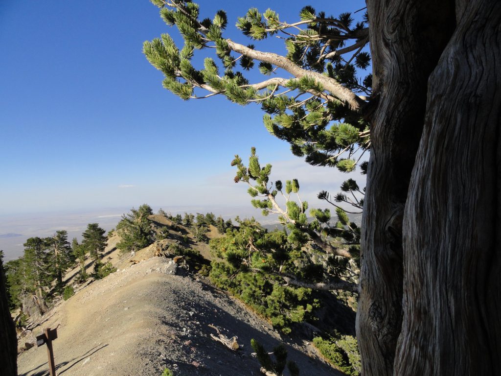
Here’s a view looking out toward the Mojave Desert. Photo was taken just below the summit of Mount Baden-Powell under the shade of an ancient limber pine in the late afternoon. Notice the trail sign in the foreground, marking the intersection of the P C T (Pacific Crest Trail) and the final few switchbacks to the summit.