Big Horn Mine Trail Map

Posted on July 18, 2016 – Written by Chris Kasten

This is a view looking into the Big Horn Mine’s upper adit. Note that the narrow ore car track is still fairly intact.

A new Big Horn Mine trail map is now available through Canyon Cartography’s website with free shipping.  Also, a number of retailers in Wrightwood carry the map as well.  Mountain Hardware, Wrightwood Market, Jensen’s Market and the Grizzly Cafe are some some of the locations where you can pick up a trail map on your way to the

The view down into Vincent Gulch taken late in the day. Photo taken near the Vincent Gap trail head. The mountain, back center skyline, is Pine Mountain (elevation 9,648′).

trailhead.  The approach to the Big Horn Mine from Vincent Gap is depicted on the Wrightwood – Big Pines Trails map.  Getting to the mine is straight forward, your path being an abandoned dirt road skirting the east slope of Mt. Baden-Powell.  The distance, one way, is 1.8 miles with 250′ of elevation

The trail head at Vincent Gap. Note the white fire road gate on left. You’ll want to follow the red dirt road that continues past the locked gate. This road will soon narrow to single track, reemerge as a road only to once, again, become narrow single track. This is your route to the Big Horn Mine. The trail sign on the right directs hikers to Mt. Baden-Powell via the Pacific Crest Trail (PCT).

gain between the Vincent Gap trailhead and the Big Horn Mine.  Your route passes amongst healthy stands of white fir, sugar pine, jeffrey pine, incense cedar and other conifers in this high country setting.  Occasionally, the terrain takes on a stark and arid feel amongst the fractured rock.  Along the way, you’re afforded spacious views of the eastern high country peaks.  Pine Mountain, Dawson Peak, Mt. Baldy and remote Iron Mountain make up a big section of the skyline.  The sky on most days is deep blue up here, with the deep and wild gorge of the East Fork of the San Gabriel River giving you a sense of depth and steepness below the path.  The main area you’re looking out toward is the Sheep Mountain Wilderness.  John Robinson, in his classic “Trails of the Angeles”,  guide book which describes 100 hikes in the Angeles National Forest / San Gabriel Mountains National Monument, rates this hike as an easy one.  When you arrive at the Vincent Gap trailhead, notice the reddish soil, a unique and scenic feature in the San Gabriel mountains.  There’s ample parking at this 6,593′ high saddle, a major

A view looking back down at the stamp mill from the upper adit. Note: dilapidated wooden ladder – not recommended for supporting your weight – avoid it!

watershed divide between the East Fork of the San Gabriel River to the south and Big Rock Creek to the north.  The Vincent Gap trailhead is less than seven miles west of the scenic mountain village of Wrightwood.

Mining in the San Gabriel mountains is an extensive and colorful part of  the history of man’s

Remnant road to the Big Horn Mine is now a single-track hiking trail due to numerous landslides on the slopes of Mt. Baden-Powell.

forays into these rugged canyons and mountainsides.  Most of the gold that’s ever been taken out of the “hard rock” types of mines in these mountains is to be found in quartz veins, known as “gold bearing quartz.”  The Big Horn mine was no exception to the rule.  Charles Tom Vincent discovered a gold bearing vein back in 1895 while hunting big horn sheep on the steep, raw slopes of Mt. Baden Powell.  Hence the name of the mine was created.  Back then, Mt. Baden-Powell was known as “North Baldy.”  Back in these early days of the mountains, there was no Angeles Crest Highway, no easy drive to this part of Southern California.  It took days of hiking from the valley towns, such as Azusa, Sierra Madre and Altadena to reach these haunts.  Miner Vincent would have trekked up the long and sinuous San Gabriel River from Azusa.  Approaching from the north, he would have ascended Big Rock Creek from distant desert locales such as Pearblossom, Victorville or the Cajon Pass to the east.  Most belongings were packed in on men’s backs or possibly mules.  Miner Vincent did not possess the resources to bore tunnels and erect a stamp mill on the precarious mountainside.  Eventually, over the decades, a number of companies played their hand at extracting the elusive gold deep within the mountain.   The usual pattern of “bonanza!” followed by heavy investment, hard work, diminishing returns and finally abandonment, took place at the Big Horn as it has in all the other hard rock mines of the San Gabriels.  Today the approach to the mine is being reclaimed by the mountains.  The skeletal remains of the stamp mill still remain adjacent to the adits (horizontal mine shafts) in this alpine

The high country peaks of Pine Mountain, Mt. Baldy and Iron Mountain are framed within this view looking out from the Big Horn Mine’s stamp mill.

setting.  Take care exploring what’s left of the Big Horn.  The slopes are extremely steep and exposed.  This is a great hike to take in a sense of what mining in the early days of the San Gabriels must have been like.  It’s also a wonderful place to take in the grandeur of the wilderness all around you.

Remnant platform emerges from the upper adit of the Big Horn Mine. This spot is located just upslope from the stamp mill.

Hike Wrightwood – Twenty Good Reasons – At least!

Posted on June 20, 2016 – Written by Chris Kasten

Crimson Columbine grace the fresh, tumbling waters of the East Fork of the San Gabriel River. This scene was photographed just downstream from Mine Gulch campsite at an elevation of 4,500′ in the Sheep Mountain Wilderness. It’s all boulder hopping downstream from the confluence of Vincent Gulch, Mine Gulch and the Prairie Fork.

There are at least twenty good reasons to hike Wrightwood during the spring and summer months.  While the front country of the San Gabriel mountains swelters under the summer heat and high humidity, there’s a beautiful place in the eastern high country where the air is lighter, cooler and a bit drier, too.  Gentle breezes sweep through the pine forests, imparting a restful, freshness to your hike.  If you can imagine spanning the ridge top distance between Wright Mountain on the east out to Mount Baden-Powell in the west, there’s a myriad of hiking trails, over 20, to be found among the high elevation pines, fir, cedars and fragrant chaparral.   Some of the trails connect places like Jackson Lake with West Blue Ridge, Wrightwood with East Blue Ridge and the Pacific Crest Trail (PCT), Big Pines with Blue Ridge Campground, Vincent Gap up to Mount Baden-Powell’s 9,399′ summit or the descent into the  headwaters of the East Fork of the San Gabriel River.

Old metal supports from the Big Horn Mine’s stamp mill provide this framed view of Pine Mountain, Mount Baldy and Iron Mountain. Thousands of feet below, the East Fork of the San Gabriel River churns through the Sheep Mountain Wilderness.


There’s quite a variety of places to hike Wrightwood that provide  you with a sense of of our past, such as the remains of the Big Horn gold mine, which clings precariously to the slopes of Mount Baden-Powell in Mine Gulch.  Dating back to the 1800′s, this hard rock mine was worked for decades by tenacious miners, in hopes of  golden outcomes.  Today its’ stamp mill and mine shafts sit idle, a testament to nature’s relentless taking back of the works of man in mountainous places.

If you look around the old Big Pines Lodge at the heart of what was once Big Pines County Park, founded in the 1920′s, classic rock work fringes rock walls and staircases from an era gone by.  Walk the Big Pines Nature Trail or head down to the old ice skating rink near the Arch Picnic Area to catch glimpses of where cabins once stood amongst groups of campers and snow players.

An ancient Limber Pine straddles the ridge top just prior to arriving at the summit of Mount Baden-Powell. Some of these beautifully gnarled pines are nearly two thousand years in age and are found near the upper end of the Pacific Crest Trail that connects Vincent Gap’s trailhead with the summit.

Hiking up to Mount Baden-Powell or dropping down into the canyons from Vincent Gap provide for a wonderful variety of terrain and plant life.  Regardless of your conditioning and time available, there’s a trail here for you.   If carrying a trail map appeals to you, there’s a large scale, hand-drawn map that highlights twenty hikes in the Wrightwood – Big Pines area of the San Gabriel mountains, providing a brief description of each hike experience with rise over run.  The map is very accurate, easy to read and has been field checked throughout.  Contour lines have been purposely omitted to provide a clear, uncluttered overview of the local high country  trails.  The Wrightwood – Big Pines Map is available online with free shipping or can be found at Mountain Hardware and the Wrightwood Market in the quaint village of Wrightwood, CA.  Happy Trails from Chris at Canyon Cartography!


Heading back up the Manzanita Trail toward Vincent Gap. Western Wall Flowers and Indian Paint Brush signal the advent of the summer hiking season.

Trails of Wrightwood – Big Pines Hiking Map

Posted on March 7, 2016 – Written by Chris Kasten

Looking east across the Sheep Mountain Wilderness. The three peaks that make up the skyline are from left to right, Pine Mountain, Dawson Peak and Mount Baldy. This photo was taken from the Pacific Crest Trail just before arriving at summit of Mount Baden-Powell.

The Trails of Wrightwood – Big Pines hiking map is now available!  This is a large-scale, hand-drawn,  trail map created on weatherproof / tear-proof paper and measures 19″ x 28″.  Folded dimension is 4.75″ x 7″. A banner listing of 20 trail hikes for the Wrightwood – Big Pines area is located at the top of the map.  Distances along with elevation gain and loss is provided for trails that range from short, easy to follow nature walks to more challenging hikes.  Check out Mountain Hardware’s Great Outdoors Page for a look at some of the trips to be taken.  Go to:  http://mtnhardware.com/outdoor-report/category/hiking-wrightwood/

Contour lines have been purposely omitted, providing clarity and a sense of open space between the trails, roads, points of interest, as well as natural features such as streams and summits.   This is a map intended for the use in traveling hiking trails, fire roads and local roadways.   If you’re planning on hiking cross-country (off trail) in this map’s area, it’s recommended that you travel with topographic maps and are skilled in the use of land navigation.

This map is hand drawn using rapidograph technical pens.  Trails and streams are hand lettered.  The base cartography was provided by using four, 7.5 minute topographic maps of the eastern San Gabriel mountains.  The maps used are: Mount San Antonio, Crystal Lake, Valyermo and Mescal Creek.  The coordinates for the southwest corner are 34 19′ 32″ N 117 46′ 9″ W  Coordinates for the northeast corner are 34 23′ 38″ N 117 37′ 38″ W.  Projection: NAD 27 CONUS.


Detail of trails near Big Pines, four miles west of Wrightwood, CA.  (sample image taken from Trails of Wrightwood – Big Pines map)

In the spring of 2015, I began doing the field work for this project.  It began with the hike down into the East Fork of the San Gabriel River from Vincent Gap on the Mine Gulch Trail.  Week after week, with clipboard in hand, another trail section would be followed within the mapping area, making corrections for trail realignments, washouts and places where bouldering and route choosing becomes necessary, such as downstream from Mine Gulch Campground or the lower Prairie Fork.  Much of the trail sections shown on the base topo maps appeared to be accurate, while a number of trails on the topo maps were now nonexistent.  Using an orienteering compass, I would site on landmarks using intersection technique to


Detail of trails near Vincent Gap on Highway 2 near Mt. Baden-Powell.  (sample image taken from Trails of Wrightwood – Big Pines map)

locate and confirm my location at many points along the various trails and then “draw in” what was actually out there.  With the changes that can occur within years and years in steep mountainous terrain, trails and roads can often literally disappear or be significantly re-routed around natural obstacles.   Even campgrounds can return back to nature, such as in the case of Cabin Flat, which can no longer be driven into from Lupine Campground.  It has now become a trail camp since the road was closed to motorized use.

The heart of this mapping project was doing the field checks and then drawing in the changes on the trails located throughout the map’s neat line.    Once back at home, I would transpose the field drawings onto a 30″ x 40″ sheet of drawing paper in pencil.   A grid was drawn on both the topo maps as well as the working copy at home.  This grid technique is quite a time-proven way of preventing distortion and mechanically increasing the size of the map being created. Finally, once I was satisfied with the accuracy of the penciled in trails and other map features, the line work was inked in.  The entire drawing was then scanned at 300 dpi on a roller scanner and converted into a jpeg file, making it compatible for editing and colorizing with PhotoShop.   From start to finish, this mapping project took just over seven months, providing an overview of the trails bounded by Wright Mountain (East), Mount Baden-Powell (West), Jackson Lake (North) and the East Fork of the San Gabriel River (South).

Following the Old Sturtevant Trail Toward Chantry Flat

Posted on February 19, 2016 – Written by Chris Kasten

This image was scanned from John W. Robinson’s “The San Gabriels.” A young lady stops for her photo at the First Water Junction on the Sturtevant Trail, not far from present day Chantry Flats.

Historic topographic quadrangle from the 1930′s.

Following the old Sturtevant Trail toward Chantry Flat today, is to put it lightly, a challenging and slow-moving proposition through thick brush and steep rocky slopes.  Built back in 1895 by Wilbur Sturtevant and a cadre of other mountaineers of the time, this trail was once a main way into the Big Santa Anita Canyon during the “Great Hiking Era.”   What an amazing time this must have been, 1895 through the late 1920′s, when the mountains rang with the joyous songs of hikers traveling on the myriad of trails through the chaparral and under the spruce, oaks and maples.  Alternating through bright glades of sun drenched brush and cool, shady nooks of ferns and shade, the Sturtevant Trail made its’ way up from Chantry’s Store and Corum’s Pack Station in Sierra Madre  to Wilbur Sturtevant’s trail resort in the Upper Big Santa Anita Canyon.  Pack trains carried construction supplies to such places as Roberts’ Camp, Hoegees, First Water, Fern Lodge and Sturtevant’s, not to mention the construction sites of over 220 private little cabins that dotted stream side flats.

Detailed section of quadrangle showing the Sturtevant Trail. Notice that the trail does not show on map past boundary into Angeles National Forest.

Just last week, our friend Adrian and I, travelled on and along what remains of the Sturtevant Trail between Sierra Madre and to a point just beyond the current Arcadia communication site located near the Angeles National Forest boundary.  Eventually, as the shadows lengthened and our energies waned, we finally peeled off the trail through a thicket of poison oak and bright green grasses to the Chantry Road at a point just down from Sherfee Spring,  where our friend Canyon Dave picked us up, without having even having planned it that way!   Much of the travel was wading through great expanses of aromatic black sage.  The temps were unseasonably warm, the low 80′s, and thoughts of fat, black coiled rattlesnakes lurked in the recesses of my mind at times.  Of course, what we worry about usually never comes to pass…


Lower section of Sturtevant Trail on approach to Lannan Canyon. Here it’s quite intact.

While much of the original trail or what I refer to as “tread work” was in place, there were just as many stretches of hillside along the way where any remains of the original tread had long since washed away. So we often found ourselves hiking up slope way more than we needed, searching in vain for the trail or in some cases, dropping far too low as well.  Adrian had calibrated his GPS to the historic topographic quadrangle that we had downloaded.  Sometimes the blue line from the GPS showed us to be directly on the trail, while at other times we were far from the mark.  In the end, there was the ever present hunch or sense of where it might have made sense for the trail to have run.  And, sure enough, it would often reappear a bit further on.  Much of the terrain is loose and crumbly, while the chaparral was composed mostly of black sage, white sage, buck brush (wild lilac) and sumac.  The views are  expansive and we found ourselves with constant views of the Chantry Road between Sierra Madre and Chantry Flats, where at road’s end,  the trailheads, ranger station, picnic area and Adams Pack Station are located today.  Although we never made it the entire way out to Chantry Flats, the experience really did give us a sense of what the hike up from Sierra Madre would have been like back before the Chantry Road existed.

Chris Kasten as seen on Sturtevant Trail in Lannan Canyon. Notice Chantry Road in background.


A wide piece of the trail’s “tread” is seen here under a tunnel of brush. We often had to crawl through places like this.


Section of crank telephone line and insulator found near site of Little Gray Inn


Adrian as seen on a piece of the old Sturtevant Trail not too far from Roberts’ Halfway Rest, now a communications site on the Angeles National Forest boundary.

Today, the old trail is slowly being reclaimed by the Earth.  Red tailed hawks circle amongst thermals on the warm, shaggy slopes.  Lizards and wood rats go through their daily routines amongst the forest of brush and scrub oak.   The plants quietly grow and blossom, season after season, filling the breezes with mingled aromatic scents.    Yet, if you’re quiet enough and get still, you can still sense the plodding of pack trains and laughter of hikers, seeking out good times in our mountains eternal.  Although the old Sturtevant Trail has been gone now between Sierra Madre and Chantry Flats for the last 80 years,  her traces still remain.

The Sturtevant Trail is still pretty intact as it makes this turn into a little side canyon between the Little Gray Inn and the Halfway House.


Looking back over the route that the Sturtevant Trail once took. That’s the Chantry Road winding below the old trail.


There’s only the faintest outline of the once busy Sturtevant Trail left on this chaparral cloaked slope. This spot is located just below the Halfway House.

El Nino, Big Santa Anita Canyon, Chantry Flats back in 2005

Posted on November 1, 2015 – Written by Chris Kasten

Here are some photos taken the day I rode my bike up to Chantry Flats to see how high the stream had become.  Photos taken during El Nino, Big Santa Anita Canyon, Chantry Flats back in 2005.  It was a huge El Nino year for Big Santa Anita Canyon and the rest of southern California.  At Sturtevant’s Camp we received over 89 + inches of rain that season.  Our  rain gauge actually overflowed during one of the storms, so the figure of 89 inches is only a “known.”   That gauge, up at Sturtevant Camp’s heliport, holds up to 23″ of water between readings!  We’ll never know how much really fell.

That year we lost the Chantry Road for over 10 months due to a massive slide above Arcadia.  We had an amazing amount of water pour down over the entire west coast of Southern California.  It’s been a decade since this kind of winter has been experienced!  Who knows just what’s in store for the Big Santa Anita Canyon and the rest of the San Gabriel mountains.

This photo shows the guard rail dangling out over nothing on the Chantry Road just down from the Big Santa Anita dam, Arcadia section.  January 10, 2005. The mountainside was so saturated with water, it eventually slumped down onto the road in just a few hours time.

Water pours over check dam adjacent to cabin #23, Big Santa Anita Canyon. This is the first dam you pass by when heading up canyon from Roberts’ Camp. Many of the check dams are over 50′ wide, such as this one, to give you some perspective on the scale of this scene.

Looking downstream at water before it pours off a check dam in Big Santa Anita Canyon. That’s the retaining wall under cabin #26 on right side of photo. This was about as far up the canyon as I was able to go that day. January 10, 2005.

Looking upstream from base of cabin #25. That’s cabin #26 upstream on the left. Amazingly, that grouping of white alders hold their own in the swift current. January 10, 2005.

The road has washed out while I was up photographing the high water on January 10, 2005. That’s my bicycle in the foreground. Fortunately, I had left my truck at a friend’s house in Arcadia at the base of the road! Vehicles belonging to Forest Service employees and others were stranded up at Chantry for over 10 months before the road was repaired.

Chantry Flat Map … How To Navigate It

Posted on August 19, 2015 – Written by Chris Kasten

If you’ve decided to pack a Chantry Flat Map, it’s important to have an orienteering compass along for your trip.  One of the key advantages of carrying a compass is the ability to orient your map to the landscape and

Align orienteering compass to map’s neat line for getting your map synchronized with the land. This placement of getting the map “right” with the earth is the first step in seeing where you are in the greater picture of things.

to ultimately discover just where you happen to be within the confines  (neat lines) of the map’s image.  Knowing where you are on any map while out hiking or biking adds greatly to your confidence in traveling the trails between Chantry Flats and Mt. Wilson. The orienteering compass you see here is inexpensive and requires no batteries.  If you travel with GPS, bringing along a compass, as well, might be a good back-up.  If you travel with your smart phone,  utilizing the north arrow function will suffice as well.  Just make sure that you line up the edge of your phone with the map’s north-south neat line as shown in the image to the left.  Rotate the map & phone together to “sync” your map to the landscape.  If you decide to buy a compass, they are available at most outdoor retailers, such as REI and Sport Chalet.

This orienteering compass is an essential item to pack when out hiking and biking on our local trails. It is inexpensive (approx. $16.00) and never needs batteries. Use it to orient your map to the lay of the land, as well as locating where you are within the map’s image

The key challenge that most travelers have in using an orienteering compass is dealing with the concept of declination.  Declination is the magnetic, angular difference between the earth’s geographic north pole and the “magnetic” pole, located well north of Hudson’s Bay, Canada.  The compass needle naturally points toward the magnetic pole.  To get your map to synchronize with the earth, the north-south edge of your map has to be parallel with the north to south lines of longitude on the earth’s sphere.  So, how do you make this happen?

For areas in the front-country of the San Gabriel mountains, specifically Chantry Flats, there’s about 13 degrees of difference between the geographic north pole and the magnetic pole.  Looking at the detail of the compass dial photo, you’ll see that instead of 360 degrees being lined up with the index mark (North), 13 degrees of declination have been subtracted to equal just about 347 degrees, instead.  This is an easterly correction that works for all of California, with an increase as you head north, say in the Sierra Nevada range.  Just twist the dial to the right to make your adjustment. Next, slowly turn your compass, keeping it level as you can, until the red end (magnetized) of the needle is

Dial on clear baseplate. Directional degrees are depicted in white numbers on black background of outer lying dial. Declination in degrees, east and west, appear on red scale. Dark red half of needle is magnetized, pointing toward magnetic north pole. www.CanyonCartography.com

superimposed over the red outline within the dial’s face.  Once this is done, the edges of the transparent baseplate are now lined up with the north-south lines of longitude.  The top of your compass is facing north.  Now take your map and turn it to the point where the map’s edge, left or right side, are parallel with the compass baseplate.  Another photo shows you what this looks like.  Voila!  Your map is now oriented to the actual mountains and canyons of Chantry Flats and Mt. Wilson.  Often, just doing this, will make a huge difference in determining just where you are on the map. In the next article, we’ll go over how to sight on an object, such as a mountain top, and determine just where you happen to be on the map.

Compensating declination for true north is accomplished by aligning the compass needle with the red outline inside the dial. Notice how needle is directly over this outline. Good!

Native Wildflowers of the San Gabriel Mountains

Posted on June 17, 2015 – Written by Chris Kasten
The following photos were recently taken while out hiking in three different canyons on the Angeles National Forest.  These three native wildflowers of the San Gabriel mountains are in full bloom as of this writing.  The first image, Crimson Columbine Aquilegia formosa, was captured along the East Fork of the San Gabriel River, just downstream from the confluence of Mine Gulch, Vincent Gulch and the Prairie Fork.  Its’ bright red and yellow created a vivid contrast against the thickets of white alder that line the stream course.

A solitary Crimson Columbine flower, Aquilegia formosa, leans out over the upper headwaters of the East Fork of the San Gabriel River. Photo was taken just downstream from Mine Gulch campsite, Sheep Mountain Wilderness. June, 2015

The second image, Humboldt’s Lily Lilium humboldtii, was taken in the Big Santa Anita Canyon between Fern Lodge Junction and Roberts’ Camp.  These lantern-like beauties favor June as their time to make their brief appearance.

The purplish leopard spots against an orange background make for this unforgettable sight. The Humboldt Lily (Lilium humboldtii) growing here was found in Big Santa Anita Canyon, just upstream from Roberts’ Camp at the confluence of the main canyon and Winter Creek.

This final image, Heart Leaved Penstemon Keckiella cordifolia, was taken alongside the Gabrielino Trail in the Arroyo Seco, between Switzer’s Campground and the confluence of Bear Canyon.  This close-up view is taken amongst chaparral plants on warm southwest facing slopes.

This symmetrical floral scene caught my eye while heading down the Arroyo Seco. Heart Leaved penstemon (Keckiella cordifolia) is a showy climbing vine that can be found throughout much of the chaparral plant community of the San Gabriel mountains.

Chantry Flats Spring Wildflowers are out Early

Posted on May 11, 2015 – Written by Chris Kasten

Sticky leaf monkey flower and indian pink grace a slope in San Olene Canyon near Chantry Flats, Big Santa Anita Canyon.

As the Spring days lengthen, look for Sticky Leaf Monkey Flower (mimulus aurantiacus) & Indian Pink (silene laciniata) in full bloom on your next hike out of Chantry Flats.  Despite our lack of winter rains and snow, the grass covered hillsides of our front-country canyons still remain mostly green.  It’s as if many of our chaparral flowering plants have a sense that if they’re going to bloom at all, then they need to do it now.  The flowery scene shown here would typically take place during the warmer summer season, almost a couple of months out from May.

Both the Upper Winter Creek and Gabrielino Trails provide the best viewing of wildflowers.  If you take the Upper Winter Creek Trail, your best opportunities for seeing flowering plants will be between the Chantry Flats picnic area and the high point of the trail where it begins to descend toward Hoegees Campground.  On the Gabrielino, most of your opportunities will be between Fern Lodge Junction and Cascade picnic area.

Whichever way you go, the ideal locations will likely be out in the direct sun or semi-shade.  Besides finding the above pictured flowers, you’ll likely see Ceanothus, commonly known  as buckbrush or wild lilac with its’ clusters of tiny, fragrant, lavender flowers.  Also, look for Phacelia, with beautiful purple, trumpet-shaped flowers.  Vines of wild cucumber along with a myriad of small, white flowers (non-edible) can be seen tangled throughout lots of the shrubs this time of year.  The spiked seed pods are bright green and soft in the Spring.  A great website to visit for details of hundreds of plants, including photos of wildflowers in the San Gabriel Mountains is:  www.calflora.net.

This is a really good time to be out hiking the front-country.   The temps are still mild and a number of canyons still have some flowing water.

High and Dry on Beautiful Monrovia Peak

Posted on February 27, 2015 – Written by Chris Kasten

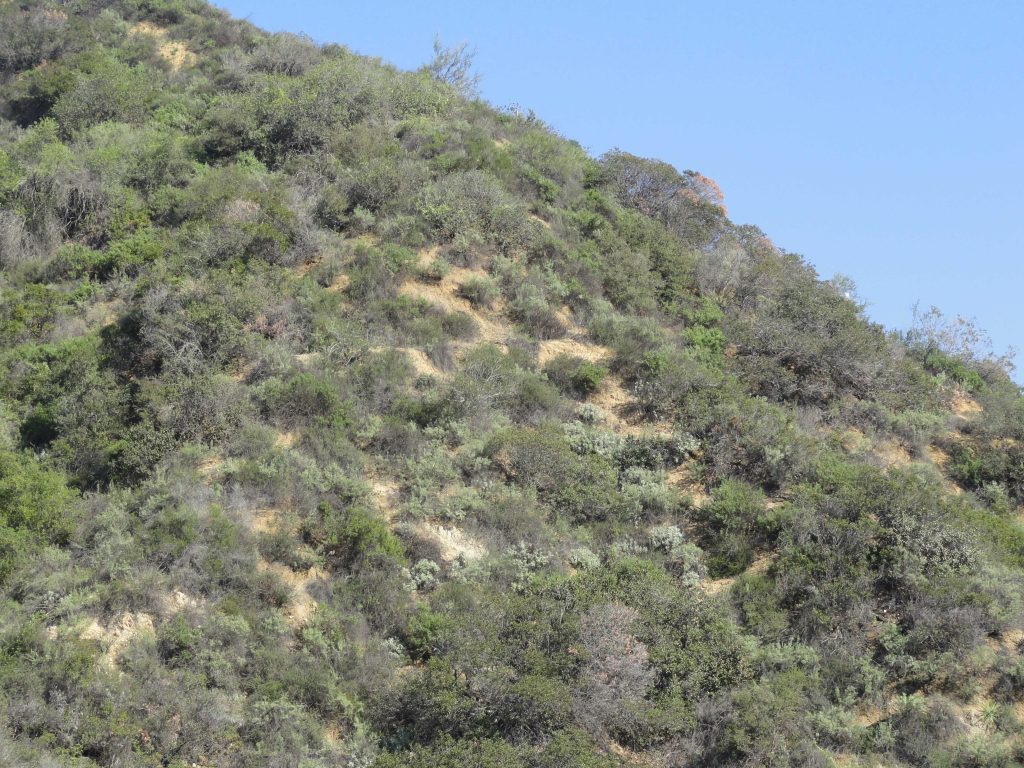
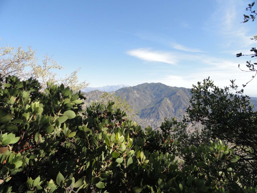
View of Monrovia Peak from Manzanita Ridge just below the Mt. Wilson Toll Road.

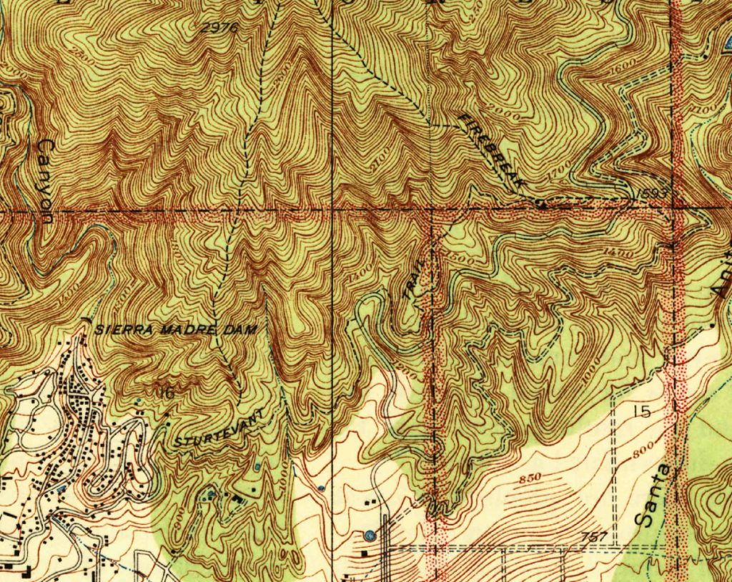
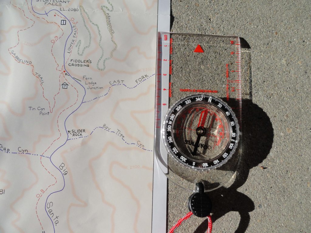
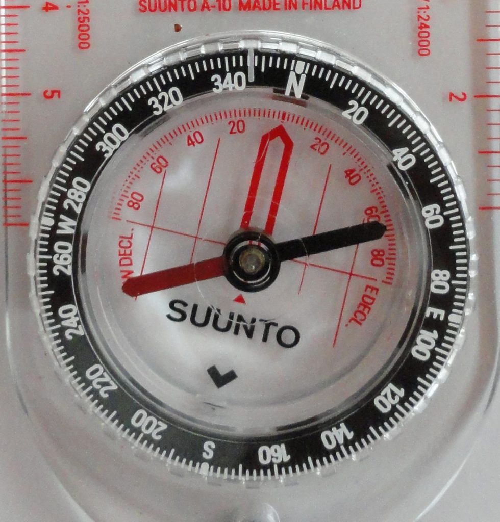
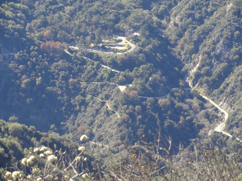
Any way you go, Monrovia Peak makes for a long and unforgettable hike.  It’s a bright, clear day in mid February as I start out on the Lower Clamshell truck trail’s eastern terminus off Ridgeside Drive in Monrovia.  We’re in our 4th year of drought and not much of winter has come.  I’m loaded up with three liters of water, lots of food and my wife’s trekking poles.  Most of the hike is on the 7.5′ Azusa quadrangle and just a sliver is covered by the Mt. Wilson map to the west.  I’m old fashioned, so, of course, I’ve brought these two paper maps and my orienteering compass.  For me, this is the way to navigate, to make decisions.

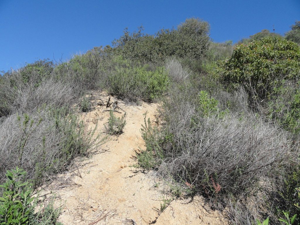
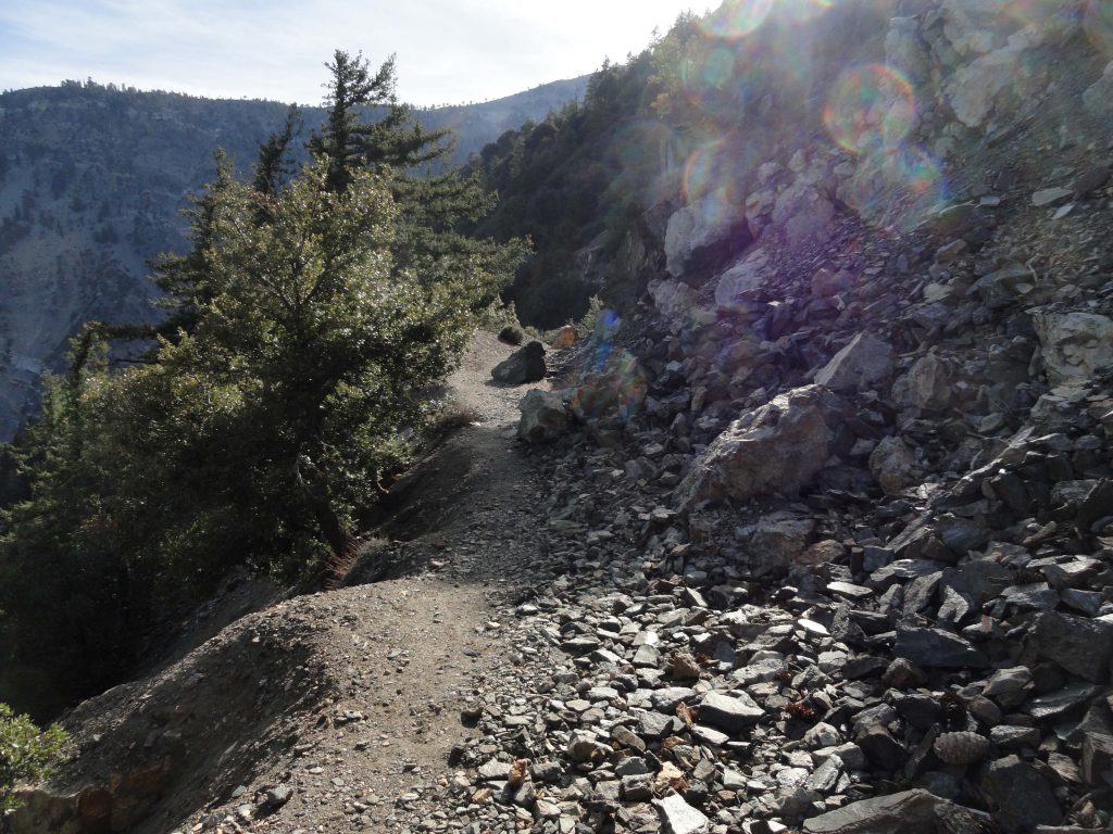
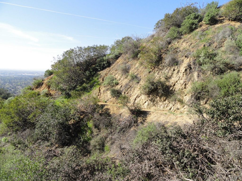
The route taken up the brushy ridge separating Clamshell Canyon from Ruby Canyon.

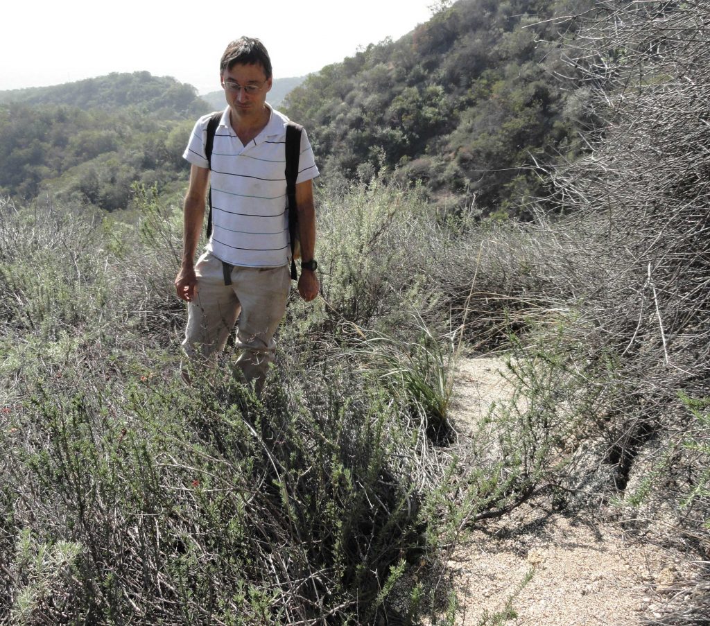
Walking on the fire road is the easy part, beginning the climb up the ridge dividing Clamshell and Ruby Canyons is the tough part.  From a high point on the fire road, where it intersects the ridge, I turned right (north) and began ascending the shrubby ridge in steep pitches.  The high-rises in L.A.’s financial district were in sharp relief, the warm air being so crystal clear.  The trekking poles that Joanie encouraged me to use soon had become essential due to the steepness.    Sweat was pouring off me as if it were summer and the sunscreen had already managed to sting my eyes.  It seemed that I’d plod up the clay-like earth, pocked with gullies for a few minutes and then do that lean on the poles, staring at the ground while letting my heart slow down.  This pattern would repeat and repeat, again and again, throughout the day.  The pungent scent of black sage was all around.  It’s funny how olfactory memories are in some way the most salient reminders of places from our past.  I kept reliving a hike behind the Santa Fe Dam and up the San Gabriel River bed past the 210 Freeway some years ago which made me think of the time we lost our dear friend George Geer.  Hikes up the switchbacks of the abandoned Burma Road made their return, too.  Following and repairing the old crank telephone line up and over the ridge between the Winter Creek and Big Santa Anita Canyon.  Different hikes with a common scent.  The views out and over the valley began to become more and more expansive.  Eventually, it was possible to see the ocean along with the freighters that were anchored off Long Beach. Restless freighters, waiting for a berth.   And so it was, the pattern had now become plodding a short distance and resting amongst black sage, white sage, ceanothus (wild lilac), sumac, buckwheat, mountain mahogany, chamise and occasionally manzanita all intermixed with the myriad of memories and thoughts that are ever-present when we’re by ourselves.   The constant views all around and down into the San Gabriel Valley kept happening amongst the thoughts from within.

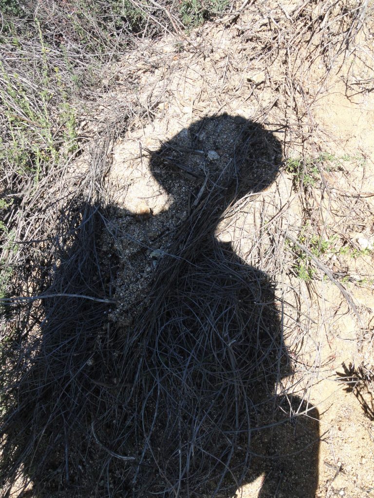
“Selfy” in shadow form while ascending ridge from Monrovia.

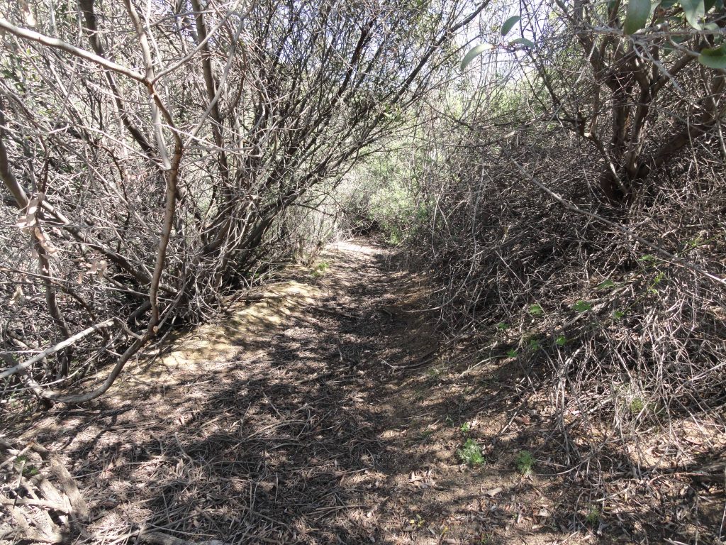
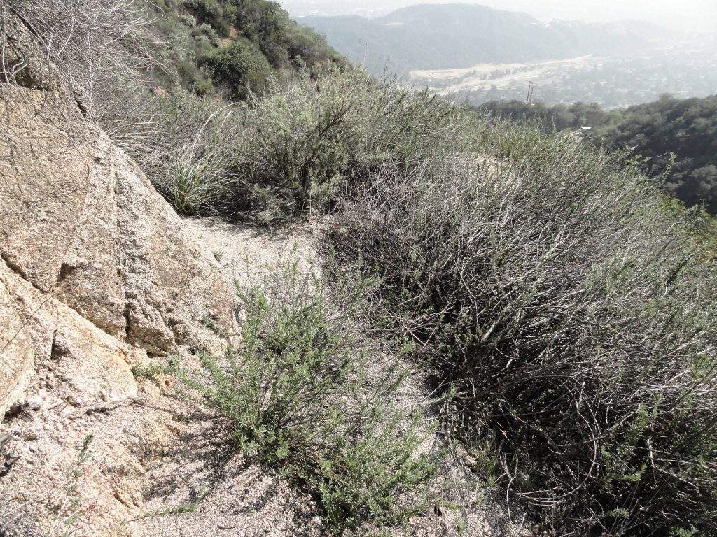
The ridge soon gave out to a steep scramble up south-facing mountainsides.  The route was little more than a wiggly trace between the brush.   This trace is actually visible from the freeway.   The hoof marks of deer were imprinted in the dried earth.  Hawks, predominately red tails, floated on the warm updrafts.  They seemed to slip and slide effortlessly high above the steep, chaparral clad slopes, searching and searching in some kind of an eternal daydream. I thought just how much the landscape seems unknown to me now since starting out from this same point back in 1985.    Hard to believe it’s been about 30 years since last trying Monrovia Peak, coming within about a half mile of the summit and turning around.  It was while on Christmas break from Humboldt State that my mom drove me up to the start of today’s hike.   That day was filled with miles of walking ridge tops and fire roads before finally arriving at Rankin Peak under gray December skies.   Monrovia Peak loomed just a short distance to the north and east, not far off…  and, yet, it just wasn’t going to happen that day.   Thoughts of Mom, Dad and Nick all swirled around my head as the slope finally gave way to a ridge top, the southern end of the Clamshell.  Several ridges on my left and right came together, culminating in a view of views.  And on I waded through tall grasses and the ever-present chaparral.

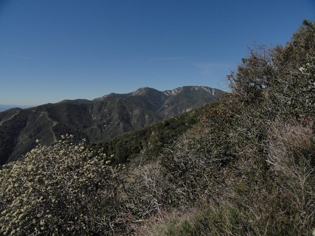
Mount Harvard and Mount Wilson as seen from Clamshell Ridge.

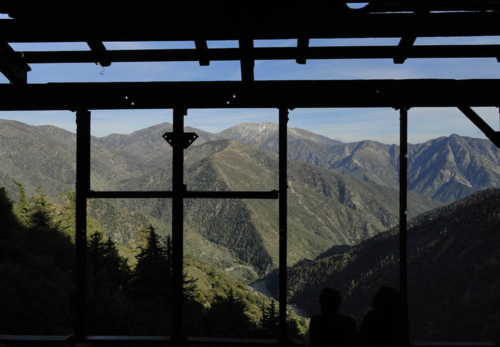
Chantry Flat along with First Water Trail and road down to Roberts’ Camp as seen from Clamshell Ridge.

The end of the Upper Clamshell truck trail was now visible below the ridge top.  Grass grew in the center of its’ light colored trace.  A lonesomeness seemed to emanate from its’ dead ended spur, high across from Chantry Flats.  Surely, deer, black bear, coyotes, mountain lions and perhaps even the occasional mountain biker had been making use of what was seldom maintained for trucks.  The view to the west encompasses the San Olene truck trail, Chantry Flat, Mounts Harvard and Wilson.  The Pacific was gleaming in the mid-day sun, while the Palos Verdes peninsula seemed to divide two oceanic worlds.   A subtle, yet substantial shift between the ’85 trip and now had taken place.  Instead of following the upper truck trail across the east wall of the Big Santa Anita into the East Fork toward Spring Camp, I was following the ridge top, trying to stay true to the divide.  Following the ridge was at times just about impossible to follow due to the thick brush.  The ups and downs took their toll.  Even though this route was slower than walking a fire road, it carried with it the alpine feeling of being on top of something that didn’t easily give itself away.  Wild and rough.  And it came with a surprise.  Clamshell Peak. Clamshell Ridge is the watershed divide between Big Santa Anita Canyon to the west and Monrovia Canyon to the east.  The ridge pretty much trends north and south until reaching Clamshell Peak, a high point where the ridge begins to trend eastward toward Rankin and Monrovia Peaks.  If you travel the truck trail, you’ll miss this peak.  Clamshell appears on the topo map as being just a bit higher than 4,360′ in elevation.  Looking out from this brushy mountain, the final undulating ridge out toward Monrovia Peak presented itself.  There is an impressive view straight into the entire Winter Creek from up here as well.   I had entirely missed this place the first time around.

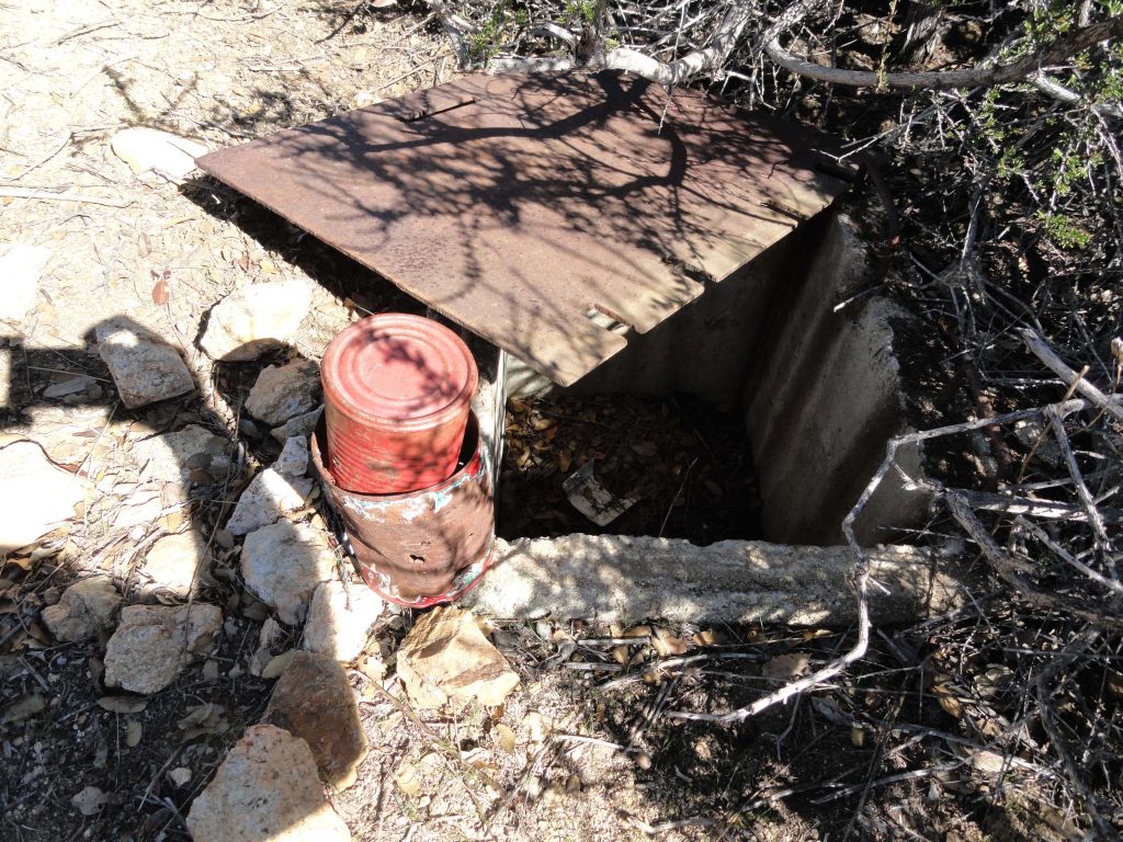
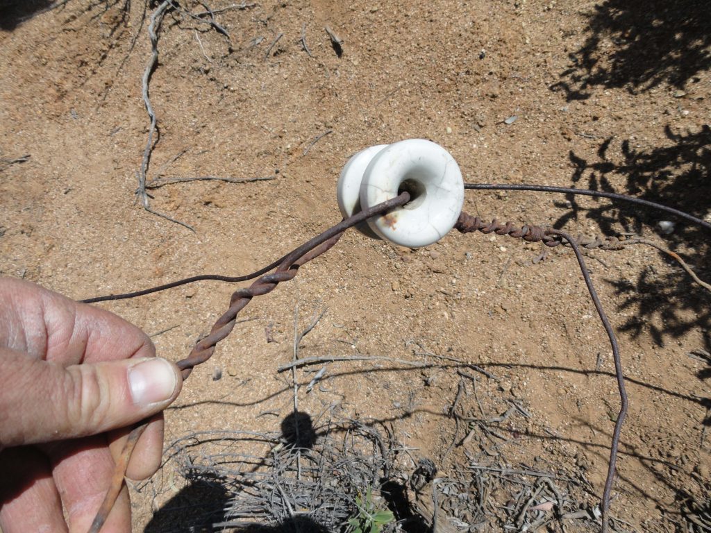
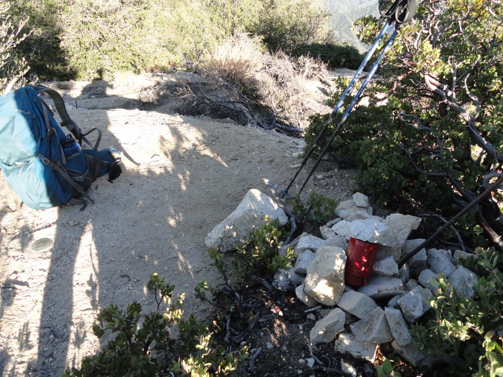
Summit register and vault box on Clamshell Peak. The register is stored inside box.

What really caught my attention was what appeared to be a U.S. Forest Service vault box of some sort on the summit.  Dragging the rusted diamond plate away from the opening, there appeared to be two red painted cans nested within one another.  An old school summit register wrapped in ziplock bags!  In the shade of a manzanita bush, I had thumbed through two steno notepads.  The one marked “old book” had signatures of visitors going back to 1987.   A signature from November of 1990 stunned me.  It was my late brother Nick’s.  I did not remember ever hearing him tell me of his visit here.  Back then, he would have been about 27 years old, in his prime and all over the San Gabriels.  What route he’d taken to get here I’ll not know in this life.   The route now shifted eastward and steeply down to the fire road.  So, for the rest of the day, he and I hiked together, again, through the trees, then up and over more miles of ridge tops.   He was young, healthy and relaxed.  I talked and he listened while the sunlight had shifted a bit.  Walking much of this old firebreak had become easier on my head although my legs seemed to have less and less in them.  We came to a small clearing at the base of some mammoth Big Cone Spruce and sat down in the pool of gold light, the kind that appears later in the afternoon.  I had ran through two of the three Nalgene bottles by this point and had a little snack.  The thoughts had turned toward Rankin Peak and I kept going back, back, back through the years.   That’s what we do, I suppose, in our mid years.   I would not be alone for the rest of the hike.

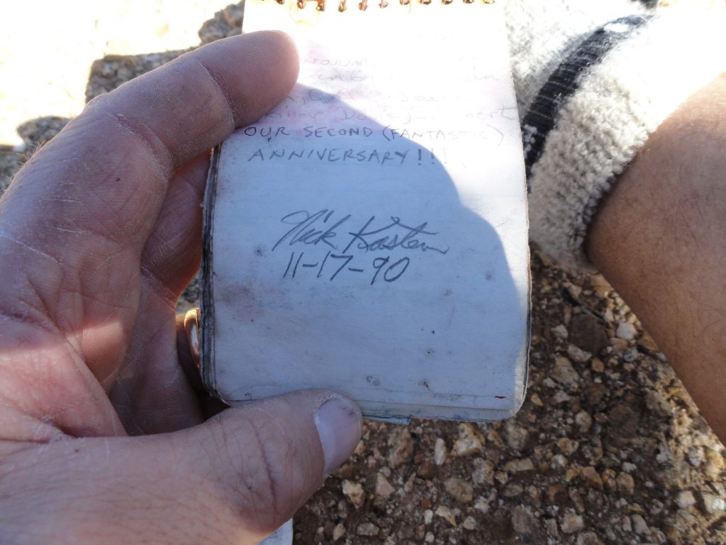
My brother’s signature found in summit register on Clamshell Peak. Nick Kasten lived from 1963 to 2014.

Eventually passing a point on the ridge that appears as “Mack” 4,364′ and paralleling the fire road, the final pitch to Rankin Peak drew near.  It was all so close visually, yet closing the gap seemed never-ending.  I’m always out hiking, like always…. yet, today it was like this was the first time ever being out in the mountains.   That first great climb out of Monrovia in the warm sunlight must have really taken its’ toll on me…  On I walked through grasses that had already grown blonde in the dry winter days.  The memory of how that ridge appeared from Sturtevant Camp’s heliport was playing in my mind.   I had known the changing colors and its’ unmistakable silhouette as part of all that encompassed and framed our existence during those years in the upper Big Santa Anita.   Being part of that scene now was like being in two places at once, looking back at myself from a time gone by.

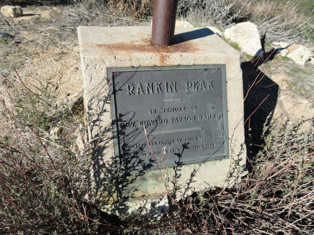
The old flagpole footing with plaque on summit of Rankin Peak. Placed here by the Yucca Hiking Club in the 1930′s.

Arriving at Rankin Peak looked nothing like I had remembered it.  There were fewer trees than my mind had recollected.  Low, scraggly brush crowned the summit and the remnant flagpole was low and bent way over.  Two monuments had been placed here commemorating Reverend Rankin.  The Yucca Hiking Club had placed the brass plaque and white marble marker here back in the 1930′s.    This was Reverend Rankin’s hiking club that had developed the memorial.  Will Thrall, protector and scholar of the San Gabriels, editor of Trails Magazine, a periodical for people hiking our local trails back in the 1920′s and 30′s, routinely included articles from the Yucca Hiking Club out of Monrovia.   Seeing places like this and the need for immortalizing memory brings to mind just how much we all need the mountains and each other.  Some things will never change.

Very top of Monrovia Peak. Note the benchmark adjacent to my pack. The red can is the summit register.

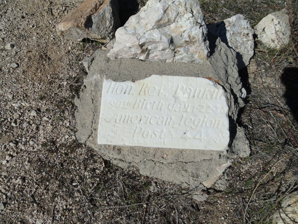
Old tombstone style marker on peak commemorating Reverend Rankin’s 90th birthday.

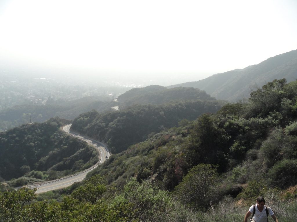
It was here where I turned around all those years ago.  Not this time.  I had to finish this thing once and for all.  And on I went.  There’s the descent, then a climb up an unnamed bump, followed by another descent to a saddle which is then followed by a final and steep climb to Monrovia Peak.  Finally at the top of Monrovia Peak’s 5,409′ summit.  Whew… The summit is small, like 20′ across or so, and is basically a low bump or mound above a circular track most likely created by a bulldozer many years ago.  I suppose the firebreak builders didn’t want to disturb the summit benchmark and I’m glad they didn’t.  I sat down between a small manzanita and mountain mahogany bush and, of course, went through the summit register.  There had actually been a family of three up there earlier that same day!   The sun had fallen even lower now, the shadows lengthening across the canyons.  It was time to take another good look all around.  Red Box saddle at the upper end of the West Fork of the San Gabriel River was visible in the west.  The long rambling ridge of Mounts Pacifico and Gleason framed the north horizon out toward the desert.  Devil’s Canyon and Bear Creek in the San Gabriel Wilderness filled in the scene toward the northeast, while Mounts Williamson, Throop, Baden-Powell, Pine, Dawson and finally Baldy filled the skyline toward the east high country.   And way off to the east and south, San Gorgonio, San Jacinto and Saddleback  poked up through the fine marine haze.  Not a finer view could I have expected to have had anywhere.  One more look around and the descent began.  I followed an old and very steep, rutted firebreak down toward where the Edison high-tension power lines cross over the Rincon – Red Box fire road toward the north east of the summit.   Lonesome, shaded country.   After about a half hour, I was walking down fire roads that lead toward Monrovia Canyon Park.  It’s about 11 miles of fire roads down to where I’d left the car earlier that day. The key to getting back down to Monrovia and not San Gabriel Canyon or even Duarte, is to follow the Rincon – Red Box road east to your first option on the right, which appears on the topo map as the Upper Clamshell truck trail.  Passing through a gate, take this road down through  Cold Springs Canyon traveling underneath the Edison power lines.  You’ll stay on this road for quite awhile until finally arriving at White Saddle.  At the saddle, take another right, bearing down into Saw Pit Canyon.  There’s a metal sign at this critical junction which indicates that you’ve still got another 4.8 miles to go…    By now I was walking with moonlight as well as the light coming up from the city.  Often it was possible to not have the flashlight on, unless I was under the cover of trees.  Mile after mile I hummed little songs and songs blessing  those who I had known over the years.

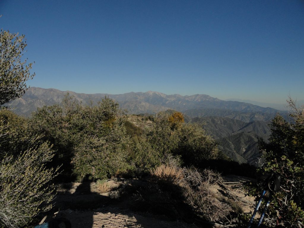
Looking east toward Mt. Baldy from Monrovia Peak’s summit.

Dropping into Deer Park, while coming around a switchback, the sound of wind could be heard.  No, that wasn’t wind, it was water!    I had a Life Straw for drinking untreated water.  Things were looking up.  Unfortunately, getting down to the stream in the darkness required going down a low cliff covered with nettles and poison oak, so on I went with aqueous dreams.  Further down near Trask Scout reservation, a tremendous chorus of frogs celebrating their watery existence could be heard, yet it appeared that uninvited visitors of the two-legged variety were not welcome on the private property, so on I walked.  Eventually passing by the Saw Pit dam, I could look down and hear the water spilling out of the base of the dam, yet no way to reach it from my great height…  By now this had become comical and my sense of thirst had almost gone away.  I walked down the Monrovia Canyon Park road along a barbed wire fence that separated me from the creek which I could hear.  It was totally hilarious!  Perhaps I was mildly dehydrated and had lost touch with my predicament.  At any rate, I finally found our car and drove straight to Chantry Flat and drank as much water as I could get from the little drinking fountain out front of the ranger station.

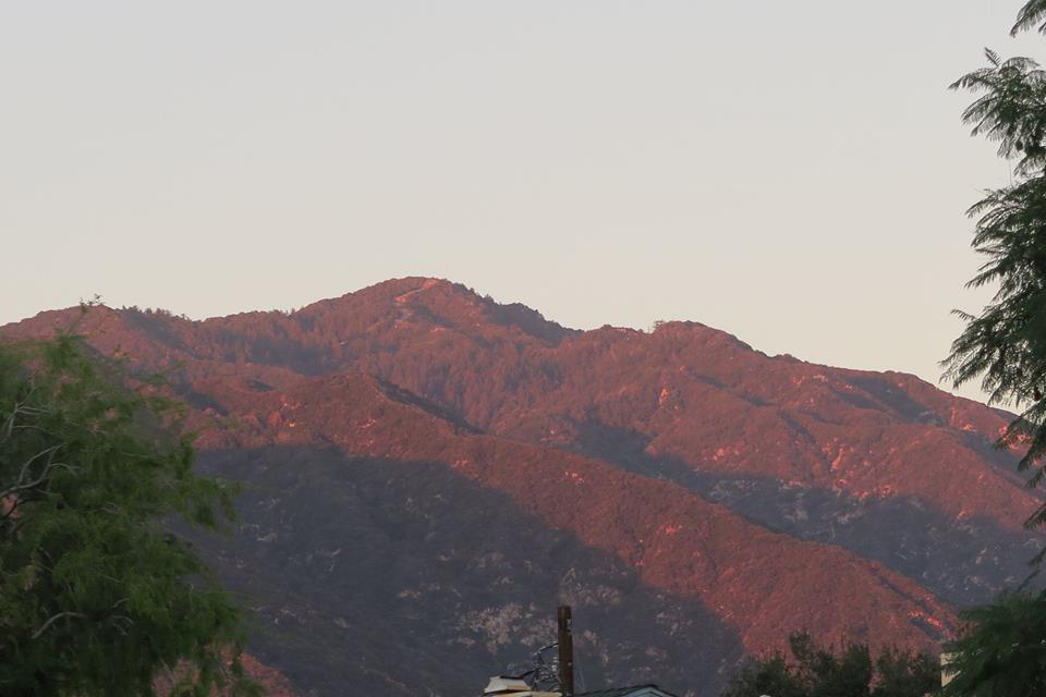
Monrovia Peak as seen from the communities of Arcadia and Monrovia. Photo taken by Dave Nickoloff at the time I was on the summit.

A short distance later, I was at our cabin telling Joanie about the great adventure.  The ice cold bottle of beer that emerged from our little gas fridge was beyond heavenly.  Glass after glass of spring water had become the chaser.  Candle light cast its’ soft, warm glow all around.  A tea light on the mantle cast its’ glow on some old framed black and whites I’d taken of my parents, brother and sister.   The sound of our little stream played in the background.  I was here and it was good to be home.

Chantry Flats Hiking Trails Updated Map

Posted on December 31, 2014 – Written by Chris Kasten

If you spend time on the trails above Arcadia and Sierra Madre, here’s the Chantry Flats hiking trails updated map that covers the area between Chantry Flats & Mt. Wilson.    It’s comes in either a weather-proof paper form with free shipping or as a downloadable pdf image through canyoncartography.com.   It is completely hand-drawn and accurate.   This two-sided map is also available at the Adams Pack Station General Store.    When you’re up at the Chantry Flats trailhead,  just head over to the Pack Station, located on the other side of the picnic area from the upper parking lot.   As of January 2020, Maggie Moran is the new owner of Adams Pack Station.     She’s made some significant improvements to the operation, such as a new deck for seating.  The Pack Station’s General Store is a great place to enjoy delicious food and a cold drink at the end of your hike!    Limited parking is also available.  The Pack Station can be reached at (626) 447-7356.    Thanks –   Chris

A grouping of baby blue eyes as seen in the cool, late afternoon light. Stream side trail between Roberts’ Camp and Fern Lodge Junction, Big Santa Anita Canyon.

The same map area is still depicted on the front page as the earlier versions.  Just flip the map over and continue on your trip to Mt. Wilson.  The entire Mt. Wilson Loop is found on this map, front and back.   Besides the coverage area now being nearly twice as large, index contour lines (200′ intervals) have been added to depict shape and steepness of slope.  Contours have been added at 50% opacity to prevent their competing visually with trail, stream and print detail. The Spring wildflowers are out in abundance.   Go to www.simpsoncity.com/hiking/plants/ for excellent photos with descriptions of flowering plants in the San Gabriel mountains.  You’ll see the lavender clusters of wild lilac on the Gabrielino Trail once you’re above Fern Lodge Junction.  Baby blue eyes are making their presence down alongside some of the stream banks and other moist, shaded areas.   Look for edible miners lettuce on the upslope side of the trails that are near the stream.  Dark blue and delicate larkspur can be seen on the outer edge of the steep road as you climb out of Roberts’ Camp, just before the first bench.  It’s also seen along the Upper Falls Trail in the area where you can look down at Sturtevant Falls.   With yet another year of little rain, it seems that most of the blossoming is going on about a month early this year.

updated map of Chantry Flats hiking trails, canyon cartography.com