
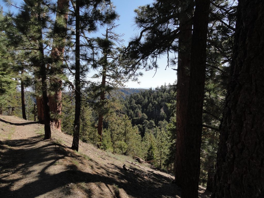
Looking down into Sawmill Canyon while descending the Blue Ridge Trail. Photo taken just below Blue Ridge Campground. That’s Pinyon Ridge out in the distance.
It’s already far enough into the Spring to do the Blue Ridge Trail hike in Wrightwood, CA. Yesterday, Joanie and I worked our way up the Blue Ridge Trail, which begins across the street from the old Big Pines Lodge just a few miles west of Wrightwood. The air was fresh (mid 40′s) as shredded white clouds blew fast to the north over Blue Ridge. The Blue Ridge Trail is 2 miles in length and climbs about 1,100′ between Big Pines and Blue Ridge Campground. This trail hike is a pleasant climb, in many places contouring shaded slopes and occasionally poking into quiet little side canyons filled with willows. Much of the view is of the Swarthout Valley which cradles the little mountain village of Wrightwood.
Half way up the mountainside is a wooden bench that performs double-duty as both a place to sit as well as a trail sign. The recessed lettering indicates that Blue Ridge Campground is one mile up and Big Pines one mile down. The trail continues on, contouring and climbing the mountainside above Sawmill Canyon. Eventually, the trail switchbacks just prior to reaching Blue Ridge Campground, a pretty little spot with eight campsites straddling piney Blue Ridge. The Pacific Crest Trail, spanning from the
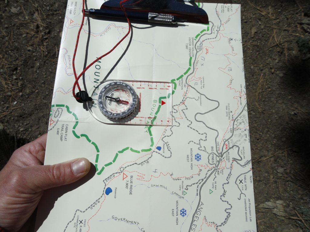
A section of the Trails of Wrightwood – Big Pines map is being oriented to the local landscape. This photo was taken on the lower end of the Blue Ridge Trail between Big Pines and Blue Ridge Campground.Mexican border all the way to Canada, is also met here at the campground.
Mexico border all the way to Canada passes through the campground.
You can return back down the mountainside, the same way you came up, or make a loop out of it by taking the PCT (Pacific Crest Trail) toward Inspiration Point and then cutting off onto a dirt access road which descends back toward Mountain High West ski area. This route can be seen on both the Trails of Wrightwood – Big Pines map or Tom Harrison’s Angeles High Country map.
Regardless of which way you do your return trip, you’re sure to enjoy passing through healthy and mature stands of black oak, jeffrey pine, ponderosa pine, sugar pine and white fir.
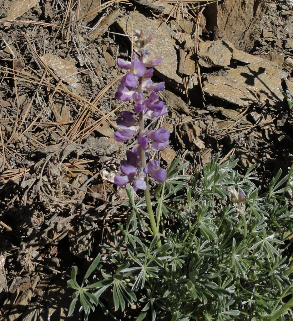
Morning light on flowering lupine. Photo taken about midway between Big Pines and Blue Ridge Campground.