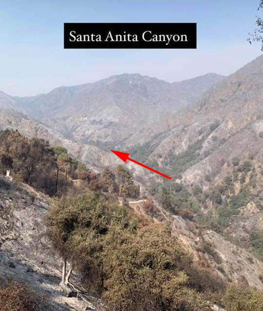
This photo was taken just a couple of days ago by an unnamed fire fighter and posted on Instagram. Photo was taken near Chantry Flat and is looking north up toward Sturtevant Falls. The arrow tip is in the Fern Lodge area of the main canyon, where the Upper Falls Trail and Gabrielino Trail leave the canyon bottom, continuing up and past Sturtevant Falls toward Cascade Picnic Area and Spruce Grove trail camp. It appears that much of the canyon bottom tree canopy is still intact after the Bobcat Fire !
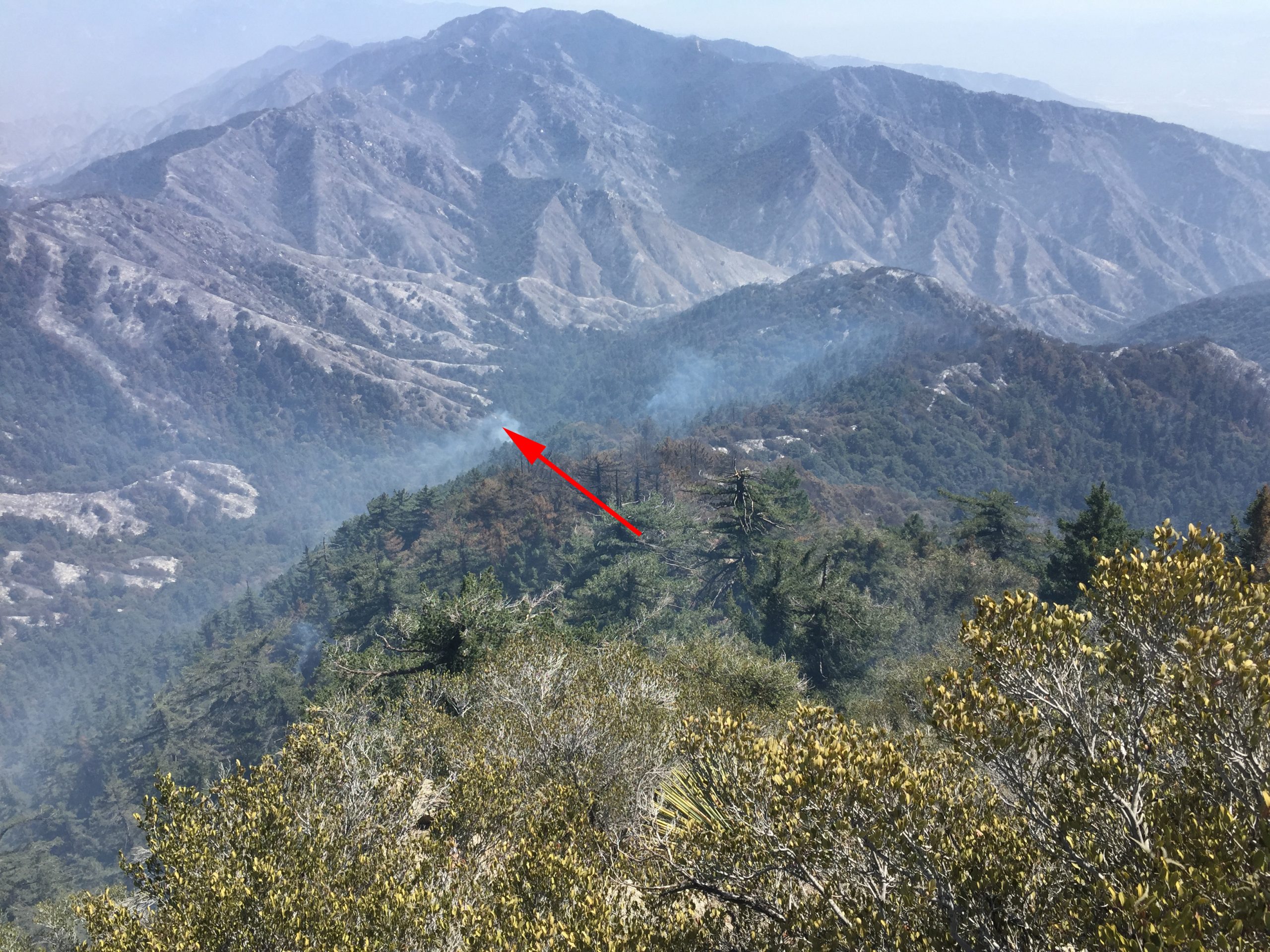
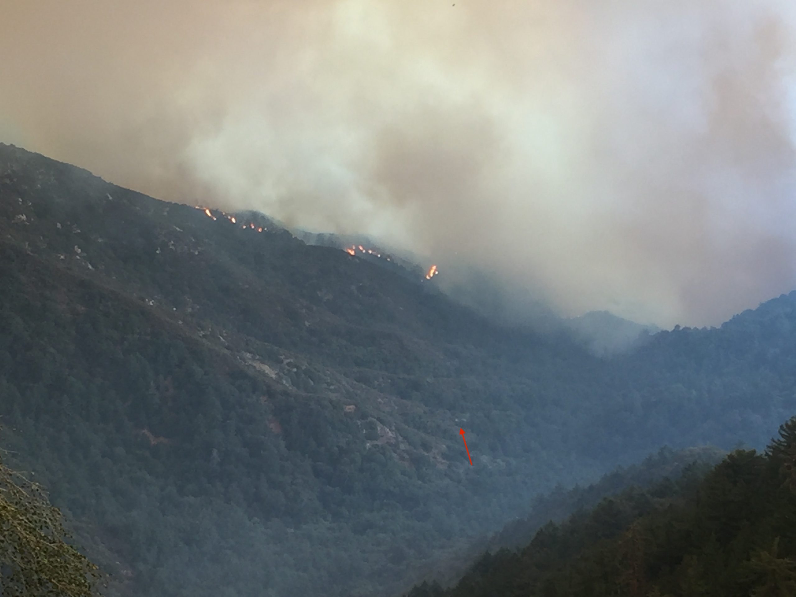
Attached are two photos taken of Big Santa Anita Canyon in the aftermath of the Bobcat Fire. There’s a third photo here, too. It is of the flames dropping into the upper Big Santa Anita Canyon during the fire’s early stages of development. The first photo was taken a couple of days ago. Here you’re looking up the canyon from a point near the trailhead at Chantry Flats. The second photo was taken by Larry Webster of Mt. Wilson just a day ago. The view is from the east end of the summit looking down toward Sturtevant Camp. Note the smoke still curling up from either the camp or adjacent to it. It’s still too early to know what the damage actually was to the camp or the nearly eighty private cabins up and down the Big Santa Anita Canyon and Winter Creek. Updates to follow as they come in.
This photo was taken after the fire passed through, by Larry Webster of Mt. Wilson, CA. That’s Monrovia Peak, highest point in center horizon of photo. At the tip of arrow is Sturtevant Camp. As of this writing, it’s unknown how the camp fared in the Bobcat Fire.
This photo was taken before the Bobcat Fire reached Mt. Wilson. Sturtevant Camp’s heliport is marked by the small red arrow. Coincidentally, the camp itself, is located at the bottom, or start, of the arrow’s shaft.
The Bobcat Fire dropping down into upper Big Santa Anita Canyon. At the end of the little red arrow is the heliport at Sturtevant Camp. Photo taken from Mt. Wilson by Larry Webster.
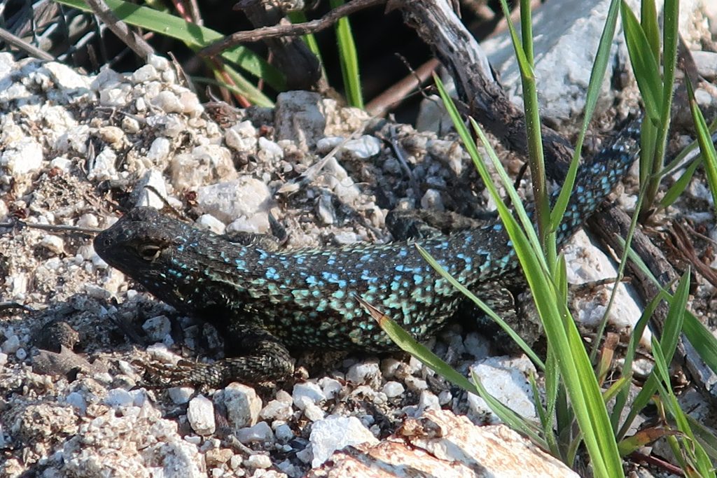
This turquoise colored fence lizard (Sceloporus occidentalis) was seen out in the warmth of early Spring at Tin Can Point. Tin Can Point is just up from Fern Lodge Junction on the Gabrielino Trail. It’s the first switchback you’d encounter after the trail passes through the canyon live oak forest and then enters the chaparral, just a few minutes up from the trail junction.
A beautiful fence lizard basks in the gentle warmth of early Spring at Tin Can Point. See inset of the Chantry Flat – Mt. Wilson Trails map, below, to see where this point is. As of this writing, a cold wet pacific storm is dropping nearly six days of chilly rain and snow in much of the San Gabriel mountains. Big Santa Anita Canyon dam has received over 5 1/2″ of rain in the last week. Something I just learned recently about these Western Fence lizards is that their populations have the effect of reducing the incidence of Lyme’s disease in the ticks that live in the chaparral, such as found covering much of the slopes of the Big Santa Anita Canyon! Apparently, a protein in the lizard’s blood kills the bacterium in the tick’s gut, which is good news for hikers and even their dogs during the spring and autumn months.
Like most reptiles, Western Fence lizards hibernate, at least for a little while each winter throughout their habitats which are wide-spread throughout California. As for food, these lizards eat spiders and various insects such as mosquitos, beetles and grasshoppers. The females lay several small clutches of eggs (3-17) in the spring, the young emerging in the summer.
Detail of Gabrielino Trail section, Chantry Flat – Mt. Wilson Trails map.
On your next hike out from Chantry Flats, watch for for lizards flitting about on the trails and sunning themselves on the myriad stretches of rock. As for the various types of reptiles to be found in the Big Santa Anita, Western Fence lizards are abundant and deserve a place in the sun!
Looking east from the Rim Trail just before reaching Mt. Wilson. On the horizon, far left, can be seen Twin Peaks. Mt. Baldy is in the center distance. Big Santa Anita Canyon is below and off to the right.
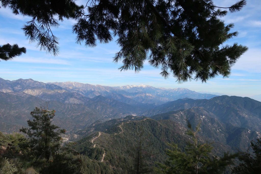
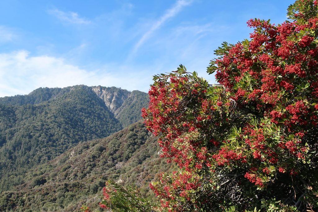
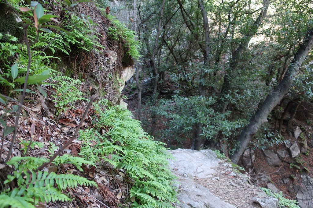
Hike Chantry Flat to Mt. Wilson by way of the Rim Trail during these bright, crisp winter months. This last weekend, I made my way up Big Santa Anita Canyon’s Upper Falls Trail from Fern Lodge Junction. Our rain gauge has recorded nearly 12″ of rain from the two previous storms of late November through December, so lots of bracken fern beds are at their height of deep and bright greens as they perch high on their cliffy ledges above the bubbling creek. Although we’re off to a dry start to the new year, the plants are responding to the generous rains and even snow in the higher elevations. This is also a good time to still catch the deep orangy red of the Toyon berries in their showy clumps that still feel reminiscent of Christmas time.
Trip Details:
Total roundtrip distance: 16.9 miles
Elevation gain / loss: 440′ initial loss to Roberts’ Camp. 3950′ gain to Mt. Wilson’s Echo Rock.
Take Gabrielino Trail up Big Santa Anita Canyon to junction below Sturtevant Camp. Continue on toward Newcomb Pass. From there, follow RimTrail west to Mt. Wilson’s Echo Rock. Return toChantry down Sturtevant Trail and continue back on Gabrielino to the trailhead.
Mt. Wilson as seen from the Newcomb Pass Trail (Gabrielino) about a mile and a half up from Sturtevant Camp. Some healthy looking toyon is seen here in the foreground.
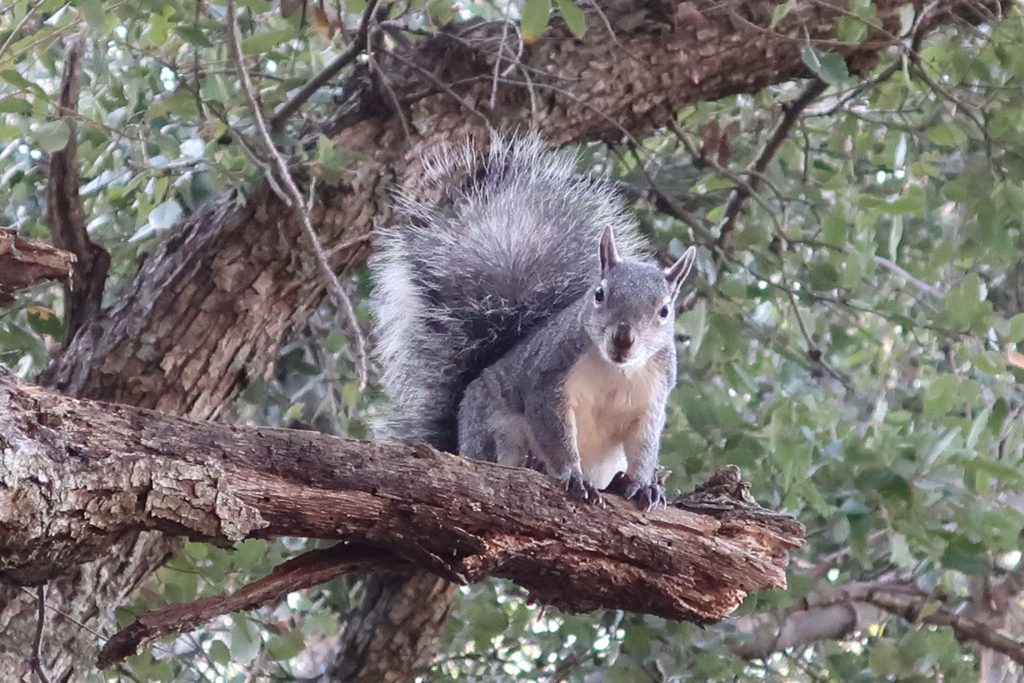
So, on I went past the songs of canyon wrens, their descending, laughing tones evoking that eternal longing for Winter becoming Spring. As always, leaving behind Sturtevant Falls, the crowds dropped off, too. Save for an occasional small group of hikers, I saw few people between the top of the Falls and Spruce Grove Campground. Once on the section of the Gabrielino that heads off for Newcomb Pass, there’d be no one, with the exception of squirrels, birds and gnats until reaching the top of Mt. Wilson. Solitude.
A curious tree squirrel peers down at Newcomb Pass.
At the trail junction just below Sturtevant Camp, I peel off for Newcomb Pass and the quietness envelopes me. The trail was a bit overgrown and more noticeably there was a fair number of trees and shrubs over the trail. No problem, just took my time climbing down or up and around on the dark, loamy soil with winter’s dampness. Once out in the chaparral, on came the sunglasses and the great joy of warm winter days that only Southern California can bestow upon the mountains. The most prominent scene that kept repeating itself was the red display of Toyon against the background of varied greens. Pretty soon the backcountry opened itself up, first Twin Peaks, then the Mt. Baldy massif. Snow, blue sky and chaparral all seemed to merge as I neared Newcomb Pass.
Bracken ferns along the Gabrielino Trail. Photo just up canyon from Falling Sign Junction, Big Santa Anita Canyon.
Once at Newcomb’s, I found a sunny picnic table and finished off my sandwich. Ever since the Station Fire of 2009, the debris of cut down trees for re- establishing a firebreak has taken away the charm of the place. Coupled with that, some hair brain scheme had taken place, erecting T-posts with orange web fencing at the bottom of the man-made swaths. Sort of like what CalTrans might do along a highway construction site. The old Newcomb Pass sign lay forlornly off to the side, a casualty of yet another oak that has fallen. I got so depressed by the memory of what once was and what was now that only a few minutes elapsed before taking off on the Rim Trail.
A gentle stretch of the Rim Trail about a mile west of Newcomb Pass.
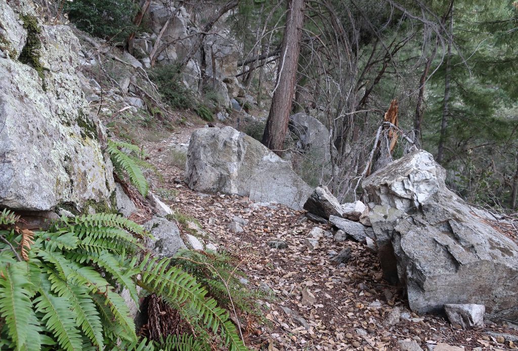
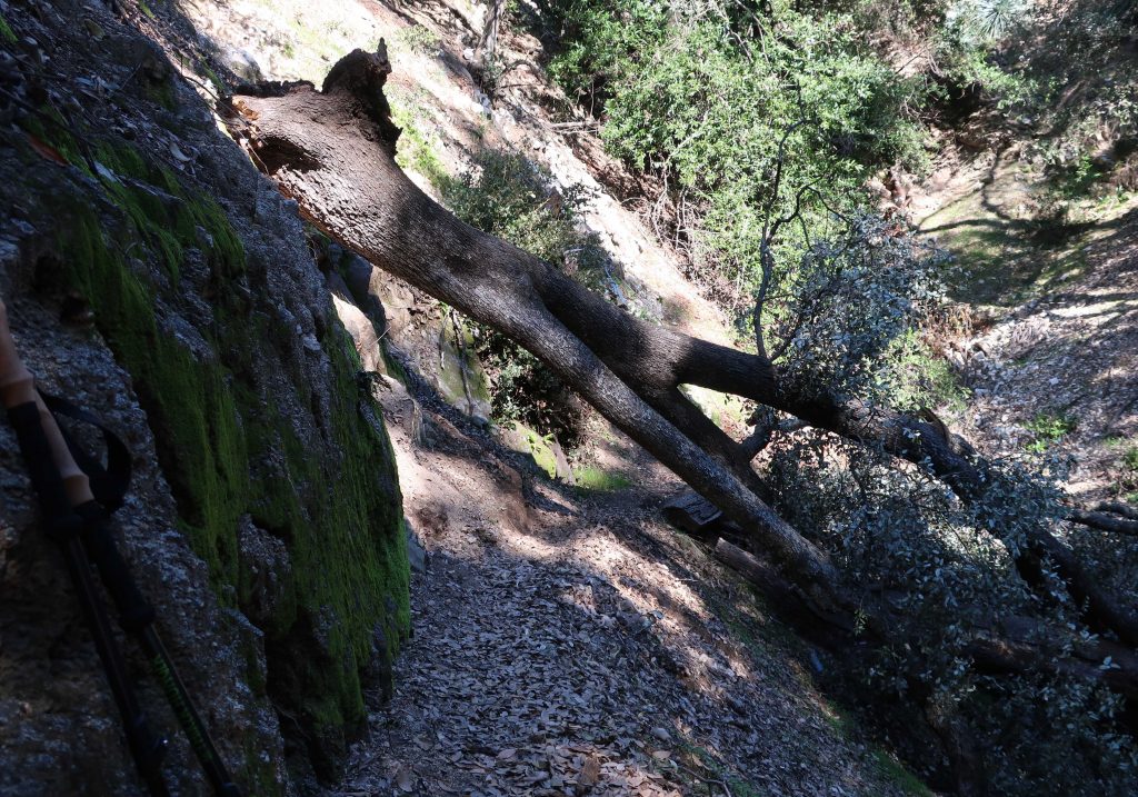
The first 1/2 mile along the Rim Trail was fraught with downed oaks, lots of them. The tracks of those before were clearly etched in the soft, moist soil as they worked out ways to get over, under, up and around thickets of branches tangled up with thick cords of poison oak. Aside from this, most of the going was pleasant, indeed beautiful as this area truly is. If you love being under oaks and amongst ferns and spruce, this is a good place to be. Also, you’re regaled with scenic views down into the West Fork of the San Gabriel River and out across to places as far west as Mt. Pacifico and eastward to Mt. Baldy and beyond. Fire scars from the Station Fire are still seen at the base of many big cone spruce along the trail. These are healthy scars only running a short distance up from the ground, leaving a really healthy evergreen forest. It’s peaceful country. Toward the top, you begin to encounter places where the trail is whittled out of rock. Old dry stack walls, the good work of trail builders from another century, still hold the trail into the mountainside. Eventually you make your way up and through a gentle twisting and turning through forested hillsides along the summit to the asphalt maintenance road near the Cosmic Cafe’s Pavilion. Turn left here, following signs toward the Sturtevant Trail. Pass by the Astronomical Museum, the Solar Camera and eventually the 100″ and 60″ telescope domes before dropping down to Echo Rock and the beginning of the Sturtevant Trail.
Here was one of the first trees that I encountered on the way up to Newcomb Pass. This spot is about a quarter mile up from Sturtevant Camp. Most of the downed trees along my hike were canyon live oaks.
Take the time to look off of Echo Rock before your descent back into the Big Santa Anita Canyon. The view is superb and you really can get a good echo if you set your mind to it. Yell toward the cliff straight across from you!
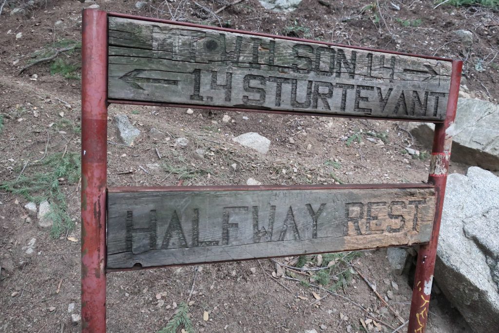
Get ready for a steep drop down from Echo Rock. I’m big on trekking poles for preventing slips and saving your knees on descent. Years ago when my wife and I ran Sturtevant Camp, we starting using the poles when we had a winter (2005) that had washed out the Chantry Road, necessitating getting to the camp by way of this very trail. Pass by the “Halfway Rest” and on down further into the upper canyon. This is timbered and wild country between the top and Sturtevant’s Camp. Savor the views and more solitude.
Here’s the sign you’ll find halfway between Sturtevant Camp and Mt. Wilson’s Echo Rock. There’s 2,500′ of elevation difference between the places in only 2.8 miles!
When you pass by Sturtevant Camp and then walk across the check dam to the side of the camp, you’ll drop down to the junction where you were earlier in the day, having just completed your loop. Head back to Chantry the way you came.
This photo was taken of Big Santa Anita’s Creek just upstream from Roberts’ Camp. This spot is close to cabin #23, on an outside turn of the creek. As of this writing, Chantry Flats’ rain total is at 42 1/2″ for season. Good flow and good sound throughout the canyon!
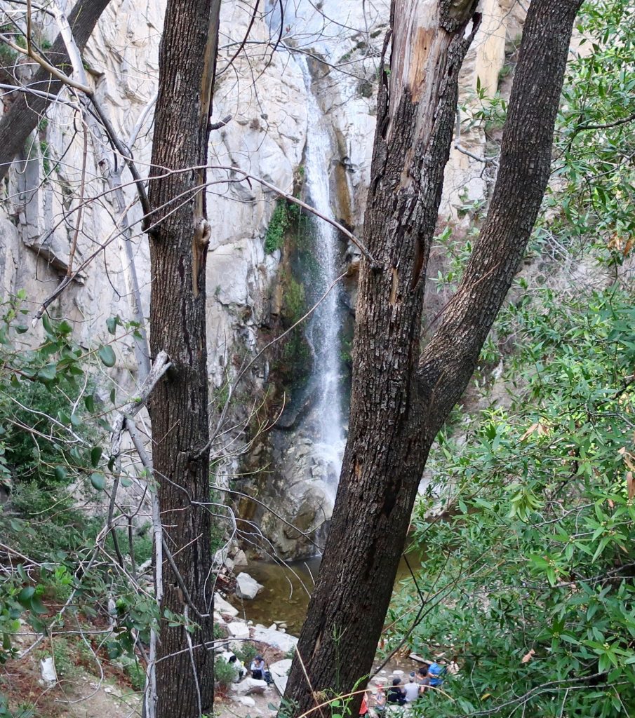
Looking across at Sturtevant Falls and plunge pool from the Upper Falls Trail.
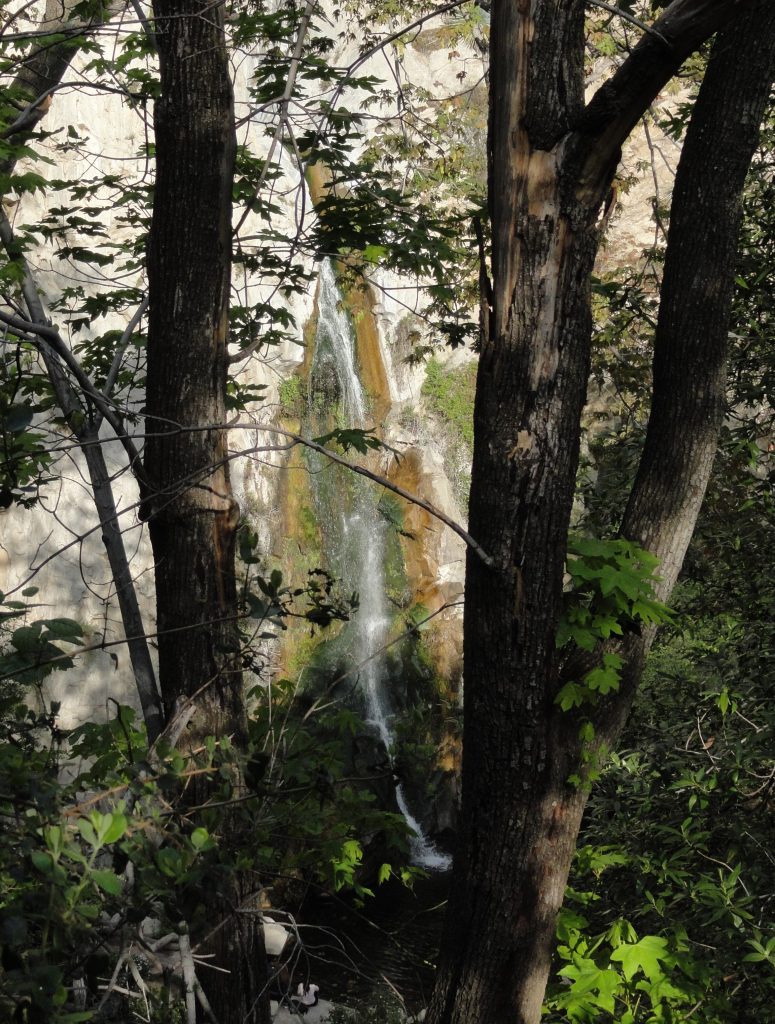
Big Santa Anita Creek comes alive after recent storms. 55′ high Sturtevant Falls is back in its’ former glory as well! As we all know, years of drought have taken their toll throughout the southwest, especially in the myriad of canyons throughout the mountains of Southern California.
Joanie and I discovered 9.57″ of rain in our gauge at Fern Lodge on January 18th. Several storms, back to back, have made a huge difference in the appearance of not only the Big Santa Anita creek, but all the rest of the front country streams in the Angeles. A week later, we hiked up and past Sturtevant Falls where we took these two photos.
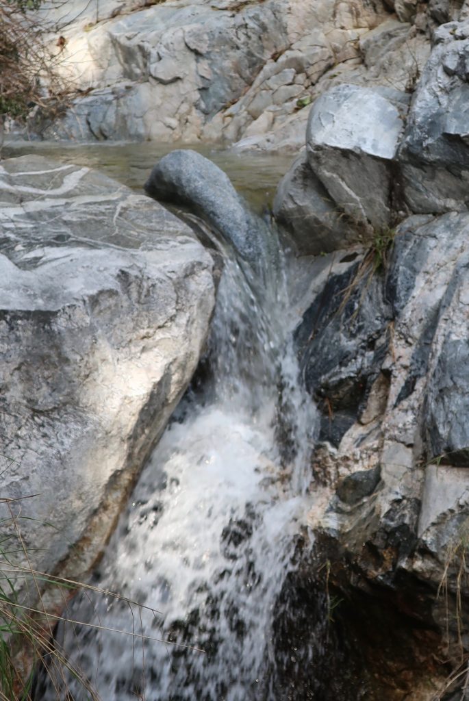
This view taken just above Sturtevant Falls. This is at the top of the slot pools.
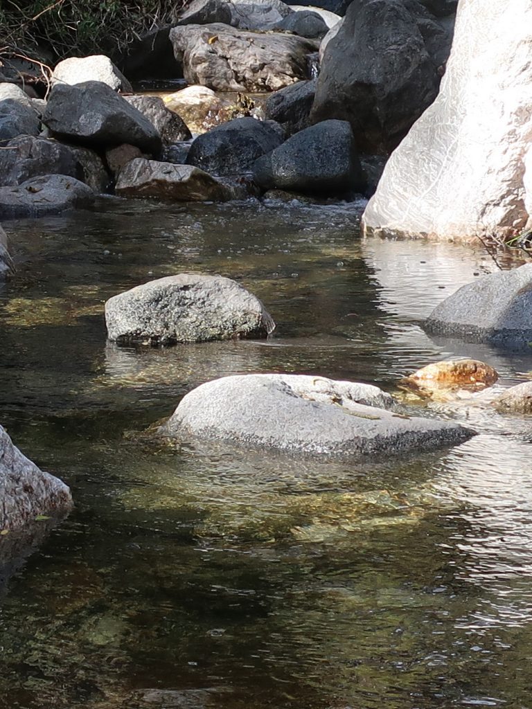
As of today, February 10th, a lot more rain has fallen. The stream beds have been scoured of the dark organic mat that’s built up for years. This has left bright, colorful sands and rocks under the clear waters. Beautiful.
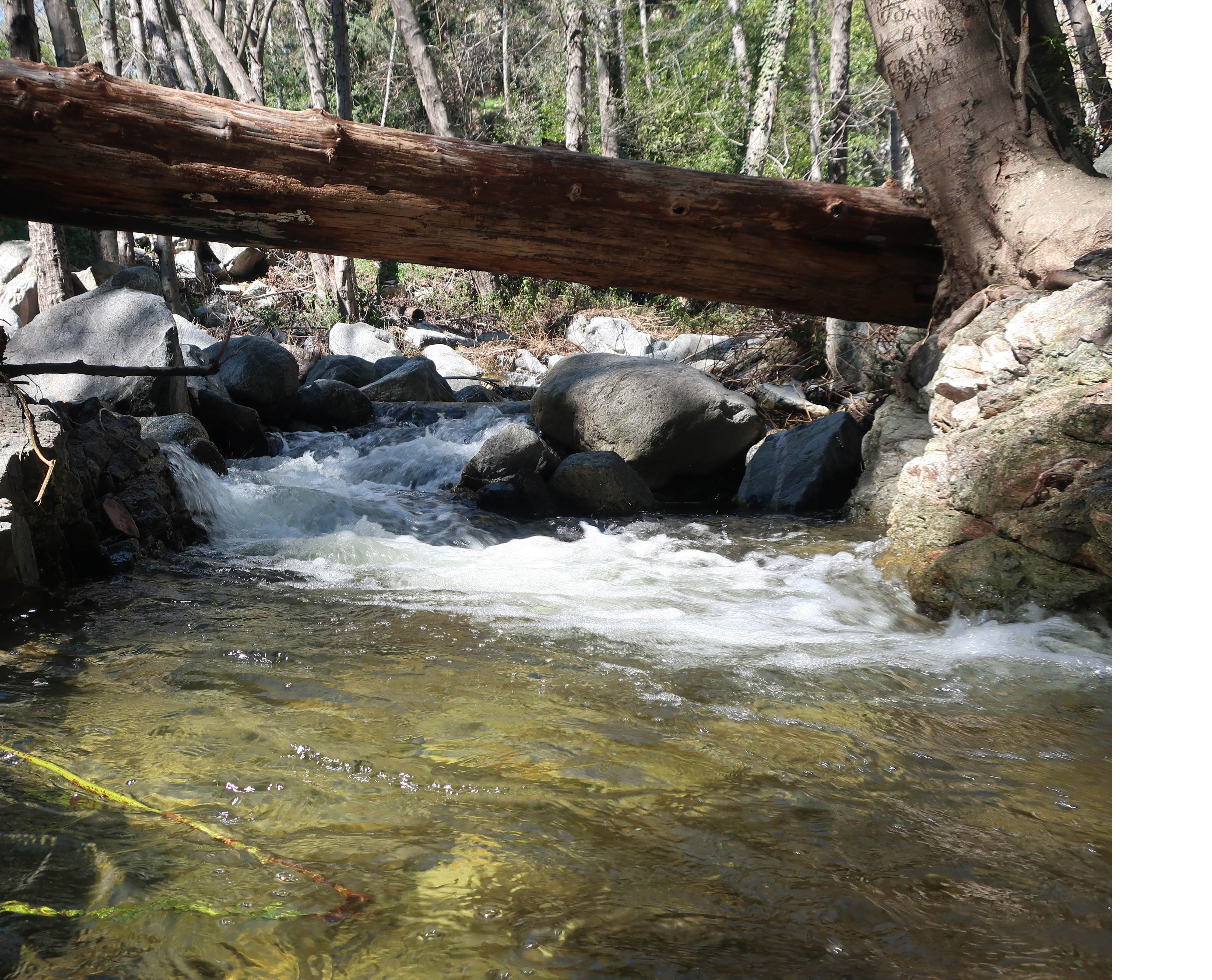
A tranquil stretch of the Big Santa Anita Creek in the Fern Lodge area of the canyon. This spot is near the little cabin village where the Upper Falls and Gabrielino trails depart the canyon bottom.
Sturtevant Falls as seen from the Upper Falls Trail on Sunday. Despite the fairly dry winter season, recent rains brought us nearly three more inches of rain, bringing up the levels of the stream.
Sturtevant Falls is flowing at it’s peak level for Spring. This photo was taken while hiking on the Upper Falls Trail this last Sunday. The rain gauge at our cabin in the Fern Lodge area recorded 2.92″ from the recent storm. The stream’s nice and full, it’s song filling the canyon from wall to wall. Many of the pools in the canyon have received a cleansing scouring. Dark organics that build up over the year on the stream bed have finally been washed clean out of the sand. This is a great time to take a hike at Chantry Flats in the Big Santa Anita Canyon! Fern beds on the steep slopes and cliffs are growing in their thick greenery. Sturtevant Falls is definitely one of the most sought after places to visit during the spring hiking season. If at all possible, try to get in a hike to the falls during the week days due to the parking congestion at the trailhead.
The hike in is less than two miles one way, rated as “easy” in John W. Robinson’s Trails of the Angeles. Begin your hike at the Gabrielino trailhead, located adjacent to the lower parking lot at Chantry Flats. Descend over 400′ to the canyon bottom in less than 3/4 of a mile. Cross the foot bridge at Roberts’ Camp, then follow the dirt road upstream, passing by the little cabins built over a hundred years ago. The road soon peters out, your route becoming single-track off and on until you reach the base of the falls. Return the way you came.
Posted on August 2, 2012 – Written by Chris Kasten
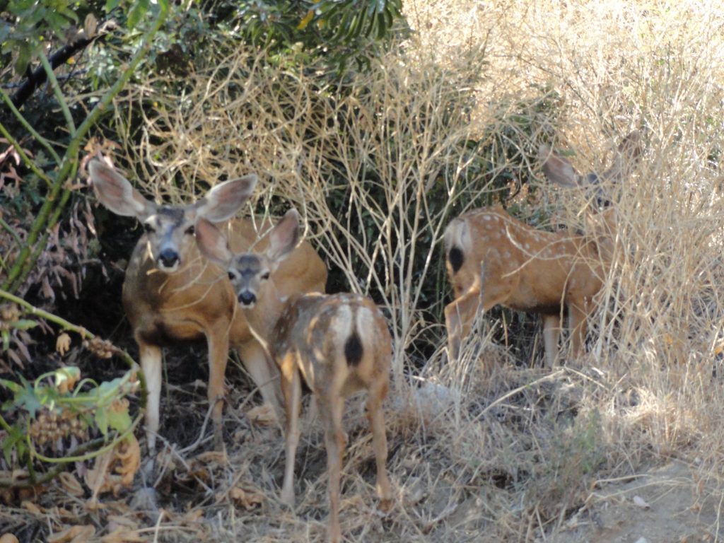
The accompanying photo was snapped from our car at the second hairpin turn up from the beginning of the Chantry Road. These are mule deer, named for their unusually large ears. Mule deer are often quite prevalent along the lower stretches of the road and can also be a routine challenge for homeowners’ plantings in the foothill areas of the San Gabriel mountains. Mule deer can often be seen browsing on the deliciously, delicate flowers and tender grasses in the landscaped yards of homes in the Highland Oaks area of Arcadia and, of course, Sierra Madre.
A doe and two fawns in Lannon Canyon on the Chantry Road.
This doe and her young occasionally travel up and down the actual drive lanes of this narrow, windy road. So, take your time driving up to the trailhead and keep an eye out for deer darting out in front of your car, especially during the early morning and evening hours.
Posted on August 1, 2012 – Written by Chris Kasten
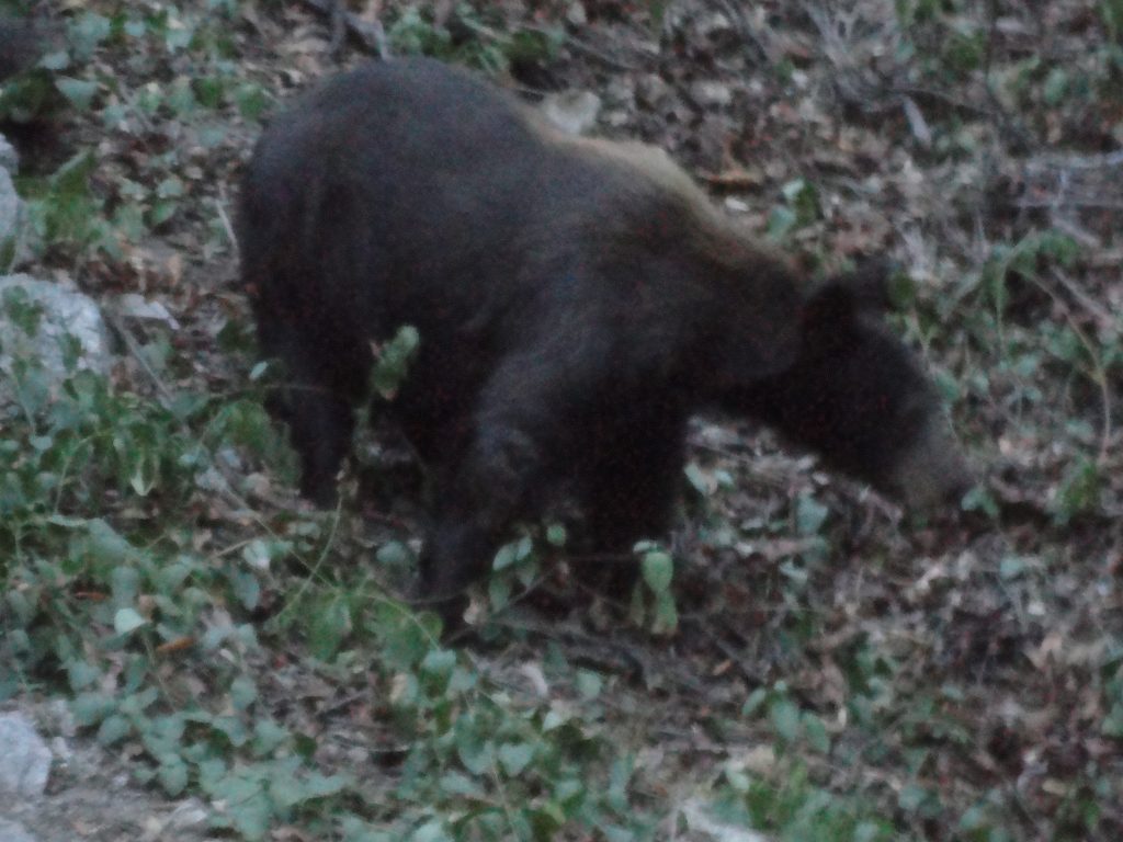
The San Gabriel mountains provide habitat for black bears (Ursus americanus californiensis) throughout the year. The accompanying photo was taken through the screen door of a cabin at Fern Lodge just before dark. These elusive animals are seldom seen along the trails that radiate out from Chantry Flats. As a rule, bears will avoid contact with humans if given the chance. However, in the aftermath of a light winter, streams in many of the smaller side canyons are now drying up. This causes much wildlife, including bears, to drop down to lower elevations in search of water. The Big Santa Anita and Winter Creek flow throughout the driest months (September-October-November), becoming the primary source of drinking water for all creatures.
A resident black bear makes his / her way down the slope directly behind cabin #63 in the Fern Lodge area.
Bears are omnivorous, seeking both plants, insects (grubs and ants) and occasionally small game for food. Right now, their scat can be seen alongside the hiking trails. One of the black bear’s mainstays is manzanita berries, which can be seen abundantly throughout their scat.
Black bears although shy, are very powerful. They are tree climbers and can quickly scale the steepest hillsides if necessary. On the descent, they’re a bit slower and clumsy. As for shelter, bears den in naturally occurring voids of rock and soil. Winter conditions in the San Gabriel mountains are quite mild in contrast to other North American mountain ranges, so deep hibernation is not a part of the local black bear’s lifecycle as it might be further north. Therefore, it’s possible to see a bear any month of the year!
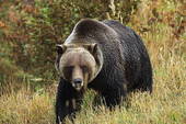
An adult grizzly bear far, far away from Big Santa Anita Canyon. The San Gabriel mountains had a grizzly population up until the last one was shot in Little Tujunga Canyon in 1919.
There was a time once when another species of bear roamed the San Gabriels. This was the Grizzly, (Ursus arctos horribilis) now extinct throughout California. Grizzly bears were known to many backcountry travelers of the 19th century as X bears, due to the hourglass shape of lighter colored fur on their backs. When the grizzly bear was aggravated, the light colored fur would stand straight up, sort of the way that dogs do when upset. You can read more about this time of grizzly bears roaming the San Gabriels in John W. Robinson’s “The San Gabriels, Southern California Mountain Country.”
If you are fortunate enough to see a bear in the Big Santa Anita Canyon or Winter Creek, keep your distance and calmness. Should one approach you, stand tall and hold your ground. Clap your hands together and yell as loud as you can to scare it off. Chances are he or she just didn’t see you until your closing distance narrowed way down. Although a bear’s eyesight is not terribly keen, its’ sense of smell is acute. While camping up at Spruce Grove or Hoegees campgrounds, hang your food well out on a tree limb at night. Generally, try to keep your food bag at least 8′ up from the ground and 8′ out from the main trunk of the tree. A bear-proof food storage canister is really the best way to go and a lot easier than finding the perfect tree. Keep your campsite clean and wash your dishes well. No food should ever be stored inside your tent! Remember, bears are afraid of humans, yet will do just about ANYTHING for food.
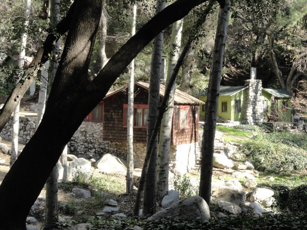
An idyllic scene of cabins found along the trail in the Big Santa Anita Canyon. They are privately owned by individuals and families within the U.S. Forest Service Recreational Residence Program. The special-use permits for these cabins prohibits them being rented out. Please respect the privacy of cabin owners.
As of January 2020, Maggie Moran became the new owner of Adams Pack Station! Please call her at the Pack Station (626) 447-7356 with your questions regarding their general store and cabins currently for sale. The Pack Station is currently developing an Instagram page as well as a new website. As soon as these are up and running, I’ll update this blog with their links. Thank you – Chris
When first hiking into the Big Santa Anita Canyon along most any of the trails, one can’t help wondering about the origins of the little Chantry Flats cabins that appear alongside the paths and streams. Construction of these early dwellings dates back to the early teens and 1920′s. Back then, during the Great Hiking Era, the U.S. Forest Service was actually encouraging the building of cabins on “never before settled” suitable locations in a number of national forests throughout the United States. In the Big Santa Anita Canyon, all kinds of potential cabin “sites” were discovered and developed. Typically an Angeles National Forest ranger would hike to the potential site with the cabin builder applicant for approval of a special use permit or not. Back then, the Chantry Road to the current trailhead did not exist. The road would not be built to Chantry Flat until 1935. Therefore, you would hike all the way from Sierra Madre, thus adding about 4 miles each way to your destination. It was over 8 miles one way to Sturtevant’s Camp, versus the current 4 mile trip in! There were motivated hikers, to say the least.
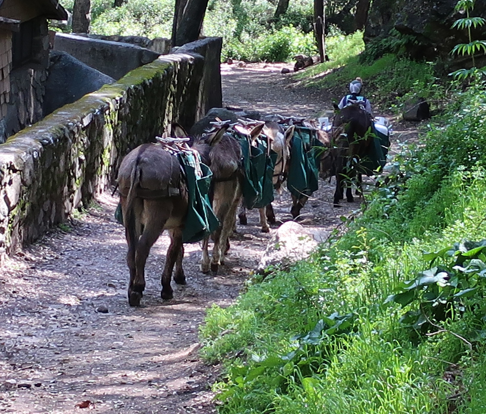
Maggie Moran leads her pack train down the Big Santa Anita Canyon on the Gabrielino National Recreation Trail. This is how supplies are transported between Chantry Flat and the private cabins along the hiking trails. Photo taken near Fern Lodge, just downstream from Sturtevant Falls.
When the cabin building program began, “recreational resident cabins” (U.S. Forest Service language) numbered over 220 + in the Big Santa Anita and Winter Creek canyons. Materials for these cabins was hauled in on mules and people’s backs for the numerous building projects. Pack trains travelled the narrow mountain trails seven days a week through the busy construction years. Not only cabins were being built, but trail resorts were springing up as well! Five resorts alone were in existence during this period. Hoegees, Roberts’ Camp, First Water, Fern Lodge and Sturtevant’s were enormously popular for groups of hikers seeking an overnight experience. Information about the colorful events from the camps is a separate subject entirely. Just imagine how the canyon would have sounded and looked during the evenings as lanterns flickered through the little windows amongst the trees and reflecting stream.
As for the cabins, a number of natural and man-made events pared down the initial number of structures dramatically. A great flood that took place in 1938 (the 38′Flood) washed out many cabins, not only in the Big Santa Anita, but in other front country canyons such as the Arroyo Seco and San Gabriel Canyon as well. The next sizable event for the canyon was the 1953 Monrovia Peak Fire, which started up at Spring Camp near the summit of Monrovia Peak. More cabins succumbed to this catastrophic fire which burned for weeks. In 1969, yet another flood occurred, which took out some more of the cabins. Amongst all this, occasionally cabin owners have had a part in accidentally burning down their own dwellings. Although uncommon, it has happened even into recent times. Today, there are less than 79 cabins left standing in the Winter Creek and Big Santa Anita canyons.
The cabins are privately owned and are a labor of love to say the least. To this day, supplies are hauled in by the Adams Pack Station at Chantry Flats. Items such as propane, lumber, groceries, furniture, roofing and more are taken to the trailside cabins by the pack string of mules and donkeys. Also, a frequent foot patrol takes place to ensure the security of the cabins. The cabins are unavailable for rent to the general public. If you’re interested in purchasing one, go to the Adams Pack Station website (www.adamspackstation.com) to inquire about cabins that may be up for sale. The cabins are located on public land, so cabin owners must comply with U.S. Forest Service regulations in regard to everything from paint color, type of roofing, sanitation practices and the gathering of downed wood. When you’re out hiking or backpacking, please respect the privacy of the cabins. Many people have been drawn to the Big Santa Anita Canyon due to its’ popularity as one of most scenic L.A. County waterfall hikes. These unique little cabins are a sweetly unexpected find for the eyes.
If you’re interested in ever spending the night in a cabin, there is one place where you can rent. Sturtevant Camp, located a couple of miles upstream from Sturtevant Falls, is available to individuals, couples and groups by reservation. The camp has comfortable, clean amenities and is open throughout the year. Check out the Adams Pack Station website adamspackstation.com for details on how to make this happen.