Mount Baden-Powell Hike

Posted on September 14, 2016 – Written by Chris Kasten

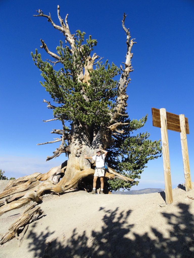
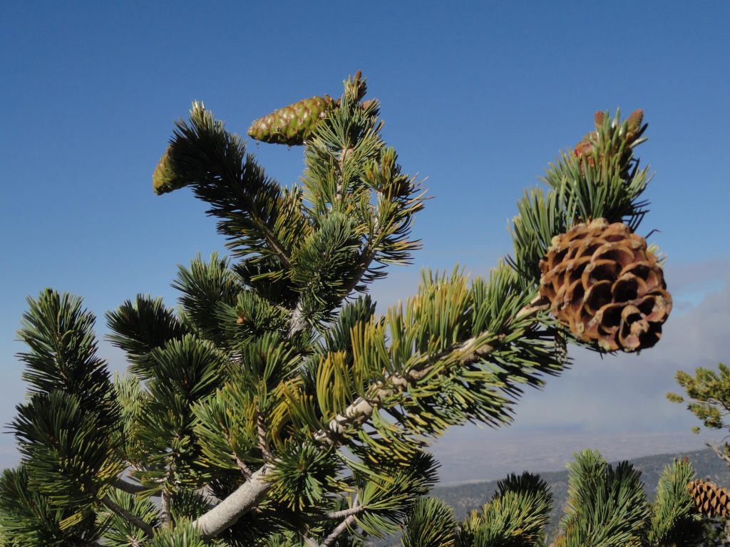
Here’s a close-up image of a bough of Limber Pine (pinus flexilis) taken near the summit of Mount Baden-Powell. Some of these trees found high, about 9,000′ elevation, on this mountain slope in the eastern San Gabriel mountains range in age from 1,500 – 2,500 years. Look for needles numbering five within each sheath, smallish cones and white, cordlike branches that are very flexible. The trees are not terribly tall and sometimes appear shrubby and very wind bent.

The Mount Baden-Powell hike is featured in the Trails of Wrightwood – Big Pines Map,  as well as 19 other trail hikes in the surrounding area.  The map is hand-drawn on weather-proof map paper.  Unfolded, it measures 19″ x 28″, giving a clear sense of how many of the trails are laid out in this part of the eastern San Gabriel Mountains high-country.   Contour lines have been purposely omitted, presenting a clear and uncluttered appearance.  Just click on www.hikewrightwood.net to see details.  Late summer and fall are both good times of the year to hike up this beautifully forested mountainside.

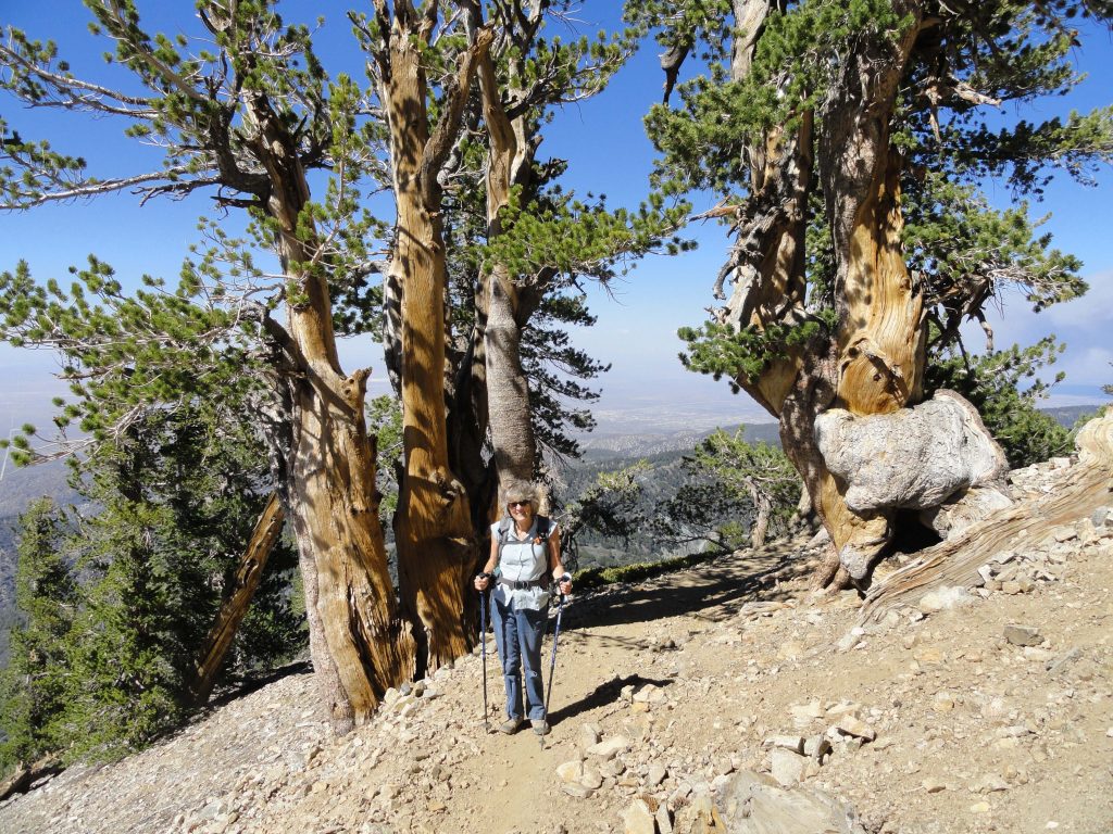
Joanie Kasten framed between two ancient limber pines as she nears the summit of Mt. Baden-Powell.

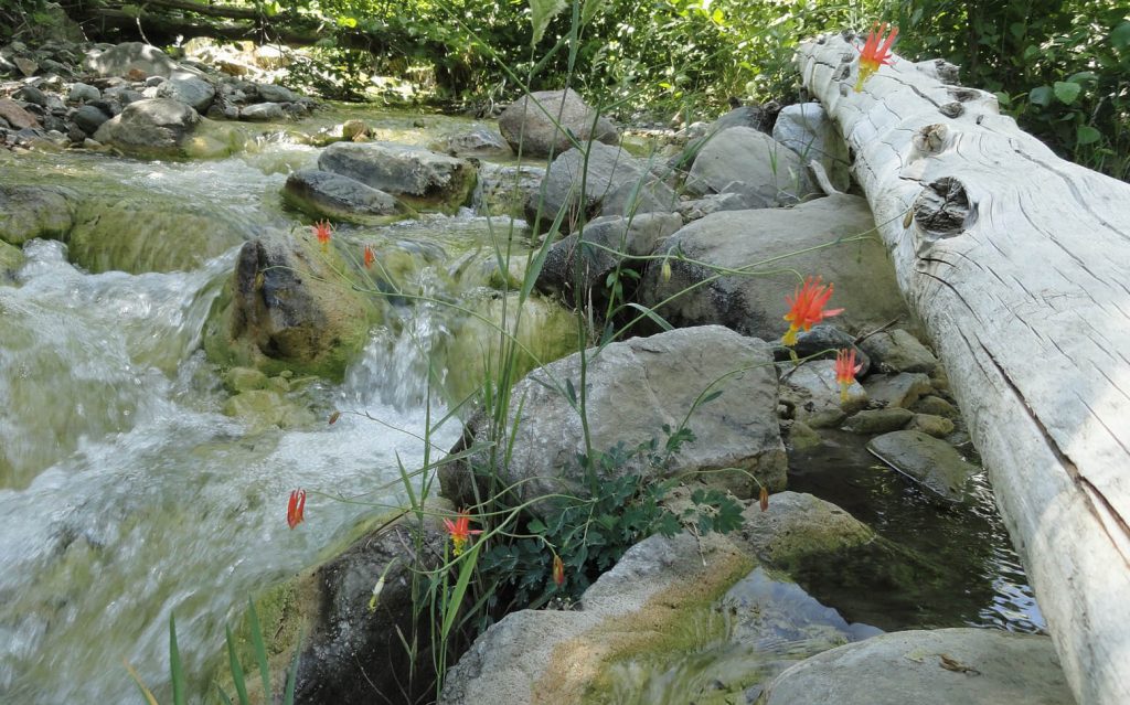
You start out at Vincent Gap on the Angeles Crest Highway in an area of red soil, sort of like a color you’d see in New Mexico.  In 38 switchbacks you’ll climb 2,800′ to the top of the windswept summit.  Less than half way up, make sure to stop at Lamel Spring and check out native wildflowers, such as Shooting Stars and Crimson Monkey flowers.

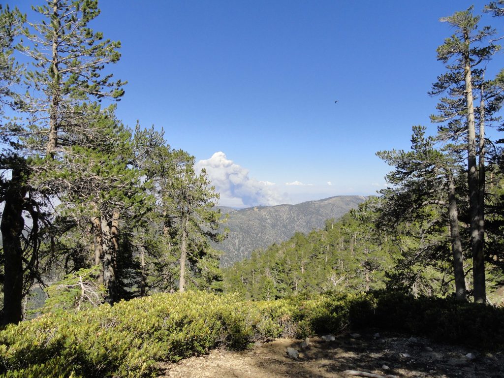
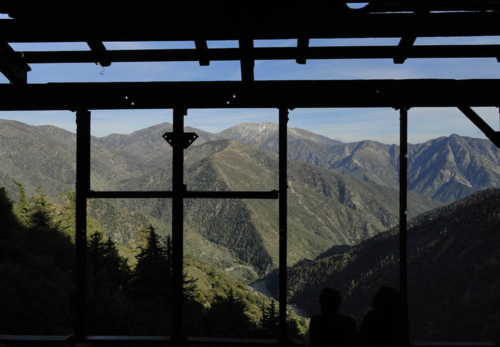
About 2/3 of the way up to Mount Baden-Powell, you can see a smoke cloud behind East Blue Ridge. We thought that the fire might be near Wrightwood, however, it was way down on the I-15 Freeway in the Cajon Pass. Notice the deer brush and Lodgepole pines in the foreground.

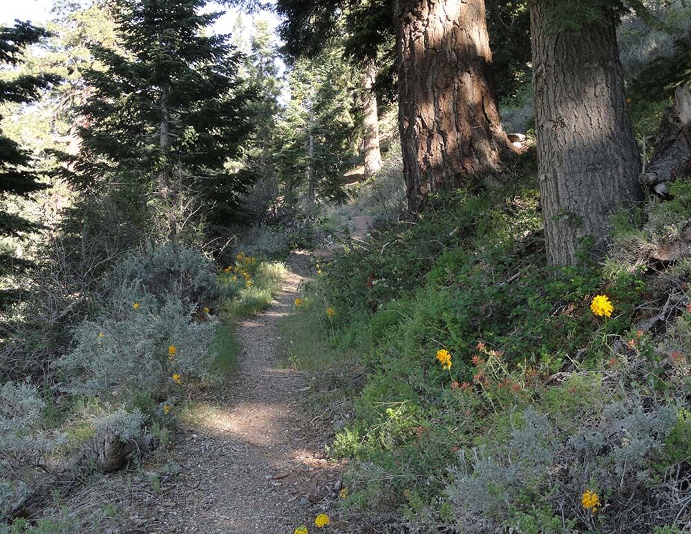
One of the great reasons to do this hike is to experience forest transition the whole way up.  Start your hike out in scrub oak and lots of jeffrey pine.  Soon, you’ll be experiencing stately sugar pines with their long, glistening cones hanging from the tips of broad horizontal branches.  Next, you’ll travel through stands of lodgepole, nearly perfectly straight in stature, with a myriad of tiny cones covering the forest floor at their base.  As you near the summit, start to look for the ancient limber pines, which have been buffeted by the storms of wind, rain and snow for centuries.  In some cases, 2,500 years!   Whatever your reasons for doing the  Mount Baden-Powell hike, you’re sure to to enjoy majestic panoramas of the Mojave Desert to the north along with a view of the rugged peaks of Pine Mountain, Dawson Peak and Mount Baldy to the east.  Come back refreshed.

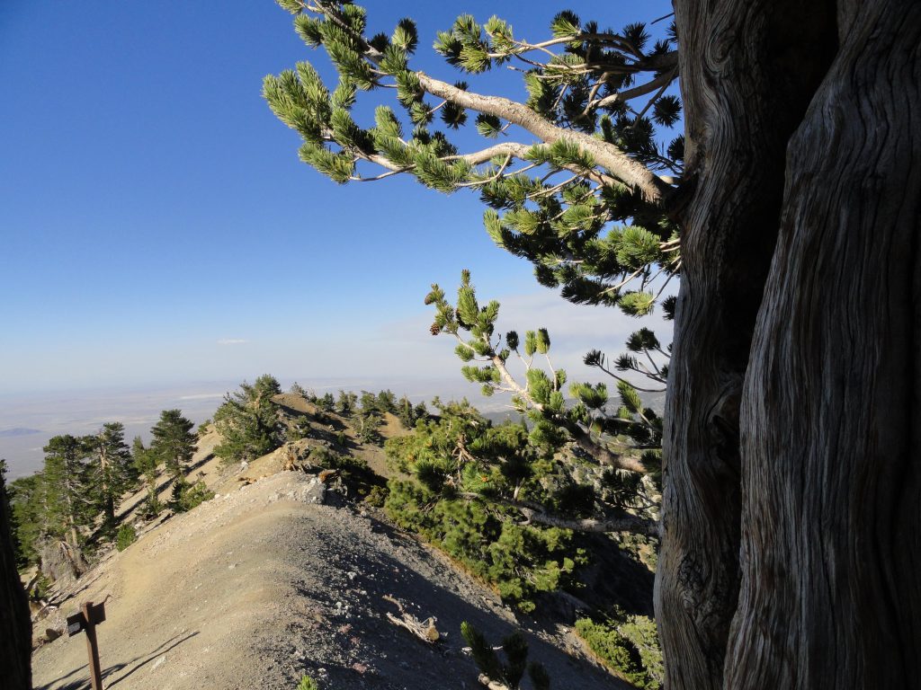
Here’s a view looking out toward the Mojave Desert. Photo was taken just below the summit of Mount Baden-Powell under the shade of an ancient limber pine in the late afternoon. Notice the trail sign in the foreground, marking the intersection of the P C T (Pacific Crest Trail) and the final few switchbacks to the summit.

Hike Wrightwood – Twenty Good Reasons – At least!

Posted on June 20, 2016 – Written by Chris Kasten

Crimson Columbine grace the fresh, tumbling waters of the East Fork of the San Gabriel River. This scene was photographed just downstream from Mine Gulch campsite at an elevation of 4,500′ in the Sheep Mountain Wilderness. It’s all boulder hopping downstream from the confluence of Vincent Gulch, Mine Gulch and the Prairie Fork.

There are at least twenty good reasons to hike Wrightwood during the spring and summer months.  While the front country of the San Gabriel mountains swelters under the summer heat and high humidity, there’s a beautiful place in the eastern high country where the air is lighter, cooler and a bit drier, too.  Gentle breezes sweep through the pine forests, imparting a restful, freshness to your hike.  If you can imagine spanning the ridge top distance between Wright Mountain on the east out to Mount Baden-Powell in the west, there’s a myriad of hiking trails, over 20, to be found among the high elevation pines, fir, cedars and fragrant chaparral.   Some of the trails connect places like Jackson Lake with West Blue Ridge, Wrightwood with East Blue Ridge and the Pacific Crest Trail (PCT), Big Pines with Blue Ridge Campground, Vincent Gap up to Mount Baden-Powell’s 9,399′ summit or the descent into the  headwaters of the East Fork of the San Gabriel River.

Old metal supports from the Big Horn Mine’s stamp mill provide this framed view of Pine Mountain, Mount Baldy and Iron Mountain. Thousands of feet below, the East Fork of the San Gabriel River churns through the Sheep Mountain Wilderness.


There’s quite a variety of places to hike Wrightwood that provide  you with a sense of of our past, such as the remains of the Big Horn gold mine, which clings precariously to the slopes of Mount Baden-Powell in Mine Gulch.  Dating back to the 1800′s, this hard rock mine was worked for decades by tenacious miners, in hopes of  golden outcomes.  Today its’ stamp mill and mine shafts sit idle, a testament to nature’s relentless taking back of the works of man in mountainous places.

If you look around the old Big Pines Lodge at the heart of what was once Big Pines County Park, founded in the 1920′s, classic rock work fringes rock walls and staircases from an era gone by.  Walk the Big Pines Nature Trail or head down to the old ice skating rink near the Arch Picnic Area to catch glimpses of where cabins once stood amongst groups of campers and snow players.

An ancient Limber Pine straddles the ridge top just prior to arriving at the summit of Mount Baden-Powell. Some of these beautifully gnarled pines are nearly two thousand years in age and are found near the upper end of the Pacific Crest Trail that connects Vincent Gap’s trailhead with the summit.

Hiking up to Mount Baden-Powell or dropping down into the canyons from Vincent Gap provide for a wonderful variety of terrain and plant life.  Regardless of your conditioning and time available, there’s a trail here for you.   If carrying a trail map appeals to you, there’s a large scale, hand-drawn map that highlights twenty hikes in the Wrightwood – Big Pines area of the San Gabriel mountains, providing a brief description of each hike experience with rise over run.  The map is very accurate, easy to read and has been field checked throughout.  Contour lines have been purposely omitted to provide a clear, uncluttered overview of the local high country  trails.  The Wrightwood – Big Pines Map is available online with free shipping or can be found at Mountain Hardware and the Wrightwood Market in the quaint village of Wrightwood, CA.  Happy Trails from Chris at Canyon Cartography!


Heading back up the Manzanita Trail toward Vincent Gap. Western Wall Flowers and Indian Paint Brush signal the advent of the summer hiking season.