Now’s a Perfect Time to Hike to Mt. Wilson

Late winter through spring is a really good time to hike up to Mt. Wilson. Even as Chantry Flat in the Big Santa Anita Canyon continues to heal from the Bobcat Fire of 2020, don’t feel like there’s no good way up to Mt. Wilson. If you’ve never done it, hiking up the Old Mount Wilson Trail from scenic Sierra Madre, is not a bad way to go. The canyon you’ll travel through on your way up toward Manzanita Ridge is known as the Little Santa Anita Canyon. This is the original way up to “Wilson’s Peak”, named after Don Benito Wilson. The trail dates back to the 1860’s

A view of Mt. Baldy from Manzanita Ridge.

Manzanita Ridge, sections of it quite true to its’ name, makes up the watershed divide between the Winter Creek (to the north) and Little Santa Anita Canyon on the south. Following the ridge line up toward the Old Mount Wilson Toll Road, views out into the High Country of the San Gabriels abound. Once up on the Toll Road, you’ll continue to walk along refrigerator-sized boulders that have dropped off the near vertical slopes of Mt. Harvard.

Once you reach Martin’s Saddle, the site of a once popular trail resort of the late 19th Century, views out toward the west are to be had. You’re now contouring the slopes of Upper Eaton Canyon, a beautifully rugged wilderness in its’ own right. Looking out across the steep and deep tributary canyons, there is from left to right, Mt. Lowe, Mt. Markham (flat-topped) and San Gabriel Peak. When the air is clear, this scene is spectacular.

Boulders dot the old Toll Road along the slopes of Mt. Harvard.
Boulders accumulate on the Mt. Wilson Toll Road in the aftermath of winter storms.
A view across Upper Eaton Canyon

Once up at the top, I found a picnic bench in the open air pavilion and soaked in the sunlight for sometime before heading back down. The Pacific reflected back at me like an amber platter just to the north of the Palos Verdes peninsula. What a beautiful place to be hiking. what a beautiful place to be alive.

Bobcat Fire Aftermath – Big Santa Anita Canyon

This photo was taken just a couple of days ago by an unnamed fire fighter and posted on Instagram. Photo was taken near Chantry Flat and is looking north up toward Sturtevant Falls. The arrow tip is in the Fern Lodge area of the main canyon, where the Upper Falls Trail and Gabrielino Trail leave the canyon bottom, continuing up and past Sturtevant Falls toward Cascade Picnic Area and Spruce Grove trail camp. It appears that much of the canyon bottom tree canopy is still intact after the Bobcat Fire !

Attached are two photos taken of Big Santa Anita Canyon in the aftermath of the Bobcat Fire.   There’s a third photo here, too.  It is of the flames dropping into the upper Big Santa Anita Canyon during the fire’s early stages of development.  The first photo was taken a couple of days ago.  Here you’re looking up the canyon from a point near the trailhead at Chantry Flats.  The second photo was taken by Larry Webster of Mt. Wilson just a day ago.  The view is from the east end of the summit looking down toward Sturtevant Camp.  Note the smoke still curling up from either the camp or adjacent to it.  It’s still too early to know what the damage actually was to the camp or the nearly eighty private cabins up and down the Big Santa Anita Canyon and Winter Creek.   Updates to follow as they come in.

This photo was taken after the fire passed through,  by Larry Webster of Mt. Wilson, CA. That’s Monrovia Peak, highest point in center horizon of photo. At the tip of arrow is Sturtevant Camp. As of this writing, it’s unknown how the camp fared in the Bobcat Fire.

This photo was taken before the Bobcat Fire reached Mt. Wilson.  Sturtevant Camp’s heliport is marked by the small red arrow.  Coincidentally, the camp itself, is located at the bottom, or start,  of the arrow’s shaft.

The Bobcat Fire dropping down into upper Big Santa Anita Canyon. At the end of the little red arrow is the heliport at Sturtevant Camp. Photo taken from Mt. Wilson by Larry Webster.

Mt. Wilson – A great place to hike the Front Country in Winter

A friend of ours gave us this vintage postcard a number of years ago. The artwork depicts a scene that may have been intended as having taken place on the east end of the summit, perhaps near Echo Rock. The image somehow seems timeless, evoking that magical pull that the San Gabriels have had on generations past and those to come.

Whichever canyon you choose, getting out on our local trails is a great way to get a good start on the new year.  I’m especially fond of the trails that make their way up to Mt. Wilson.  One route that I’ll be doing in the next couple of weeks will be to  head on up the Gabrielino Trail from Chantry Flat to Newcomb Pass.    From there, take the Rim Trail to Wilson’s summit.  Return by way of the Sturtevant Trail.

Here’s a trail scene taken just below the “Halfway Rest” The forest is healthy and vibrant here in the upper Big Santa Anita Canyon.

This is a great trip to get some good winter sun while climbing up and through the warm chaparral before getting under the oaks and pines on the north side of the Rim Trail’s watershed divide.  The stream’s flowing really nicely right now, especially with the good start to winter storms that we’ve had from Thanksgiving through Christmas.  Wrightwood, alone, has received nearly an average year’s worth of snow accumulation within about a month at the end of 2019.   So, get out and enjoy the flowing streams, the bright green fern beds and the scent of damp soils and leaves.  A word of caution, though…

The bubbling Big Santa Anita Creek near Bear Trap Canyon on the Gabrielino Trail.

Make sure to be cautious of ice in the some of the higher elevations as you approach Mt. Wilson from Newcomb Pass.  Also, while traveling back down the Sturtevant Trail, watch for an ice chute within a half mile of the summit.  This time of year, it’s a good idea to at least carry a pair of MicroSpikes or a similar traction device that you can add to your shoes.  Take your time and savor the front country of the San Gabriels in the winter.

A lady bug rests here in the sun on a white sage leaf. This photo was taken on the Upper Falls Trail, Big Santa Anita Canyon.


Ascending Rush Creek, Mt. Wilson, CA

Posted on December 31, 2014 – Written by Chris Kasten

Rush Creek, Mt. Wilson, CA.  On the first day of Winter, I ascended Rush Creek, a steep and deep canyon on Mt. Wilson’s north side.  After spending the night at a completely unpeopled, chilly, yet peaceful DeVore Trail Camp, I went up upstream to West Fork Campground under steel gray skies.  That day really felt like winter, not so much in

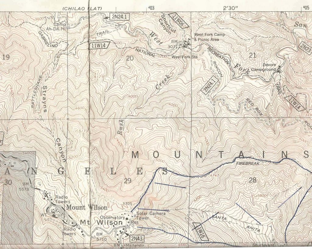
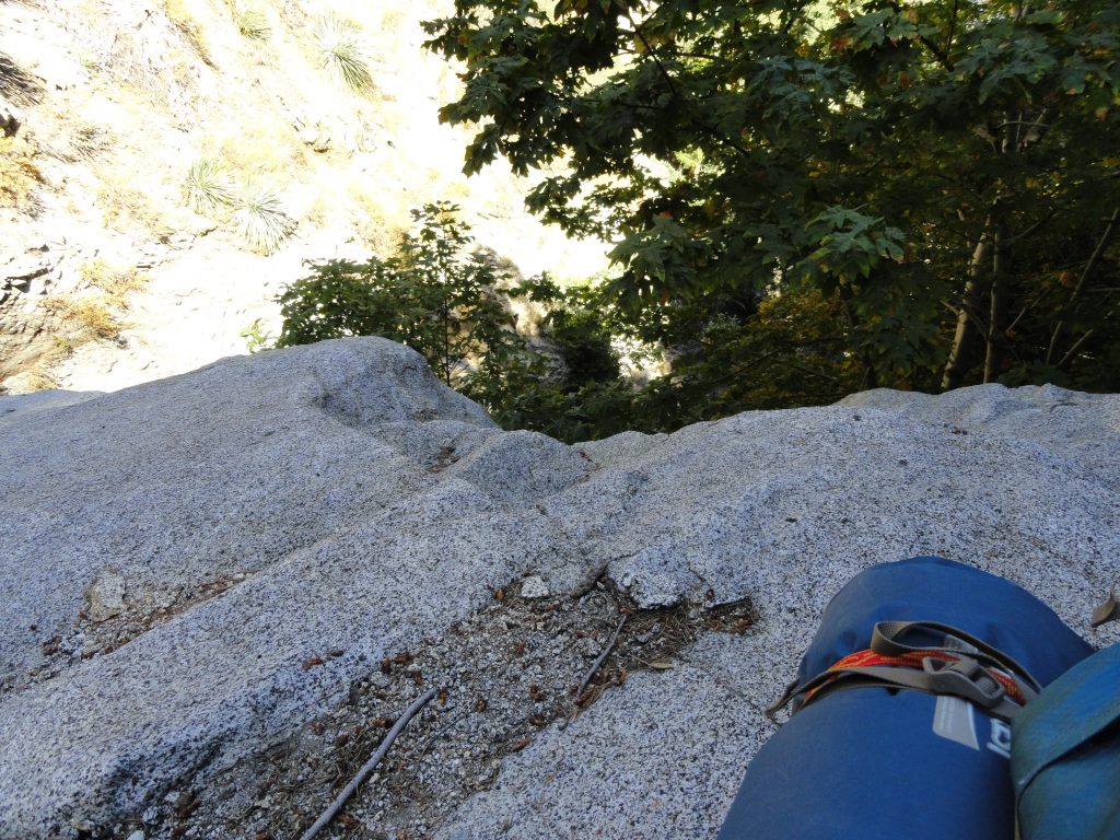
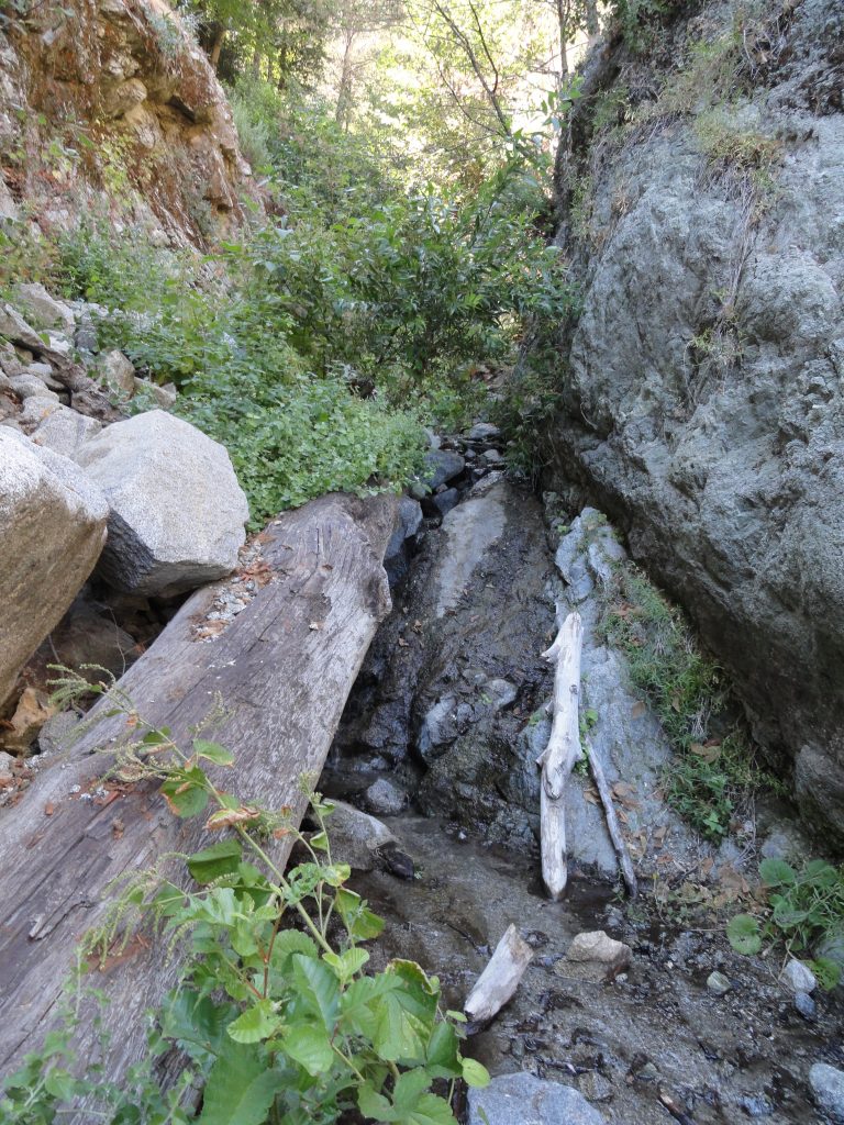
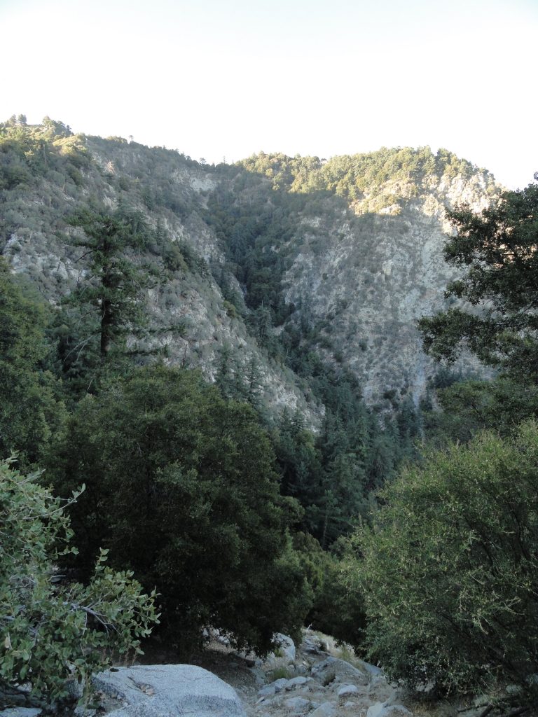
Here’s a detail of Rush Creek, which I ascended from West Fork Campground to Mt. Wilson.

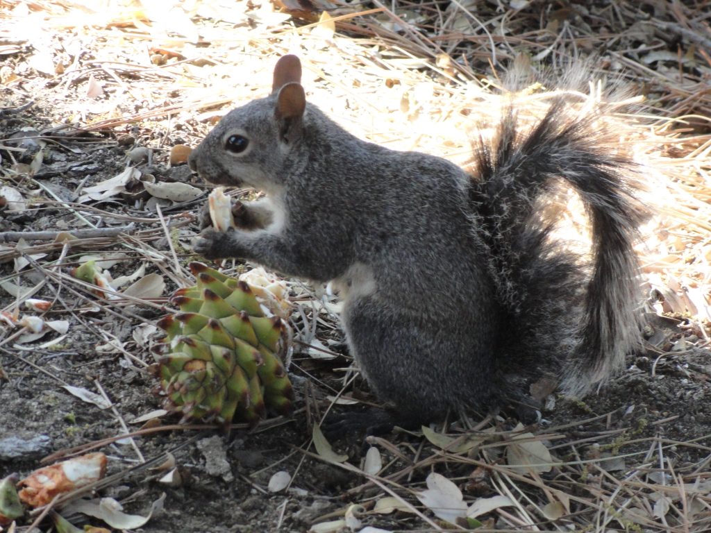
temps and winds, but in that flat gray light that’s such a part of our days in the canyons of the San Gabriels.  Lots of alders and oaks have come down across the one and a half miles of the Gabrielino Trail that crosses and re-crosses the West Fork of the San Gabriel River between these two campgrounds.  In many places, white alders seem to have broken mid way up their trunks, leaving behind shattered snags by the dozens.  Oaks have laid down, too.  Over and over, I kept on seeing the fresh, black carbon scars on the bases of trees from the Station fire of 2009.  Dams of driftwood had piled up high across the stream here and there, yet the old West Fork meandered under and through, not seeming to care at all about these very temporary nuisances in the life of a river.

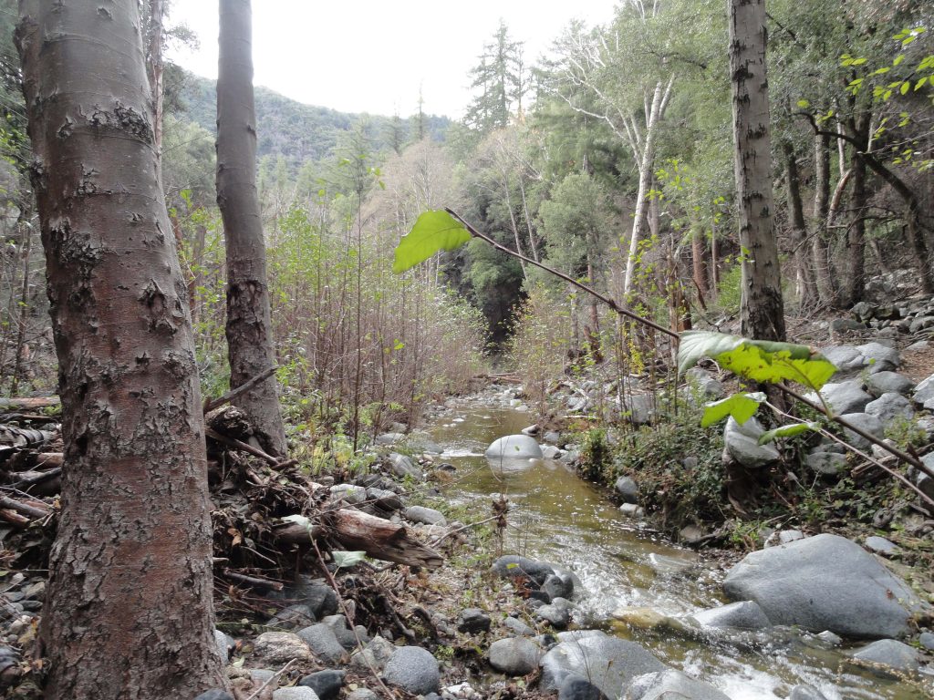
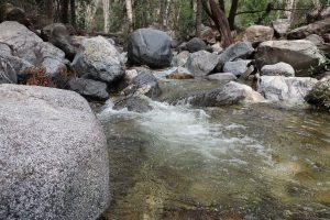
West Fork of the San Gabriel River. View is looking upstream toward West Fork Campground.

My feet were already damp from all the crossings by the time I arrived at West Fork campground.  A few folks were camping here as I wandered over to the site of the first ranger station in California.  Now only a 1950′s era Daughters of the American Revolution monument marks the place where Louis Newcomb hewed his ranger cabin back in 1900.  You can still see the reassembled cabin at its’ relocated spot adjacent to the Chilao Visitor Center up Highway 2, not far from Newcomb’s Ranch.

Now the work was to begin….  Rush Creek joins the West Fork just to the east of the campground.  Wet blackberry bushes, stinging nettles and thickets of young alders marked the beginning of the canyon.  The elevation gain to the top of Mt. Wilson is close to 2,700′ in less than two miles of bouldering.

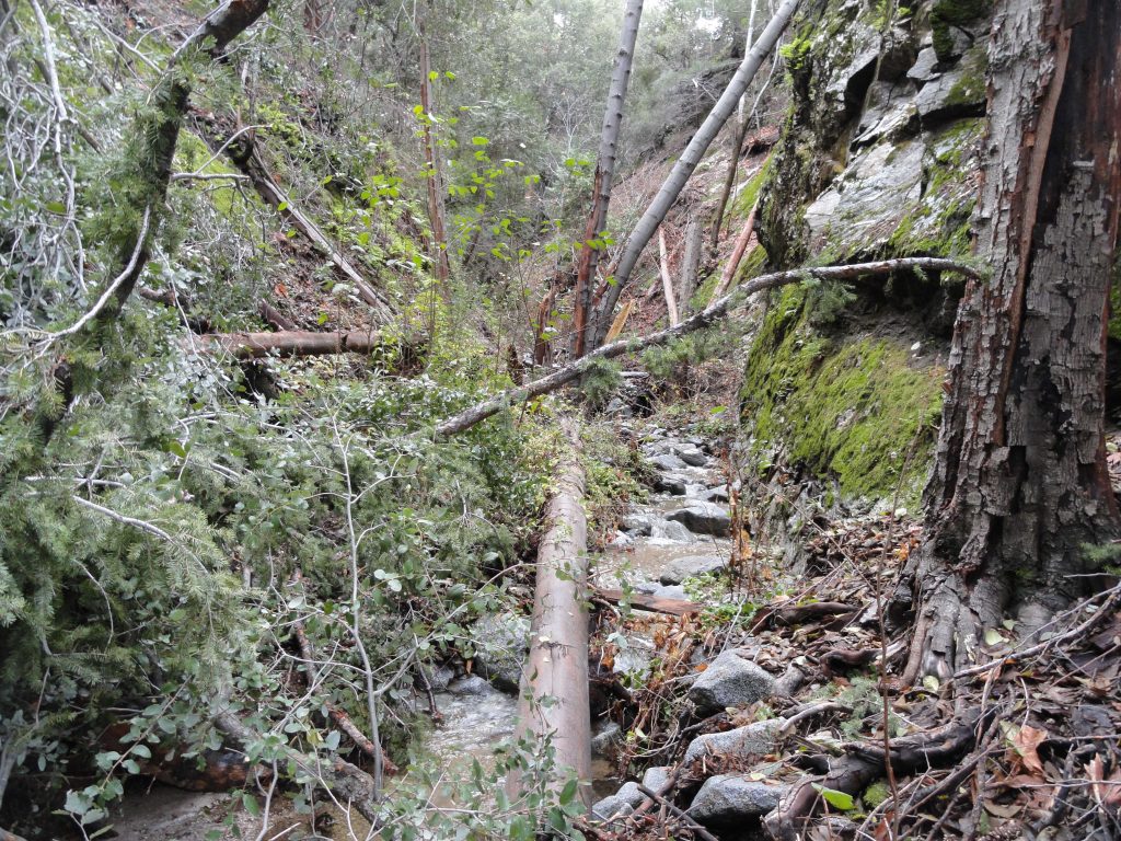
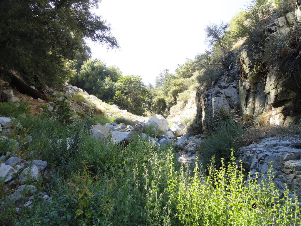
Lower Rush Creek is slow-going. Here the stream’s choked with fallen alders and berry bushes.

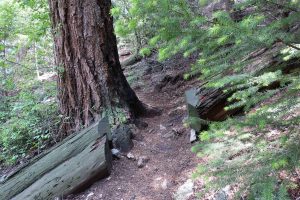
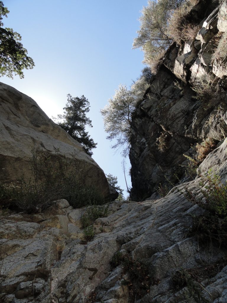
Rush Creek is true to its’ name!  The stream fell rapidly over a myriad of small waterfalls and cascades, punctuated occasionally by a few yards of calm and gentle descent.  The canyon bottom, like most in this part of the front country, was mostly narrow and fringed in mosses and ferns.  It seemed that most of the rock surfaces were damp and slick, which added an ice-like slickness to my challenges.  However, if you take your time carefully choosing your route up and around the small waterfalls and cascades, there’s no need for ropes or any climbing hardware.  Just take your time, which is what I did.


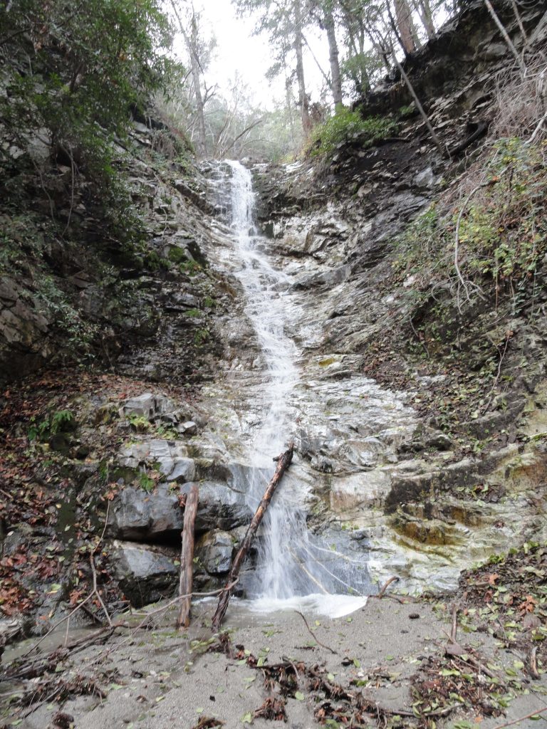
Tumbling Rush Creek Falls. It’s about thirty-five feet high. I climbed to the left of it.

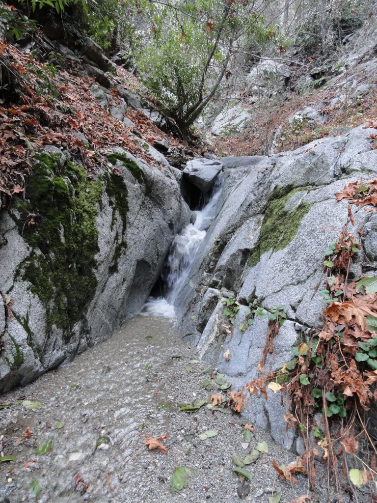
Water falling through a slot about half way up Rush Creek.

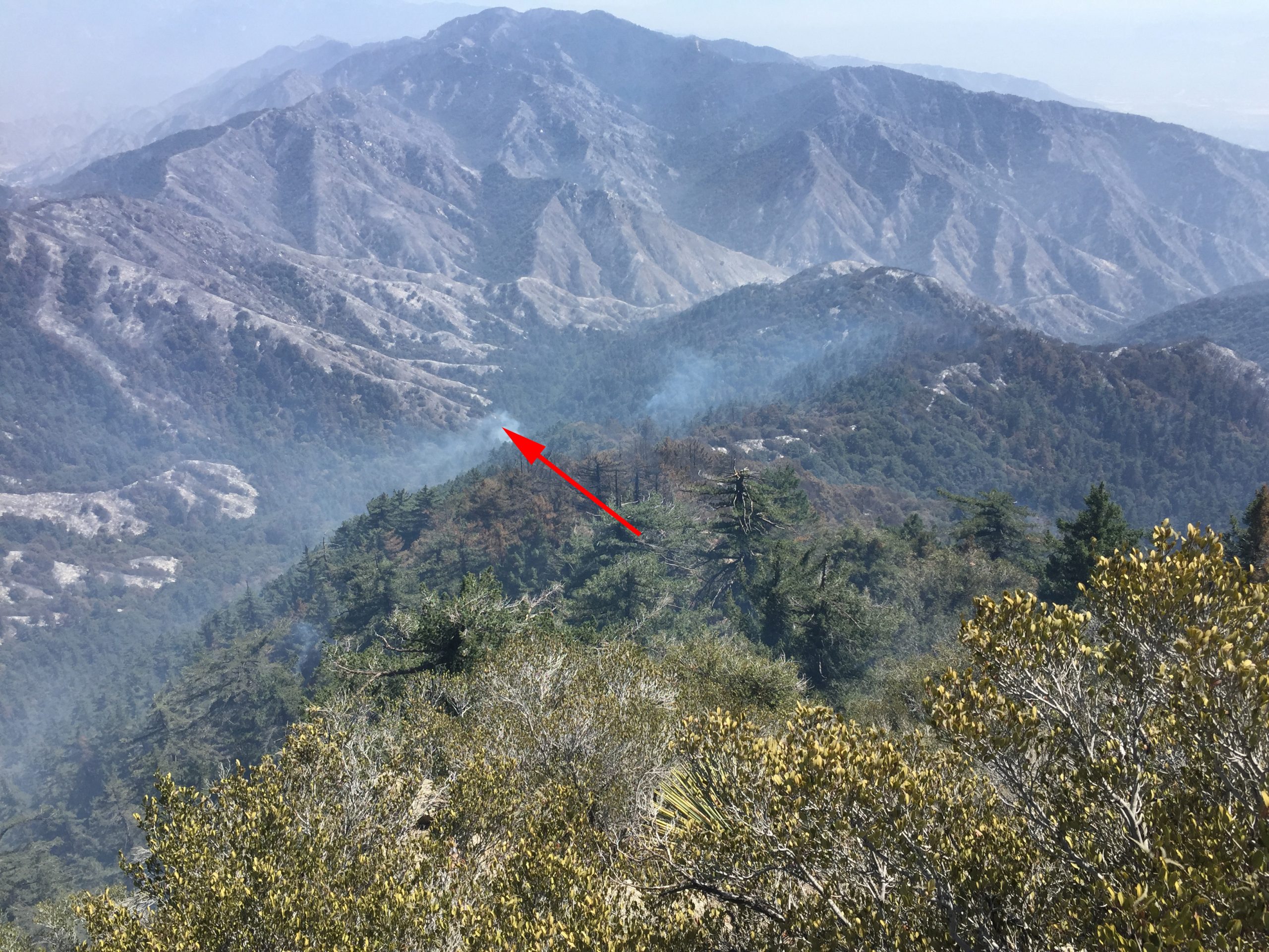
A little better than half way up, I had to choose a canyon for my final route to the top of Mt. Wilson’s eastern end, not far from the 100” telescope dome.  Eventually I chose a fork toward the left which turned out to work out fine.  Like all x-country approaches to Mt. Wilson, the semblance of a canyon soon morphs into sandy, steep slopes pocked with rock outcrops and exposed tree roots which are great for hand holds at times.  It took from about 9:40 a.m. to 2:30 p.m. to make the trip between the mouth of the canyon to the top.  It was both exhausting and exhilarating, with grand views out toward Twin Peaks and Mt. Waterman in the back country.   The flat, gray wintery light filled me with thoughts of past Christmas-time hikes and those who I had shared them with.  Here and there in the shadows, amongst the towering Big Cone Spruce, incense cedars and sugar pines, memories of my brother Nick kept following me up Rush Creek.  At one point earlier in the day, along the West Fork between DeVore and West Fork Camp, I saw the spot where he and I had been hiking one autumn years ago and had stopped for a photo in the fallen maple leaves.  I could still see him leaning against a scraggly tree in his relaxed lean, pack still on.  Nick passed away last January 9th from complications of chronic kidney disease.  He’s a couple of years younger than me, which on a number of levels has made his early passing even harder to bear.  Somehow this canyon had become the place, so late in the year, with her peaceful greens and grays, which allowed me images of my brother, thoughts of him, to flow quietly through my being.  A calm healing had been seeping into me throughout the ascent of Rush Creek, one like I had not experienced until now.

This thought kept tumbling through my head, “our time here on this earth is brief under the best of circumstances.”   Just keep on climbing and you’ll be at the summit and so will he.  So, the rest of my ascent had become a pattern of short scrambles, searching for stable footholds, letting my heartbeat slow down and starting, again.

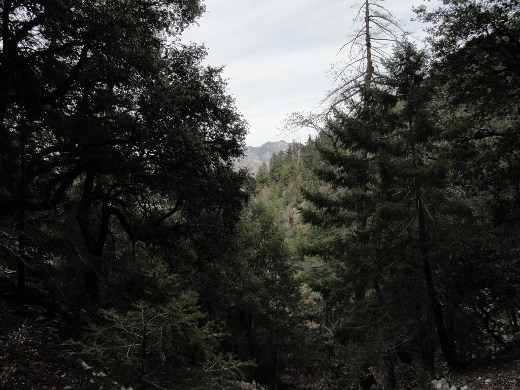
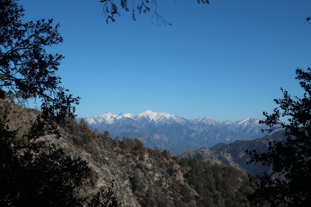
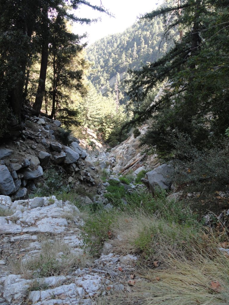
Peering out at Twin Peaks from upper Rush Creek. Here the forest is lush, green and healthy.

Eventually I topped out into a forest of scrub oaks, following a gentle ridge to a lonesome picnic table along the Rim Trail.  My eyes were damp.  Like most of my x-country hikes, I found myself wondering where this canyon had been all my life.  Soon, my soaked shirt had begun to turn to chill, so I changed into a dry top, had a little cheese and pita bread sandwich and kept on walking in the dimming light.

The return back to the little cabin in the Big Santa Anita was by way of the superbly scenic Rim Trail which parallels the ridge dividing the watersheds of the West Fork of the San Gabriel and the upper Big Santa Anita Canyon.   The distance from Mt. Wilson to Newcomb Pass is a relaxing descent of 3 1/2 miles if you take this route back toward Chantry Flats.  The sunset was stunning and soon I had the

flashlight out for the rest of the trip back to Fern Lodge in the Big Santa Anita Canyon.  Soon I began to pick up the pace, trying to beat the impending darkness.  A calm peace ran through my bones as I headed toward Newcomb Pass and then down toward Sturtevant’s Camp.  You know, the fantastic way you feel when you’ve gotten in miles and miles of canyons and ridge tops, before you arrive where you can take off your boots and stay awhile.  My old friend Bohdan greeted me in the dark near Falling Sign Junction and we hiked together back to Joanie and the warm, lit cabin with dinner on the stove.  This day was more than good.

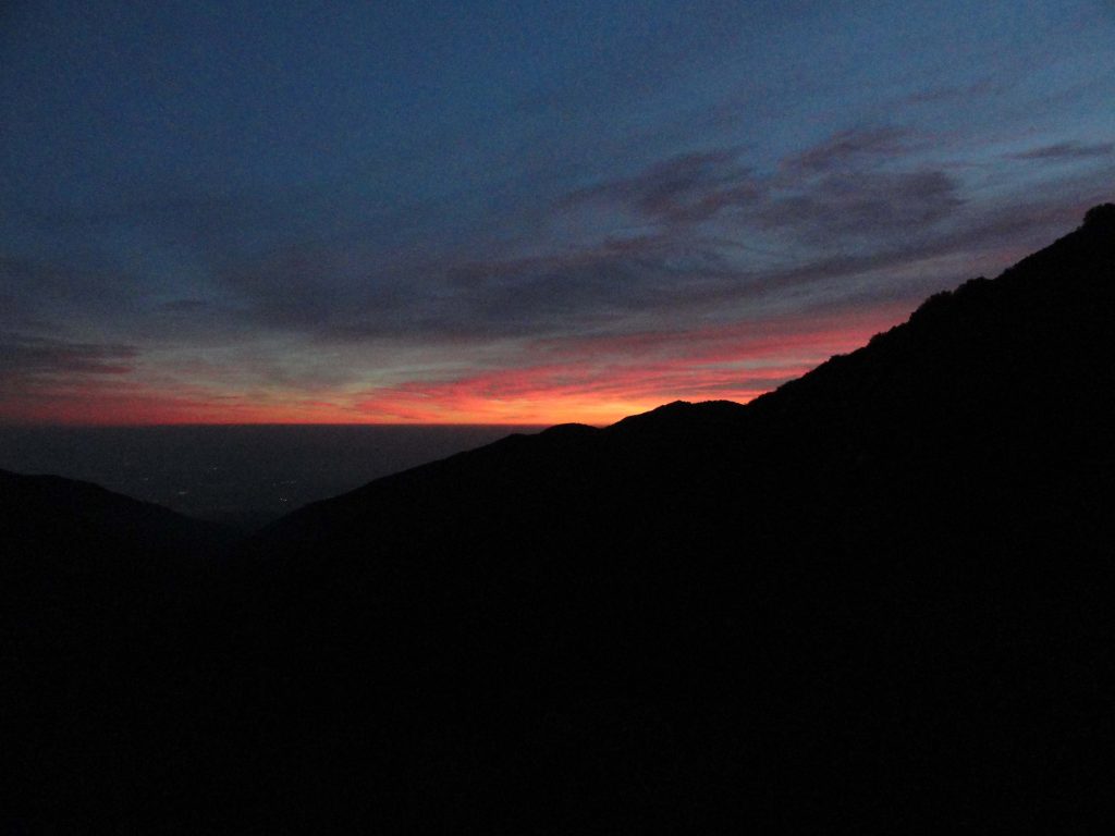
Sunset from the Rim Trail between Mt. Wilson and Newcomb Pass.

Chantry Flats to Mt Wilson X-Country via the Winter Creek

Posted on August 15, 2012 – Written by Chris Kasten

Chantry Flats to Mt. Wilson via the Winter Creek. Looking off a steep piece of granite from a ledge along the way.

Here’s another way to do Chantry Flats to Mt Wilson.    X-country via the Winter Creek Canyon is a seldom trod route.  You see, I’ve got this habit which will seem quite normal to some and quite unconventional to most.  I like to follow stream beds, canyon bottoms, in an upwards sort of way.  Never down canyon, oh no, just up – which seems to be a less clumsy way for me to do these things.  This way of hiking without the aid of trails or footpaths is often described as traveling x-country through the mountains.   It’s very leveling and calming for my mind.  Carefully stepping and watching for every detail makes me slow way down and find myself present to the world around me.  Some of my favorite x-country haunts are places like Bear Creek and Devils Canyon in the San Gabriel Wilderness.  The following describes a jaunt that I took four years ago from our little cabin at Fern Lodge to Mt. Wilson and back.  I have just gone through and updated this blog today on 10/17/2016.  A significant chunk of the day was spent traveling x-country up the Winter Creek to its’ farthest reaches.  These are my notes.

I said goodbye to my wife and left our little cabin at 10:20 a.m. on a warm summer morning this last Sunday.  Motes of light filled with the talc-like dust from hikers boots filled the air along the Gabrielino Trail to Roberts’ Camp.  From there my route followed the Lower Winter Creek Trail up past Hoegees Trail Camp.  Eventually, I got onto the trail that leads on to Manzanita Ridge and Sierra Madre.  Just near cabins 137-139 was where I cut down to the stream and then climbed up and over the last check dam in the Winter Creek.  I followed a precarious game trail along a loose, crumbly and nearly vertical slope to get around this man-made obstacle.

Looking up the Winter Creek stream bed about half-way between Hoegees and Mt. Wilson’s summit. This x-country route is basically non-technical, yet challenging on some of the steeper, narrower pitches.

Walking on older fallen logs (Big Cone Spruce) is a good way to make your way up the Winter Creek stream bed. Notice the moisture found here even in the month of August.

Once above the dam, my x-country experience began.  The steam bed was choked in places with log jams made up of Big Cone Spruce from way up high.  Found remnants of someone’s abandoned campsite not far above the last cabins.  Lots of stinging nettles grew lazily amongst the speckled gray boulders.  Scarlet and yellow monkey flowers began to make their appearance in damp sands.  At one point I stopped to take off my boots and soak my bare feet in a sparkling pool as electric blue dragon flies flew low along the water.  Further up a short distance I startled a rust colored hawk with a snake dangling from its’ talons.  The hawk then dropped the dangling narrow serpent about 8′ down into a bush where it wiggled off to safety.  Happy snake – bummed out bird.  Occasionally I climbed low cascades that had both wet and recently dried algal coatings on them.  Careful attention was needed for finding the right purchase for my feet and hand holds that would stay put.  At one point I reach for a hand hold while all my weight rests on my left foot.  Pretty soon I get that sewing machine action going in my calf muscle and the sweat pores down my forehead, stinging my eyes.  I got a bit dizzy.  Yes, Chris, you’ve got yourself into this predicament before.  Gently and nimbly I back out of my route alongside a dry waterfall as canyon wrens sing in their descending tones, laughing at this foolish human and his shock of white hair.  I climbed with an internal frame pack and was set up for overnight.  I was once, again reminded how much upper body strength it takes to climb up and over some of the rock pitches!  For the most part, the stream bed stayed narrow as its’ volume diminished with elevation gain.  There were seeps along the way that created damp, dark areas of soils and rock, often framed in ferns or grasses.  Gradually the stream gave out, the rocks and boulders became house size and the steepness increased.  Still, the angled sun-baked spruce logs lay lodged in the dry sand, sometimes creating a board walk of sorts.  The sun shifted gradually, putting me in welcome shade for a lot of my climbing.  The rocks, however, had retained the day’s heat and my mind was occasionally filled with the thoughts of basking serpents of all temperaments…

A smallish dry waterfall along the route to Mt. Wilson in the bottom of the deep and steep Winter Creek. I was able to climb up and over this choke point without too much challenge, with the exception of a lot of upper body workout!

I passed a mountain lion track in a pocket of damp sand.  Broke through occasional thickets of alder and willow, while lizards flitted about on the speckled boulders and polished cliff surfaces.  I finally passed my last forlorn pocket of seedy dampness.  The standing water too shallow for my backpacking filter intake to take advantage of.  Yellow jackets covered every bit of muddy dampness they could.  The wing beat of seemingly hundreds of flying insects filled the hot, still air.  There were no flat spots to pitch my little one man tent and I was now working on my last liter of water.  Onward I climbed on pitches of loose soils and crumbling bedrock.  The view back down the canyon was startling.  My route was as steep as a ladder, yet without good rungs.  An antique cable of braided wire that I had been following for some time became my line to hold onto for some of the steepest, loosest slopes.  Broken glass, ceramic insulator fragments and sections of rusted steel frame work, even water pipes, made their appearance as I approached the summit.  Man’s trash always goes way downhill.

A view back down the Upper Winter Creek from a peaceful, grassy ledge. Photo taken in the shade of Mt. Harvard while heading toward Mt. Wilson.

Finally, I reached the top of the mountain at an old building that used to house some kind of electrical switching gear.  There were hundreds of pieces of welding rod laying about the place.  Soon I wandered into a sadly neglected house with its’ door swung wide open, just as it had appeared earlier on in the summer when I was last up on the mountain poking around.  Wandering into the fly infested kitchen I said out loud, “Honey, I’m home!”  Just silence, punctuated by the swarming of flies and golden streams of light angled down into the rooms.  A sadness began to flow through me as I fell deeper into a tired funk.  I’ve gotta get out of here and get some much needed water.  Wandering over to the Larry Cotter memorial drinking fountain, I plop down on the adjacent picnic table.  It’s hard to get enough water into this tired, middle-aged body of mine.  I even drink down an apple juice in record time and then onto more water.  About six liters have been absorbed, most of it leaving my body in the form of profuse sweat and breath.  I’ve barely peed all day, and when I do, it’s dark yellow and not a whole lot, either.  The day is still so hot and muggy, even at 5,700′ up.  Since I’m now safely out of the grasp of the Winter Creek, why even camp out now?  I ponder sleeping out on top of my down sleeping bag, eating a P&J sandwich (my third) and swatting mosquitos and no-see-ums all night long on some dry ridge top.  The hell with that!  I’m heading back to the bliss of Joanie and the cabin – Yeah!

A cheerful cluster of California fuscia in the stream bed of the Winter Creek’s main fork. We are now very close to Mt. Wilson’s summit.

Looking across the upper Winter Creek from the Mt. Wilson Toll Road on my return back to our family cabin in the Big Santa Anita Canyon. That steep, wooded draw that you can see in Mt. Wilson’s cliff face is the route I took at the very end of the x-country adventure. Looking here at Mt. Wilson’s broad ridge top summit on the horizon, the historic astronomer’s “monastery” is near the tip to the right of the draw. Mt. Wilson’s 60″ and 100″ reflector telescopes are off to the left of the draw.

Eventually I drop down and down off the mountain to the David F. Drinkle memorial bench on Manzanita Ridge.  Our friend Bohdan built that bench years ago and did a beautiful  job on it.  It is solid and lasting.   I’m going to sit down on it as red ants swarm in their feverish way across the sun-baked sterile earth around me.  I make up some instant coffee with cold water in a tin cup, eat another tangerine, part of a P&J, cheese,nuts and soon I’m down the trail to the cabin in the gathering dusk.  In a bit of a happier, lighter way, I make up lyrics and sing songs that start me laughing.  I come up with the craziest lyrics and feel a bit drunk from the summer sun beating down on me earlier.  My voice spooks up a bear that crashes off the side of the mountain through thickets of God knows what.  At 9:20 p.m. I return home to Joanie in candle light.  She looks really clean!  Or I look…   I have a delicious tossed salad and wash it down with a high ball on the rocks.  My day begins to blur and I’m serenaded to sleep within minutes to the chorus of crickets.  A great day in the upper Winter Creek!

Mt. Wilson Trails Hike from Chantry Flats – Details of Rim Trail Section

Posted on June 16, 2012 – Written by Chris Kasten

Trailhead for Rim Trail atop Mt. Wilson.

The delicate beauty of Gilia graces a section of the Rim Trail below Mt. Wilson.

Last week I hiked the upper section of the Rim Trail, just below the summit of Mt. Wilson.  As for its’ connection to other Chantry Flats trails, the solitude and peace that you will experience here is unforgettable.The day was warm and bright, as it should be at this elevation of 5,700′ in the month of June.  I expected the deer flies and black flies to be swarming, as they were the previous weekend, yet to my surprise there were hardly any!

A doe finds peaceful rest in the shade near Mt. Wilson’s summit. Photo taken from Rim Trail.

The Rim Trail is just over 3 1/2 miles in length and connects the summit of Mt. Wilson with Newcomb Pass to the east.  With Newcomb Pass being 4,115′ in elevation, the elevation difference between the two points is about 1,600′.  The grade is fairly mild and the route follows forested north facing slopes just below the ridge that separates the upper Big Santa Anita Canyon from the West Fork of the San Gabriel River.  While on the Rim Trail, you’ll pass through miles of miles of shady oak forests intermixed with ferns and Big Cone Spruce.  Near the summit, the trail takes on an almost “Sierra-like” appearance with black (mica) and white (quartz) speckled granite outcroppings, views toward the San Gabriel mountain high country peaks and the occasional stately sugar pines with their bunches of narrow and sap dripping cones.   Feel the cooling, dry breezes that brush over the ridge top.

Gray tree squirrel nibbling on a pine cone.

Spring, summer and fall are the times to make the Rim Trail a part of your hike.  In the winter, lingering ice patches cling to the precipitous north facing slopes above steep chutes that drop down into the West Fork.  The chance for an accident, especially toward the summit is possible without the proper footwear and ice axe.   There have been fatalities as well, so reconsider taking this trail between December and March, unless you’re well-prepared.  Every location in the Angeles National Forest has its’ shadow side,  so plan accordingly.

If you’re looking for relative solitude, great views, or a chance at spotting wildlife; then this trail’s for you.

Sturtevant Trail of Big Santa Anita Canyon – A Steep Path Through Both Rugged and Gentle Beauty

Posted on May 26, 2012 – Written by Chris Kasten

I recently descended the Sturtevant Trail off the east side of Mt. Wilson, one of steepest of the Santa Anita Canyon trails.  This was the second reconnaissance trip of trails on and around Mt. Wilson’s summit for the creation of the companion map to Big Santa Anita Canyon Trails Map.  The Sturtevant Trail was the original way into Sturtevant’s Camp.  Wilbur Sturtevant built the trail into his camp in the early 1890′s.  Sturtevant Camp’s first season of hosting guests was way back in 1893.

Sturtevant’s Camp was to be the first of five resorts to be built in the Big Santa Anita Canyon and the Winter Creek.  To this day, the camp continues to host groups, making it the longest lasting trail camp from the resort days during the Great Hiking Era.

The Sturtevant Trail is identified in the Angeles National Forest’s trail catalogue as 11W16.  It is approximately 2.8 miles in length and has a total elevation gain or loss of 2,500 feet between Sturtevant Camp and Mt. Wilson.  Most of the slope that the trail follows is north and northeast facing, thus is for the most part shaded.  Be ready for two great attributes to be found along this trail.  First, while still above the Halfway Rest, enjoy views out toward the High Country of the San Gabriel mountains.  You’ll see Mt. Waterman, Twin Peaks, Throop Peak, Mt. Islip and even Old Baldy (Mt. San Antonio).  In the areas just south of Mt. Waterman and Twin Peaks, you’ll see the San Gabriel Wilderness drainage of Devil’s Canyon.  All of this is visible just above the north rim of the Big Santa Anita Canyon.  The second, and much closer treat, is the realization that you’re hiking amidst and under the canopies of very large Big Cone Spruce.  The area in and around the Halfway Rest is a particularly beautiful example of a mature forest of big cone spruce, canyon live oak and big leaf canyon maple.  There’s a park like expansiveness to be found on this slope in the extreme upper end of Big Santa Anita Canyon.

Thistle in full bloom along the Sturtevant Trail. Photo taken not too far up canyon from Sturtevant Camp.

The day I did my round trip down and back on the Sturtevant Trail, I stopped for lunch along a wild and untouched section of the stream bed just up from Sturtevant Camp.  I found this thistle just above the dry sandy and bouldery bed.