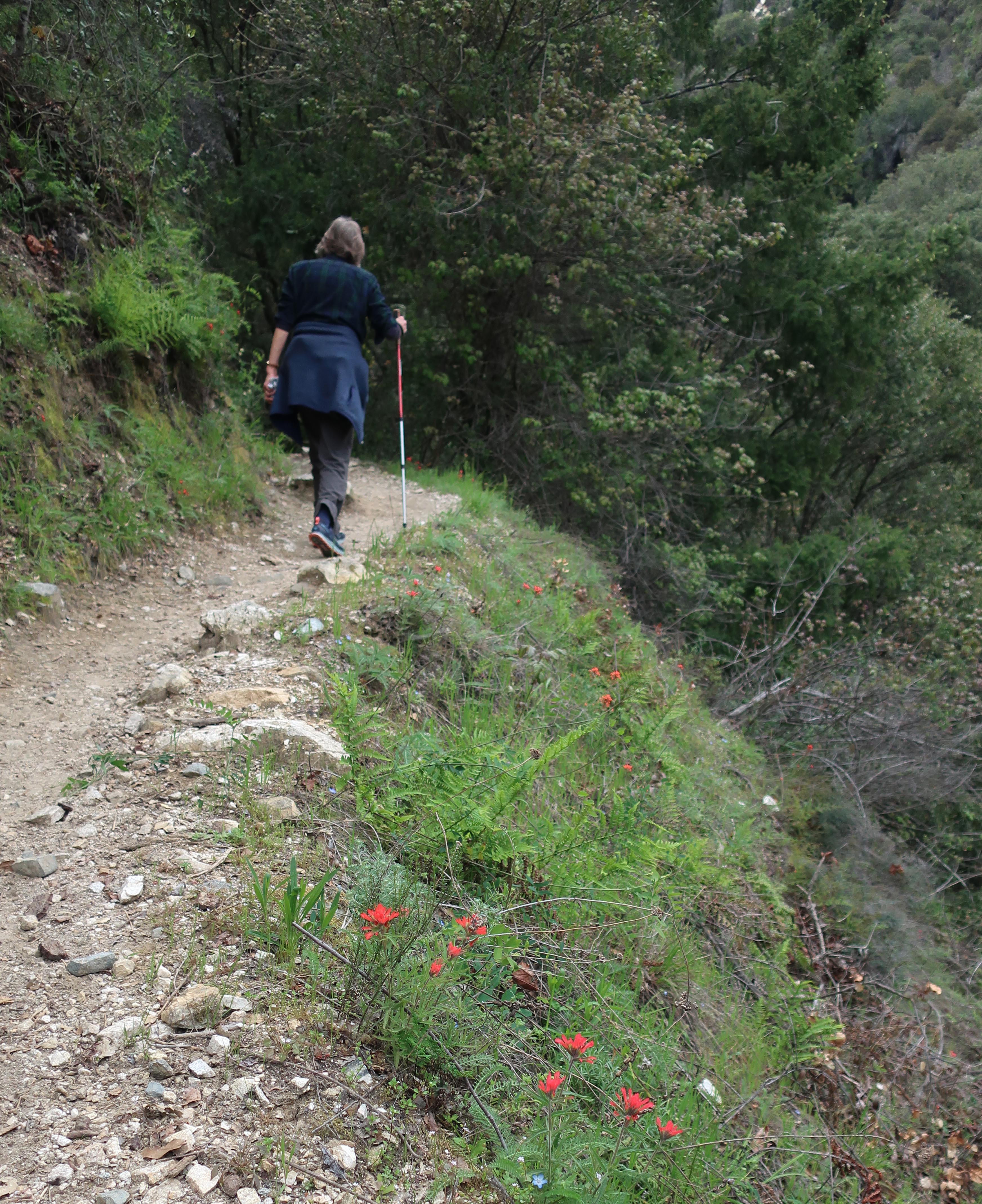
Joanie hiking up the Gabrielino just prior to Hoegee’s Drop Off. That’s Indian paintbrush popping through the green. This spot is between Fern Lodge Junction and Falling Sign Junction.
Hike Chantry’s Gabrielino for wildflowers when you get a chance. Try to do this sooner than later! This well trod trail is also known by many Boy Scouts as the Silver Moccasin up until you arrive at Shortcut Canyon in the West Fork of the San Gabriel River, where the two trails go their separate ways.
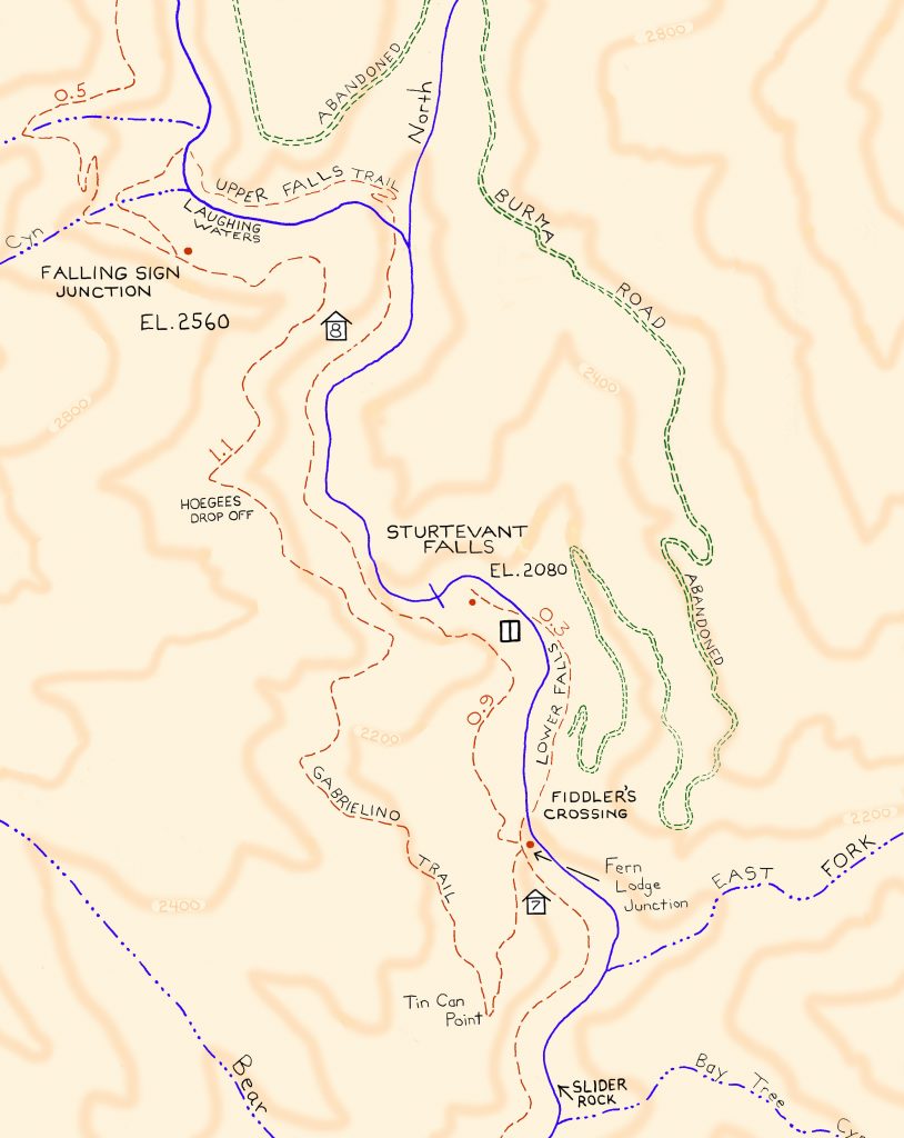
Detail of Gabrielino Trail section, Chantry Flat – Mt. Wilson Trails map.
Look at hiking this trail section these last days of April and the next couple of weeks in May. Recently my wife and I did the Falling Sign Loop, starting out from Fern Lodge Junction, heading up the Gabrielino (aka Stock Trail) to Falling Sign Junction. We returned back down the Upper Falls Trail to Fern Lodge. The loop’s only a couple of miles in length, yet that one mile section of the Gabrielino between Fern Lodge and Falling Sign Junction will offer you not only wildflowers, but vibrant green fern beds, lush green grasses and the ever-present views over the Big Santa Anita and its’ countless little side canyons.
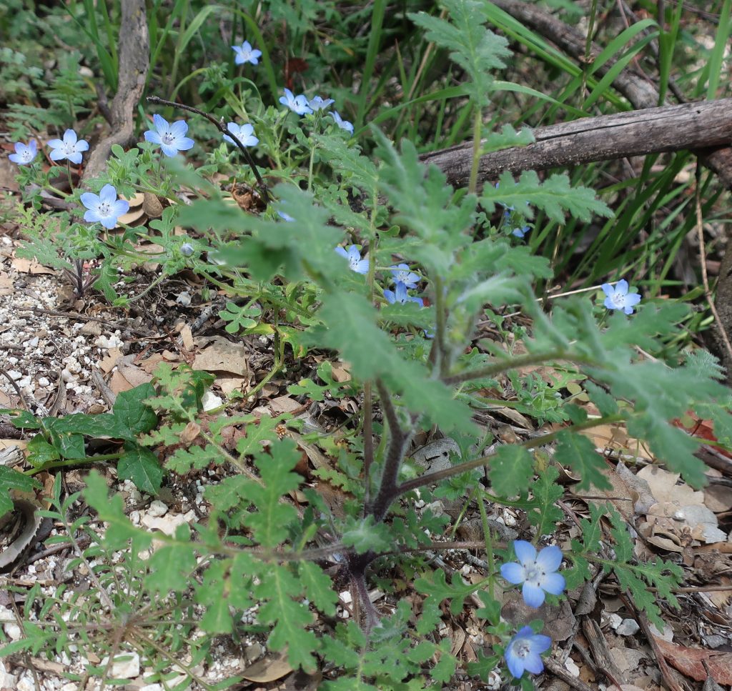
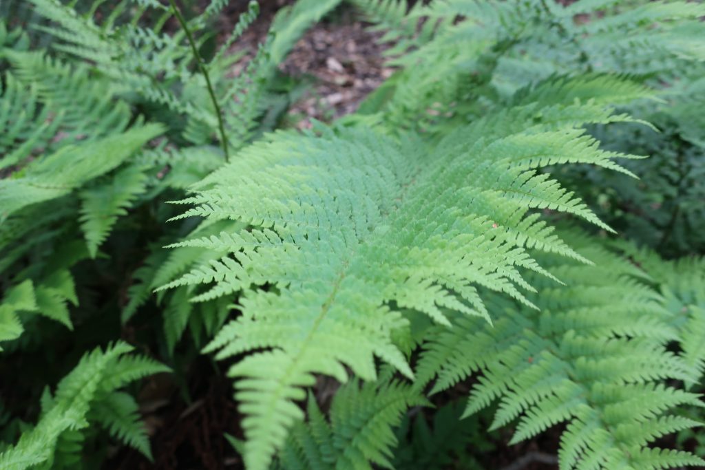
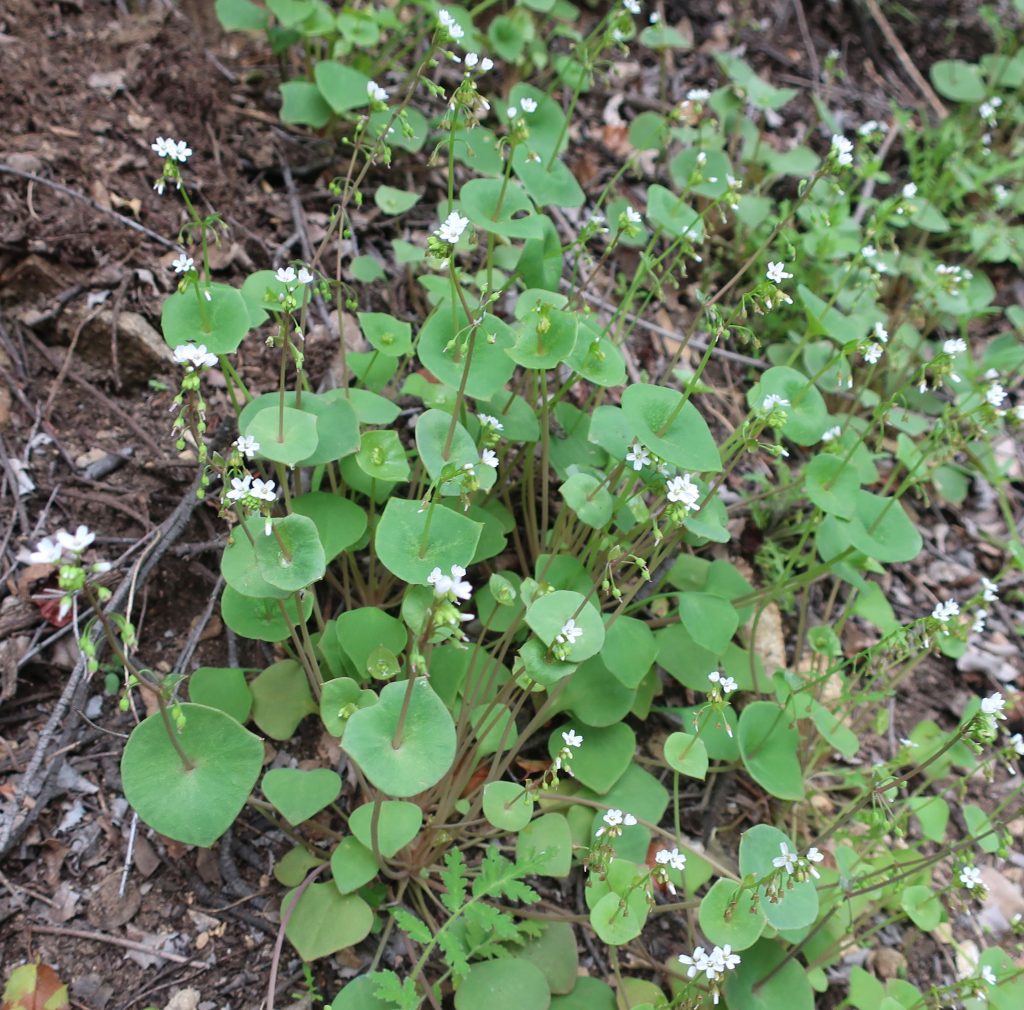
Springtime in the front country of the San Gabriel mountains wouldn’t be complete without Baby Blue Eyes. These delicate, low-lying beauties can be found during the Spring Easter season.Close up of Bracken Fern taken along the Gabrielino Trail. Shady slopes and cliff faces are covered with the fresh, deep green fern beds.Edible Miner’s lettuce grows in clumps along the moister sections of the front country canyons.
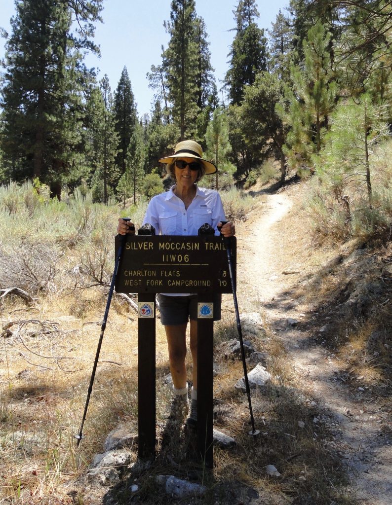
Joanie graces the Silver Moccasin Trail sign at Chilao. This is the view looking south back toward Chantry Flats.
Last Wednesday, my wife Joanie and I headed west for 33 miles on Highway 2 from our home in Wrightwood to Chilao. Also known as Chilao Flat, this gently rolling terrain of forest trees is located about midway between La Canada and Wrightwood on the scenic and diverse Angeles Crest Highway 2. Chilao has a U.S. Forest Service fire station that is home to the Chilao Hot Shot firefighters. There is a beautiful visitor center staffed by volunteers (usually open on the weekends) along with the carefully relocated and restored West Fork Guard Station built by the turn-of-the-century ranger Louis Newcomb in 1900. There are scores of places to car camp, both for groups as well as individual campsites available on a “first come – first serve” basis. Many of the campsites, such as those of the Little Pines Loop, have piped water as well. If you’re looking for a place to have a meal, a cold beer or just to rub elbows with lots, and I mean lots of motorcycle riders and sports cars owners, make sure to stop at Newcomb’s Ranch Inn, just a few hundred yards up Highway 2 from the upper Chilao entrance. The experience is the opposite of hiking, yet worth experiencing if you have the time.
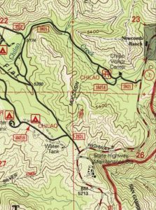
Detail of the U.S.G.S. Chilao Flat quadrangle, 1995 edition. Our route from Chilao Creek to Little Pines Loop via the Silver Moccasin Trail. Little Pines Loop is in the spot on map labeled as “Water Tank” just to left, northwest, of Highway 2.
Joanie and I had come to Chilao to hike a small section of the Silver Moccasin Trail. We parked about 3/4 of a mile down the quiet paved lane from the visitor center at a point where the trail crosses the road. In the sun, it was pretty hot, yet under the canopies of the tall incense cedars, Ponderosa and Jeffrey pines, a gentle breeze kept us cool and comfortable. We decided to head south, toward the Little Pines Campground Loop about a mile away. Our friend Kevin, the ranger at Chantry Flats had written us the good news that there was still water at Little Pines, a fact that would make things extremely convenient for a backpack trip I was about to go on with a couple of friends in mid September. We’re going to be hiking from Sierra Madre to Wrightwood, with much of the route on the Silver Moccasin (established in 1942 by the Boy Scouts of America) and also the Pacific Crest Trail (PCT) over the course of six days. Little Pines will be the second night out on the trail. This time of year, there are days on the hike where you can expect up to ten miles between any water at all. Joanie and I wanted to see how the trail approached and left the campground. Also, it was just a great excuse for hiking through the gently sloping and forested terrain of Chilao Flat in the middle of the
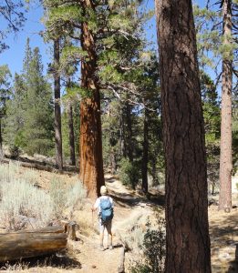
Stopping to admire one of the stately incense cedars found at Chilao. Silver Moccasin Trail.
San Gabriel mountains.
We immediately crossed the sandy wash of Chilao Creek wading our way through wild grasses, following the trail through glades of pine, cedar and sage. Eventually, we climbed up a small draw in the hillside, passing under Big Cone Spruce and alongside remnant burned trees from the 2009 Station Fire. We made our way up and over a ridge top that was baking out in the sun. Hills in the distance still held onto the upright skeletons of burned out pines and spruce from that enormous conflagration from nine years ago. In the distance it still looked bleak. Poodle dog bush and other chaparral plants filled in the rest of the scenery under the relentless August sunshine. Soon we made our way down another draw and into the pine covered coolness just outside Little Pines Campground. We found a spigot out in the hot sun, still attached to a burned post at one of the campsites. I turned the handle and the blessed liquid gold poured forth. Beyond good.
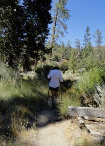
Joanie approaching Chilao Creek on the Silver Moccasin Trail.
Shade was the thing we needed right now! After a quick look at some of the campsites, we found a spot out from the sun, eating and drinking while sitting on wood chip covered ground. We walked back the way we had come. The air was quiet and peppered with the scent of pines, cedar and sage. Peace and tranquility reigned. Once, again, the mountains had delivered.