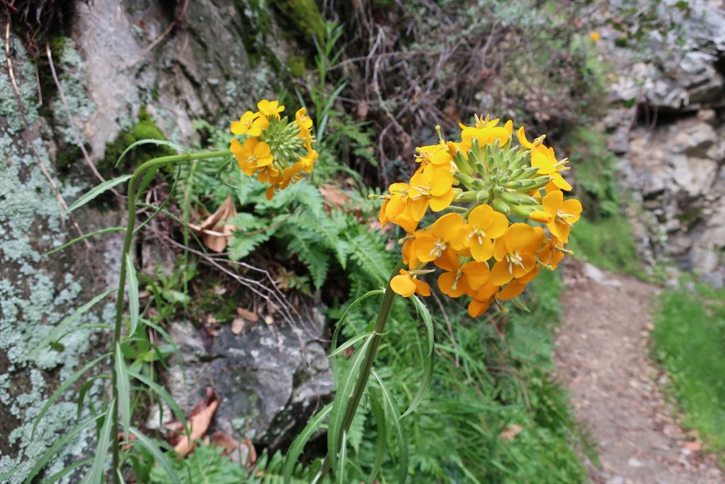
Here’s a Douglas Wallflower alongside the Upper Falls Trail as seen this last Monday while hiking up the Big Santa Anita Canyon under cloudy skies. Our series of much-needed rain storms have brought back thick green grasses and the start to what’ll most likely be a colorful Spring of other wildflowers as well. Joanie and I hiked the two mile Falling Sign Loop that originates out of Fern Lodge.
These Douglas Wallflowers (Erysimum capitatum) popped out at us just downstream from the double slot pools on the Upper Falls Trail. There’s also a nice grouping of wallflowers near the second bench up the road from Roberts’ Camp in San Olene Canyon.
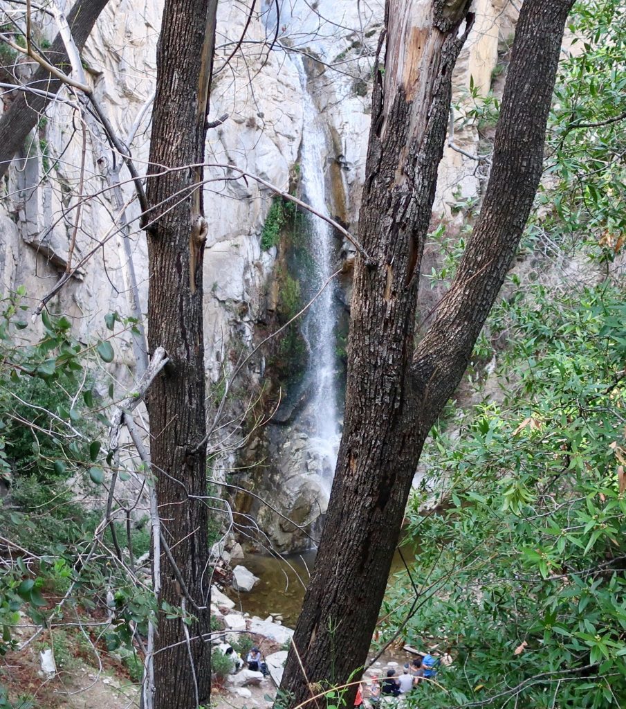
Sturtevant Falls was tumbling down nicely. The scent of white sage peppered the cool air and the background surf-like sound of the stream followed us the whole way. We brought along an old shovel, cleaning off small slides here and there. Wild lilacs (buck brush) are still sending their mild lavender scent into the canyon breezes while the bright red orange of Indian paintbrush pokes up from the damp earth near Hoegee’s Drop-Off. And overarching along most of the route, the Laurel bay blossoms still cling to the dark green canopies. Look for the tender dark reddish purple leaves of the canyon big-leaf maples as their foliage begins to fill back in for a new season. Even the white alders are pushing out a myriad of their bright green leaflets, replacing that smokey look of dormancy with new life.
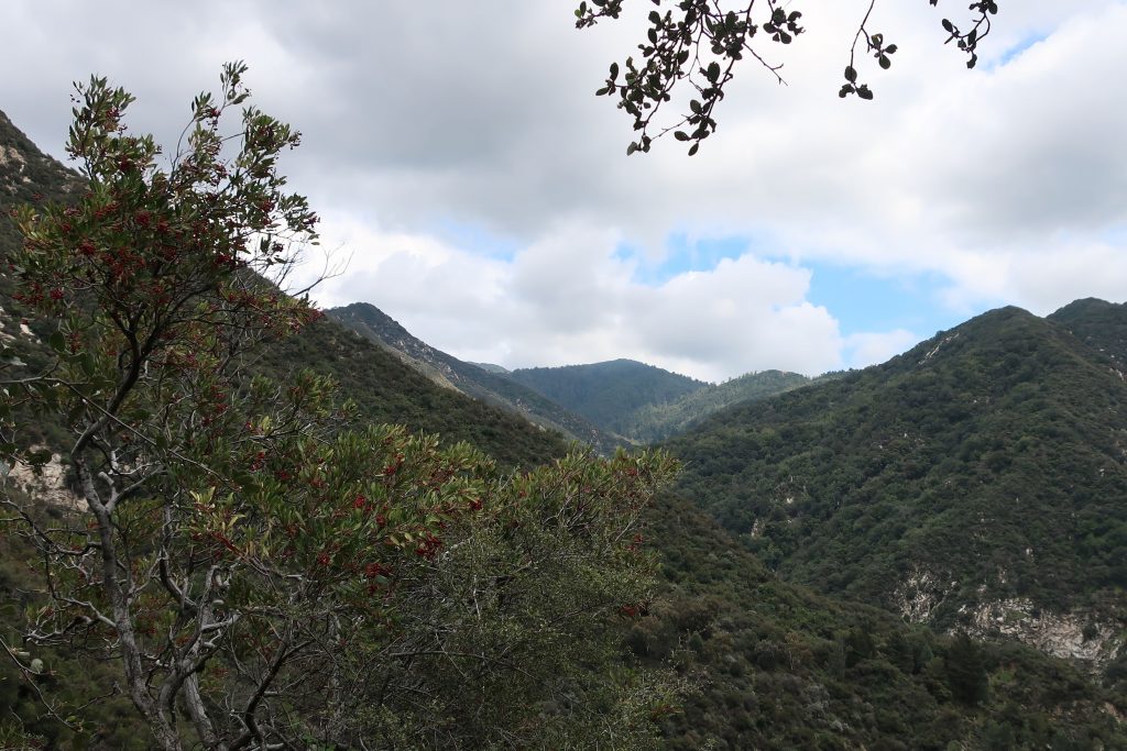
View looking east up into the East Fork of Big Santa Anita Canyon from Gabrielino Trail. Note the Toyon in the foreground, still hanging onto some of its’ red berries. That’s Rankin and Monrovia peaks in the most distant background. Clamshell Peak is barely captured on the right hand side of photo.
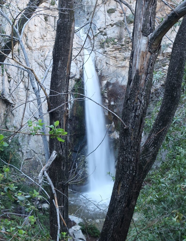
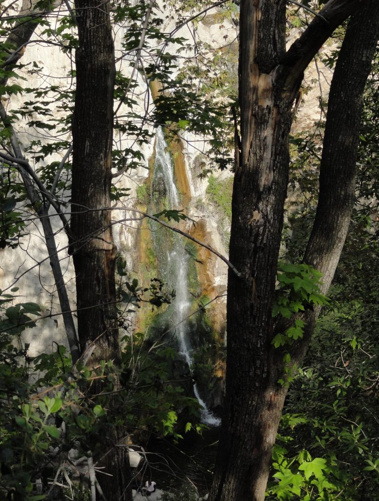
A view of 55′ high Sturtevant Falls as taken from the Upper Falls Trail this last Saturday. The stream crossings are so high right now that wading seems the best way to get across.
Our epic winter continues, with Sturtevant Falls looking more beautiful than ever. Last weekend our rain gauge had overflowed from the accumulation of a couple more storms before we could hike back in and check it. The gauge holds 12″ of rain before it overflows, so this tells something about the rains this month.
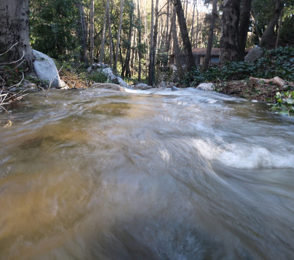
Looking downstream at Fern Lodge Junction. The stream is swollen, cold and flowing with energy.
Looking across at Sturtevant Falls and plunge pool from the Upper Falls Trail.
Big Santa Anita Creek comes alive after recent storms. 55′ high Sturtevant Falls is back in its’ former glory as well! As we all know, years of drought have taken their toll throughout the southwest, especially in the myriad of canyons throughout the mountains of Southern California.
Joanie and I discovered 9.57″ of rain in our gauge at Fern Lodge on January 18th. Several storms, back to back, have made a huge difference in the appearance of not only the Big Santa Anita creek, but all the rest of the front country streams in the Angeles. A week later, we hiked up and past Sturtevant Falls where we took these two photos.
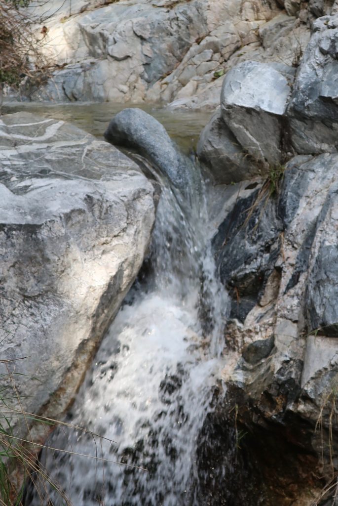
This view taken just above Sturtevant Falls. This is at the top of the slot pools.
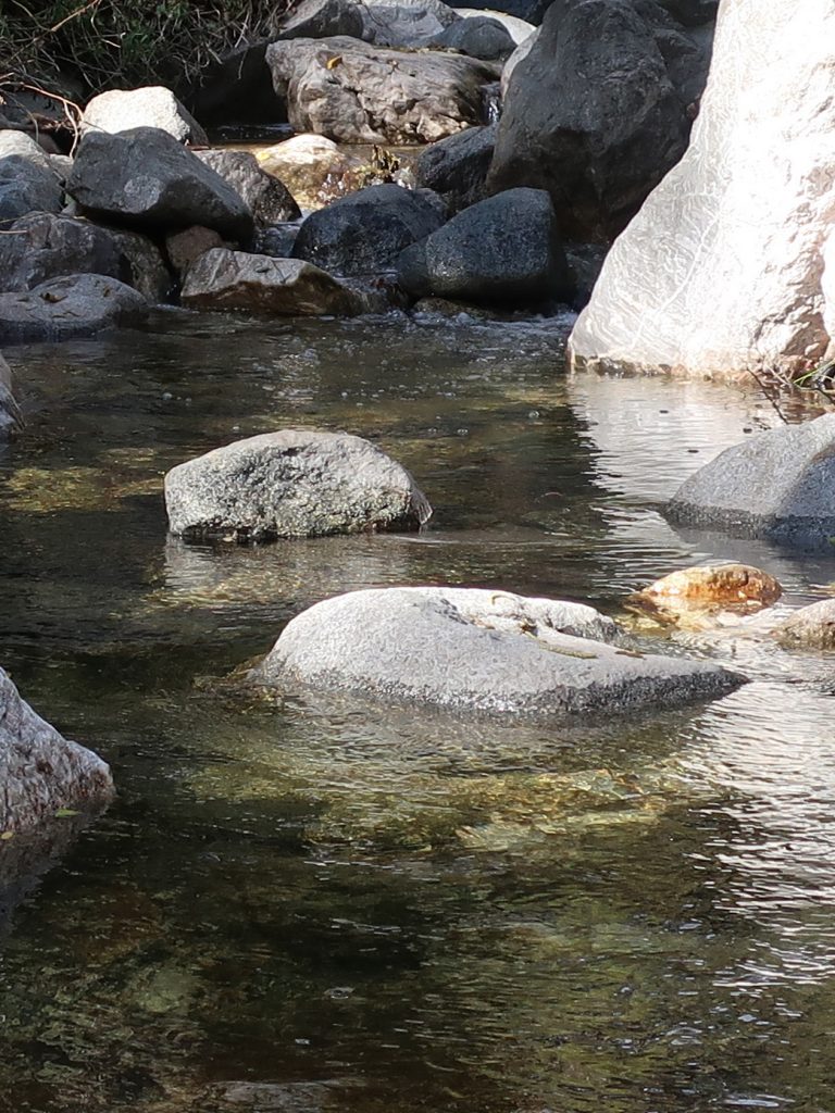
As of today, February 10th, a lot more rain has fallen. The stream beds have been scoured of the dark organic mat that’s built up for years. This has left bright, colorful sands and rocks under the clear waters. Beautiful.
A tranquil stretch of the Big Santa Anita Creek in the Fern Lodge area of the canyon. This spot is near the little cabin village where the Upper Falls and Gabrielino trails depart the canyon bottom.
Sturtevant Falls as seen from the Upper Falls Trail on Sunday. Despite the fairly dry winter season, recent rains brought us nearly three more inches of rain, bringing up the levels of the stream.
Sturtevant Falls is flowing at it’s peak level for Spring. This photo was taken while hiking on the Upper Falls Trail this last Sunday. The rain gauge at our cabin in the Fern Lodge area recorded 2.92″ from the recent storm. The stream’s nice and full, it’s song filling the canyon from wall to wall. Many of the pools in the canyon have received a cleansing scouring. Dark organics that build up over the year on the stream bed have finally been washed clean out of the sand. This is a great time to take a hike at Chantry Flats in the Big Santa Anita Canyon! Fern beds on the steep slopes and cliffs are growing in their thick greenery. Sturtevant Falls is definitely one of the most sought after places to visit during the spring hiking season. If at all possible, try to get in a hike to the falls during the week days due to the parking congestion at the trailhead.
The hike in is less than two miles one way, rated as “easy” in John W. Robinson’s Trails of the Angeles. Begin your hike at the Gabrielino trailhead, located adjacent to the lower parking lot at Chantry Flats. Descend over 400′ to the canyon bottom in less than 3/4 of a mile. Cross the foot bridge at Roberts’ Camp, then follow the dirt road upstream, passing by the little cabins built over a hundred years ago. The road soon peters out, your route becoming single-track off and on until you reach the base of the falls. Return the way you came.
Posted on November 7, 2012 – Written by Chris Kasten
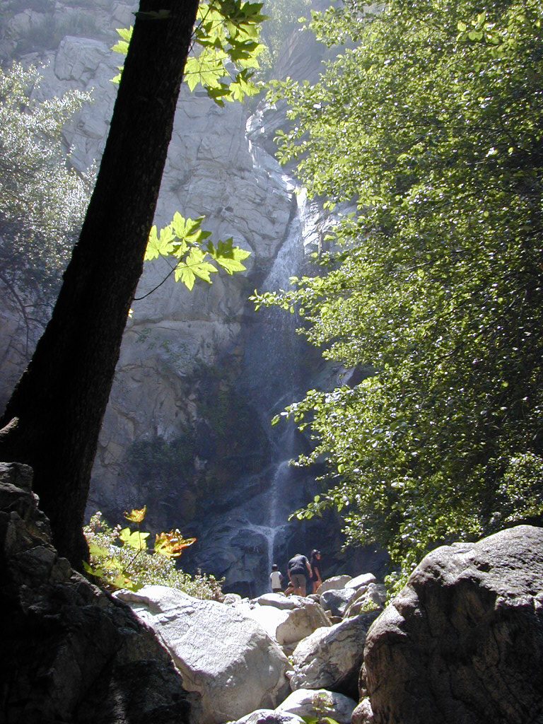
Late in the day on a summery afternoon at Sturtevant Falls in Big Santa Anita Canyon.
The pdf of the Trails of Big Santa Anita Canyon Map can now be downloaded from canyon cartography.com! This image has a resolution of 300 dpi. It sells for $1.99 and is compatible with all Apple IOS phones and I Pads. This is a great time to get out and experience the beauty of our front country canyons. Both Sturtevant and Hermit Falls continue to flow amidst the autumn colors of canyon maples. If you’re looking at hiking, running or biking up at Chantry Flats, this map will provide you with an uncluttered, easy-to-follow image that contains local place names, trail junctions, distances, elevations, locations of restrooms, campgrounds and more.
If you’re looking for a paper map, this same map sells for $4.95 + tax and ships to you for free.
Please remember to see the HIKES page at www.canyoncartography.com. This map, whether in the paper or pdf form is designed to be viewed in conjunction with the HIKES page.
Posted on August 23, 2012 – Written by Chris Kasten
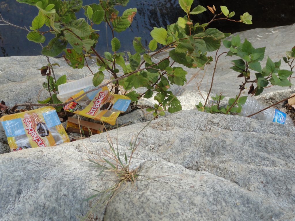
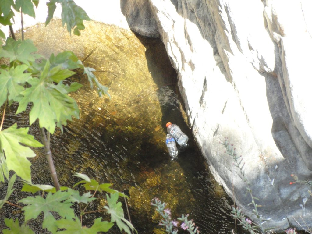
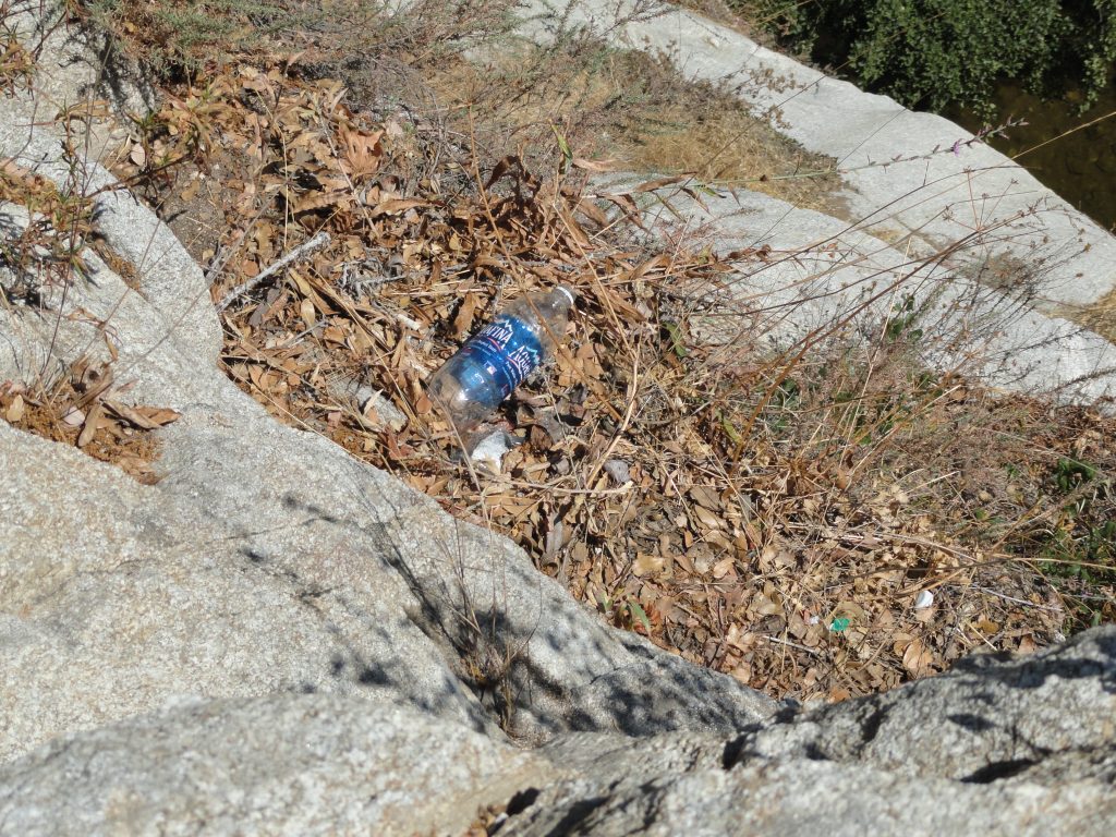
While out on a hike on the Upper Falls Trail just this last week, I happened upon more plastic refuse than usual. Plastic water bottles and food packaging seem to be on the increase in and around the pools just above Sturtevant Falls. It’s really getting crazy. Sadly crazy. What amazes me is that we’re not talking about the immediate trailhead and turnouts up and down the Chantry Road, this area is nearly two miles in from Chantry Flats. To be a litterbug this far in takes motivation. Where is the disconnect in some people’s thoughts to leave trash like this?
Trash along the Upper Winter Creek Trail, Big Santa Anita Canyon. This scene is just above Sturtevant Falls.
The Angeles National Forest’ annual operating budget continues to diminish as the years go by. The entire U.S. Forest Service, an agency within the U.S. Dept. of Agriculture, is feeling the budget crunch across the country. Essentially, the Angeles is a recreational forest, with no timber harvesting and very little mining going on. The majority of funding received by this forest goes to fire suppression. I recently saw a statistic up at the Big Pines Visitor Center that cited 96% of all fires that start on the Angeles are in some way caused by people. I’m assuming that the remaining 4% is started by lightning, which primarily strikes in the high country areas of the San Gabriel mountains. So, with that, the administrative emphasis will continue to be centered on reducing fire risks (hazard reduction) and responding to fire starts.
Plastic bottles floating in a pool just above Sturtevant Falls.
What’s left of budget, then, is a thin slice of funding for recreation. USFS staff assigned to maintaining and developing recreation sites are few and far between. In fact, it would be fair to say that those staff continue to have larger and larger territories of the Angeles to maintain. Taking care of campgrounds, picnic areas and trailheads has become daunting in the last couple of decades. And while budgets for paid staff continue to fall, forest users continue to increase in number. Day use in the Chantry Flat Recreation Area continues to climb and climb. Five years back or more, one could more or less predict that a mid-week visit to Chantry might be rather quiet and unpeopled. Now, especially since the Station Fire of 2009 and the ever expanding advent of the internet, any day of the week can find the parking areas at the Gabrielino and Upper Winter Creek trailheads filled with cars. There might even be cars parked in turnouts a short distance down the road. I’m talking about Tuesdays or Wednesdays!
Volunteers continue to help throughout the Angeles in the maintenance of trails, cleaning up trash, eradicating graffiti, taking care of campsites / picnic areas, cleaning public toilets and much, much more. Fortunately, much of the Angeles, including the Big Santa Anita Canyon, has had its’ hard working volunteers to fill in the wide gaps over the years. However, there’s only so much volunteering can accomplish in the operation of any national forest. We need more paid staff out on the trails around busy places like Chantry. Some tasks, such as routinely cleaning restrooms and outhouses, should be paid. Period. Having a law enforcement presence in high-use areas on the forest is also necessary and requires funding. There needs to be a Forest Service presence on the trails to help educate and model responsible outdoor practices for forest visitors and,ultimately, for the protection of the land.
If the wear and tear on our canyon and the rest of the Angeles’ front country is getting to you, pick up the phone, send a letter or e-mail your Forest Service. Go to the Angeles National Forest website for contact information. If you’re not satisfied with your progress within the Angeles N.F. bureaucracy, contact your local congress person and let them know your concerns. In the end, Forest Service budgets are decided upon in Washington, DC. On a much more local level, the Chantry Flats Recreation area is administered by the Los Angeles River Ranger District of the Angeles. The phone number for the LARRD is: (818) 899-1900. While volunteering on our national forests will always be necessary, getting rangers hired and back out on the trails is imperative if we’re going to keep up with the influx of visitors to our mountains. It’s all about priorities.
Posted on August 10, 2012 – Written by Chris Kasten
Chances are that if you’re braving the parking up at Chantry or anywhere along the road, you’re hoping the trail that you pick will lead you to unblemished natural beauty. Perhaps you’re even looking for some much needed solitude from the busyness that engulfs most of our lives. The choice of natural environments that can be found on the Upper Winter Creek, Gabrielino, First Water, Upper Falls or Mt. Zion trails are close at hand. One minute you can be in oak woodland, then out in the chaparral and only moments later be resting along a white alder tree in the riparian environment along the stream. It seems that ever since the Station Fire of 2009, hundreds of hikers and mountain bikers who formerly spent their outdoor time in places like the Arroyo Seco, Big Tujunga, Mt. Gleason, the West Fork of the San Gabriel River or Charlton Flats to name a few – have now discovered the enchanting beauty of the Big Santa Anita Canyon.
Another source of the population increase in and around Chantry Flats is the internet. Scores of people have discovered the YouTube video postings of people cliff jumping at Hermit Falls and on social media sites such as FaceBook and Twitter. This, of course, does not even include some of the rating sites such as Yelp!
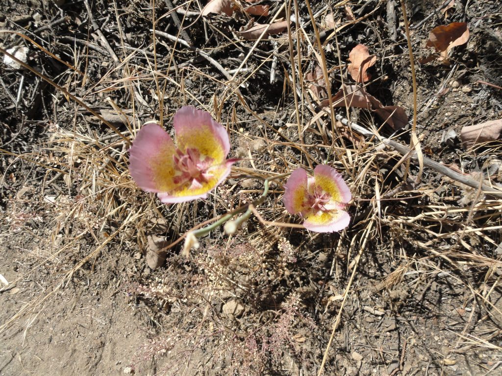
Mariposa Lillies.
Plainly put, the Big Santa Anita and Winter Creek canyons are beginning to show the scars of all the different types of visitors. Just visit Hermit Falls and you’ll see a beautiful set of plunge pools set in polished granite. Mixed in with this scene are piles of garbage strewn down hillsides. Graffiti is <marring the once pristine granite surfaces of boulders and cliff faces. Trees are carved into as well.
Just last week I was down at Hermit Falls and it seemed to me that the human impact had actually gotten worse than the previous month of July. The garbage that’s left behind consists primarily of plastic water bottles (the new litter of our time), cigarette packs, empty cans of cheap, mass-produced beer, various items of clothing covered with shit, toilet paper, human shit… and I’m saving the best for last. Disposable baby diapers with a gift wrapped inside…. It is beyond appalling what people will leave behind.
If you happen to be on your way to Sturtevant Falls, don’t be surprised by the recent rash of colorful dog poop bags left along side the trail. Of course, the owners of the dogs were halfway there in doing the right thing… Yet, they didn’t want to carry their dog’s poop to the next trash can – so they left behind the little gift for someone else to deal with. What are they thinking? Yes, I get it, there’s the “poop police” waiting just around the corner to deal with the transport issue. Yeah, that’s it! On hot days when the sun is hitting these bags, their contents begin to cook and the resultant fumes inflate these bags the way a hot air balloon would fill up. Lovely.
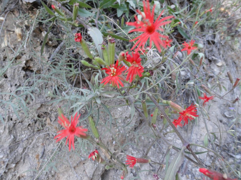
Indian paintbrush.
Last but not least, let’s not forget the garbage that some campers have left behind at Hoegees and Spruce Grove. If the transgressor is really shy, he or she will just wait til no one is watching and throw their garbage into one of the pit toilets. Last week I found four 13 gallon size bags of garbage stacked alongside one of the outhouses at Hoegees Campground. Again, the attitude seems to be that someone else will deal with my mess. I find this so sad that these types of habits are continuing to spoil our sacred spaces.
So, to put all this into perspective, it’s essential to believe -and- know that the vast majority of people who love our mountains are not part of this irresponsible and disconnected percentage doing the damage. People are out in the canyon much of the time picking up someone else’s trash or doing their best to eradicate graffiti. There is so much more care than there is harm. The glass really is half full ! The earth’s soul is our soul. When we’re gentle on the land, we’re nurturing our own soul. Really.
Today, may I remind myself, that there’s the possibility our urban culture will continue to become more caring of the land. That the health of the land is an indicator of the health within ourselves, or lack of it… That I continue to grow and model myself as a steward of these sacred places. That I gently encourage others to love this land. That you and I heal as these canyons return to health. Amen.

 phone, send a letter or e-mail your Forest Service. Go to the