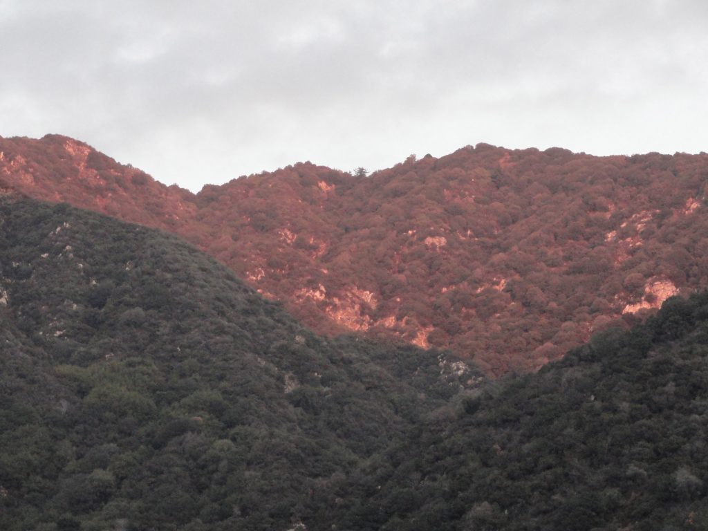
This photo was taken just a couple of days ago by an unnamed fire fighter and posted on Instagram. Photo was taken near Chantry Flat and is looking north up toward Sturtevant Falls. The arrow tip is in the Fern Lodge area of the main canyon, where the Upper Falls Trail and Gabrielino Trail leave the canyon bottom, continuing up and past Sturtevant Falls toward Cascade Picnic Area and Spruce Grove trail camp. It appears that much of the canyon bottom tree canopy is still intact after the Bobcat Fire !
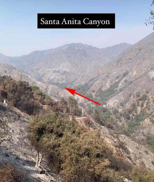
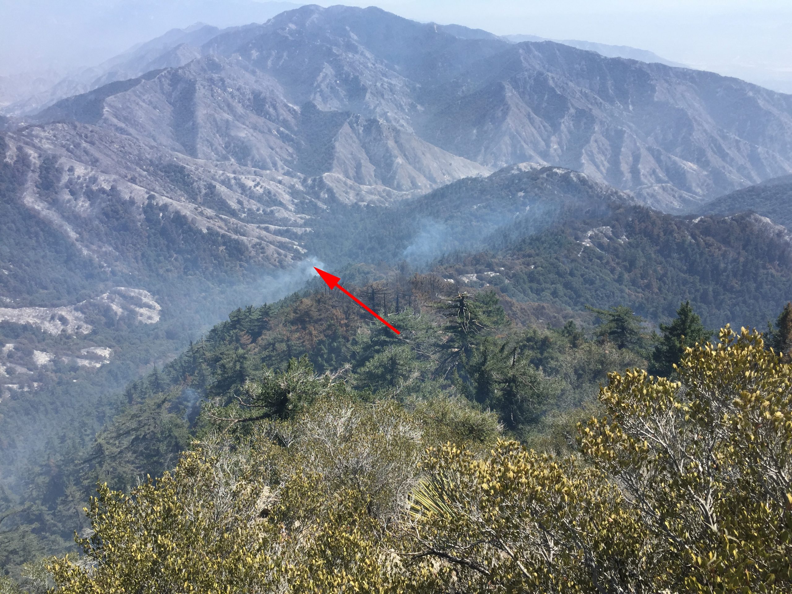
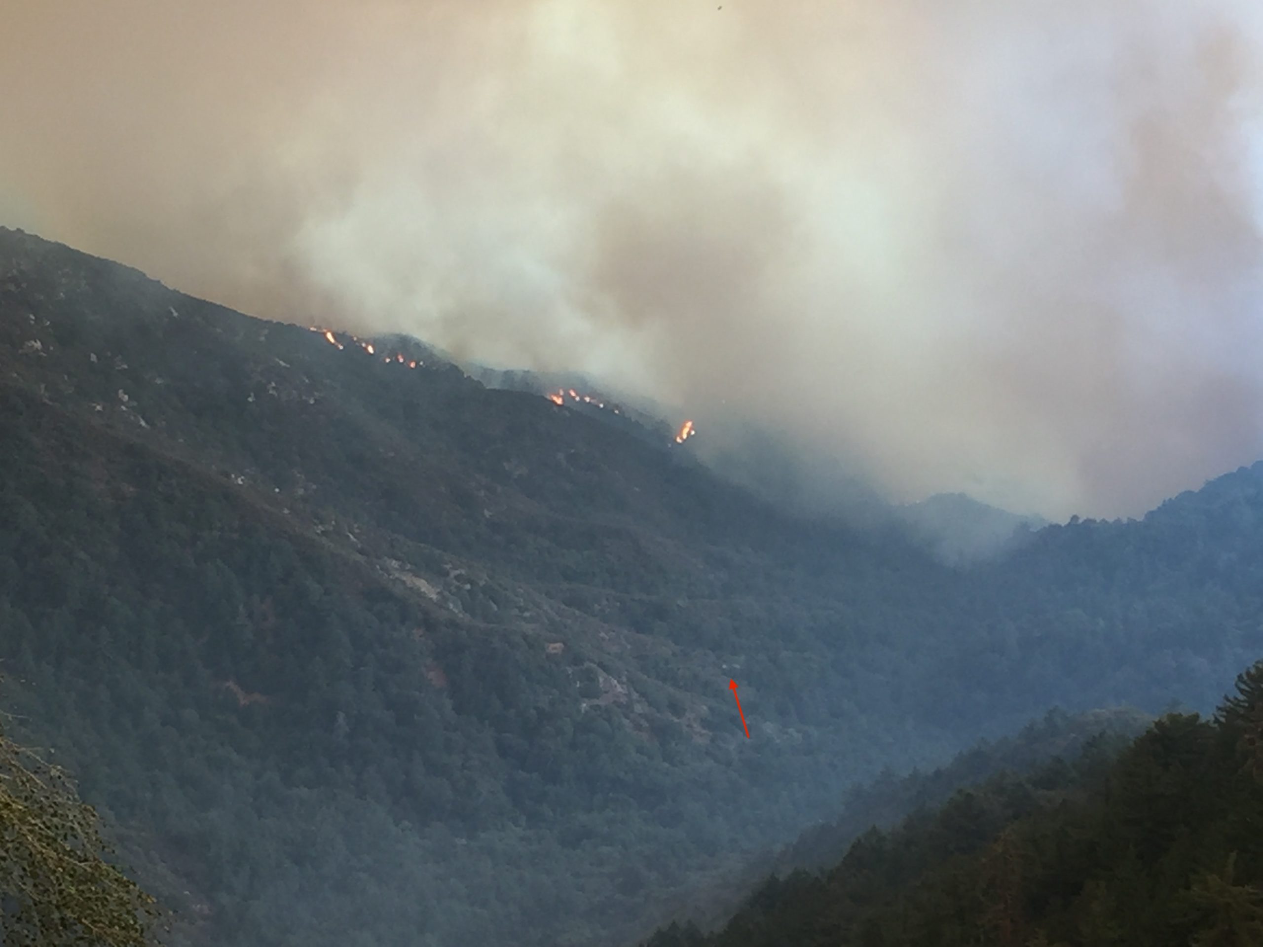
Attached are two photos taken of Big Santa Anita Canyon in the aftermath of the Bobcat Fire. There’s a third photo here, too. It is of the flames dropping into the upper Big Santa Anita Canyon during the fire’s early stages of development. The first photo was taken a couple of days ago. Here you’re looking up the canyon from a point near the trailhead at Chantry Flats. The second photo was taken by Larry Webster of Mt. Wilson just a day ago. The view is from the east end of the summit looking down toward Sturtevant Camp. Note the smoke still curling up from either the camp or adjacent to it. It’s still too early to know what the damage actually was to the camp or the nearly eighty private cabins up and down the Big Santa Anita Canyon and Winter Creek. Updates to follow as they come in.
This photo was taken after the fire passed through, by Larry Webster of Mt. Wilson, CA. That’s Monrovia Peak, highest point in center horizon of photo. At the tip of arrow is Sturtevant Camp. As of this writing, it’s unknown how the camp fared in the Bobcat Fire.
This photo was taken before the Bobcat Fire reached Mt. Wilson. Sturtevant Camp’s heliport is marked by the small red arrow. Coincidentally, the camp itself, is located at the bottom, or start, of the arrow’s shaft.
The Bobcat Fire dropping down into upper Big Santa Anita Canyon. At the end of the little red arrow is the heliport at Sturtevant Camp. Photo taken from Mt. Wilson by Larry Webster.
Looking east from the Rim Trail just before reaching Mt. Wilson. On the horizon, far left, can be seen Twin Peaks. Mt. Baldy is in the center distance. Big Santa Anita Canyon is below and off to the right.
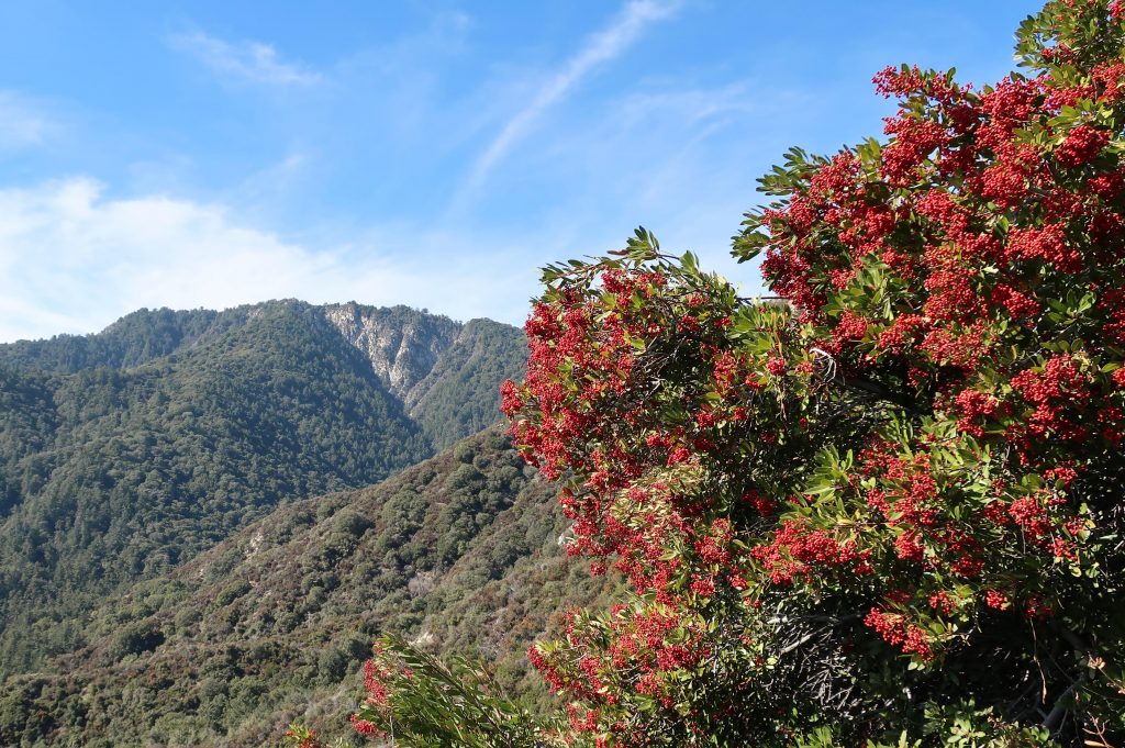
Hike Chantry Flat to Mt. Wilson by way of the Rim Trail during these bright, crisp winter months. This last weekend, I made my way up Big Santa Anita Canyon’s Upper Falls Trail from Fern Lodge Junction. Our rain gauge has recorded nearly 12″ of rain from the two previous storms of late November through December, so lots of bracken fern beds are at their height of deep and bright greens as they perch high on their cliffy ledges above the bubbling creek. Although we’re off to a dry start to the new year, the plants are responding to the generous rains and even snow in the higher elevations. This is also a good time to still catch the deep orangy red of the Toyon berries in their showy clumps that still feel reminiscent of Christmas time.
Trip Details:
Total roundtrip distance: 16.9 miles
Elevation gain / loss: 440′ initial loss to Roberts’ Camp. 3950′ gain to Mt. Wilson’s Echo Rock.
Take Gabrielino Trail up Big Santa Anita Canyon to junction below Sturtevant Camp. Continue on toward Newcomb Pass. From there, follow RimTrail west to Mt. Wilson’s Echo Rock. Return toChantry down Sturtevant Trail and continue back on Gabrielino to the trailhead.
Mt. Wilson as seen from the Newcomb Pass Trail (Gabrielino) about a mile and a half up from Sturtevant Camp. Some healthy looking toyon is seen here in the foreground.
So, on I went past the songs of canyon wrens, their descending, laughing tones evoking that eternal longing for Winter becoming Spring. As always, leaving behind Sturtevant Falls, the crowds dropped off, too. Save for an occasional small group of hikers, I saw few people between the top of the Falls and Spruce Grove Campground. Once on the section of the Gabrielino that heads off for Newcomb Pass, there’d be no one, with the exception of squirrels, birds and gnats until reaching the top of Mt. Wilson. Solitude.
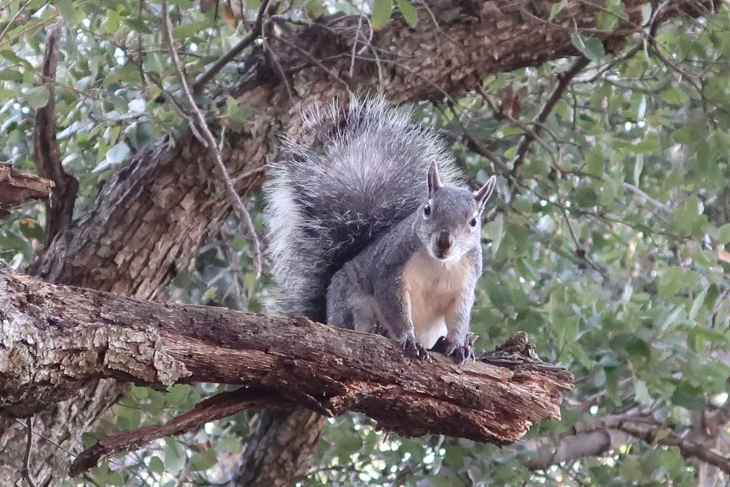
A curious tree squirrel peers down at Newcomb Pass.
At the trail junction just below Sturtevant Camp, I peel off for Newcomb Pass and the quietness envelopes me. The trail was a bit overgrown and more noticeably there was a fair number of trees and shrubs over the trail. No problem, just took my time climbing down or up and around on the dark, loamy soil with winter’s dampness. Once out in the chaparral, on came the sunglasses and the great joy of warm winter days that only Southern California can bestow upon the mountains. The most prominent scene that kept repeating itself was the red display of Toyon against the background of varied greens. Pretty soon the backcountry opened itself up, first Twin Peaks, then the Mt. Baldy massif. Snow, blue sky and chaparral all seemed to merge as I neared Newcomb Pass.
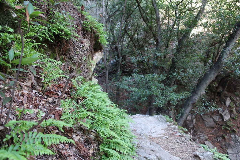
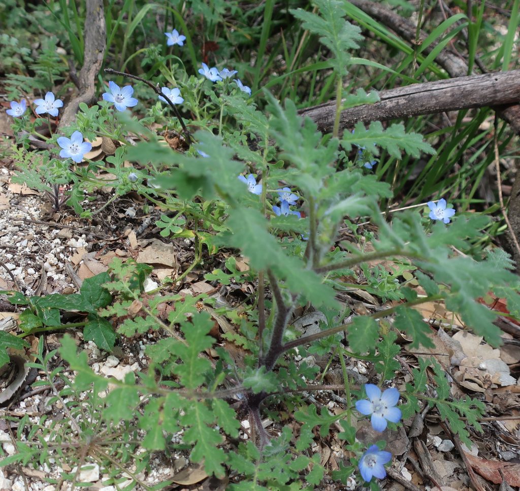
Bracken ferns along the Gabrielino Trail. Photo just up canyon from Falling Sign Junction, Big Santa Anita Canyon.
Once at Newcomb’s, I found a sunny picnic table and finished off my sandwich. Ever since the Station Fire of 2009, the debris of cut down trees for re- establishing a firebreak has taken away the charm of the place. Coupled with that, some hair brain scheme had taken place, erecting T-posts with orange web fencing at the bottom of the man-made swaths. Sort of like what CalTrans might do along a highway construction site. The old Newcomb Pass sign lay forlornly off to the side, a casualty of yet another oak that has fallen. I got so depressed by the memory of what once was and what was now that only a few minutes elapsed before taking off on the Rim Trail.
A gentle stretch of the Rim Trail about a mile west of Newcomb Pass.
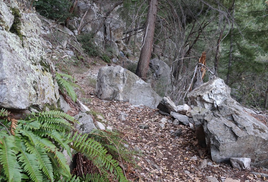
The first 1/2 mile along the Rim Trail was fraught with downed oaks, lots of them. The tracks of those before were clearly etched in the soft, moist soil as they worked out ways to get over, under, up and around thickets of branches tangled up with thick cords of poison oak. Aside from this, most of the going was pleasant, indeed beautiful as this area truly is. If you love being under oaks and amongst ferns and spruce, this is a good place to be. Also, you’re regaled with scenic views down into the West Fork of the San Gabriel River and out across to places as far west as Mt. Pacifico and eastward to Mt. Baldy and beyond. Fire scars from the Station Fire are still seen at the base of many big cone spruce along the trail. These are healthy scars only running a short distance up from the ground, leaving a really healthy evergreen forest. It’s peaceful country. Toward the top, you begin to encounter places where the trail is whittled out of rock. Old dry stack walls, the good work of trail builders from another century, still hold the trail into the mountainside. Eventually you make your way up and through a gentle twisting and turning through forested hillsides along the summit to the asphalt maintenance road near the Cosmic Cafe’s Pavilion. Turn left here, following signs toward the Sturtevant Trail. Pass by the Astronomical Museum, the Solar Camera and eventually the 100″ and 60″ telescope domes before dropping down to Echo Rock and the beginning of the Sturtevant Trail.
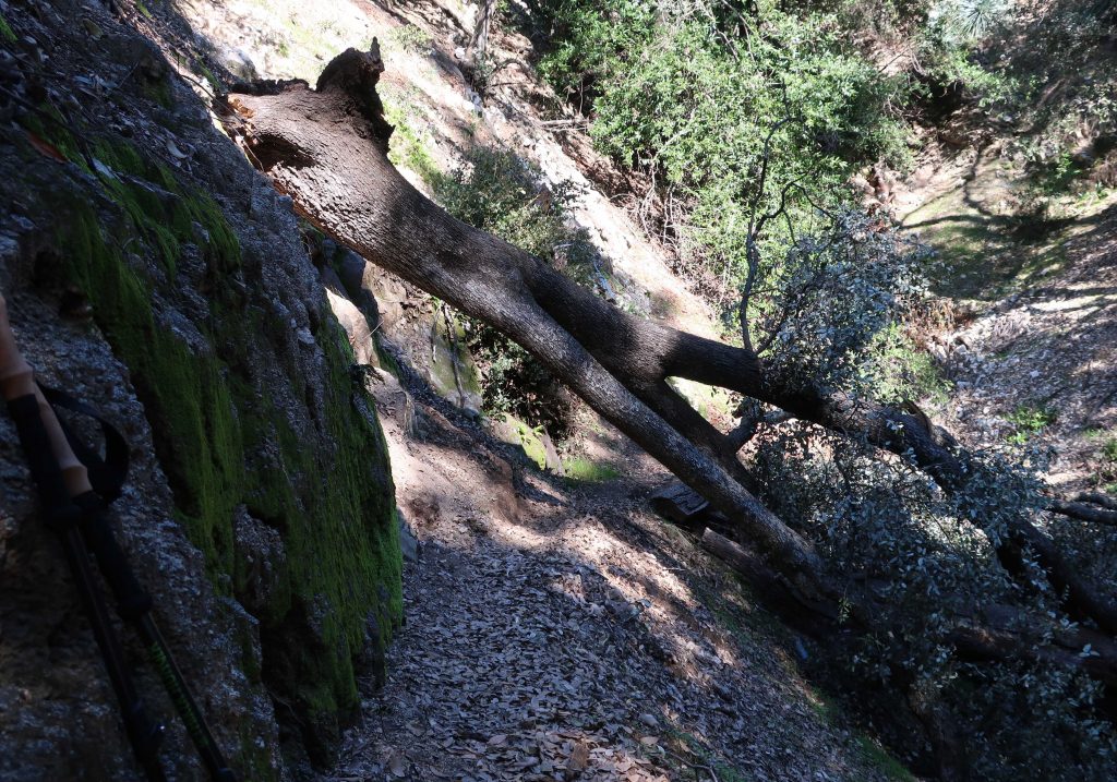
Here was one of the first trees that I encountered on the way up to Newcomb Pass. This spot is about a quarter mile up from Sturtevant Camp. Most of the downed trees along my hike were canyon live oaks.
Take the time to look off of Echo Rock before your descent back into the Big Santa Anita Canyon. The view is superb and you really can get a good echo if you set your mind to it. Yell toward the cliff straight across from you!
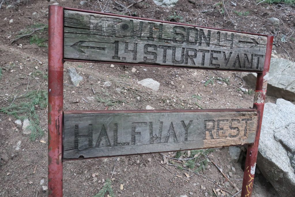
Get ready for a steep drop down from Echo Rock. I’m big on trekking poles for preventing slips and saving your knees on descent. Years ago when my wife and I ran Sturtevant Camp, we starting using the poles when we had a winter (2005) that had washed out the Chantry Road, necessitating getting to the camp by way of this very trail. Pass by the “Halfway Rest” and on down further into the upper canyon. This is timbered and wild country between the top and Sturtevant’s Camp. Savor the views and more solitude.
Here’s the sign you’ll find halfway between Sturtevant Camp and Mt. Wilson’s Echo Rock. There’s 2,500′ of elevation difference between the places in only 2.8 miles!
When you pass by Sturtevant Camp and then walk across the check dam to the side of the camp, you’ll drop down to the junction where you were earlier in the day, having just completed your loop. Head back to Chantry the way you came.
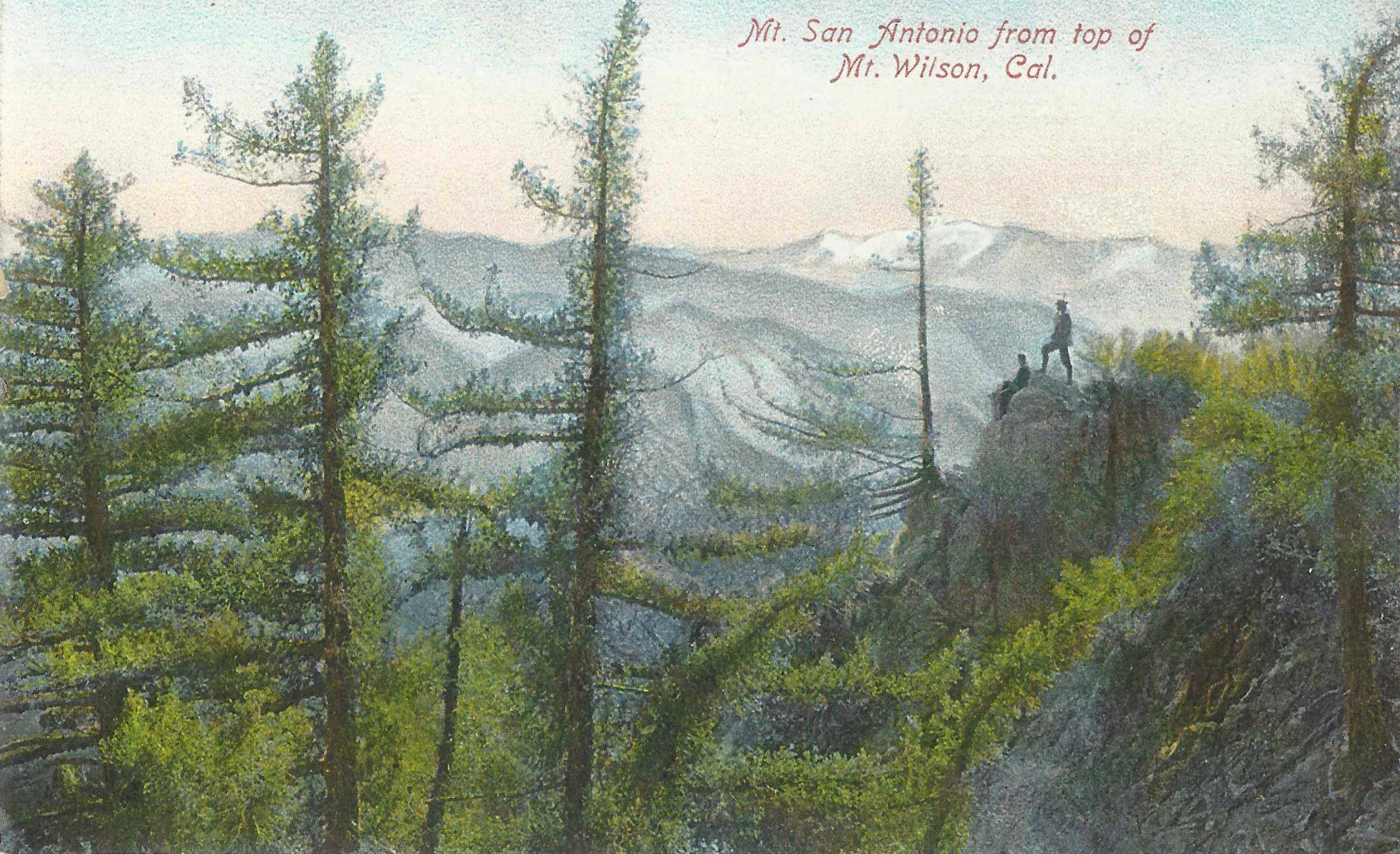
A friend of ours gave us this vintage postcard a number of years ago. The artwork depicts a scene that may have been intended as having taken place on the east end of the summit, perhaps near Echo Rock. The image somehow seems timeless, evoking that magical pull that the San Gabriels have had on generations past and those to come.
Whichever canyon you choose, getting out on our local trails is a great way to get a good start on the new year. I’m especially fond of the trails that make their way up to Mt. Wilson. One route that I’ll be doing in the next couple of weeks will be to head on up the Gabrielino Trail from Chantry Flat to Newcomb Pass. From there, take the Rim Trail to Wilson’s summit. Return by way of the Sturtevant Trail.
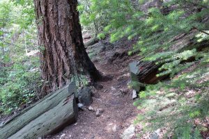
Here’s a trail scene taken just below the “Halfway Rest” The forest is healthy and vibrant here in the upper Big Santa Anita Canyon.
This is a great trip to get some good winter sun while climbing up and through the warm chaparral before getting under the oaks and pines on the north side of the Rim Trail’s watershed divide. The stream’s flowing really nicely right now, especially with the good start to winter storms that we’ve had from Thanksgiving through Christmas. Wrightwood, alone, has received nearly an average year’s worth of snow accumulation within about a month at the end of 2019. So, get out and enjoy the flowing streams, the bright green fern beds and the scent of damp soils and leaves. A word of caution, though…
The bubbling Big Santa Anita Creek near Bear Trap Canyon on the Gabrielino Trail.
Make sure to be cautious of ice in the some of the higher elevations as you approach Mt. Wilson from Newcomb Pass. Also, while traveling back down the Sturtevant Trail, watch for an ice chute within a half mile of the summit. This time of year, it’s a good idea to at least carry a pair of MicroSpikes or a similar traction device that you can add to your shoes. Take your time and savor the front country of the San Gabriels in the winter.
A lady bug rests here in the sun on a white sage leaf. This photo was taken on the Upper Falls Trail, Big Santa Anita Canyon.
This photo was taken this last week, June 20th, looking downstream in the West Fork of the San Gabriel River at DeVore Trail Camp. We had such an amazing winter throughout the mountains of the western U.S. The San Gabriels were no exception! Right now the West Fork is flowing full and clear.This little waterfall is seen here dropping into the West Fork of the San Gabriel River. The location is about midway between West Fork Campground and DeVore Trail Camp.
Joanie hiking up the Gabrielino just prior to Hoegee’s Drop Off. That’s Indian paintbrush popping through the green. This spot is between Fern Lodge Junction and Falling Sign Junction.
Hike Chantry’s Gabrielino for wildflowers when you get a chance. Try to do this sooner than later! This well trod trail is also known by many Boy Scouts as the Silver Moccasin up until you arrive at Shortcut Canyon in the West Fork of the San Gabriel River, where the two trails go their separate ways.
Detail of Gabrielino Trail section, Chantry Flat – Mt. Wilson Trails map.
Look at hiking this trail section these last days of April and the next couple of weeks in May. Recently my wife and I did the Falling Sign Loop, starting out from Fern Lodge Junction, heading up the Gabrielino (aka Stock Trail) to Falling Sign Junction. We returned back down the Upper Falls Trail to Fern Lodge. The loop’s only a couple of miles in length, yet that one mile section of the Gabrielino between Fern Lodge and Falling Sign Junction will offer you not only wildflowers, but vibrant green fern beds, lush green grasses and the ever-present views over the Big Santa Anita and its’ countless little side canyons.
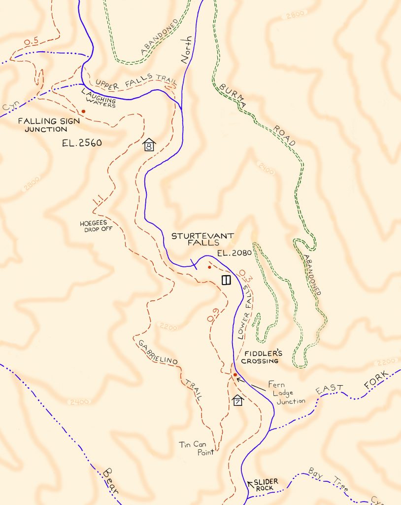
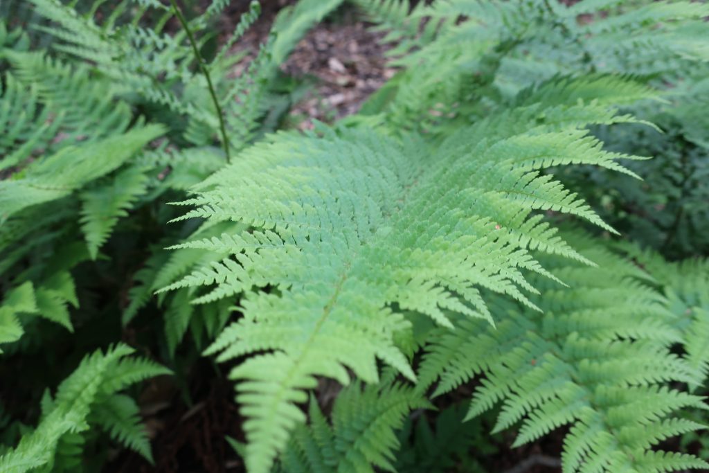
Springtime in the front country of the San Gabriel mountains wouldn’t be complete without Baby Blue Eyes. These delicate, low-lying beauties can be found during the Spring Easter season.Close up of Bracken Fern taken along the Gabrielino Trail. Shady slopes and cliff faces are covered with the fresh, deep green fern beds.Edible Miner’s lettuce grows in clumps along the moister sections of the front country canyons.
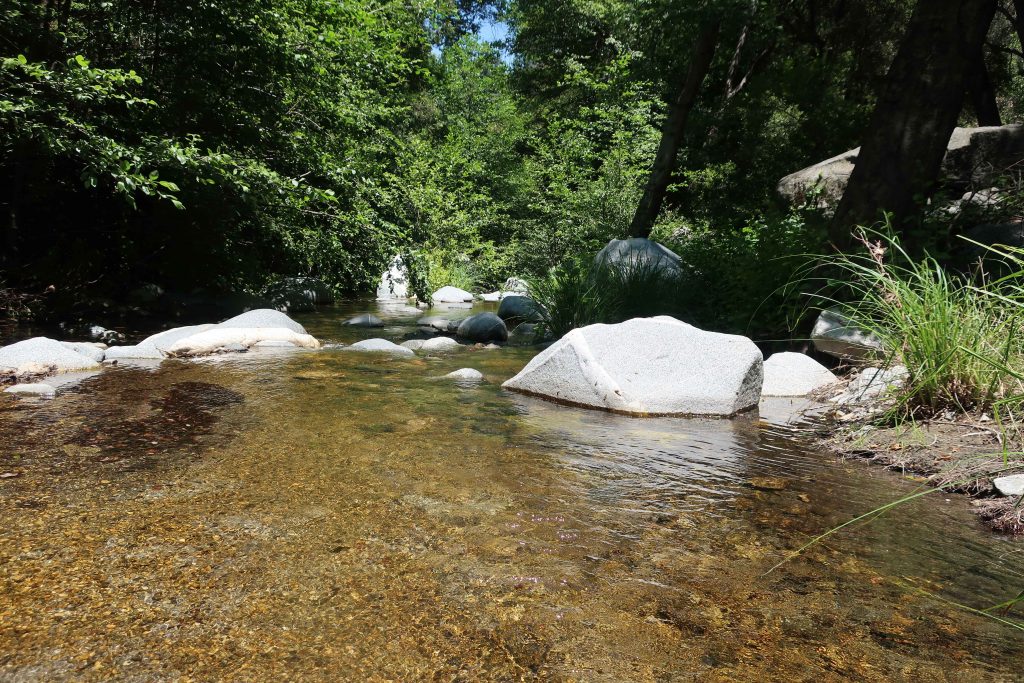
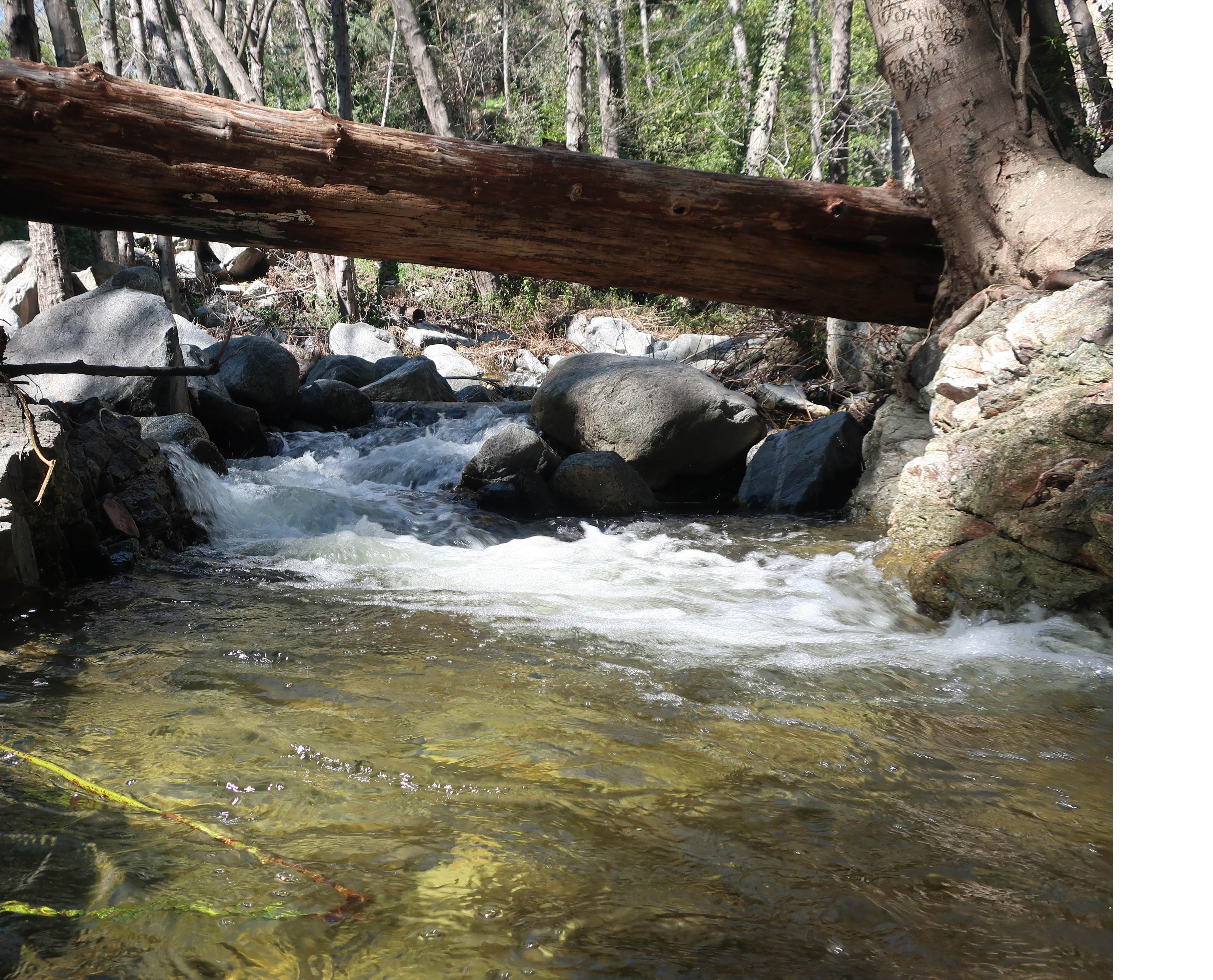
This photo was taken of Big Santa Anita’s Creek just upstream from Roberts’ Camp. This spot is close to cabin #23, on an outside turn of the creek. As of this writing, Chantry Flats’ rain total is at 42 1/2″ for season. Good flow and good sound throughout the canyon!
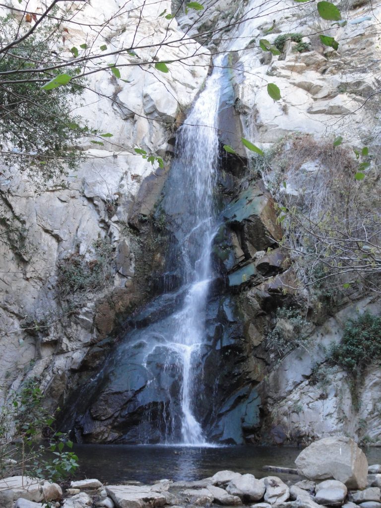
A view of 55′ high Sturtevant Falls as taken from the Upper Falls Trail this last Saturday. The stream crossings are so high right now that wading seems the best way to get across.
Our epic winter continues, with Sturtevant Falls looking more beautiful than ever. Last weekend our rain gauge had overflowed from the accumulation of a couple more storms before we could hike back in and check it. The gauge holds 12″ of rain before it overflows, so this tells something about the rains this month.
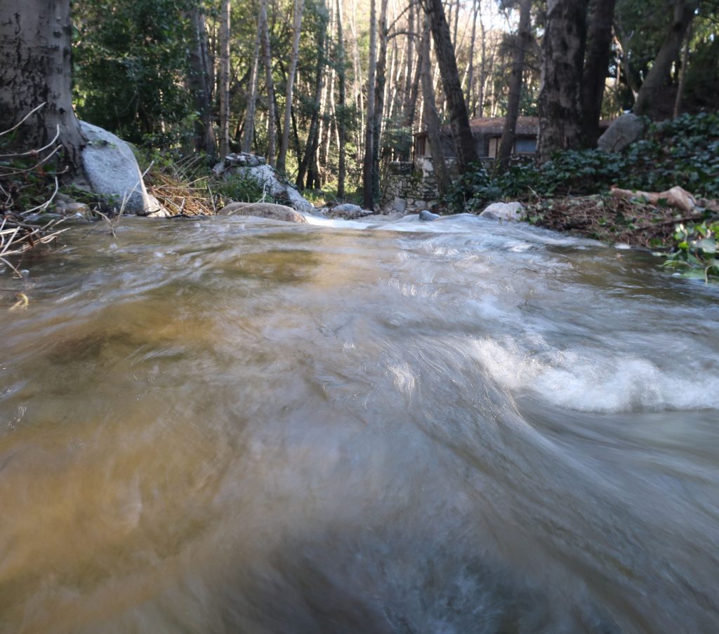
Looking downstream at Fern Lodge Junction. The stream is swollen, cold and flowing with energy.
Looking across at Sturtevant Falls and plunge pool from the Upper Falls Trail.
Big Santa Anita Creek comes alive after recent storms. 55′ high Sturtevant Falls is back in its’ former glory as well! As we all know, years of drought have taken their toll throughout the southwest, especially in the myriad of canyons throughout the mountains of Southern California.
Joanie and I discovered 9.57″ of rain in our gauge at Fern Lodge on January 18th. Several storms, back to back, have made a huge difference in the appearance of not only the Big Santa Anita creek, but all the rest of the front country streams in the Angeles. A week later, we hiked up and past Sturtevant Falls where we took these two photos.
This view taken just above Sturtevant Falls. This is at the top of the slot pools.
As of today, February 10th, a lot more rain has fallen. The stream beds have been scoured of the dark organic mat that’s built up for years. This has left bright, colorful sands and rocks under the clear waters. Beautiful.
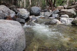
A tranquil stretch of the Big Santa Anita Creek in the Fern Lodge area of the canyon. This spot is near the little cabin village where the Upper Falls and Gabrielino trails depart the canyon bottom.
Sturtevant Falls as seen from the Upper Falls Trail on Sunday. Despite the fairly dry winter season, recent rains brought us nearly three more inches of rain, bringing up the levels of the stream.
Sturtevant Falls is flowing at it’s peak level for Spring. This photo was taken while hiking on the Upper Falls Trail this last Sunday. The rain gauge at our cabin in the Fern Lodge area recorded 2.92″ from the recent storm. The stream’s nice and full, it’s song filling the canyon from wall to wall. Many of the pools in the canyon have received a cleansing scouring. Dark organics that build up over the year on the stream bed have finally been washed clean out of the sand. This is a great time to take a hike at Chantry Flats in the Big Santa Anita Canyon! Fern beds on the steep slopes and cliffs are growing in their thick greenery. Sturtevant Falls is definitely one of the most sought after places to visit during the spring hiking season. If at all possible, try to get in a hike to the falls during the week days due to the parking congestion at the trailhead.
The hike in is less than two miles one way, rated as “easy” in John W. Robinson’s Trails of the Angeles. Begin your hike at the Gabrielino trailhead, located adjacent to the lower parking lot at Chantry Flats. Descend over 400′ to the canyon bottom in less than 3/4 of a mile. Cross the foot bridge at Roberts’ Camp, then follow the dirt road upstream, passing by the little cabins built over a hundred years ago. The road soon peters out, your route becoming single-track off and on until you reach the base of the falls. Return the way you came.
Posted on January 29, 2017 – Written by Chris Kasten
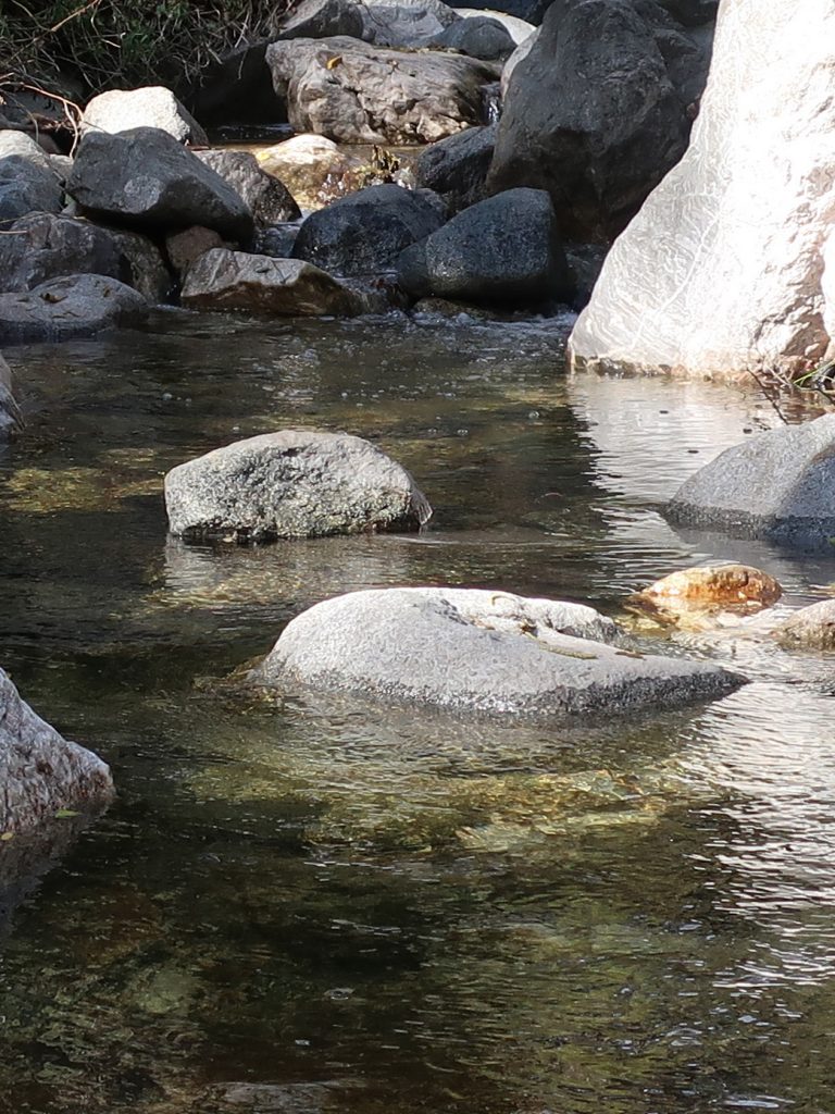
Big Santa Anita Creek is coming back after years of drought. Here’s a trailside view of the bubbling mountain stream midway between Roberts’ Camp and Sturtevant Falls. Notice the light, tea-like coloring of the water created by the leaching of tannins from last year’s fallen leaves.
This is a great time for your Sturtevant Falls hike! The recent storms to visit Southern California have brought abundant rain and snow to the drought parched San Gabriel Mountains. 26.60″ of rain has fallen at Chantry Flats as of this writing. Measuring of the rain season begins on October 1st and concludes on September 30th of the following year, so we’re off to a good start for our winter season. All the trails radiating out of Chantry Flats lead to canyons filled with stream song. Bright green thickets of Bracken ferns grow profusely among the ledges of rocky cliffs.
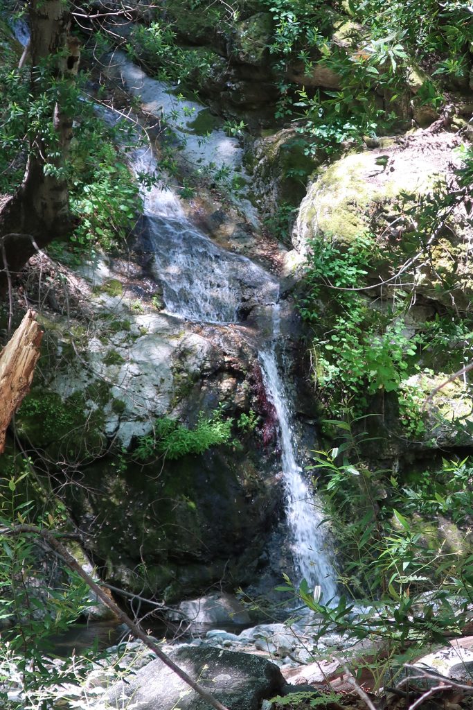
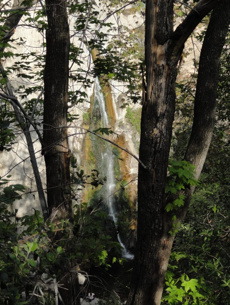
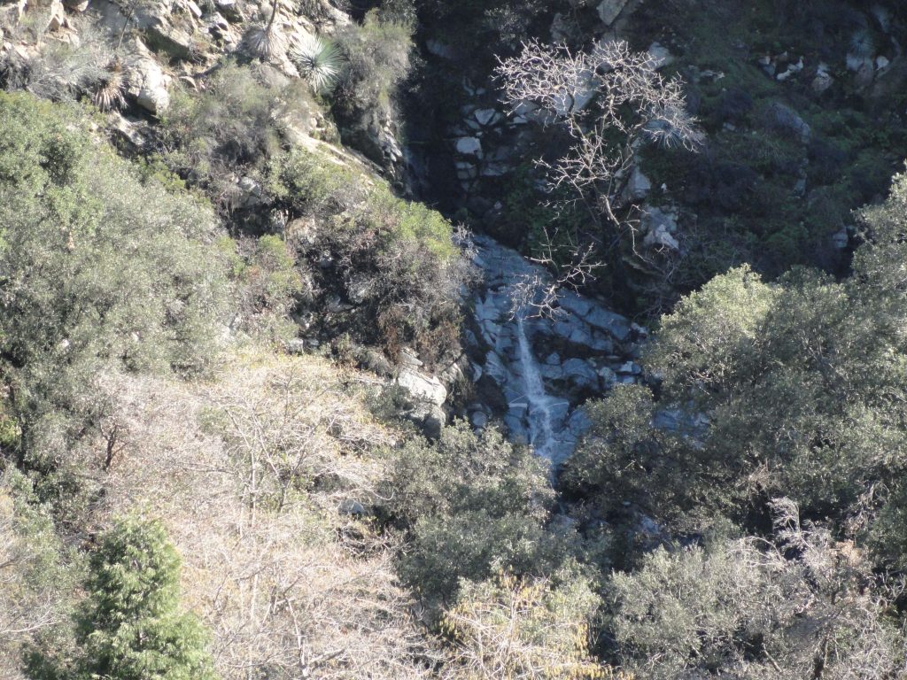
The Pagoda Tree with her outstretched arms, as seen here high atop Clamshell Ridge. Look for it when dropping down the road (Gabrielino Trail) from Chantry Flats to Roberts’ Camp. The watershed directly below it is McKinley Canyon, also the source of the falls photographed here in this same article.
Looking down from the road that drops down from Chantry into the canyon, you can make out the gray, smokey canopy of the leafless alders hugging the boisterous mountain creek. Looking straight out (east) from San Olene Canyon, about half way down to Roberts’ Camp, the Pagoda Tree welcomes you back to the canyon. This big cone spruce stretches out its’ shaggy arms from high atop Clamshell Ridge, with a backdrop of open sky.
Sturtevant Falls as seen from the Upper Falls Trail, Big Santa Anita Canyon. A recent triple-round of storms to visit Southern California brought much needed rain and snow to the San Gabriel Mountains. The Falls haven’t looked this good in over six to seven years!
Right now the Big Santa Anita Canyon and Winter Creek carry, too, the scent of winter. Last autumn’s leaves mulch down into the myriad of sand and soil along the stream beds. This earthy, organic loam creates an invigorating damp scent that helps to bookmark your memories of the canyon trails and where you were all those years ago. So, when you return to Chantry for your next hike, that good wintery scent brings you back to your old haunts and all those thoughts that went along for the ride.
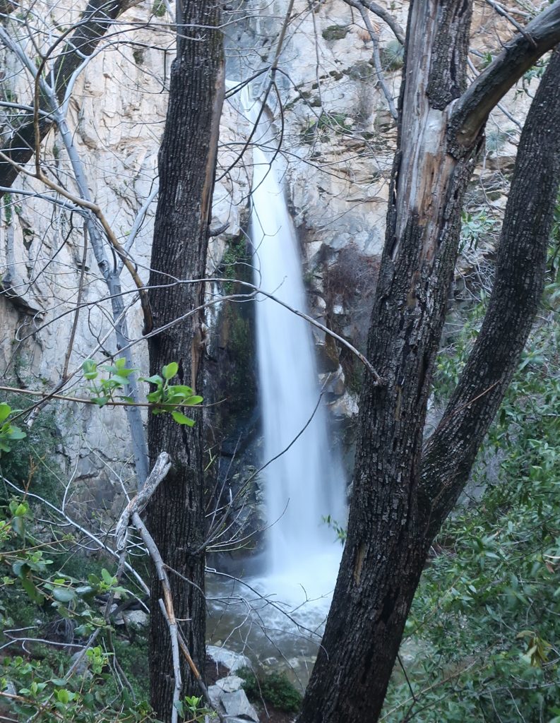
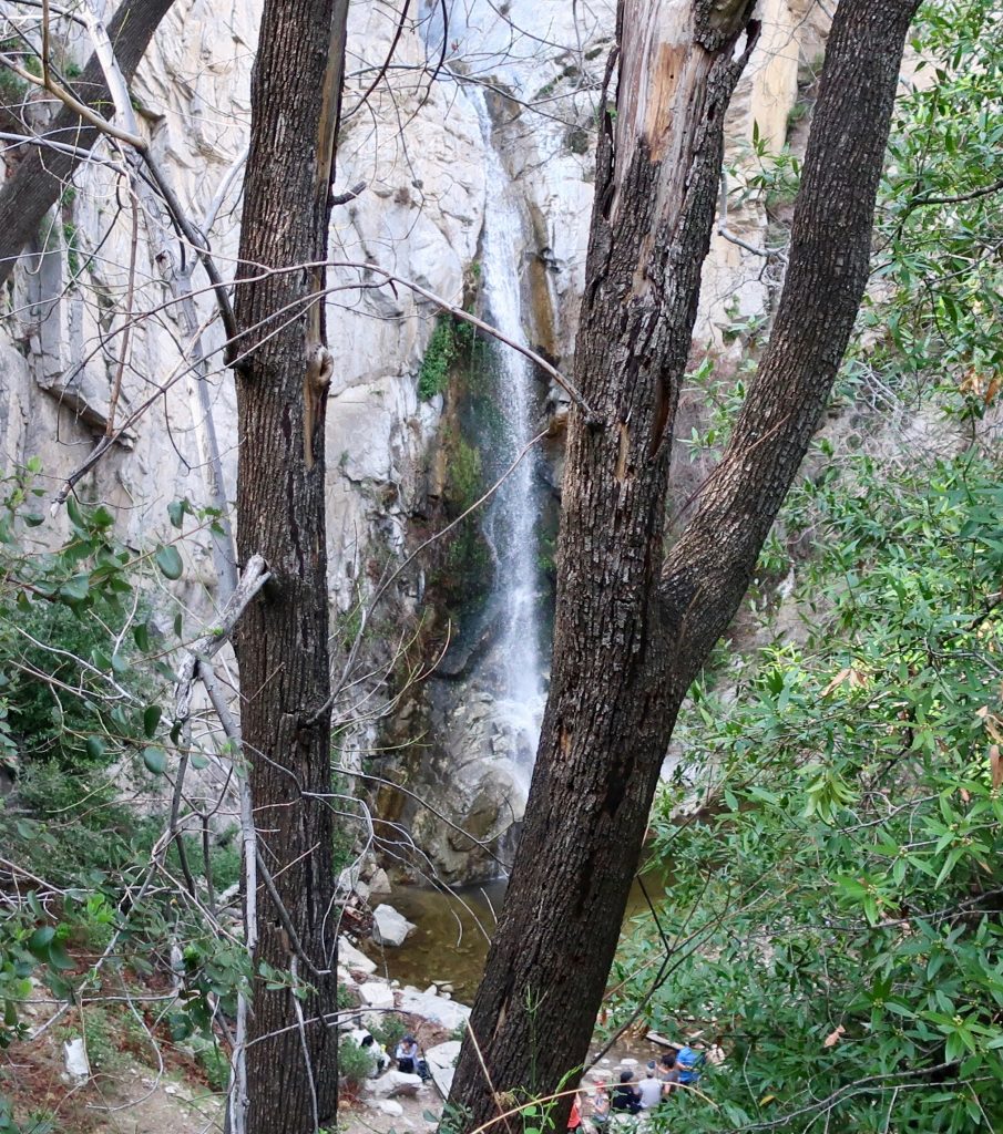
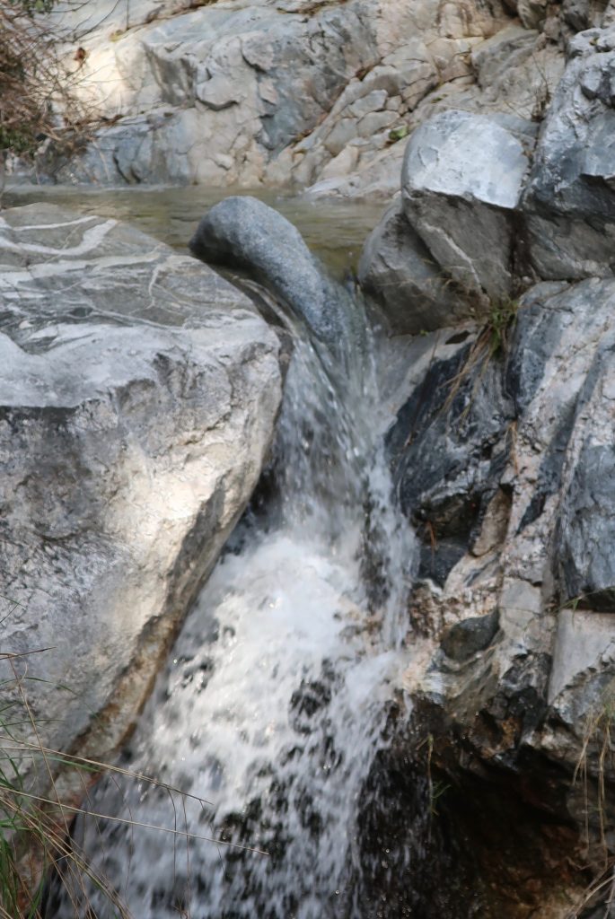
McKinley Canyon Falls as seen from the road that descends from Chantry Flats to Roberts’ Camp. Seldom does this cliff become a waterfall. It’s been nearly seven years since this scene last occurred! McKinley Canyon is visible directly across from San Olene Canyon. Wild, steep and narrow, it drains the Clamshell Ridge watershed.
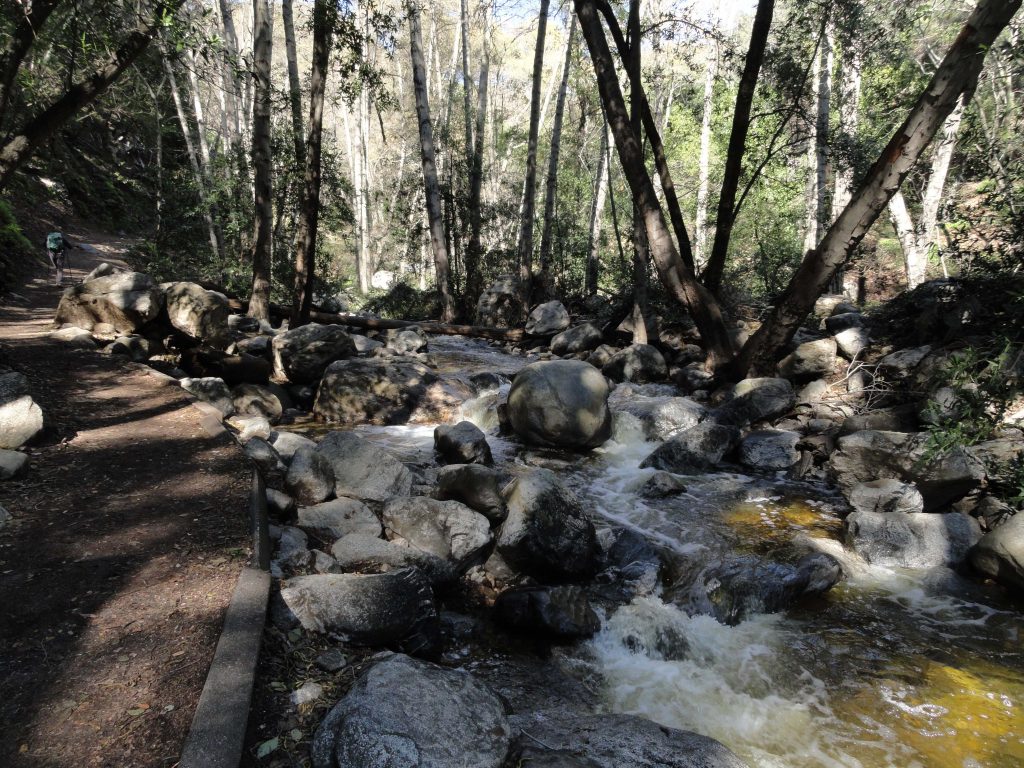
When on the green footbridge at Roberts’ Camp, you cross the boisterous tumbling Winter Creek and its’ trout pools that were created by Lynn Roberts back around 1912 during the Great Hiking Era. This little creek flows down from Mt. Wilson, twisting and turning for miles, dropping approx. 4,000′ to the confluence of the Big Santa Anita’s main canyon. After leaving Roberts’ Camp, head up the main canyon, passing by the Lincoln Log style check dams. Big Santa Anita Canyon, like the Winter Creek, also begins at Mt. Wilson’s summit. Little cabins, many built over a century ago, are perched on small flats along your hike. The canopy of alder, canyon live oak and bay shade much of your way. Along with stream song, listen for the descending fluid notes of the canyon wren, a year-round resident of this watery place. In less than a couple of miles you arrive at the base of 55′ high Sturtevant Falls. The canyon big-leaf maples grace the open bowl around the plunge pool at the bottom of the falls. Leafless, their silent, bare branches seem to reach out over you, stretching and awaiting Spring.
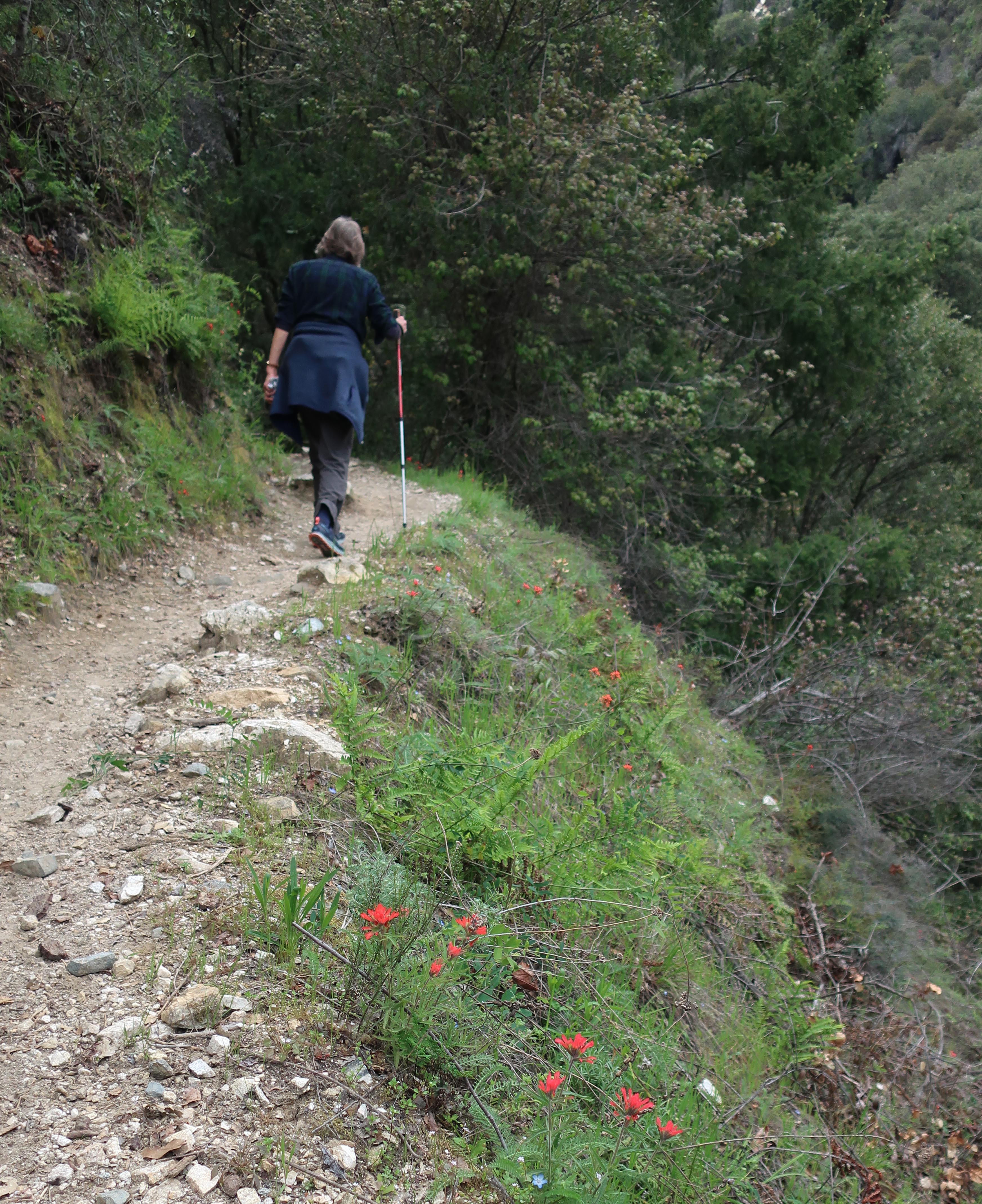
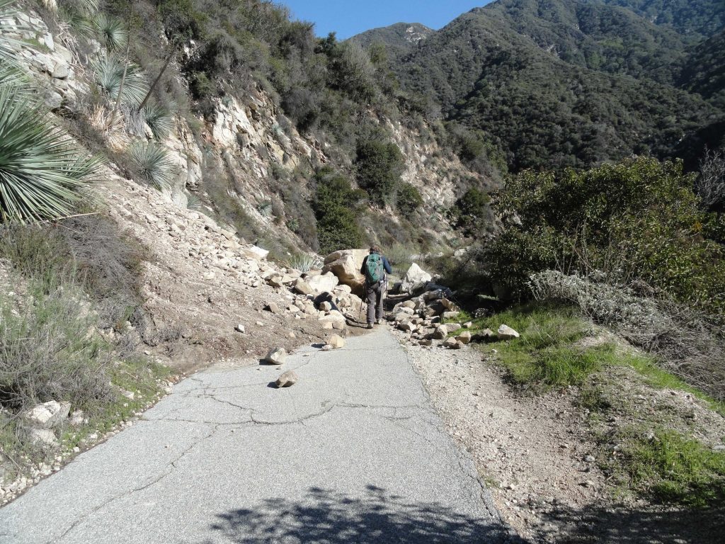
Joanie Kasten walks around a freshly fallen slide in San Olene Canyon on her way down to Roberts’ Camp. The Chantry Flats area, like all the front country of the San Gabriels have benefited greatly from the recent series of storms. While the high country is blanketed with snow, front country hiking is graced by stream song, green grasses and the flute-like song of the native canyon wrens.