Hike Circle Mountain, Wrightwood, CA

Hike Circle Mountain without having to leave Wrightwood!  If you live in or near Wrightwood, this local mountain is in just about everyone’s skyline on any given day.  The view along the way, not to mention at the summit, is a superb 360 degree panorama.  In less than a mile, you’ll climb about 800′ to the top.  Some parts of the trail are hard-packed sand and super steep.  It’s easy to slip, especially on the descent, so I highly recommend bringing trekking poles.

Excerpt of U.S.G.S. 7.5′ quadrangle showing the terrain from the east end of Wrightwood up to Circle Mountain. The ranger district boundary line from Lone Pine Canyon Road (BM 6,078) to the summit (6,875) is the hiking route to the top.

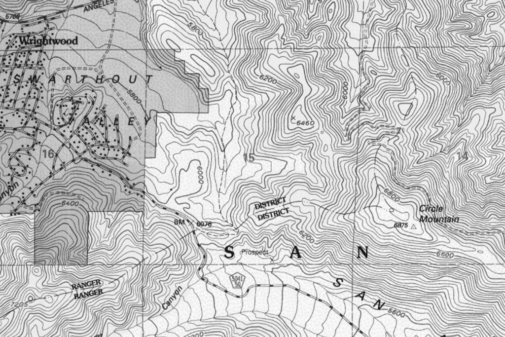
The route starts at a shiny white, heavy duty Forest Service fire road gate, at the crest of Lone Pine Canyon.  If you live in Wrightwood, it’s that gate on your right hand side when you reach the very top of Lone Pine Canyon Road before coming back into the village from the freeway.   You might even know the area at the fire road gate as “Helicopter Hill.”

Joanie stops to wait for me on the steep, sandy path. The summit is still a ways off.

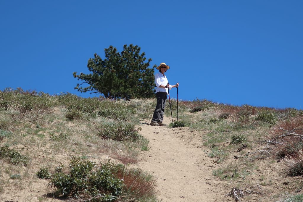
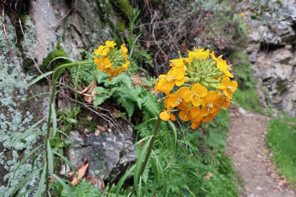
Just walk around the gate and follow the fire road eastward for a few minutes before reaching a barricade of boulders, marking the drivable end of the world’s shortest fire road.   From here, the little sandy path drops down a little and continues along the exposed the ridge top before your climb begins in earnest.  After the initial steep climb, the trail levels out a bit before you begin the second pitch.  The Blue Cut Fire really burned off a lot of brush, including scrub oak and a number of pines.  Despite this, plants are coming back.  There are hardly any places to duck out of the bright sun, so bring a good sun hat and plenty of water.  You’ll pass by clumps of Poodle Dog Bush, recognized by its’ ragged leaf margins and pungent scent.   Also, look for Fremontia (flannel bush), chamise, yuccas and buckwheat.  The chaparral that grows here is subjected to day after day of intense sunlight.

Chris pauses by a trail cairn of “balancing rocks” on the way up Circle Mountain. The burnt thickets of branches are from the Blue Cut Fire. Scrub oaks are slowly making a come back in the scorching sun.

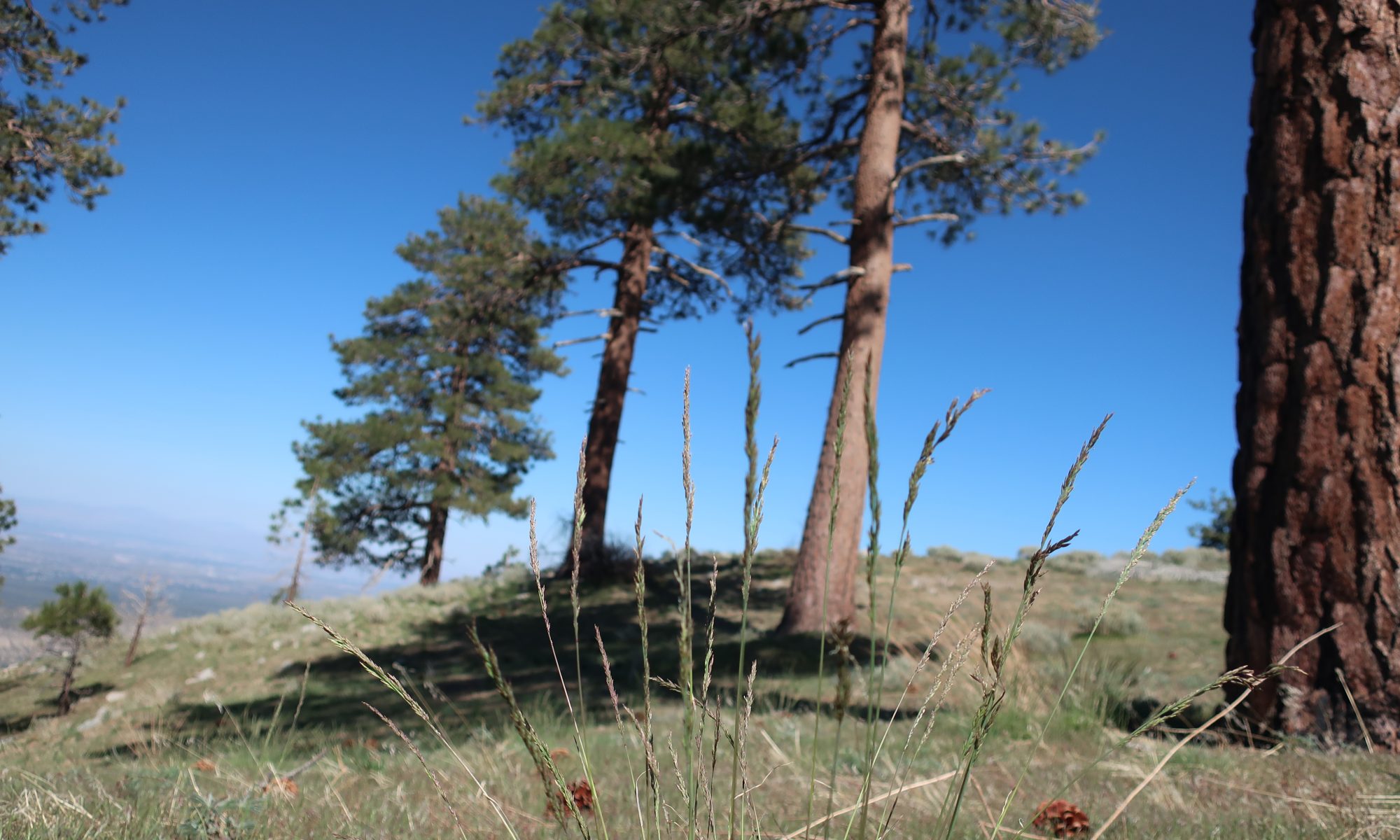
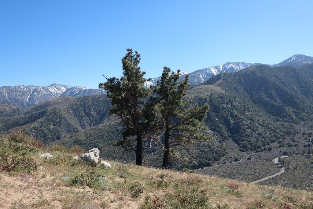
Here and there, as you climb, you’ll spot Jeffrey and Ponderosa pines with fire scars at their bases, yet their crowns blaze deeply green against the cobalt blue sky that only the high elevation can provide.

This view toward the southwest highlights some of the highest peaks in the eastern San Gabriels. From right to left: Pine Mountain, Dawson Peak and Mount San Antonio (Mt. Baldy) obscured by the pine trees. That’s Lone Pine Canyon Road in the right hand foreground.
Looking back up the Swarthout Valley toward Big Pines. The eastern portion of Wrightwood is in the immediate foreground. The main road heading straight through the pine forested landscape is Highway 2, the Angeles Crest Highway.

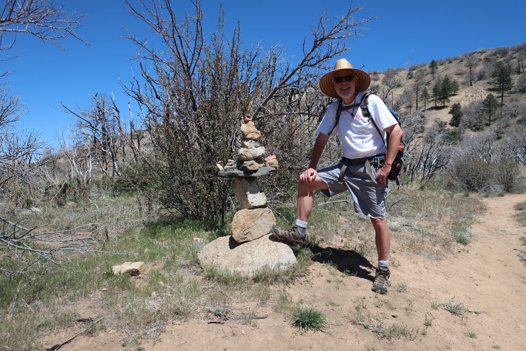
Something to know about Circle Mountain, is that its listed on the Sierra Club’s Hundred Peaks Section “peak list.”   The list was created by Weldon Heald back in 1941.  Throughout the decades, those attempting to bag all 100 summits, make a visit to our backyard mountain.

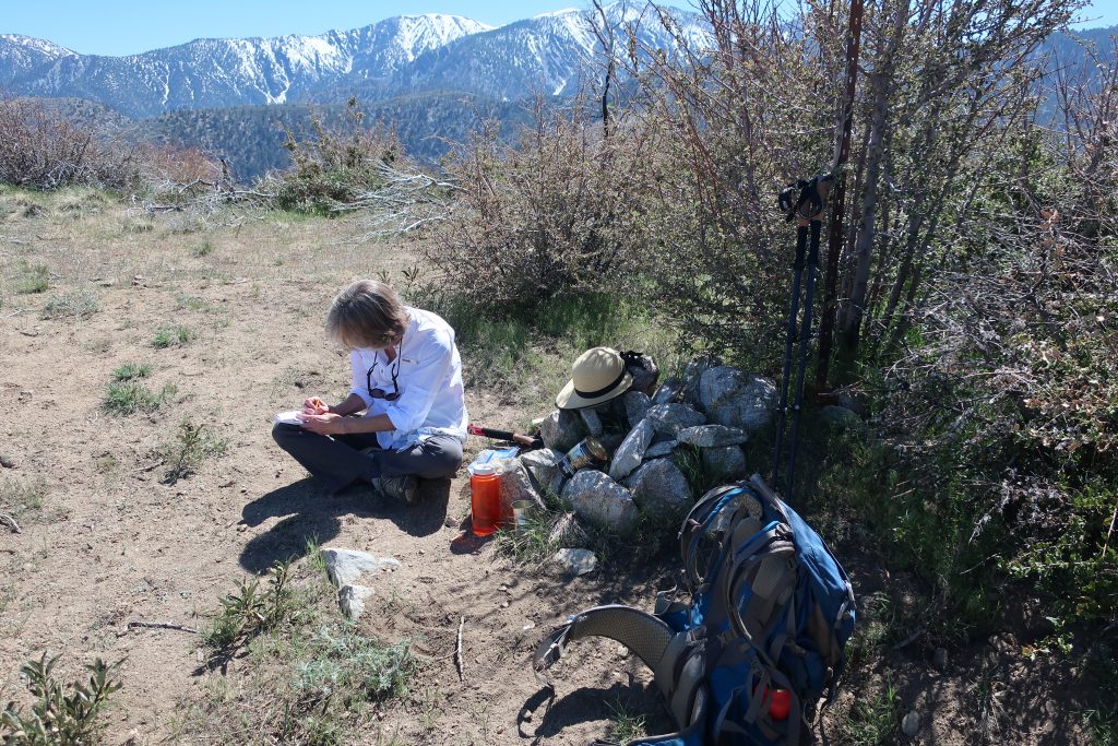
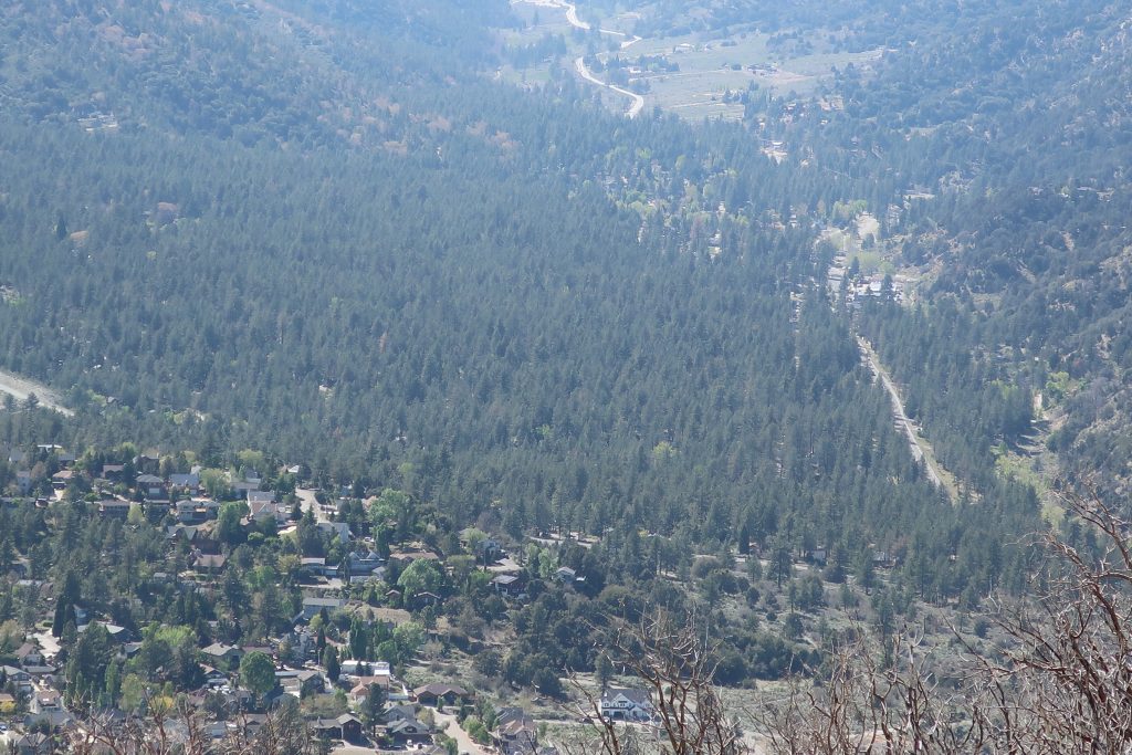
After reaching the summit, Joanie and had our lunch in a little glade of grasses amongst a grouping of tall pines on the north side of the mountain.  From there we looked off into the hazy distance of the Mojave.  The gentle summery breeze combed through the green boughs above.  A little bit of heaven just minutes from the start.  As we descended, the treat of one of the most unique views of Wrightwood and its’ Swarthout Valley was laid out before us.  This little hike, though steep, is one worth making the time for.

Joanie Kasten signs in at the summit register. Look for a U.S. Forest Service pre-attack marker and this little cairn of rocks while up on the broad summit.


Western Fence lizards are out at Tin Can Point


This turquoise colored fence lizard (Sceloporus occidentalis) was seen out in the warmth of early Spring at Tin Can Point. Tin Can Point is just up from Fern Lodge Junction on the Gabrielino Trail. It’s the first switchback you’d encounter after the trail passes through the canyon live oak forest and then enters the chaparral, just a few minutes up from the trail junction.

A beautiful fence lizard basks in the gentle warmth of early Spring at Tin Can Point.   See inset of the Chantry Flat – Mt. Wilson Trails map, below, to see where this point is.  As of this writing,  a cold wet pacific storm is dropping nearly six days of chilly rain and snow in much of the San Gabriel mountains.  Big Santa Anita Canyon dam has received over 5 1/2″ of rain in the last week.  Something I just learned recently about these Western Fence lizards is that their populations have the effect of reducing the incidence of Lyme’s disease in the ticks that live in the chaparral,  such as found covering much of the slopes of the Big Santa Anita Canyon!  Apparently, a protein in the lizard’s blood kills the bacterium in the tick’s gut, which is good news for hikers and even their dogs during the spring and autumn months.

Like most reptiles, Western Fence lizards hibernate, at least for a little while each winter throughout their habitats which are wide-spread throughout California.  As for food, these lizards eat spiders and various insects such as mosquitos, beetles and grasshoppers.   The females lay several small clutches of eggs (3-17) in the spring, the young emerging in the summer.

Detail of Gabrielino Trail section, Chantry Flat – Mt. Wilson Trails map.

On your next hike out from Chantry Flats, watch for for lizards flitting about on the trails and sunning themselves on the myriad stretches of rock.  As for the various types of reptiles to be found in the Big Santa Anita, Western Fence lizards are abundant and deserve a place in the sun!

source:  Wikipedia, Western Fence lizards

Douglas Wallflowers in Blossom

Here’s a Douglas Wallflower alongside the Upper Falls Trail as seen this last Monday while hiking up the Big Santa Anita Canyon under cloudy skies.   Our series of much-needed rain storms have brought back thick green grasses and the start to what’ll most likely be a colorful Spring of other wildflowers as well.  Joanie and I hiked the two mile Falling Sign Loop that originates out of Fern Lodge.

These Douglas Wallflowers (Erysimum capitatum) popped out at us just downstream from the double slot pools on the Upper Falls Trail. There’s also a nice grouping of wallflowers near the second bench up the road from Roberts’ Camp in San Olene Canyon.

Sturtevant Falls was tumbling down nicely.  The scent of white sage peppered the cool air and the background surf-like sound of the stream followed us the whole way.  We brought along an old shovel, cleaning off small slides here and there.   Wild lilacs (buck brush) are still sending their mild lavender scent into the canyon breezes while the bright red orange of Indian paintbrush pokes up from the damp earth near Hoegee’s Drop-Off.  And overarching along most of the route, the Laurel bay blossoms still cling to the dark green canopies.  Look for the tender dark reddish purple leaves of the canyon big-leaf maples as their foliage begins to fill back in for a new season.  Even the white alders are pushing out a myriad of their bright green leaflets, replacing that smokey look of dormancy with new life.

View looking east up into the East Fork of Big Santa Anita Canyon from Gabrielino Trail. Note the Toyon in the foreground, still hanging onto some of its’ red berries. That’s Rankin and Monrovia peaks in the most distant background. Clamshell Peak is barely captured on the right hand side of photo.

The Good Mountains of John Steinbeck

Posted on April 8, 2017 – Written by Chris Kasten

The Good Mountains of John Steinbeck were referred to in the timeless novel “Grapes of Wrath”, written back in 1939.  For some

John Steinbeck in his younger years. One of his timeless novels is “The Grapes of Wrath.” Published back in the 1930′s, this fiction follows a grouping of families who take their chances in California as a result of the dust bowl disaster of Oklahoma.

years I occasionally connected Steinbeck with this observation of the San Gabriel Mountains, as observed along Route 66, the “Mother Road”, traveled by thousands and thousands of migrants migrating to California from Oklahoma’s 1930′s dust bowl.  Had I really read that?

Well, this morning, I found the passage just after finishing breakfast on this last day of March.  Here’s an excerpt from John Steinbeck’s novel, Grapes of Wrath, page 152 (Penguin Books, reprinted 1987).   Imagine yourself driving that asphalt two-lane heading for California and the unknown.


“Then out of the broken sun-rotted mountains of Arizona to the Colorado, with green reeds on its banks, and that’s the end of Arizona.  There’s California just over the river, and a pretty town to start it.  Needles, on the river.  But the river is a stranger in this place.  Up from Needles and over a burned range, and there’s the desert.  And 66 goes on over the terrible desert, where the distance shimmers and the black center mountains hang unbearably in the distance.  At last there’s Barstow, and more desert until at last the mountains rise up again, the good mountains, and 66 winds through them.  Then suddenly a pass, and below the beautiful valley, below orchards and vineyards and little houses, and in the distance a city.  And, oh, my God, it’s over.”

Steinbeck is, of course, describing the southward view from what we now know as the I – 15 freeway, probably near Lenwood.  His “good mountains” are the San Gabriels and the pass happens to be the Cajon Pass.  The San Gabriel Mountains seem to have always held an allure as the “good mountains” to head towards and be in.  I wonder what John Steinbeck’s connection to the San Gabriels happened to be…  More to follow.

Steinbeck’s, “The Grapes of Wrath.” This page describes a portion of Route 66, the ‘Mother Road’, which travels from Chicago, Illinois to Santa Monica, CA. Page 152 makes a reference to the San Gabriel Mountains of Southern California as “the good mountains.” The next sentence reads “Then suddenly a pass, and below the beautiful valley…” This is the Cajon Pass and the following downslope Inland Empire towns such as Cucamonga, Etiwanda, Upland and more.

Cover of Grapes of Wrath by John Steinbeck. As you can see, this little book of ours has gotten a bit of wear.