Lightning Ridge Nature Trail – Wrightwood, CA

Posted on May 1, 2017 – Written by Chris Kasten

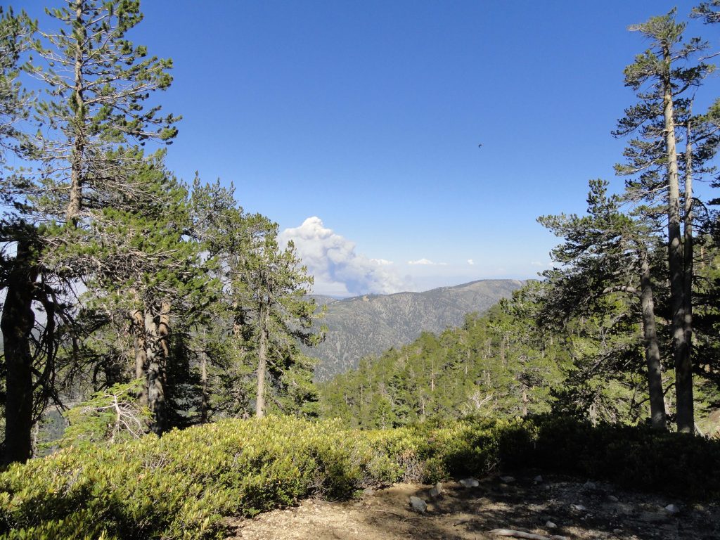
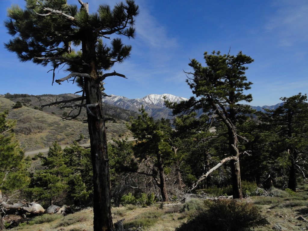
The northwest side of Mount Baldy as seen from the Lightning Ridge Nature Trail ( summit is between the two pines in foreground). To the left of Mt. Baldy is Pine Mountain. It too, still has some snow on its’ slopes. Mount Baldy, officially known as Mount San Antonio, is the highest peak in the San Gabriel mountains at 10,064′ elevation.  That’s the Angeles Crest Highway (Hwy. 2) coming up from the mountain village of Wrightwood on the left side of photograph.

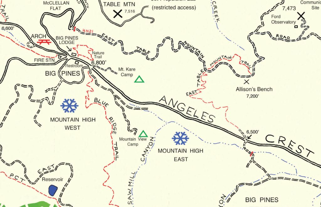
Now that it’s May and the days have started to warm up and lengthen,  consider walking the Lightning Ridge Nature Trail.  It’s up 7,300′ on the spine of the San Gabriel mountains.  This is high country with fabulous views in all directions.  A short drive west of Wrightwood, approximately 5 miles, takes you to the trailhead just across Hwy. 2 (Angeles Crest Highway) from Inspiration Point.

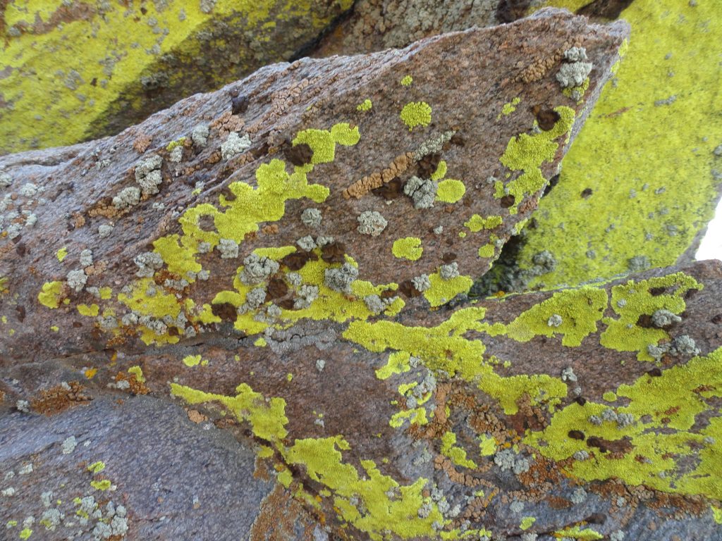
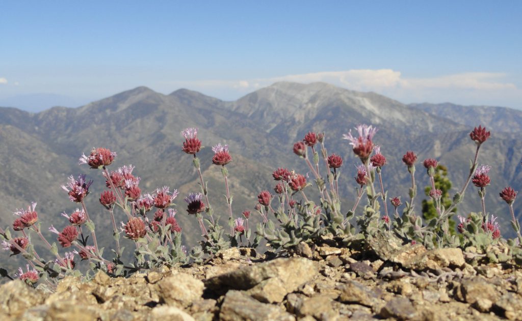
Colorful lichens make these wind swept boulders their home atop the San Gabriel mountains. Elevation is 7,400′ on an exposed ridge top.  Lightning Ridge Nature Trail – Wrightwood, CA.

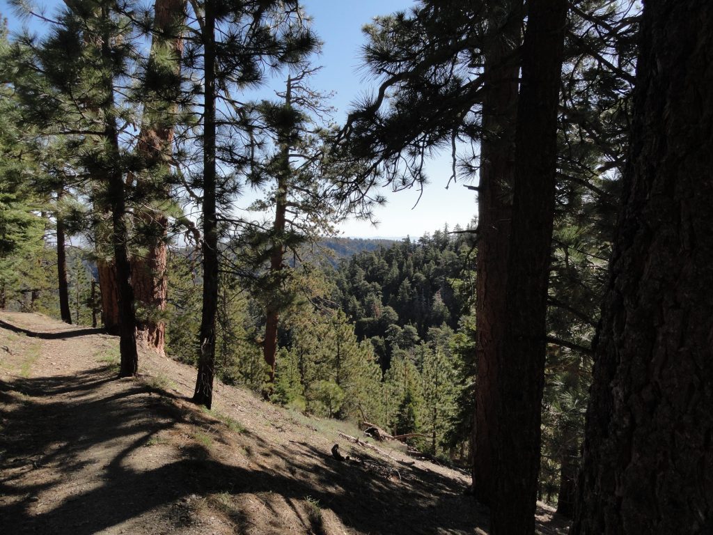
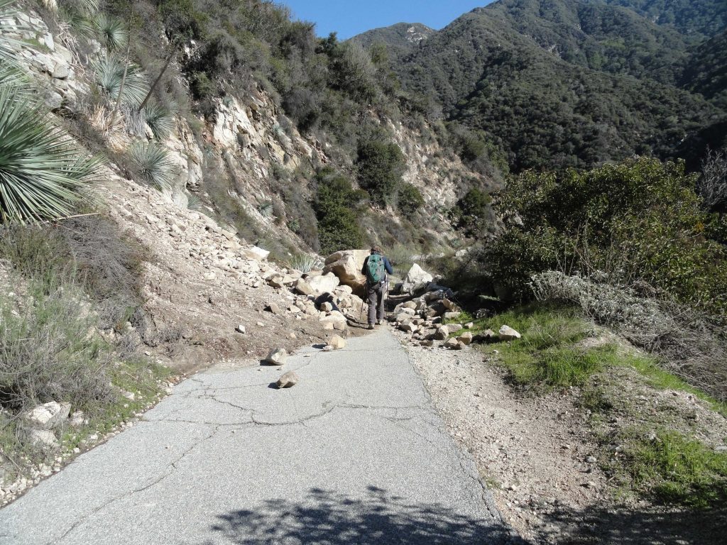
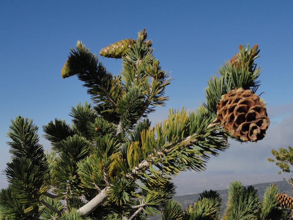
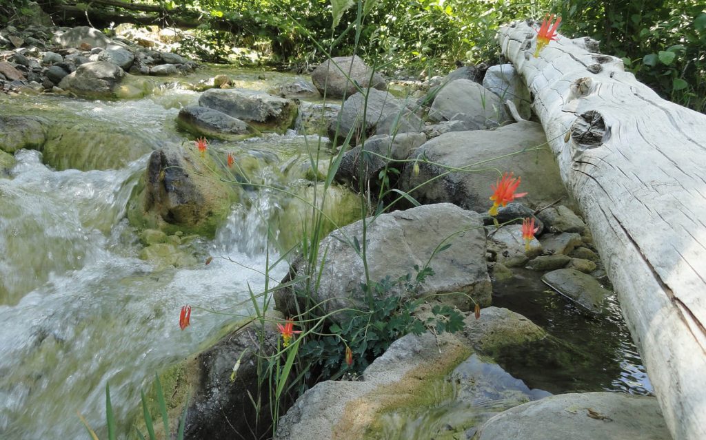
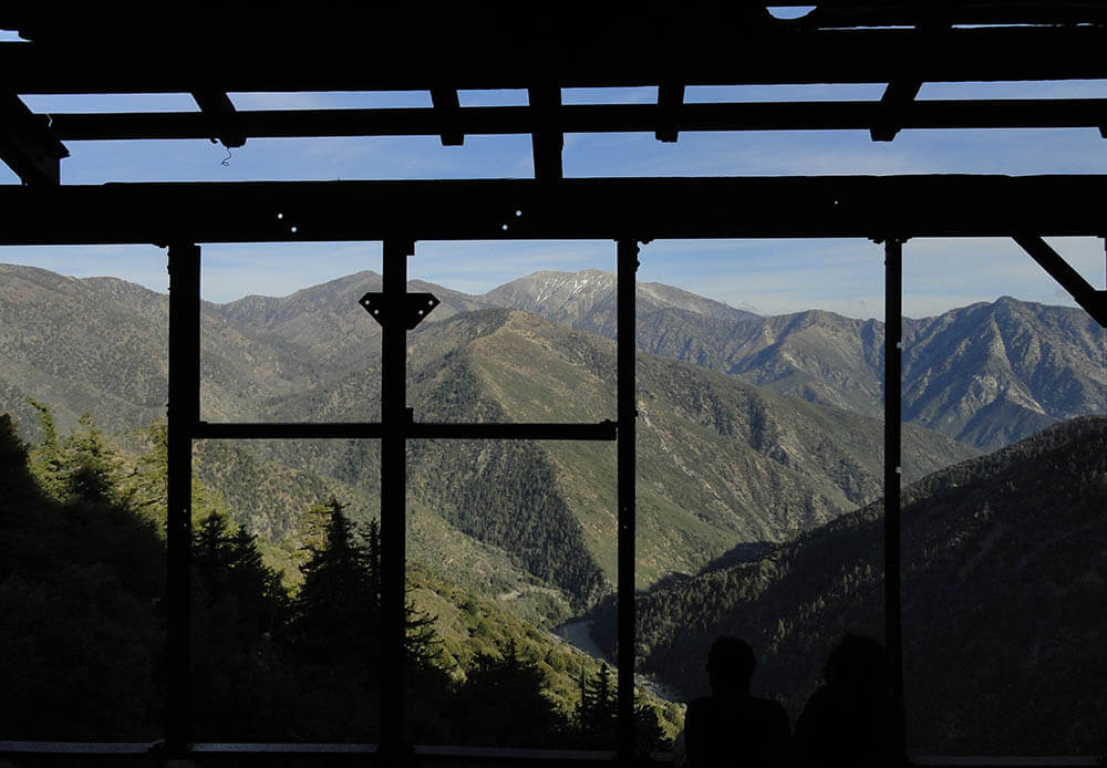
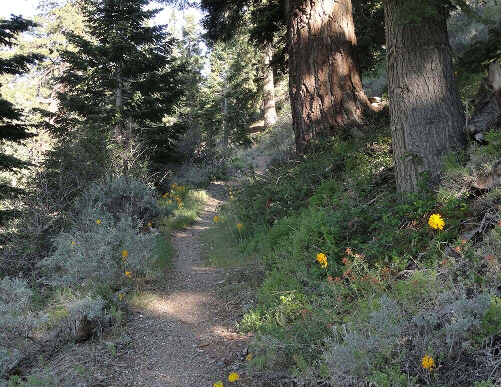
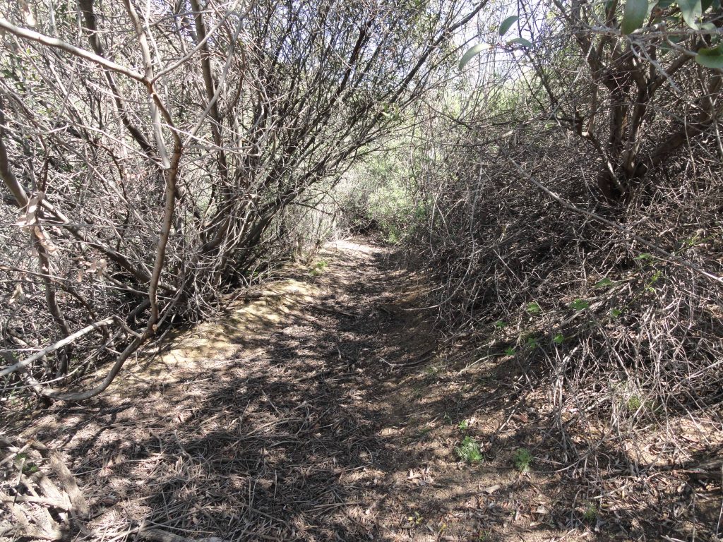
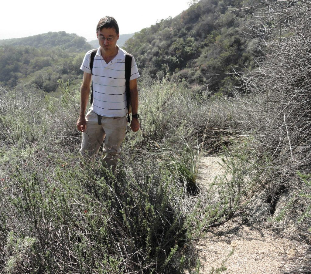
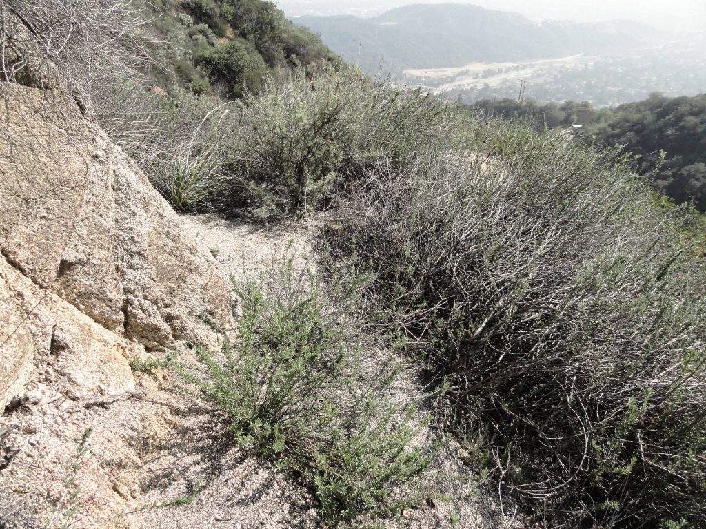
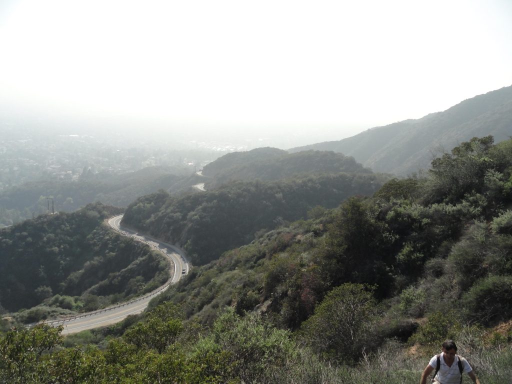
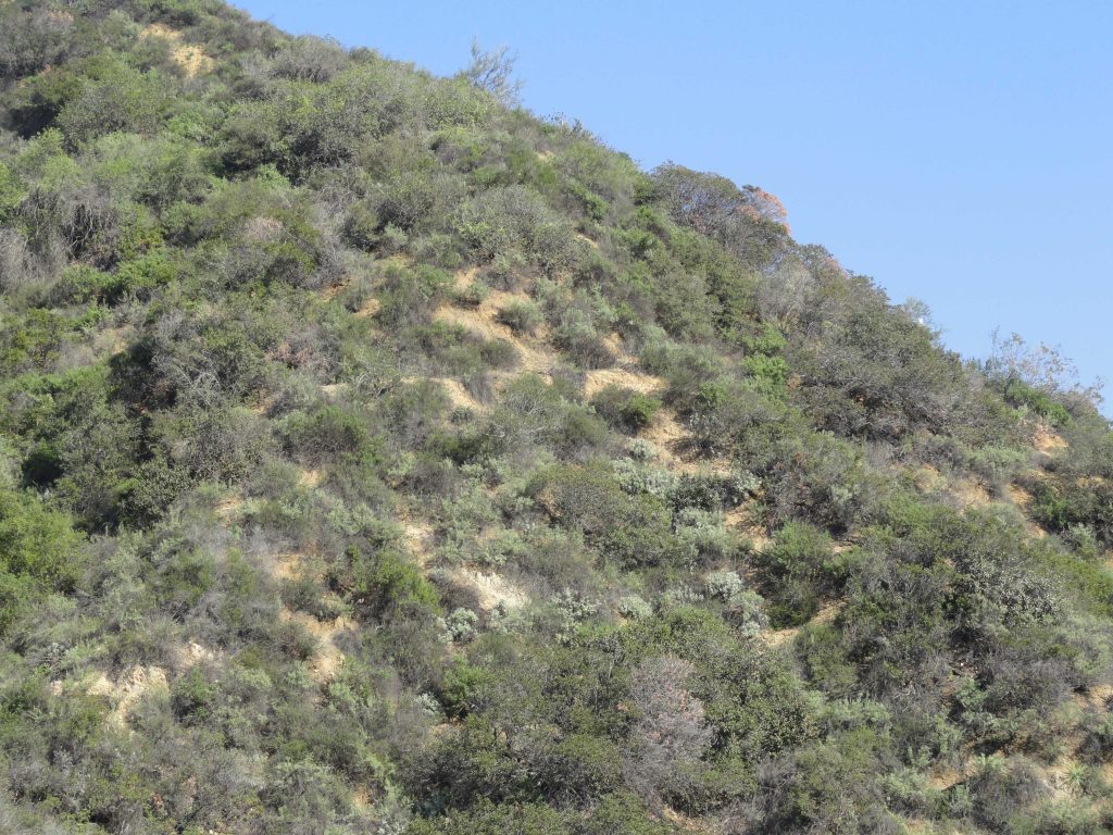
The trailhead is on the north side of Hwy. 2 in a wide turnout next to a backdrop of willows and shrubs.  There’s a red metal picnic table there as well.  Find your way through the little brushy opening and you’ll see a PCT (Pacific Crest Trail) signpost marking the trail to your left.  You’ll take the trail directly in front of you, contouring the gentle slope.  Sometimes you’ll find leaflets in the covered metal box at the trail’s beginning that describe the flora along the way.  Whether you find them or not, there’s plenty to ponder and take in without knowing the names of all the plants along the way.  This loop trail is only a bit over half a mile in length, climbs about a hundred feet from the start and perfect for all ages and abilities.  The Lightning Ridge Nature Trail travels underneath mature Jeffrey pines and black oaks, at times switchbacking amongst whitethorn chaparral (buckthorn) and even ascending the slope by means of steps made of landscape timbers.  Over the years, our family has often used these steps as little seats to look out over the nearby desert with its’ ever-changing palette of color and shadow.  One of the unique qualities of this loop trail is the constant grand views of the Mojave Desert to the north, Mount Baden-Powell toward the west, the open canyon country of the East Fork of the San Gabriel River to the south and, of course, Pine Mountain, Dawson Peak and Old Baldy to the east.

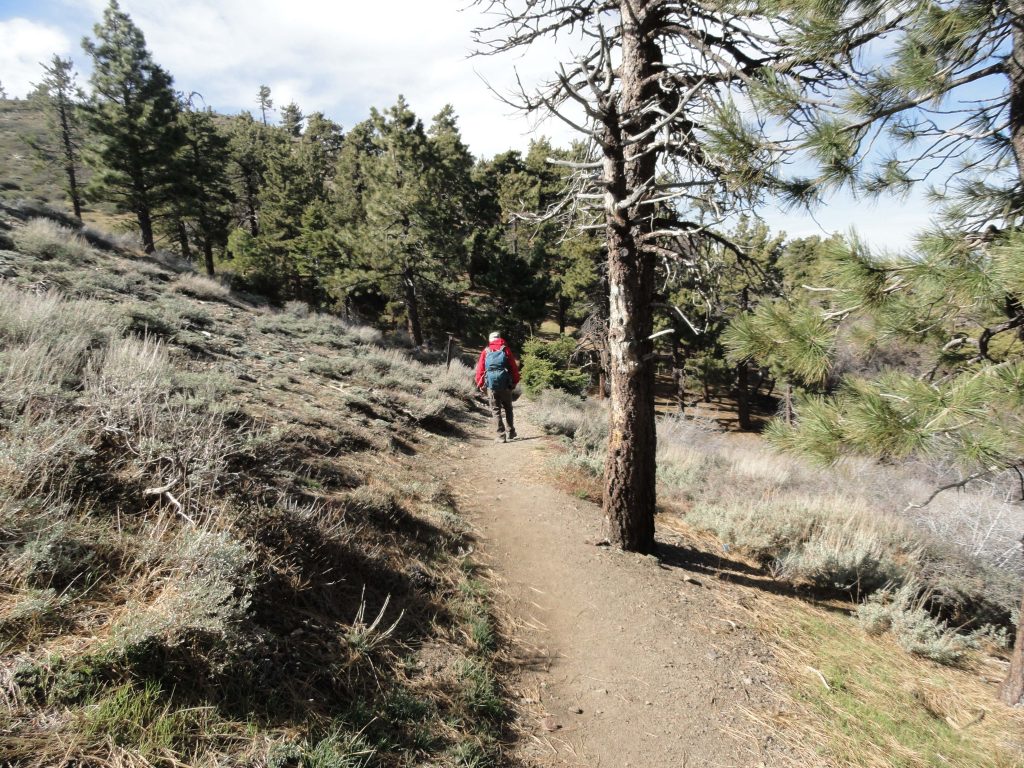
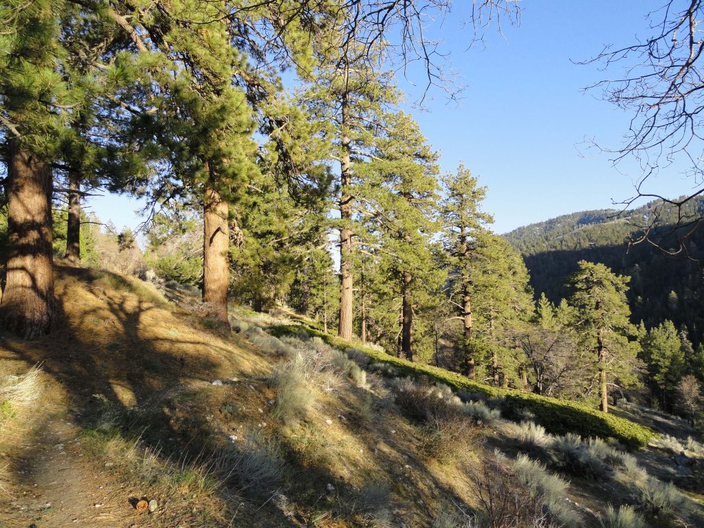
A view of the beginning of the Lightning Ridge Nature Trail. This short loop trail is a wonderful introduction for all ages into the landscape and flora of the San Gabriel mountains high country.

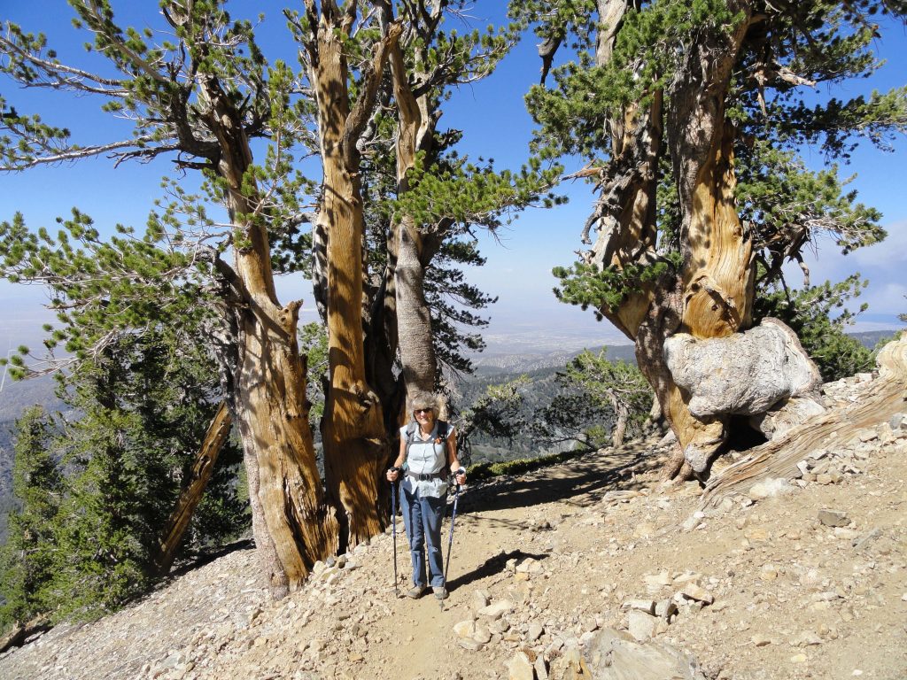
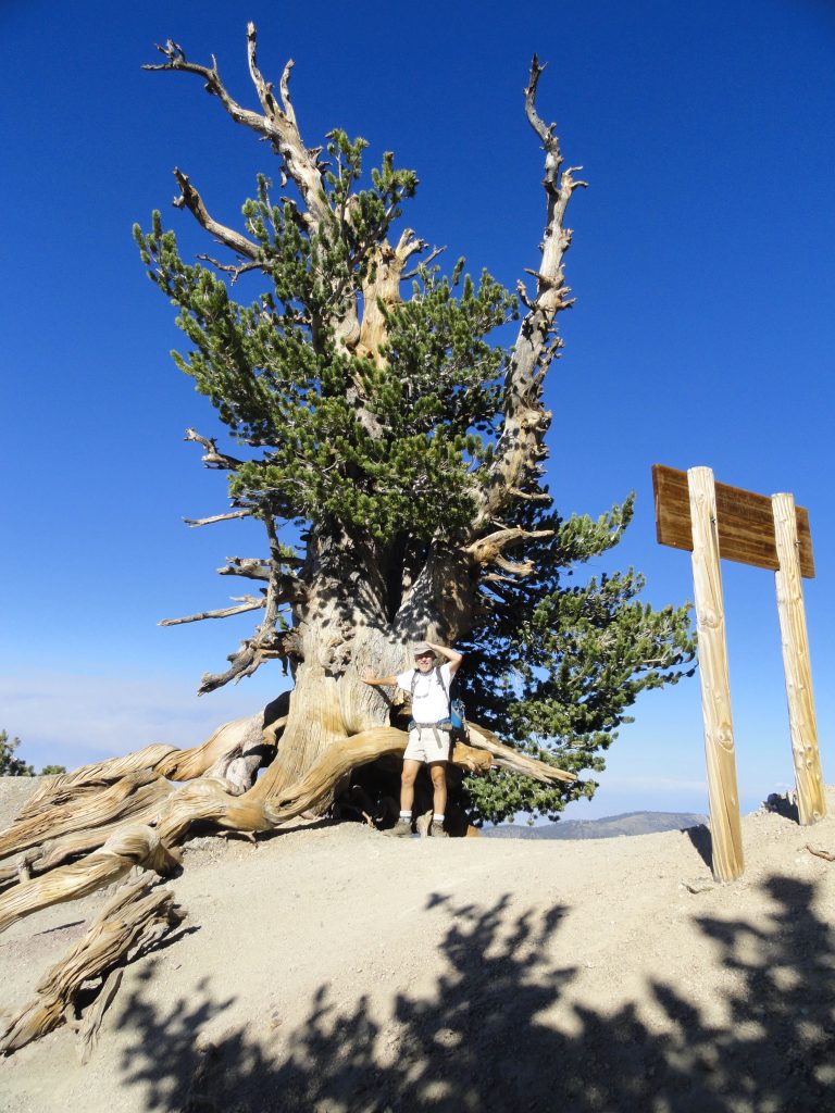
As the trail circles back in on itself and joins the PCT for the return, take a little time to rest on the overlook bench, taking in the fine views of canyons and peaks.  Much of the Sheep Mountain Wilderness area is directly out front of you from this ridge top perch.  One of the range’s most isolated and challenging peaks, Iron Mountain (elevation 8,008′), can be seen straight out to the south at the end of lonesome West San Antonio Ridge, which comes off of Mt. Baldy to it’s right (west).  Iron Mountain’s nipple shaped summit is easy to identify from this vantage point.  When you’re ready, return back to the beginning by way of the PCT.  You’ll pass by fallen giant tree trunks, bleached smooth by the high elevation sun and wind.  A great trail to experience at sunset!

Big Pines Nature Trail – Wrightwood, CA

Posted on April 19, 2017 – Written by Chris Kasten

Close up of plate-like tree bark on Ponderosa Pine. The Big Pines Nature Trail travels among mature stands of Jeffrey and Ponderosa pines. The north-facing forested slope of Blue Ridge is off to the right.

Just went up to the Big Pines Nature Trail last week.  It was late in the day and thick, gold light was drifting down through the pines and slopes.  Located just three miles west of Wrightwood, this is a convenient spot to walk a gentle, half-mile loop up amongst some

Looking out at Wright Mountain on the far east end of Blue Ridge. Mature stands of Ponderosa and Jeffrey pine are in the foreground.

really large pines along with fine views of thickly forested Blue Ridge.  The trail starts next to the old Big Pines Lodge.  Look for a little parking lot on the north side of Highway 2, just before passing the old Big Pines Lodge.  You start your loop hike by walking up a flight of beautiful stone stairs built back when Big Pines was developed as the jewel of the Los Angeles County parks.  These stairs were tread upon by visitors to this mountain wonderland of four seasons.  Not only was there a lodge here for dances, movies, plays and replete with fireplaces, but there were housekeeping cabins, a place to dine, sled runs, ice skating, camping, swimming and even a little zoo.  Back then, the Angeles Crest Highway had not yet been finished, so one drove here from

North Tower. This is what remains of Davidson Arch, built back in 1926. The arch spanned the highway, providing a pedestrian overpass for the many visitors to Big Pines. The arch was torn down in 1950 to accommodate the widening of the highway.

the desert side on County Route

N4 or up from Cajon Canyon by way of Lone Pine Canyon Road through Wrightwood.  No freeways. The San Gabriel Mountains have always held an allure for people seeking beauty and peace.  It’s no different today, and although the times and works of man pass slowly by, the beauty of these mountains remains.  An easy walk for all ages, this self-guided nature trail does about a hundred feet of gain in just over a half mile before returning back down to its’ beginning.  There are signs along the path that point out the native plants along the way.  The slope you travel is south-facing and receives good light

This benchmark, placed next to where the north tower of Davidson Arch is located, marks your elevation at 6,861 feet above sea level. As you can see, it was placed here 93 years ago by the surveyors!

and even in the winter and early spring can still be comfortably warm while snow still clings to the north slopes of Blue Ridge.  Because of this slope’s southerly aspect, you’ll find sun loving plants such as Yerba Santa, Parry’s Manzanita and Fremontia (flannel bush) to name a few.  Yet, you’ll still enjoy the welcome shade of Ponderosa, Jeffrey pine and leafy black oaks (Kellogg). There are some good spots to sit down and rest awhile and think about nothing.  Upon your return, don’t forget to poke your head into the door of the visitor center, located on far right side of the porch of the old Big Pines Lodge.  Presently, the center is staffed by the U.S. Forest Service Friday through Tuesday, providing information on local places to visit and hike.

Blue Ridge Trail Hike in Wrightwood, CA

Posted on April 9, 2017 – Written by Chris Kasten

Looking down into Sawmill Canyon while descending the Blue Ridge Trail. Photo taken just below Blue Ridge Campground. That’s Pinyon Ridge out in the distance.

It’s already far enough into the Spring to do the Blue Ridge Trail hike in Wrightwood, CA.  Yesterday, Joanie and I worked our way up the Blue Ridge Trail, which begins across the street from the old Big Pines Lodge just a few miles west of Wrightwood.   The air was fresh (mid 40′s) as shredded white clouds blew fast to the north over Blue Ridge.  The Blue Ridge Trail is 2 miles in length and climbs about 1,100′ between Big Pines and Blue Ridge Campground.  This trail hike is a pleasant climb, in many places contouring shaded slopes and occasionally poking into quiet little side canyons filled with willows.  Much of the view is of the Swarthout Valley which cradles the little mountain village of Wrightwood.

Half way up the mountainside is a wooden bench that performs double-duty as both a place to sit as well as a trail sign.  The recessed lettering indicates that Blue Ridge Campground is one mile up and Big Pines one mile down.   The trail continues on,  contouring and climbing the mountainside above Sawmill Canyon.  Eventually, the trail switchbacks just prior to reaching Blue Ridge Campground, a pretty little spot with eight campsites straddling piney Blue Ridge.   The Pacific Crest Trail, spanning from the

A section of the Trails of Wrightwood – Big Pines map is being oriented to the local landscape. This photo was taken on the lower end of the Blue Ridge Trail between Big Pines and Blue Ridge Campground.Mexican border all the way to Canada,  is also met here at the campground.

Mexico border all the way to Canada passes through the campground.

You can return back down the mountainside, the same way you came up, or make a loop out of it by taking the PCT (Pacific Crest Trail) toward Inspiration Point and then cutting off onto a dirt access road which descends back toward Mountain High West ski area.  This route can be seen on both the Trails of Wrightwood – Big Pines map or Tom Harrison’s Angeles High Country map.

Regardless of which way you do your return trip, you’re sure to enjoy passing through healthy and mature stands of black oak, jeffrey pine, ponderosa pine, sugar pine and white fir.

Morning light on flowering lupine. Photo taken about midway between Big Pines and Blue Ridge Campground.


The Good Mountains of John Steinbeck

Posted on April 8, 2017 – Written by Chris Kasten

The Good Mountains of John Steinbeck were referred to in the timeless novel “Grapes of Wrath”, written back in 1939.  For some

John Steinbeck in his younger years. One of his timeless novels is “The Grapes of Wrath.” Published back in the 1930′s, this fiction follows a grouping of families who take their chances in California as a result of the dust bowl disaster of Oklahoma.

years I occasionally connected Steinbeck with this observation of the San Gabriel Mountains, as observed along Route 66, the “Mother Road”, traveled by thousands and thousands of migrants migrating to California from Oklahoma’s 1930′s dust bowl.  Had I really read that?

Well, this morning, I found the passage just after finishing breakfast on this last day of March.  Here’s an excerpt from John Steinbeck’s novel, Grapes of Wrath, page 152 (Penguin Books, reprinted 1987).   Imagine yourself driving that asphalt two-lane heading for California and the unknown.


“Then out of the broken sun-rotted mountains of Arizona to the Colorado, with green reeds on its banks, and that’s the end of Arizona.  There’s California just over the river, and a pretty town to start it.  Needles, on the river.  But the river is a stranger in this place.  Up from Needles and over a burned range, and there’s the desert.  And 66 goes on over the terrible desert, where the distance shimmers and the black center mountains hang unbearably in the distance.  At last there’s Barstow, and more desert until at last the mountains rise up again, the good mountains, and 66 winds through them.  Then suddenly a pass, and below the beautiful valley, below orchards and vineyards and little houses, and in the distance a city.  And, oh, my God, it’s over.”

Steinbeck is, of course, describing the southward view from what we now know as the I – 15 freeway, probably near Lenwood.  His “good mountains” are the San Gabriels and the pass happens to be the Cajon Pass.  The San Gabriel Mountains seem to have always held an allure as the “good mountains” to head towards and be in.  I wonder what John Steinbeck’s connection to the San Gabriels happened to be…  More to follow.

Steinbeck’s, “The Grapes of Wrath.” This page describes a portion of Route 66, the ‘Mother Road’, which travels from Chicago, Illinois to Santa Monica, CA. Page 152 makes a reference to the San Gabriel Mountains of Southern California as “the good mountains.” The next sentence reads “Then suddenly a pass, and below the beautiful valley…” This is the Cajon Pass and the following downslope Inland Empire towns such as Cucamonga, Etiwanda, Upland and more.

Cover of Grapes of Wrath by John Steinbeck. As you can see, this little book of ours has gotten a bit of wear.


Sturtevant Falls Hike

Posted on January 29, 2017 – Written by Chris Kasten


Big Santa Anita Creek is coming back after years of drought. Here’s a trailside view of the bubbling mountain stream midway between Roberts’ Camp and Sturtevant Falls. Notice the light, tea-like coloring of the water created by the leaching of tannins from last year’s fallen leaves.

This is a great time for your Sturtevant Falls hike!   The recent storms to visit Southern California have brought abundant rain and snow to the drought parched San Gabriel Mountains.  26.60″ of rain has fallen at Chantry Flats as of this writing.  Measuring of the rain season begins on October 1st and concludes on September 30th of the following year, so we’re off to a good start for our winter season.  All the trails radiating out of Chantry Flats lead to canyons filled with stream song.  Bright green thickets of Bracken ferns grow profusely among the ledges of rocky cliffs.


The Pagoda Tree with her outstretched arms, as seen here high atop Clamshell Ridge. Look for it when dropping down the road (Gabrielino Trail) from Chantry Flats to Roberts’ Camp. The watershed directly below it is McKinley Canyon, also the source of the falls photographed here in this same article.

Looking down from the road that drops down from Chantry into the canyon, you can make out the gray, smokey canopy of the leafless alders hugging the boisterous mountain creek.  Looking straight out (east) from San Olene Canyon, about half way down to Roberts’ Camp, the Pagoda Tree welcomes you back to the canyon.  This big cone spruce stretches out its’ shaggy arms from high atop Clamshell Ridge, with a backdrop of open sky.


Sturtevant Falls as seen from the Upper Falls Trail, Big Santa Anita Canyon. A recent triple-round of storms to visit Southern California brought much needed rain and snow to the San Gabriel Mountains. The Falls haven’t looked this good in over six to seven years!

Right now the Big Santa Anita Canyon and Winter Creek carry, too, the scent of winter.  Last autumn’s leaves mulch down into the myriad of sand and soil along the stream beds. This earthy, organic loam creates an invigorating damp scent that helps to bookmark your memories of the canyon trails and where you were all those years ago.  So, when you return to Chantry for your next hike, that good wintery scent brings you back to your old haunts and all those thoughts that went along for the ride.


McKinley Canyon Falls as seen from the road that descends from Chantry Flats to Roberts’ Camp. Seldom does this cliff become a waterfall. It’s been nearly seven years since this scene last occurred! McKinley Canyon is visible directly across from San Olene Canyon. Wild, steep and narrow, it drains the Clamshell Ridge watershed.

When on the green footbridge at Roberts’ Camp, you cross the boisterous tumbling Winter Creek and its’ trout pools that were created by Lynn Roberts back around 1912 during the Great Hiking Era.  This little creek flows down from Mt. Wilson, twisting and turning for miles, dropping approx. 4,000′ to the confluence of the Big Santa Anita’s main canyon.  After leaving Roberts’ Camp, head up the main canyon, passing by the Lincoln Log style check dams.  Big Santa Anita Canyon, like the Winter Creek, also begins at Mt. Wilson’s summit.  Little cabins, many built over a century ago, are perched on small flats along your hike.  The canopy of alder, canyon live oak and bay shade much of your way.  Along with stream song, listen for the descending fluid notes of the canyon wren, a year-round resident of this watery place.  In less than a couple of miles you arrive at the base of  55′ high Sturtevant Falls.  The canyon big-leaf maples grace the open bowl around the plunge pool at the bottom of the falls.   Leafless, their silent, bare branches seem to reach out over you, stretching and awaiting Spring.


Joanie Kasten walks around a freshly fallen slide in San Olene Canyon on her way down to Roberts’ Camp. The Chantry Flats area, like all the front country of the San Gabriels have benefited greatly from the recent series of storms. While the high country is blanketed with snow, front country hiking is graced by stream song, green grasses and the flute-like song of the native canyon wrens.

Mount Baden-Powell Hike

Posted on September 14, 2016 – Written by Chris Kasten

Here’s a close-up image of a bough of Limber Pine (pinus flexilis) taken near the summit of Mount Baden-Powell. Some of these trees found high, about 9,000′ elevation, on this mountain slope in the eastern San Gabriel mountains range in age from 1,500 – 2,500 years. Look for needles numbering five within each sheath, smallish cones and white, cordlike branches that are very flexible. The trees are not terribly tall and sometimes appear shrubby and very wind bent.

The Mount Baden-Powell hike is featured in the Trails of Wrightwood – Big Pines Map,  as well as 19 other trail hikes in the surrounding area.  The map is hand-drawn on weather-proof map paper.  Unfolded, it measures 19″ x 28″, giving a clear sense of how many of the trails are laid out in this part of the eastern San Gabriel Mountains high-country.   Contour lines have been purposely omitted, presenting a clear and uncluttered appearance.  Just click on www.hikewrightwood.net to see details.  Late summer and fall are both good times of the year to hike up this beautifully forested mountainside.

Joanie Kasten framed between two ancient limber pines as she nears the summit of Mt. Baden-Powell.

You start out at Vincent Gap on the Angeles Crest Highway in an area of red soil, sort of like a color you’d see in New Mexico.  In 38 switchbacks you’ll climb 2,800′ to the top of the windswept summit.  Less than half way up, make sure to stop at Lamel Spring and check out native wildflowers, such as Shooting Stars and Crimson Monkey flowers.

About 2/3 of the way up to Mount Baden-Powell, you can see a smoke cloud behind East Blue Ridge. We thought that the fire might be near Wrightwood, however, it was way down on the I-15 Freeway in the Cajon Pass. Notice the deer brush and Lodgepole pines in the foreground.

One of the great reasons to do this hike is to experience forest transition the whole way up.  Start your hike out in scrub oak and lots of jeffrey pine.  Soon, you’ll be experiencing stately sugar pines with their long, glistening cones hanging from the tips of broad horizontal branches.  Next, you’ll travel through stands of lodgepole, nearly perfectly straight in stature, with a myriad of tiny cones covering the forest floor at their base.  As you near the summit, start to look for the ancient limber pines, which have been buffeted by the storms of wind, rain and snow for centuries.  In some cases, 2,500 years!   Whatever your reasons for doing the  Mount Baden-Powell hike, you’re sure to to enjoy majestic panoramas of the Mojave Desert to the north along with a view of the rugged peaks of Pine Mountain, Dawson Peak and Mount Baldy to the east.  Come back refreshed.

Here’s a view looking out toward the Mojave Desert. Photo was taken just below the summit of Mount Baden-Powell under the shade of an ancient limber pine in the late afternoon. Notice the trail sign in the foreground, marking the intersection of the P C T (Pacific Crest Trail) and the final few switchbacks to the summit.

Big Horn Mine Trail Map

Posted on July 18, 2016 – Written by Chris Kasten

This is a view looking into the Big Horn Mine’s upper adit. Note that the narrow ore car track is still fairly intact.

A new Big Horn Mine trail map is now available through Canyon Cartography’s website with free shipping.  Also, a number of retailers in Wrightwood carry the map as well.  Mountain Hardware, Wrightwood Market, Jensen’s Market and the Grizzly Cafe are some some of the locations where you can pick up a trail map on your way to the

The view down into Vincent Gulch taken late in the day. Photo taken near the Vincent Gap trail head. The mountain, back center skyline, is Pine Mountain (elevation 9,648′).

trailhead.  The approach to the Big Horn Mine from Vincent Gap is depicted on the Wrightwood – Big Pines Trails map.  Getting to the mine is straight forward, your path being an abandoned dirt road skirting the east slope of Mt. Baden-Powell.  The distance, one way, is 1.8 miles with 250′ of elevation

The trail head at Vincent Gap. Note the white fire road gate on left. You’ll want to follow the red dirt road that continues past the locked gate. This road will soon narrow to single track, reemerge as a road only to once, again, become narrow single track. This is your route to the Big Horn Mine. The trail sign on the right directs hikers to Mt. Baden-Powell via the Pacific Crest Trail (PCT).

gain between the Vincent Gap trailhead and the Big Horn Mine.  Your route passes amongst healthy stands of white fir, sugar pine, jeffrey pine, incense cedar and other conifers in this high country setting.  Occasionally, the terrain takes on a stark and arid feel amongst the fractured rock.  Along the way, you’re afforded spacious views of the eastern high country peaks.  Pine Mountain, Dawson Peak, Mt. Baldy and remote Iron Mountain make up a big section of the skyline.  The sky on most days is deep blue up here, with the deep and wild gorge of the East Fork of the San Gabriel River giving you a sense of depth and steepness below the path.  The main area you’re looking out toward is the Sheep Mountain Wilderness.  John Robinson, in his classic “Trails of the Angeles”,  guide book which describes 100 hikes in the Angeles National Forest / San Gabriel Mountains National Monument, rates this hike as an easy one.  When you arrive at the Vincent Gap trailhead, notice the reddish soil, a unique and scenic feature in the San Gabriel mountains.  There’s ample parking at this 6,593′ high saddle, a major

A view looking back down at the stamp mill from the upper adit. Note: dilapidated wooden ladder – not recommended for supporting your weight – avoid it!

watershed divide between the East Fork of the San Gabriel River to the south and Big Rock Creek to the north.  The Vincent Gap trailhead is less than seven miles west of the scenic mountain village of Wrightwood.

Mining in the San Gabriel mountains is an extensive and colorful part of  the history of man’s

Remnant road to the Big Horn Mine is now a single-track hiking trail due to numerous landslides on the slopes of Mt. Baden-Powell.

forays into these rugged canyons and mountainsides.  Most of the gold that’s ever been taken out of the “hard rock” types of mines in these mountains is to be found in quartz veins, known as “gold bearing quartz.”  The Big Horn mine was no exception to the rule.  Charles Tom Vincent discovered a gold bearing vein back in 1895 while hunting big horn sheep on the steep, raw slopes of Mt. Baden Powell.  Hence the name of the mine was created.  Back then, Mt. Baden-Powell was known as “North Baldy.”  Back in these early days of the mountains, there was no Angeles Crest Highway, no easy drive to this part of Southern California.  It took days of hiking from the valley towns, such as Azusa, Sierra Madre and Altadena to reach these haunts.  Miner Vincent would have trekked up the long and sinuous San Gabriel River from Azusa.  Approaching from the north, he would have ascended Big Rock Creek from distant desert locales such as Pearblossom, Victorville or the Cajon Pass to the east.  Most belongings were packed in on men’s backs or possibly mules.  Miner Vincent did not possess the resources to bore tunnels and erect a stamp mill on the precarious mountainside.  Eventually, over the decades, a number of companies played their hand at extracting the elusive gold deep within the mountain.   The usual pattern of “bonanza!” followed by heavy investment, hard work, diminishing returns and finally abandonment, took place at the Big Horn as it has in all the other hard rock mines of the San Gabriels.  Today the approach to the mine is being reclaimed by the mountains.  The skeletal remains of the stamp mill still remain adjacent to the adits (horizontal mine shafts) in this alpine

The high country peaks of Pine Mountain, Mt. Baldy and Iron Mountain are framed within this view looking out from the Big Horn Mine’s stamp mill.

setting.  Take care exploring what’s left of the Big Horn.  The slopes are extremely steep and exposed.  This is a great hike to take in a sense of what mining in the early days of the San Gabriels must have been like.  It’s also a wonderful place to take in the grandeur of the wilderness all around you.

Remnant platform emerges from the upper adit of the Big Horn Mine. This spot is located just upslope from the stamp mill.

Hike Wrightwood – Twenty Good Reasons – At least!

Posted on June 20, 2016 – Written by Chris Kasten

Crimson Columbine grace the fresh, tumbling waters of the East Fork of the San Gabriel River. This scene was photographed just downstream from Mine Gulch campsite at an elevation of 4,500′ in the Sheep Mountain Wilderness. It’s all boulder hopping downstream from the confluence of Vincent Gulch, Mine Gulch and the Prairie Fork.

There are at least twenty good reasons to hike Wrightwood during the spring and summer months.  While the front country of the San Gabriel mountains swelters under the summer heat and high humidity, there’s a beautiful place in the eastern high country where the air is lighter, cooler and a bit drier, too.  Gentle breezes sweep through the pine forests, imparting a restful, freshness to your hike.  If you can imagine spanning the ridge top distance between Wright Mountain on the east out to Mount Baden-Powell in the west, there’s a myriad of hiking trails, over 20, to be found among the high elevation pines, fir, cedars and fragrant chaparral.   Some of the trails connect places like Jackson Lake with West Blue Ridge, Wrightwood with East Blue Ridge and the Pacific Crest Trail (PCT), Big Pines with Blue Ridge Campground, Vincent Gap up to Mount Baden-Powell’s 9,399′ summit or the descent into the  headwaters of the East Fork of the San Gabriel River.

Old metal supports from the Big Horn Mine’s stamp mill provide this framed view of Pine Mountain, Mount Baldy and Iron Mountain. Thousands of feet below, the East Fork of the San Gabriel River churns through the Sheep Mountain Wilderness.


There’s quite a variety of places to hike Wrightwood that provide  you with a sense of of our past, such as the remains of the Big Horn gold mine, which clings precariously to the slopes of Mount Baden-Powell in Mine Gulch.  Dating back to the 1800′s, this hard rock mine was worked for decades by tenacious miners, in hopes of  golden outcomes.  Today its’ stamp mill and mine shafts sit idle, a testament to nature’s relentless taking back of the works of man in mountainous places.

If you look around the old Big Pines Lodge at the heart of what was once Big Pines County Park, founded in the 1920′s, classic rock work fringes rock walls and staircases from an era gone by.  Walk the Big Pines Nature Trail or head down to the old ice skating rink near the Arch Picnic Area to catch glimpses of where cabins once stood amongst groups of campers and snow players.

An ancient Limber Pine straddles the ridge top just prior to arriving at the summit of Mount Baden-Powell. Some of these beautifully gnarled pines are nearly two thousand years in age and are found near the upper end of the Pacific Crest Trail that connects Vincent Gap’s trailhead with the summit.

Hiking up to Mount Baden-Powell or dropping down into the canyons from Vincent Gap provide for a wonderful variety of terrain and plant life.  Regardless of your conditioning and time available, there’s a trail here for you.   If carrying a trail map appeals to you, there’s a large scale, hand-drawn map that highlights twenty hikes in the Wrightwood – Big Pines area of the San Gabriel mountains, providing a brief description of each hike experience with rise over run.  The map is very accurate, easy to read and has been field checked throughout.  Contour lines have been purposely omitted to provide a clear, uncluttered overview of the local high country  trails.  The Wrightwood – Big Pines Map is available online with free shipping or can be found at Mountain Hardware and the Wrightwood Market in the quaint village of Wrightwood, CA.  Happy Trails from Chris at Canyon Cartography!


Heading back up the Manzanita Trail toward Vincent Gap. Western Wall Flowers and Indian Paint Brush signal the advent of the summer hiking season.

Trails of Wrightwood – Big Pines Hiking Map

Posted on March 7, 2016 – Written by Chris Kasten

Looking east across the Sheep Mountain Wilderness. The three peaks that make up the skyline are from left to right, Pine Mountain, Dawson Peak and Mount Baldy. This photo was taken from the Pacific Crest Trail just before arriving at summit of Mount Baden-Powell.

The Trails of Wrightwood – Big Pines hiking map is now available!  This is a large-scale, hand-drawn,  trail map created on weatherproof / tear-proof paper and measures 19″ x 28″.  Folded dimension is 4.75″ x 7″. A banner listing of 20 trail hikes for the Wrightwood – Big Pines area is located at the top of the map.  Distances along with elevation gain and loss is provided for trails that range from short, easy to follow nature walks to more challenging hikes.  Check out Mountain Hardware’s Great Outdoors Page for a look at some of the trips to be taken.  Go to:  http://mtnhardware.com/outdoor-report/category/hiking-wrightwood/

Contour lines have been purposely omitted, providing clarity and a sense of open space between the trails, roads, points of interest, as well as natural features such as streams and summits.   This is a map intended for the use in traveling hiking trails, fire roads and local roadways.   If you’re planning on hiking cross-country (off trail) in this map’s area, it’s recommended that you travel with topographic maps and are skilled in the use of land navigation.

This map is hand drawn using rapidograph technical pens.  Trails and streams are hand lettered.  The base cartography was provided by using four, 7.5 minute topographic maps of the eastern San Gabriel mountains.  The maps used are: Mount San Antonio, Crystal Lake, Valyermo and Mescal Creek.  The coordinates for the southwest corner are 34 19′ 32″ N 117 46′ 9″ W  Coordinates for the northeast corner are 34 23′ 38″ N 117 37′ 38″ W.  Projection: NAD 27 CONUS.


Detail of trails near Big Pines, four miles west of Wrightwood, CA.  (sample image taken from Trails of Wrightwood – Big Pines map)

In the spring of 2015, I began doing the field work for this project.  It began with the hike down into the East Fork of the San Gabriel River from Vincent Gap on the Mine Gulch Trail.  Week after week, with clipboard in hand, another trail section would be followed within the mapping area, making corrections for trail realignments, washouts and places where bouldering and route choosing becomes necessary, such as downstream from Mine Gulch Campground or the lower Prairie Fork.  Much of the trail sections shown on the base topo maps appeared to be accurate, while a number of trails on the topo maps were now nonexistent.  Using an orienteering compass, I would site on landmarks using intersection technique to


Detail of trails near Vincent Gap on Highway 2 near Mt. Baden-Powell.  (sample image taken from Trails of Wrightwood – Big Pines map)

locate and confirm my location at many points along the various trails and then “draw in” what was actually out there.  With the changes that can occur within years and years in steep mountainous terrain, trails and roads can often literally disappear or be significantly re-routed around natural obstacles.   Even campgrounds can return back to nature, such as in the case of Cabin Flat, which can no longer be driven into from Lupine Campground.  It has now become a trail camp since the road was closed to motorized use.

The heart of this mapping project was doing the field checks and then drawing in the changes on the trails located throughout the map’s neat line.    Once back at home, I would transpose the field drawings onto a 30″ x 40″ sheet of drawing paper in pencil.   A grid was drawn on both the topo maps as well as the working copy at home.  This grid technique is quite a time-proven way of preventing distortion and mechanically increasing the size of the map being created. Finally, once I was satisfied with the accuracy of the penciled in trails and other map features, the line work was inked in.  The entire drawing was then scanned at 300 dpi on a roller scanner and converted into a jpeg file, making it compatible for editing and colorizing with PhotoShop.   From start to finish, this mapping project took just over seven months, providing an overview of the trails bounded by Wright Mountain (East), Mount Baden-Powell (West), Jackson Lake (North) and the East Fork of the San Gabriel River (South).

Following the Old Sturtevant Trail Toward Chantry Flat

Posted on February 19, 2016 – Written by Chris Kasten

This image was scanned from John W. Robinson’s “The San Gabriels.” A young lady stops for her photo at the First Water Junction on the Sturtevant Trail, not far from present day Chantry Flats.

Historic topographic quadrangle from the 1930′s.

Following the old Sturtevant Trail toward Chantry Flat today, is to put it lightly, a challenging and slow-moving proposition through thick brush and steep rocky slopes.  Built back in 1895 by Wilbur Sturtevant and a cadre of other mountaineers of the time, this trail was once a main way into the Big Santa Anita Canyon during the “Great Hiking Era.”   What an amazing time this must have been, 1895 through the late 1920′s, when the mountains rang with the joyous songs of hikers traveling on the myriad of trails through the chaparral and under the spruce, oaks and maples.  Alternating through bright glades of sun drenched brush and cool, shady nooks of ferns and shade, the Sturtevant Trail made its’ way up from Chantry’s Store and Corum’s Pack Station in Sierra Madre  to Wilbur Sturtevant’s trail resort in the Upper Big Santa Anita Canyon.  Pack trains carried construction supplies to such places as Roberts’ Camp, Hoegees, First Water, Fern Lodge and Sturtevant’s, not to mention the construction sites of over 220 private little cabins that dotted stream side flats.

Detailed section of quadrangle showing the Sturtevant Trail. Notice that the trail does not show on map past boundary into Angeles National Forest.

Just last week, our friend Adrian and I, travelled on and along what remains of the Sturtevant Trail between Sierra Madre and to a point just beyond the current Arcadia communication site located near the Angeles National Forest boundary.  Eventually, as the shadows lengthened and our energies waned, we finally peeled off the trail through a thicket of poison oak and bright green grasses to the Chantry Road at a point just down from Sherfee Spring,  where our friend Canyon Dave picked us up, without having even having planned it that way!   Much of the travel was wading through great expanses of aromatic black sage.  The temps were unseasonably warm, the low 80′s, and thoughts of fat, black coiled rattlesnakes lurked in the recesses of my mind at times.  Of course, what we worry about usually never comes to pass…


Lower section of Sturtevant Trail on approach to Lannan Canyon. Here it’s quite intact.

While much of the original trail or what I refer to as “tread work” was in place, there were just as many stretches of hillside along the way where any remains of the original tread had long since washed away. So we often found ourselves hiking up slope way more than we needed, searching in vain for the trail or in some cases, dropping far too low as well.  Adrian had calibrated his GPS to the historic topographic quadrangle that we had downloaded.  Sometimes the blue line from the GPS showed us to be directly on the trail, while at other times we were far from the mark.  In the end, there was the ever present hunch or sense of where it might have made sense for the trail to have run.  And, sure enough, it would often reappear a bit further on.  Much of the terrain is loose and crumbly, while the chaparral was composed mostly of black sage, white sage, buck brush (wild lilac) and sumac.  The views are  expansive and we found ourselves with constant views of the Chantry Road between Sierra Madre and Chantry Flats, where at road’s end,  the trailheads, ranger station, picnic area and Adams Pack Station are located today.  Although we never made it the entire way out to Chantry Flats, the experience really did give us a sense of what the hike up from Sierra Madre would have been like back before the Chantry Road existed.

Chris Kasten as seen on Sturtevant Trail in Lannan Canyon. Notice Chantry Road in background.


A wide piece of the trail’s “tread” is seen here under a tunnel of brush. We often had to crawl through places like this.


Section of crank telephone line and insulator found near site of Little Gray Inn


Adrian as seen on a piece of the old Sturtevant Trail not too far from Roberts’ Halfway Rest, now a communications site on the Angeles National Forest boundary.

Today, the old trail is slowly being reclaimed by the Earth.  Red tailed hawks circle amongst thermals on the warm, shaggy slopes.  Lizards and wood rats go through their daily routines amongst the forest of brush and scrub oak.   The plants quietly grow and blossom, season after season, filling the breezes with mingled aromatic scents.    Yet, if you’re quiet enough and get still, you can still sense the plodding of pack trains and laughter of hikers, seeking out good times in our mountains eternal.  Although the old Sturtevant Trail has been gone now between Sierra Madre and Chantry Flats for the last 80 years,  her traces still remain.

The Sturtevant Trail is still pretty intact as it makes this turn into a little side canyon between the Little Gray Inn and the Halfway House.


Looking back over the route that the Sturtevant Trail once took. That’s the Chantry Road winding below the old trail.


There’s only the faintest outline of the once busy Sturtevant Trail left on this chaparral cloaked slope. This spot is located just below the Halfway House.