East Fork of Big Santa Anita Canyon – Still Wild & Free

Posted on November 16, 2012 – Written by Chris Kasten
Bouldery stream bed, East Fork of Big Santa Anita Canyon

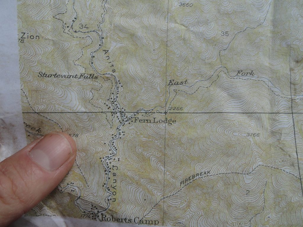
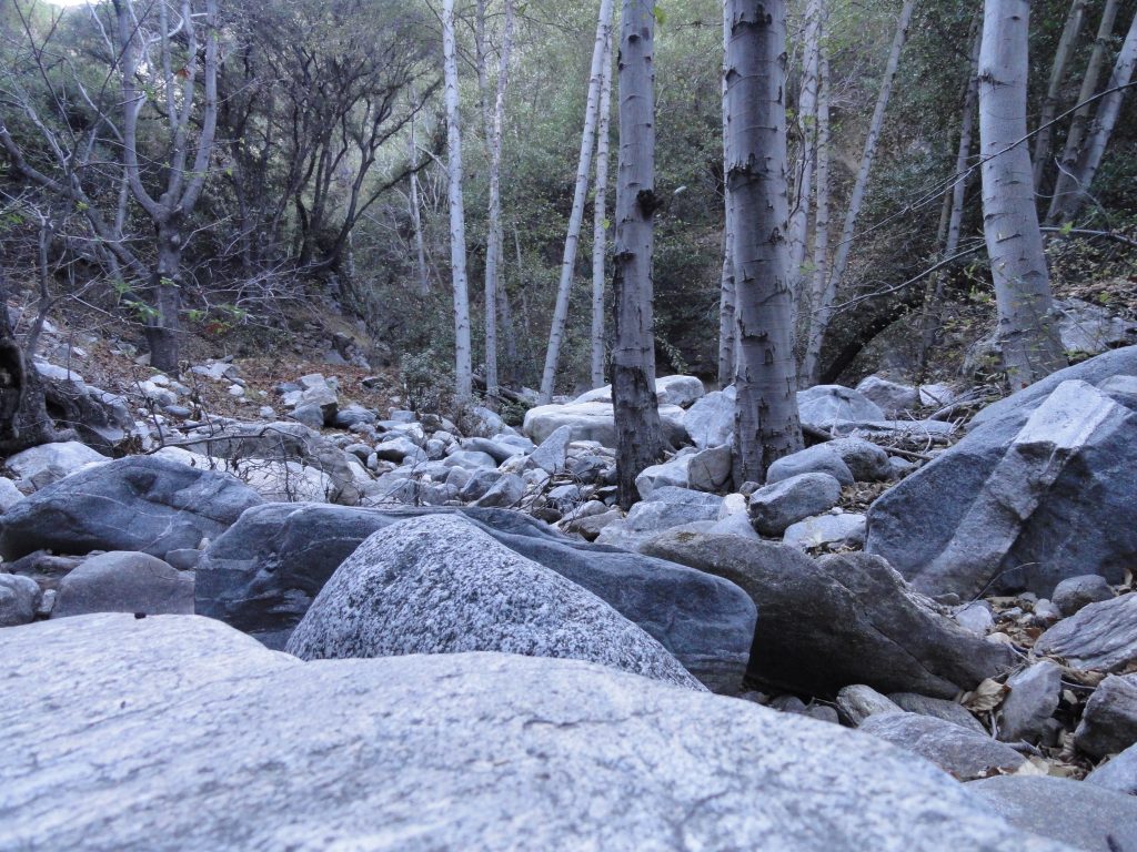
I was poking around up in the Big Santa Anita Canyon’s East Fork the other day.  It was morning and a flat, gray light lay all around me.  Jumping from boulder to boulder in a stream bed of dry leaves and sand.  Completely quiet all around – and cool.   It felt as if this time of year was still holding its’ breath for the storms to blow in and fill our canyons with roiling waters.

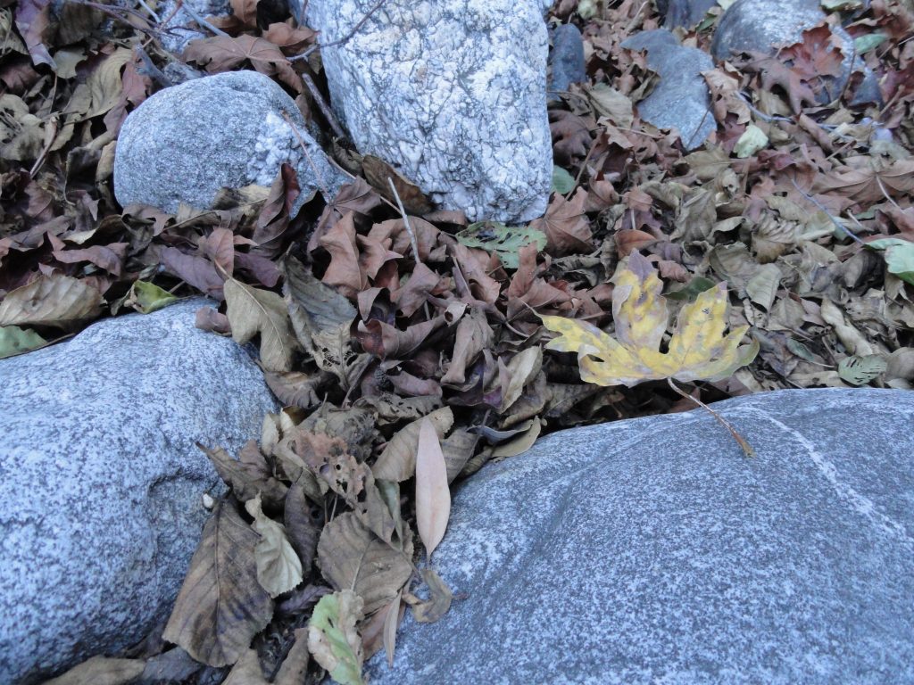
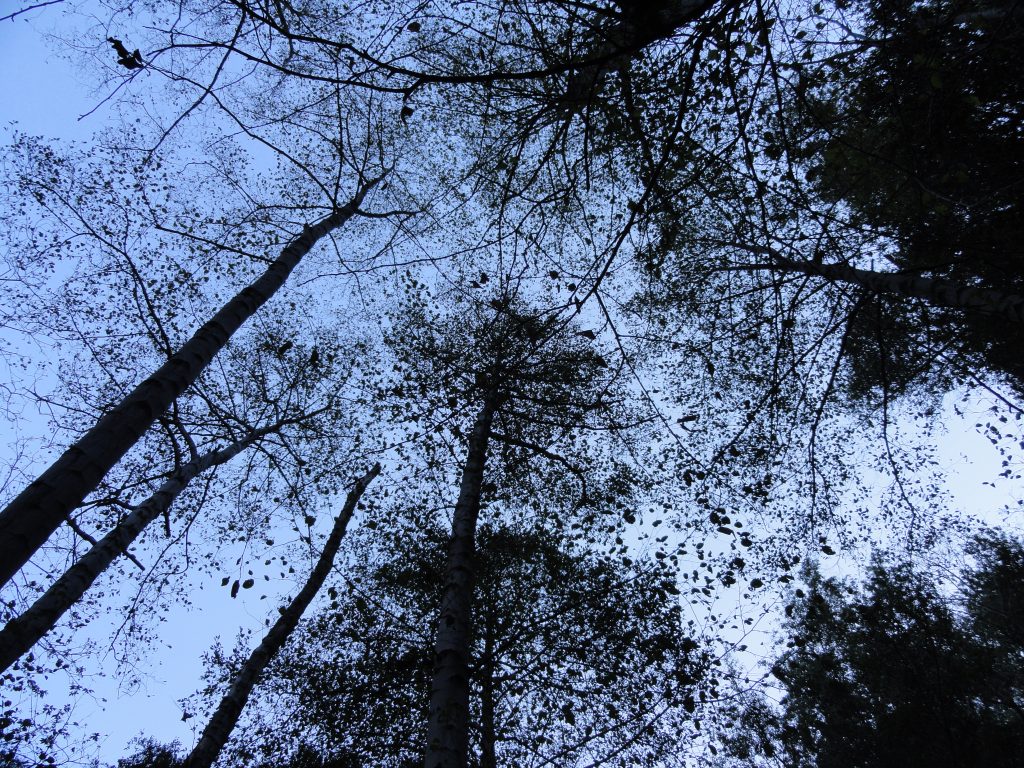
So, I hung out on a smoothy polished boulder about the size of a Volkswagen Beetle and just did nothing.  The more nothing I did, the more that came into view and the more that became audible.  Within a few moments, the soft hush of a down canyon breeze filtered through the boughs of some big cone spruce trees clinging to the steep slope above.  The tangle of leaves, downed trees and rock began to take on increasing detail and clarity.  The subtle variations of color in fallen leaves went from one to over half a dozen shades that my eyes could make out.  In the beginning of my stillness, my mind was doing its’ constant thinking thing with non-stop episodes of images and thoughts in words.  After a little while, the thoughts slowed down and my images were more about where I was and less about where I’d been.  The most significant part of all this is when the perceived – and I mean perceived – duality of I and Thou, me and you, self and scene….. begins to fade.  Being here right in the present for a short time.

Gray morning light on cobbles and dry alder / maple leaves. East Fork, Big Santa Anita Canyon.
Looking up into a canopy of dormant white alders. East Fork, Big Santa Anita Canyon.

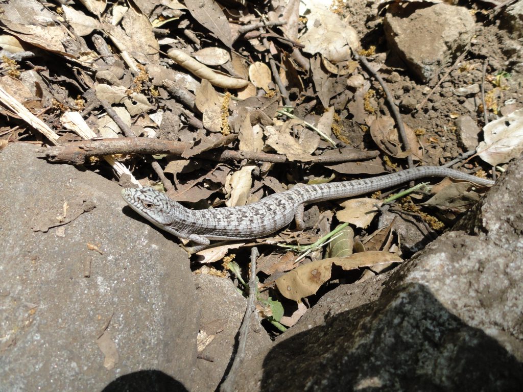
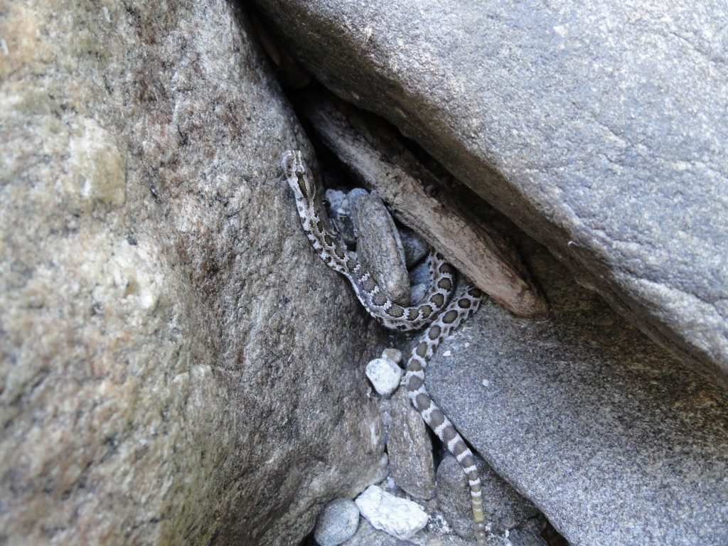
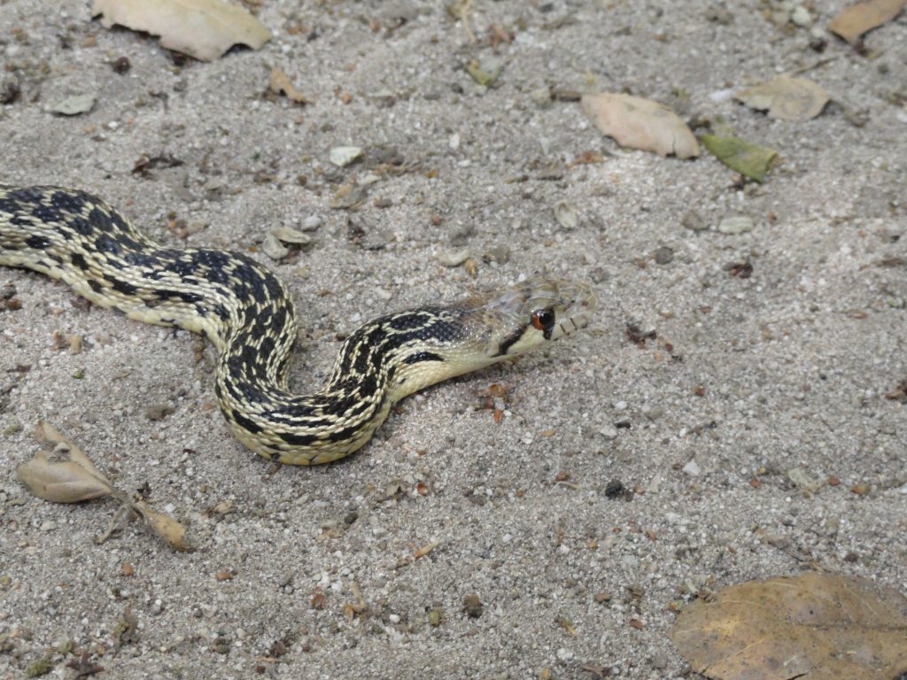
The East Fork is such a wild place.  No check dams here and no maintained trails.  The breezes move up and down canyon just as they have for centuries.  Fish and salamanders linger in the deeper, perennial pools.  Rattlesnakes linger under shady ledges during summery months while deer and mountain lions traverse the higher slopes on ancient paths created by hooves and paws.  The stream dries up in places as fall progresses and then becomes its’ naturally wet and turbulent self once, again.  Over and over.   Every pattern here is in the form of a circle.  One can count on the return of the next season.  This canyon is only what it is and has been.  Just wild and free.

As Summer Heats Ramps Up At Chantry Flats – Watch For Reptiles

Posted on July 11, 2012 – Written by Chris Kasten
A western fence lizard near Slider Rock, Big Santa Anita Canyon.
A young rattlesnake between the boulders. East Fork of Big Santa Anita Canyon.

It’s July and summer temps continue to ramp up into the triple digits in the San Gabriel Valley.    What a great time to head up into the cooling depths of the Big Santa Anita Canyon!  This time of year, it’s often possible to experience temperatures reaching up into the 90′s, especially where you park your car up at Chantry Flats.  Out in the open sun it can feel more like a 100 degrees, especially when you’re out hiking up or down the paved fire road between Chantry Flats and Roberts’ Camp.  The summer sun not only bears down on you from above, but heat then is re-radiated back up off the pavements and light colored expanses of rock along the mountainside.  This is a scene that requires thinking ahead for your next trip out of Chantry Flats.  Bring plenty of water for each person.  Two liters per person is really not too much when it’s hot.  Wear a good sun hat and consider the benefits of applying sunscreen as well.

During the height of the summer sun, the warmest hours are quite often between 12:00 noon and 3:00 p.m.  While the sun’s up high, we seek the welcome of shade and so do the reptiles.  Of the myriad forms of wildlife to be found in the Big Santa Anita Canyon, it’s the reptiles who are in their season between March and November, with the high point of sightings taking place in late June through August.

Because reptiles cannot regulate their body heat, such as humans can, snakes and lizards are utterly dependent on the temperature of the air.  To regulate their internal body temps, snakes and lizards must seek shade during the middle of the day when the sun’s bearing directly down into the canyon.  As the sun’s angle shifts later on in the day, these animals will venture back out from their hiding places.  During summer evenings, it’s not uncommon to see the occasional snake out on a road surface, which still emits stored heat from the baking day.  When traveling back down the Chantry Road on a summer evening, try to slow down so as to avoid running over these defenseless animals.  They’re just trying to seek a little warmth against the cooling night.  As the morning sun begins to make its’ presence, watch for snakes and lizards sunning themselves out in the open as they attempt to warm back up from the evening’s coolness.  This pattern of seeking, avoiding and then seeking heat is an endless pattern in the life of any reptile.

In Big Santa Anita Canyon, most of the species of snakes are non venomous.  Our only venomous snake is the Southern Pacific Diamondback.  Probably one of the most misunderstood creatures of all times, rattlesnakes are by their very nature shy and secretive, avoiding human contact if at all possible.  Rattlesnakes should not be approached or provoked.  Their rattling and coiled stance is a defensive behavior.  If given the chance, any rattlesnake will eventually retreat and seek to create as much distance between itself and humans as possible!   All lizards in the Big Santa Anita are non venomous.

As for snakes and lizards in our canyon, there’s quite a variety.   For more images of these amazing animals, go to http://herp-pix.org/As you hike on any of the trails out of Chantry Flats, it’s quite likely you’ll see lizards of all sizes and coloring, flitting alongside rock faces and down sandy stretches of trail.  Snakes often tend to be a bit more elusive, yet if you’re quiet and keep a constant watch into the shady hollows under brush, trees and rocks, you might just get to see one.   Like all creatures, reptiles have their part to do in the natural landscape.  These creatures feed mainly on insects, small amphibians, rodents and occasionally on one another.  The hiking trails out of Chantry Flats are a fantastic place to see these wonderful creatures.

A Rare Find – Benchmark Found near Chantry Flat

Posted on May 10, 2012 – Written by Chris Kasten

Here’s the benchmark for the corner section that appears just within feet of the old Monrovia Peak Trail. This corner section benchmark (monument) is attached to the end of a pipe.  Richard Loe and I found this 1927 benchmark entirely by accident, when sunlight happened to be shining on it at just the right moment!

Here’s an old topographic map of the Big Santa Anita Canyon showing lots and lots of cabins that were still here before the great flood of 1938 and the Monrovia Peak Fire of 1953. Where those lines cross, to the upper right of my thumb, is the range and township monument (benchmark) that Richard and I found. Look how close it is to the old Monrovia Peak Trail heading up the East Fork tributary canyon.

A rare find – 1927 benchmark found near Chantry Flat.  Check out what was found while traveling up the old East Fork Trail, which once ran from Fern Lodge in the Big Santa Anita Canyon to Spring Camp near Monrovia Peak.   This benchmark is dated 1927.  While x-country hiking with Richard Loe, we found this oxidized brass range and township marker located just below the old East Fork trail about 80-100′ up from the stream bed.    If you look closely, it’s possible to see that it was installed by the U.S. General Land Office surveyors.  See the location of this marker on the old topographic map, lower image.  If the light cast on the mountainside hadn’t been just right…. and if I hadn’t looked in just the exact location at that moment, it would have been quite likely we would have just hiked right on by!  It’s amazing to me that rockslides and  the movement of soils over the last 85 years hadn’t just buried this cartographer’s treasure from the past.  Upon closer inspection, it was discovered that the benchmark “cap” was affixed to a galvanized steel pipe driven into the mountainside.  There are undoubtedly other markers to be found by those hiking cross-country in the front-country canyons of the San Gabriel mountains.