Sturtevant Falls Trail Hike – A Good Time Time to Be There

Posted on January 17, 2016 – Written by Chris Kasten

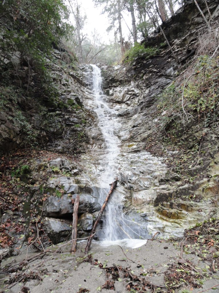
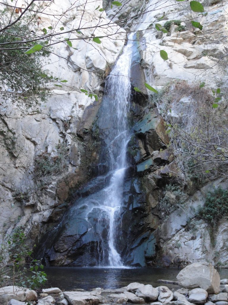
55′ high Sturtevant Falls as it appears from the Upper Falls Trail,  just days after the first significant storm of the new year. We received 6.61″ of rain at our gauge just downstream from the falls in the Fern Lodge area of Big Santa Anita Canyon. This is hopefully just the beginning in a series of winter storms in our current El Nino weather situation!

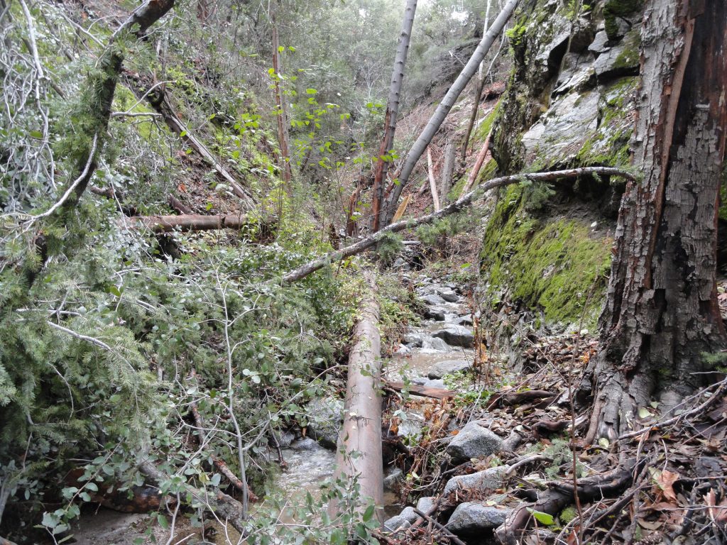
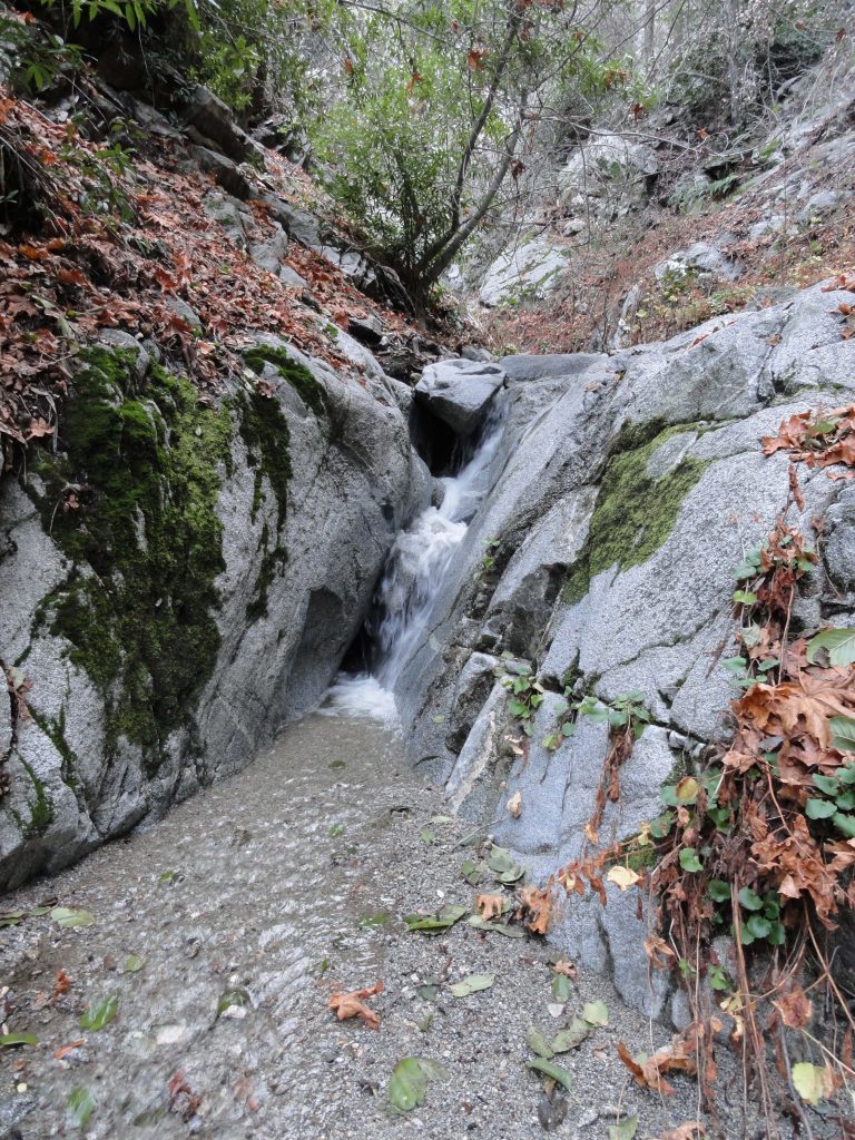
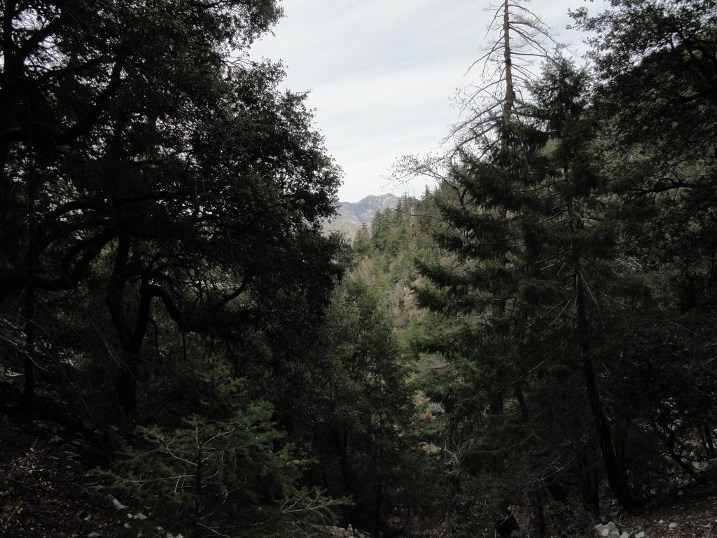
Next time you’re considering spending a little time in the front-country of the Angeles National Forest, the Sturtevant Falls trail hike is a good one, especially since our recent rains earlier this month.  Over 6 1/2″ of rain fell throughout the first week of the new year in Big Santa Anita Canyon.  Ferns and mosses have sprung back to life, creating varied depths and textures of green across cliffy faces and hillsides.  The song of the stream has come back, too.   As you begin your descent down into the canyon, the gentle rush of the stream can be made out if it’s still and quiet, such as in the early evening.  Owls and stream song mix with the cool, soft canyon breezes that make their way amongst the thickets of white alders and overarching oaks.  The mild and sweet fragrance of flowering laurel bay is just around the next bend, most likely in just the next couple of weeks.

When you get up next to the stream, say somewhere between Roberts’ Camp and Fern Lodge, take a moment to notice how for the first time in several years, the stream finally received enough “push” to clean out some of that dark black organic mat that’s been concealing the light colored gravel and rocks.  Such a great, hopeful thing.  If we get into a pattern of storms with this forecasted El Nino, then watch more and more of the dark mat wash away, exposing ever more bright sand and banded rocks.  Fallen limbs and tree trunks will be washed out of the way.  Pools will deepen and the sounds will once, again, change; reverberating between the rocks and cliffs of not only the Big Santa Anita, but the Winter Creek, too.    The canyon wrens have already begun their bright chirping songs, mixing amongst the watery spray of our tumbling mountain brook.  California newts are making their eternal slow crawl up and away from the stream, often to be found along the Gabrielino and Lower Winter Creek trails.   Seems like a good time for me, too,  to make my slow crawl up along the streams of our beautiful canyons.

El Nino, Big Santa Anita Canyon, Chantry Flats back in 2005

Posted on November 1, 2015 – Written by Chris Kasten

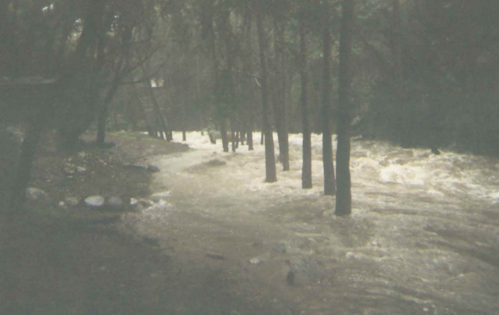
Here are some photos taken the day I rode my bike up to Chantry Flats to see how high the stream had become.  Photos taken during El Nino, Big Santa Anita Canyon, Chantry Flats back in 2005.  It was a huge El Nino year for Big Santa Anita Canyon and the rest of southern California.  At Sturtevant’s Camp we received over 89 + inches of rain that season.  Our  rain gauge actually overflowed during one of the storms, so the figure of 89 inches is only a “known.”   That gauge, up at Sturtevant Camp’s heliport, holds up to 23″ of water between readings!  We’ll never know how much really fell.

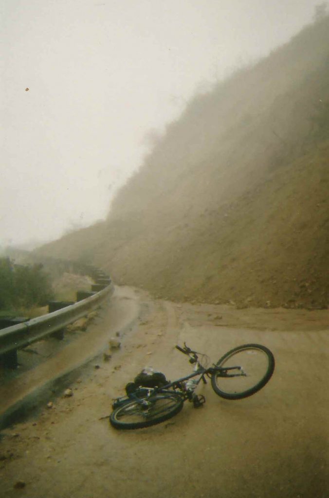
That year we lost the Chantry Road for over 10 months due to a massive slide above Arcadia.  We had an amazing amount of water pour down over the entire west coast of Southern California.  It’s been a decade since this kind of winter has been experienced!  Who knows just what’s in store for the Big Santa Anita Canyon and the rest of the San Gabriel mountains.

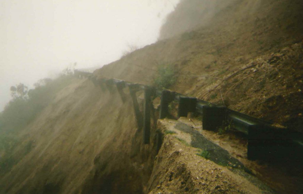
This photo shows the guard rail dangling out over nothing on the Chantry Road just down from the Big Santa Anita dam, Arcadia section.  January 10, 2005. The mountainside was so saturated with water, it eventually slumped down onto the road in just a few hours time.

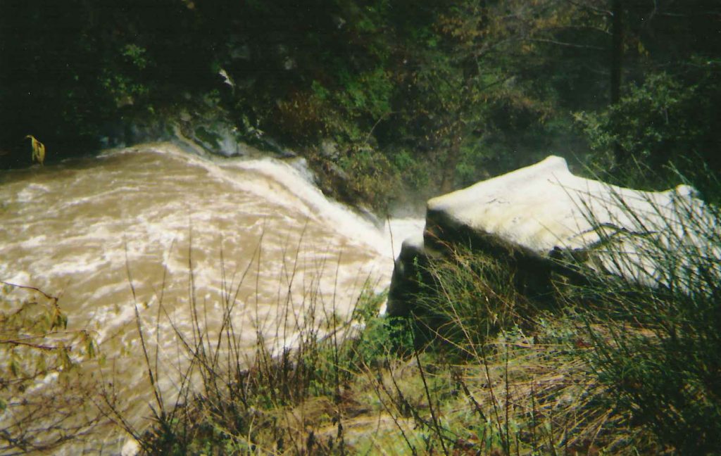
Water pours over check dam adjacent to cabin #23, Big Santa Anita Canyon. This is the first dam you pass by when heading up canyon from Roberts’ Camp. Many of the check dams are over 50′ wide, such as this one, to give you some perspective on the scale of this scene.

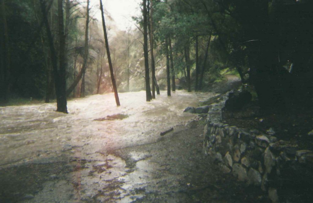
Looking downstream at water before it pours off a check dam in Big Santa Anita Canyon. That’s the retaining wall under cabin #26 on right side of photo. This was about as far up the canyon as I was able to go that day. January 10, 2005.

Looking upstream from base of cabin #25. That’s cabin #26 upstream on the left. Amazingly, that grouping of white alders hold their own in the swift current. January 10, 2005.

The road has washed out while I was up photographing the high water on January 10, 2005. That’s my bicycle in the foreground. Fortunately, I had left my truck at a friend’s house in Arcadia at the base of the road! Vehicles belonging to Forest Service employees and others were stranded up at Chantry for over 10 months before the road was repaired.

Chantry Flat Map … How To Navigate It

Posted on August 19, 2015 – Written by Chris Kasten

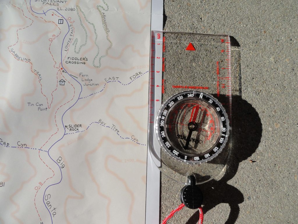
If you’ve decided to pack a Chantry Flat Map, it’s important to have an orienteering compass along for your trip.  One of the key advantages of carrying a compass is the ability to orient your map to the landscape and

Align orienteering compass to map’s neat line for getting your map synchronized with the land. This placement of getting the map “right” with the earth is the first step in seeing where you are in the greater picture of things.

to ultimately discover just where you happen to be within the confines  (neat lines) of the map’s image.  Knowing where you are on any map while out hiking or biking adds greatly to your confidence in traveling the trails between Chantry Flats and Mt. Wilson. The orienteering compass you see here is inexpensive and requires no batteries.  If you travel with GPS, bringing along a compass, as well, might be a good back-up.  If you travel with your smart phone,  utilizing the north arrow function will suffice as well.  Just make sure that you line up the edge of your phone with the map’s north-south neat line as shown in the image to the left.  Rotate the map & phone together to “sync” your map to the landscape.  If you decide to buy a compass, they are available at most outdoor retailers, such as REI and Sport Chalet.

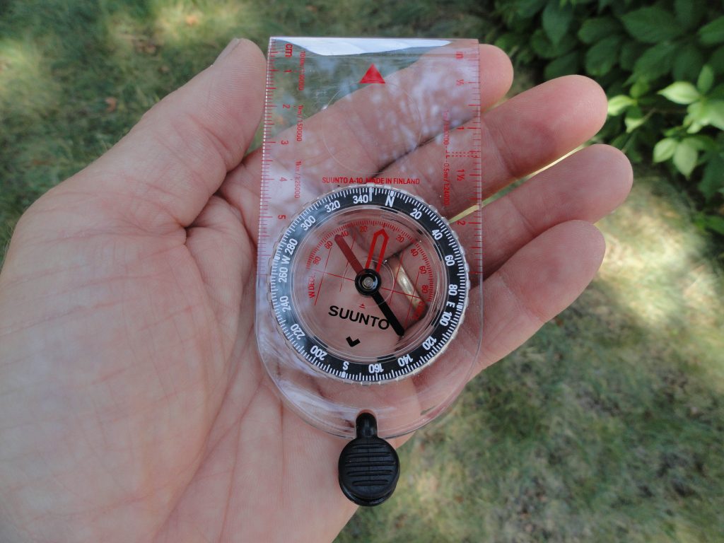
This orienteering compass is an essential item to pack when out hiking and biking on our local trails. It is inexpensive (approx. $16.00) and never needs batteries. Use it to orient your map to the lay of the land, as well as locating where you are within the map’s image

The key challenge that most travelers have in using an orienteering compass is dealing with the concept of declination.  Declination is the magnetic, angular difference between the earth’s geographic north pole and the “magnetic” pole, located well north of Hudson’s Bay, Canada.  The compass needle naturally points toward the magnetic pole.  To get your map to synchronize with the earth, the north-south edge of your map has to be parallel with the north to south lines of longitude on the earth’s sphere.  So, how do you make this happen?

For areas in the front-country of the San Gabriel mountains, specifically Chantry Flats, there’s about 13 degrees of difference between the geographic north pole and the magnetic pole.  Looking at the detail of the compass dial photo, you’ll see that instead of 360 degrees being lined up with the index mark (North), 13 degrees of declination have been subtracted to equal just about 347 degrees, instead.  This is an easterly correction that works for all of California, with an increase as you head north, say in the Sierra Nevada range.  Just twist the dial to the right to make your adjustment. Next, slowly turn your compass, keeping it level as you can, until the red end (magnetized) of the needle is

Dial on clear baseplate. Directional degrees are depicted in white numbers on black background of outer lying dial. Declination in degrees, east and west, appear on red scale. Dark red half of needle is magnetized, pointing toward magnetic north pole. www.CanyonCartography.com

superimposed over the red outline within the dial’s face.  Once this is done, the edges of the transparent baseplate are now lined up with the north-south lines of longitude.  The top of your compass is facing north.  Now take your map and turn it to the point where the map’s edge, left or right side, are parallel with the compass baseplate.  Another photo shows you what this looks like.  Voila!  Your map is now oriented to the actual mountains and canyons of Chantry Flats and Mt. Wilson.  Often, just doing this, will make a huge difference in determining just where you are on the map. In the next article, we’ll go over how to sight on an object, such as a mountain top, and determine just where you happen to be on the map.

Compensating declination for true north is accomplished by aligning the compass needle with the red outline inside the dial. Notice how needle is directly over this outline. Good!

Native Wildflowers of the San Gabriel Mountains

Posted on June 17, 2015 – Written by Chris Kasten
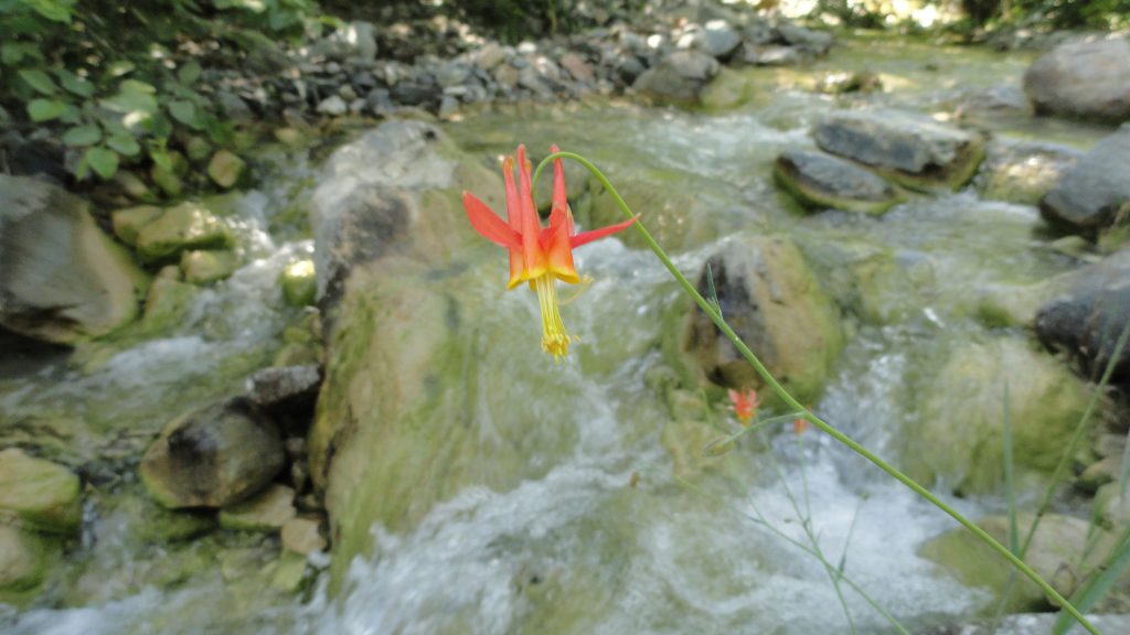
The following photos were recently taken while out hiking in three different canyons on the Angeles National Forest.  These three native wildflowers of the San Gabriel mountains are in full bloom as of this writing.  The first image, Crimson Columbine Aquilegia formosa, was captured along the East Fork of the San Gabriel River, just downstream from the confluence of Mine Gulch, Vincent Gulch and the Prairie Fork.  Its’ bright red and yellow created a vivid contrast against the thickets of white alder that line the stream course.

A solitary Crimson Columbine flower, Aquilegia formosa, leans out over the upper headwaters of the East Fork of the San Gabriel River. Photo was taken just downstream from Mine Gulch campsite, Sheep Mountain Wilderness. June, 2015

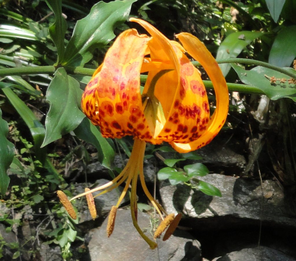
The second image, Humboldt’s Lily Lilium humboldtii, was taken in the Big Santa Anita Canyon between Fern Lodge Junction and Roberts’ Camp.  These lantern-like beauties favor June as their time to make their brief appearance.

The purplish leopard spots against an orange background make for this unforgettable sight. The Humboldt Lily (Lilium humboldtii) growing here was found in Big Santa Anita Canyon, just upstream from Roberts’ Camp at the confluence of the main canyon and Winter Creek.

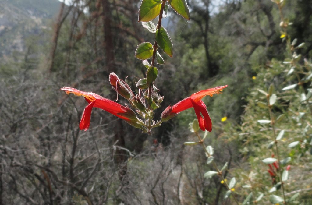
This final image, Heart Leaved Penstemon Keckiella cordifolia, was taken alongside the Gabrielino Trail in the Arroyo Seco, between Switzer’s Campground and the confluence of Bear Canyon.  This close-up view is taken amongst chaparral plants on warm southwest facing slopes.

This symmetrical floral scene caught my eye while heading down the Arroyo Seco. Heart Leaved penstemon (Keckiella cordifolia) is a showy climbing vine that can be found throughout much of the chaparral plant community of the San Gabriel mountains.

Chantry Flats Spring Wildflowers are out Early

Posted on May 11, 2015 – Written by Chris Kasten

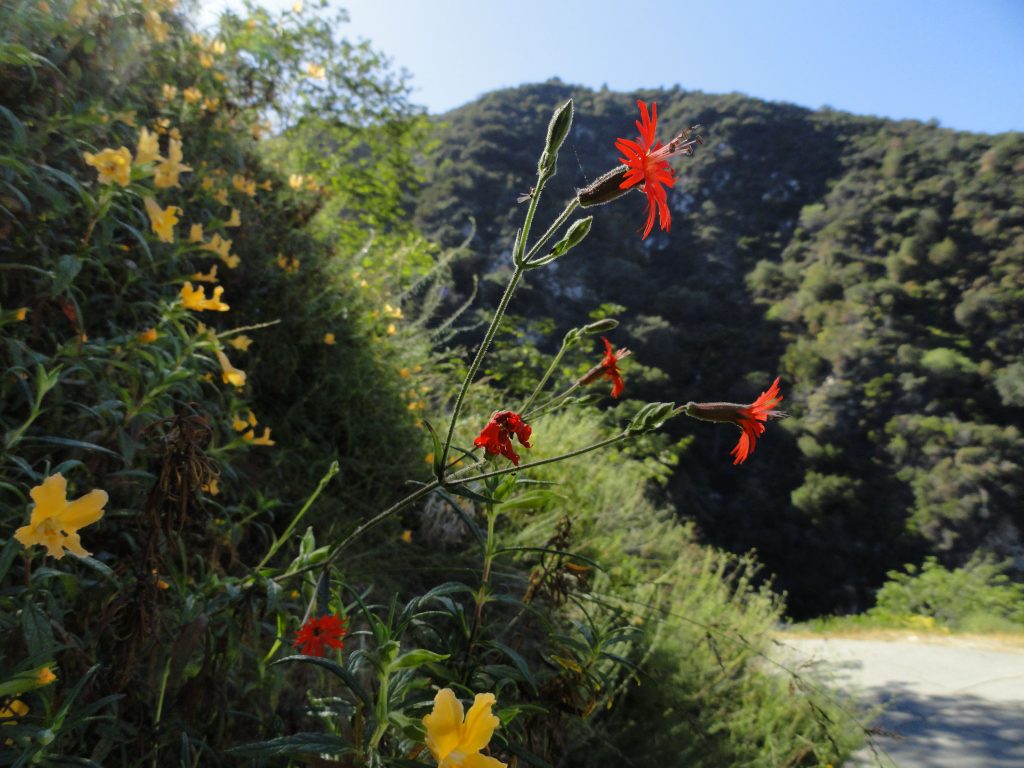
Sticky leaf monkey flower and indian pink grace a slope in San Olene Canyon near Chantry Flats, Big Santa Anita Canyon.

As the Spring days lengthen, look for Sticky Leaf Monkey Flower (mimulus aurantiacus) & Indian Pink (silene laciniata) in full bloom on your next hike out of Chantry Flats.  Despite our lack of winter rains and snow, the grass covered hillsides of our front-country canyons still remain mostly green.  It’s as if many of our chaparral flowering plants have a sense that if they’re going to bloom at all, then they need to do it now.  The flowery scene shown here would typically take place during the warmer summer season, almost a couple of months out from May.

Both the Upper Winter Creek and Gabrielino Trails provide the best viewing of wildflowers.  If you take the Upper Winter Creek Trail, your best opportunities for seeing flowering plants will be between the Chantry Flats picnic area and the high point of the trail where it begins to descend toward Hoegees Campground.  On the Gabrielino, most of your opportunities will be between Fern Lodge Junction and Cascade picnic area.

Whichever way you go, the ideal locations will likely be out in the direct sun or semi-shade.  Besides finding the above pictured flowers, you’ll likely see Ceanothus, commonly known  as buckbrush or wild lilac with its’ clusters of tiny, fragrant, lavender flowers.  Also, look for Phacelia, with beautiful purple, trumpet-shaped flowers.  Vines of wild cucumber along with a myriad of small, white flowers (non-edible) can be seen tangled throughout lots of the shrubs this time of year.  The spiked seed pods are bright green and soft in the Spring.  A great website to visit for details of hundreds of plants, including photos of wildflowers in the San Gabriel Mountains is:  www.calflora.net.

This is a really good time to be out hiking the front-country.   The temps are still mild and a number of canyons still have some flowing water.

High and Dry on Beautiful Monrovia Peak

Posted on February 27, 2015 – Written by Chris Kasten

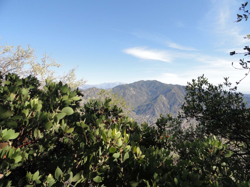
View of Monrovia Peak from Manzanita Ridge just below the Mt. Wilson Toll Road.

Any way you go, Monrovia Peak makes for a long and unforgettable hike.  It’s a bright, clear day in mid February as I start out on the Lower Clamshell truck trail’s eastern terminus off Ridgeside Drive in Monrovia.  We’re in our 4th year of drought and not much of winter has come.  I’m loaded up with three liters of water, lots of food and my wife’s trekking poles.  Most of the hike is on the 7.5′ Azusa quadrangle and just a sliver is covered by the Mt. Wilson map to the west.  I’m old fashioned, so, of course, I’ve brought these two paper maps and my orienteering compass.  For me, this is the way to navigate, to make decisions.
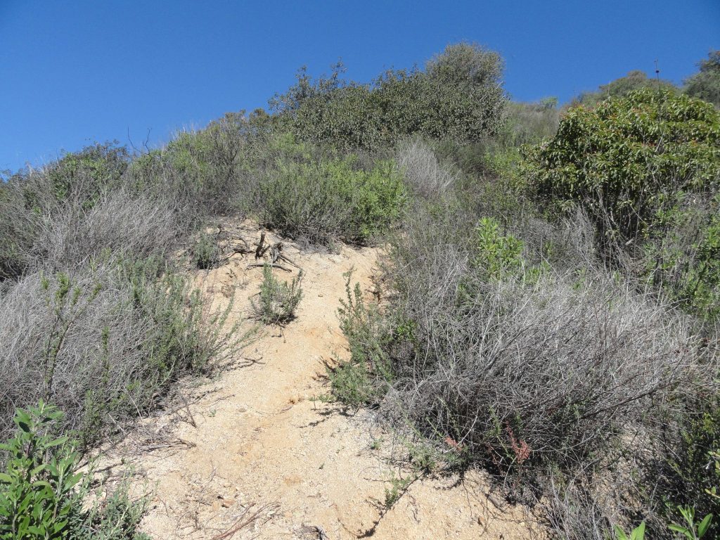
The route taken up the brushy ridge separating Clamshell Canyon from Ruby Canyon.

Walking on the fire road is the easy part, beginning the climb up the ridge dividing Clamshell and Ruby Canyons is the tough part.  From a high point on the fire road, where it intersects the ridge, I turned right (north) and began ascending the shrubby ridge in steep pitches.  The high-rises in L.A.’s financial district were in sharp relief, the warm air being so crystal clear.  The trekking poles that Joanie encouraged me to use soon had become essential due to the steepness.    Sweat was pouring off me as if it were summer and the sunscreen had already managed to sting my eyes.  It seemed that I’d plod up the clay-like earth, pocked with gullies for a few minutes and then do that lean on the poles, staring at the ground while letting my heart slow down.  This pattern would repeat and repeat, again and again, throughout the day.  The pungent scent of black sage was all around.  It’s funny how olfactory memories are in some way the most salient reminders of places from our past.  I kept reliving a hike behind the Santa Fe Dam and up the San Gabriel River bed past the 210 Freeway some years ago which made me think of the time we lost our dear friend George Geer.  Hikes up the switchbacks of the abandoned Burma Road made their return, too.  Following and repairing the old crank telephone line up and over the ridge between the Winter Creek and Big Santa Anita Canyon.  Different hikes with a common scent.  The views out and over the valley began to become more and more expansive.  Eventually, it was possible to see the ocean along with the freighters that were anchored off Long Beach. Restless freighters, waiting for a berth.   And so it was, the pattern had now become plodding a short distance and resting amongst black sage, white sage, ceanothus (wild lilac), sumac, buckwheat, mountain mahogany, chamise and occasionally manzanita all intermixed with the myriad of memories and thoughts that are ever-present when we’re by ourselves.   The constant views all around and down into the San Gabriel Valley kept happening amongst the thoughts from within.
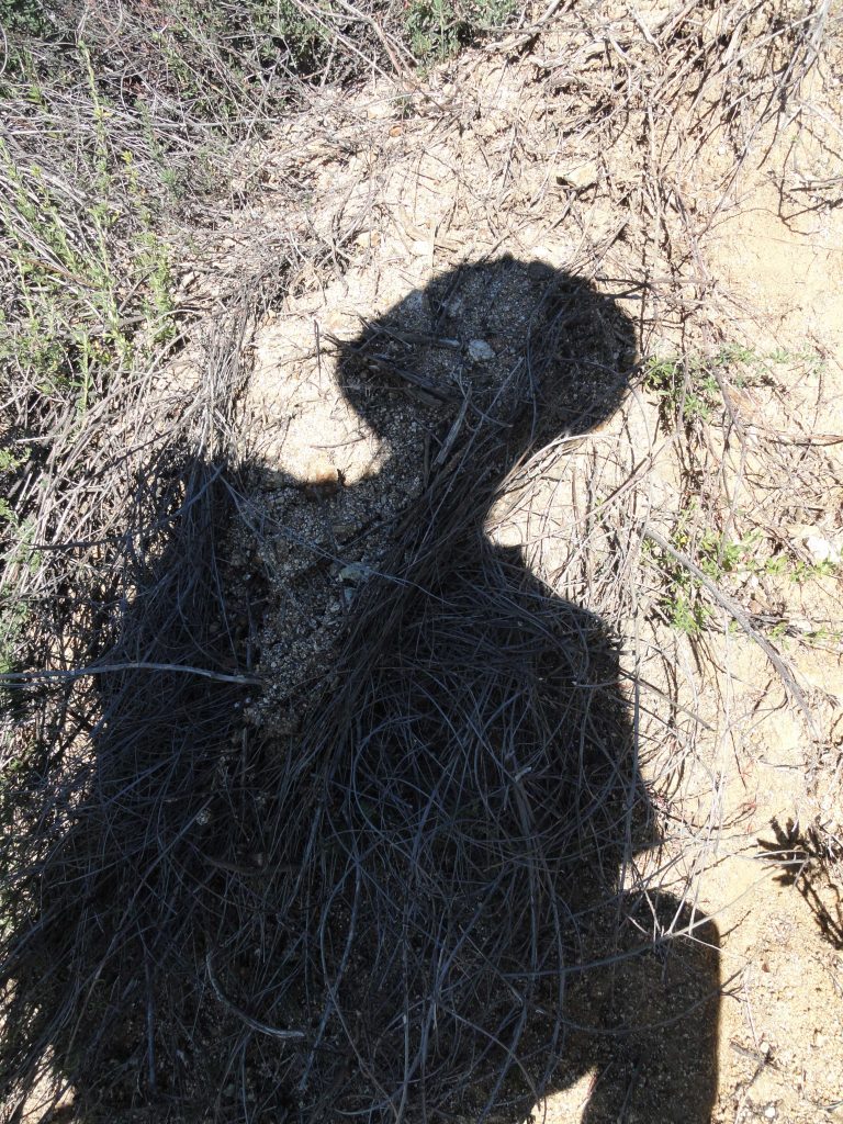
“Selfy” in shadow form while ascending ridge from Monrovia.

The ridge soon gave out to a steep scramble up south-facing mountainsides.  The route was little more than a wiggly trace between the brush.   This trace is actually visible from the freeway.   The hoof marks of deer were imprinted in the dried earth.  Hawks, predominately red tails, floated on the warm updrafts.  They seemed to slip and slide effortlessly high above the steep, chaparral clad slopes, searching and searching in some kind of an eternal daydream. I thought just how much the landscape seems unknown to me now since starting out from this same point back in 1985.    Hard to believe it’s been about 30 years since last trying Monrovia Peak, coming within about a half mile of the summit and turning around.  It was while on Christmas break from Humboldt State that my mom drove me up to the start of today’s hike.   That day was filled with miles of walking ridge tops and fire roads before finally arriving at Rankin Peak under gray December skies.   Monrovia Peak loomed just a short distance to the north and east, not far off…  and, yet, it just wasn’t going to happen that day.   Thoughts of Mom, Dad and Nick all swirled around my head as the slope finally gave way to a ridge top, the southern end of the Clamshell.  Several ridges on my left and right came together, culminating in a view of views.  And on I waded through tall grasses and the ever-present chaparral.
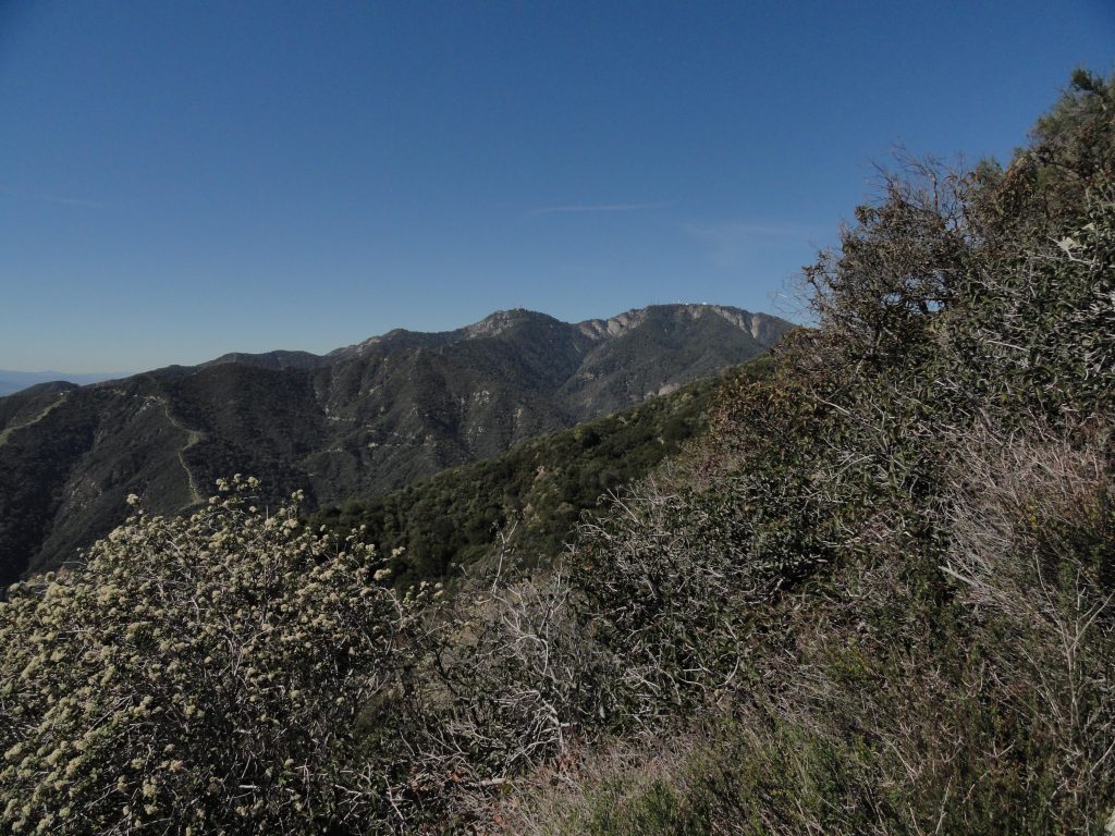
Mount Harvard and Mount Wilson as seen from Clamshell Ridge.
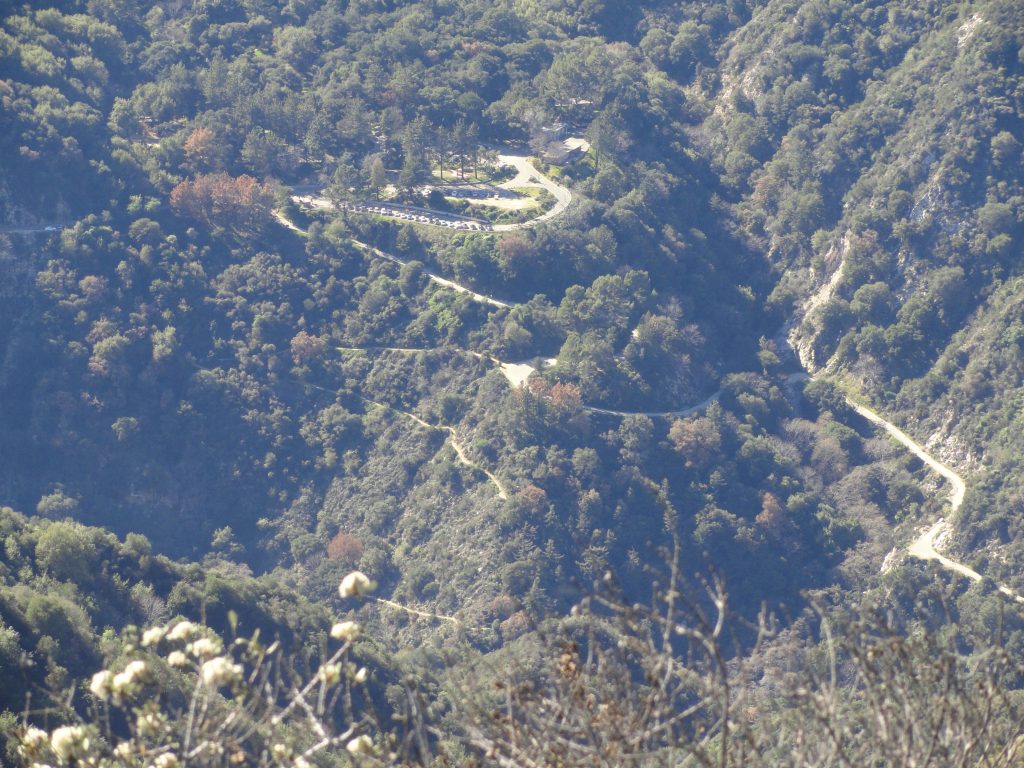
Chantry Flat along with First Water Trail and road down to Roberts’ Camp as seen from Clamshell Ridge.

The end of the Upper Clamshell truck trail was now visible below the ridge top.  Grass grew in the center of its’ light colored trace.  A lonesomeness seemed to emanate from its’ dead ended spur, high across from Chantry Flats.  Surely, deer, black bear, coyotes, mountain lions and perhaps even the occasional mountain biker had been making use of what was seldom maintained for trucks.  The view to the west encompasses the San Olene truck trail, Chantry Flat, Mounts Harvard and Wilson.  The Pacific was gleaming in the mid-day sun, while the Palos Verdes peninsula seemed to divide two oceanic worlds.   A subtle, yet substantial shift between the ’85 trip and now had taken place.  Instead of following the upper truck trail across the east wall of the Big Santa Anita into the East Fork toward Spring Camp, I was following the ridge top, trying to stay true to the divide.  Following the ridge was at times just about impossible to follow due to the thick brush.  The ups and downs took their toll.  Even though this route was slower than walking a fire road, it carried with it the alpine feeling of being on top of something that didn’t easily give itself away.  Wild and rough.  And it came with a surprise.  Clamshell Peak. Clamshell Ridge is the watershed divide between Big Santa Anita Canyon to the west and Monrovia Canyon to the east.  The ridge pretty much trends north and south until reaching Clamshell Peak, a high point where the ridge begins to trend eastward toward Rankin and Monrovia Peaks.  If you travel the truck trail, you’ll miss this peak.  Clamshell appears on the topo map as being just a bit higher than 4,360′ in elevation.  Looking out from this brushy mountain, the final undulating ridge out toward Monrovia Peak presented itself.  There is an impressive view straight into the entire Winter Creek from up here as well.   I had entirely missed this place the first time around.
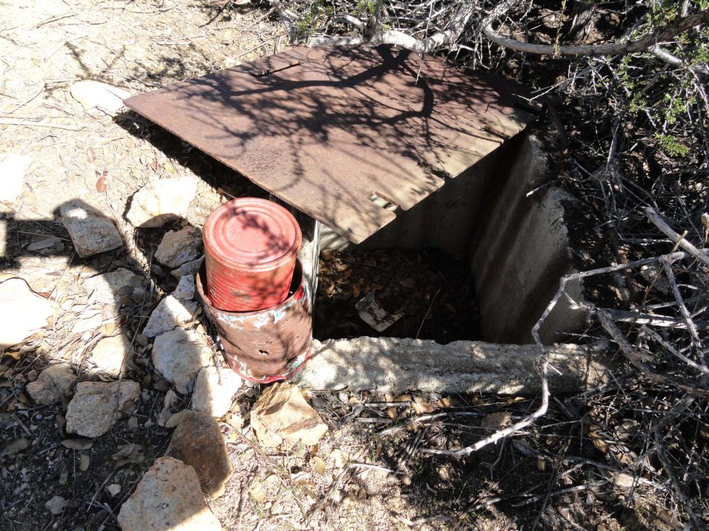
Summit register and vault box on Clamshell Peak. The register is stored inside box.

What really caught my attention was what appeared to be a U.S. Forest Service vault box of some sort on the summit.  Dragging the rusted diamond plate away from the opening, there appeared to be two red painted cans nested within one another.  An old school summit register wrapped in ziplock bags!  In the shade of a manzanita bush, I had thumbed through two steno notepads.  The one marked “old book” had signatures of visitors going back to 1987.   A signature from November of 1990 stunned me.  It was my late brother Nick’s.  I did not remember ever hearing him tell me of his visit here.  Back then, he would have been about 27 years old, in his prime and all over the San Gabriels.  What route he’d taken to get here I’ll not know in this life.   The route now shifted eastward and steeply down to the fire road.  So, for the rest of the day, he and I hiked together, again, through the trees, then up and over more miles of ridge tops.   He was young, healthy and relaxed.  I talked and he listened while the sunlight had shifted a bit.  Walking much of this old firebreak had become easier on my head although my legs seemed to have less and less in them.  We came to a small clearing at the base of some mammoth Big Cone Spruce and sat down in the pool of gold light, the kind that appears later in the afternoon.  I had ran through two of the three Nalgene bottles by this point and had a little snack.  The thoughts had turned toward Rankin Peak and I kept going back, back, back through the years.   That’s what we do, I suppose, in our mid years.   I would not be alone for the rest of the hike.
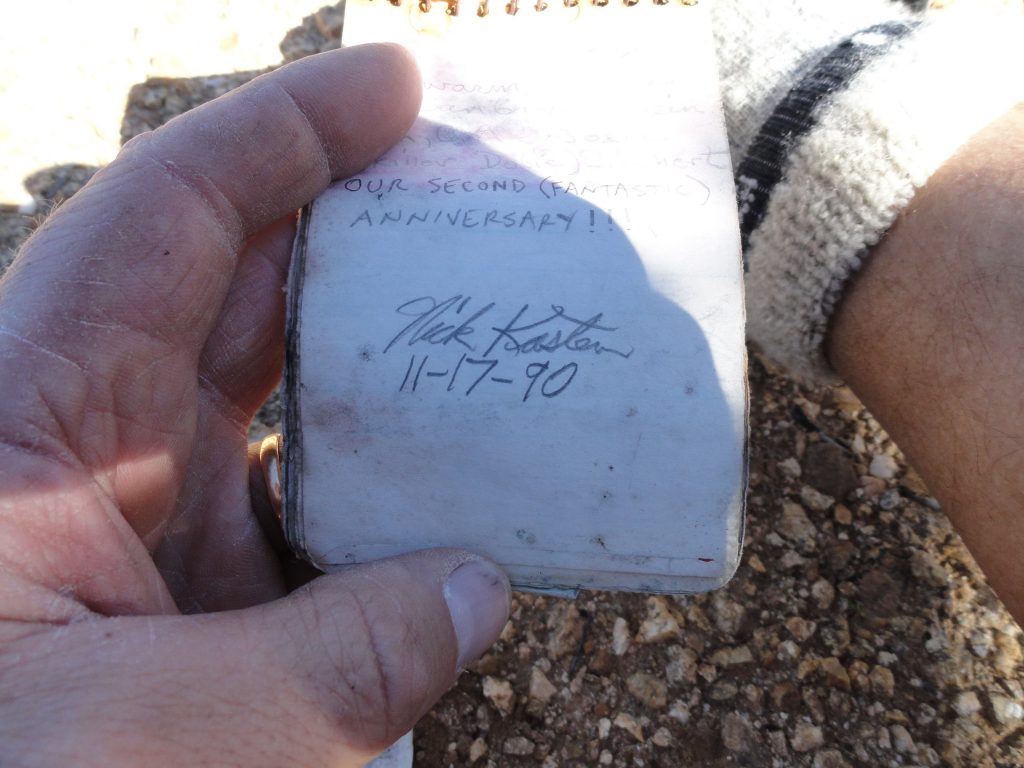
My brother’s signature found in summit register on Clamshell Peak. Nick Kasten lived from 1963 to 2014.

Eventually passing a point on the ridge that appears as “Mack” 4,364′ and paralleling the fire road, the final pitch to Rankin Peak drew near.  It was all so close visually, yet closing the gap seemed never-ending.  I’m always out hiking, like always…. yet, today it was like this was the first time ever being out in the mountains.   That first great climb out of Monrovia in the warm sunlight must have really taken its’ toll on me…  On I walked through grasses that had already grown blonde in the dry winter days.  The memory of how that ridge appeared from Sturtevant Camp’s heliport was playing in my mind.   I had known the changing colors and its’ unmistakable silhouette as part of all that encompassed and framed our existence during those years in the upper Big Santa Anita.   Being part of that scene now was like being in two places at once, looking back at myself from a time gone by.
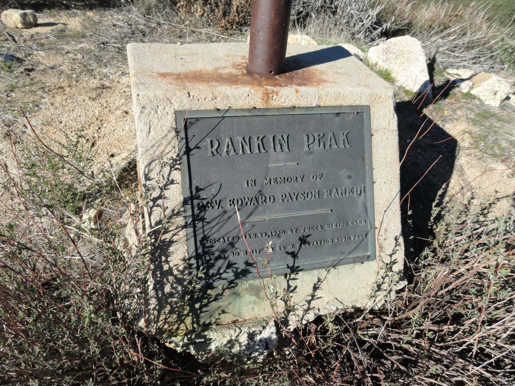
The old flagpole footing with plaque on summit of Rankin Peak. Placed here by the Yucca Hiking Club in the 1930′s.

Arriving at Rankin Peak looked nothing like I had remembered it.  There were fewer trees than my mind had recollected.  Low, scraggly brush crowned the summit and the remnant flagpole was low and bent way over.  Two monuments had been placed here commemorating Reverend Rankin.  The Yucca Hiking Club had placed the brass plaque and white marble marker here back in the 1930′s.    This was Reverend Rankin’s hiking club that had developed the memorial.  Will Thrall, protector and scholar of the San Gabriels, editor of Trails Magazine, a periodical for people hiking our local trails back in the 1920′s and 30′s, routinely included articles from the Yucca Hiking Club out of Monrovia.   Seeing places like this and the need for immortalizing memory brings to mind just how much we all need the mountains and each other.  Some things will never change.
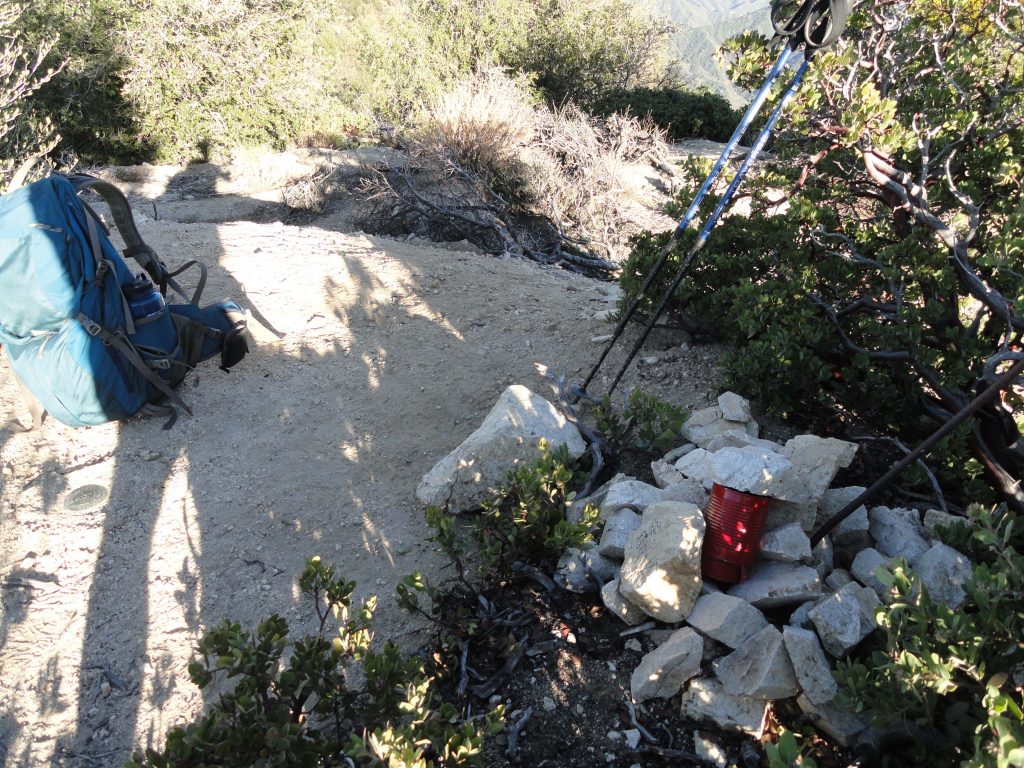
Very top of Monrovia Peak. Note the benchmark adjacent to my pack. The red can is the summit register.
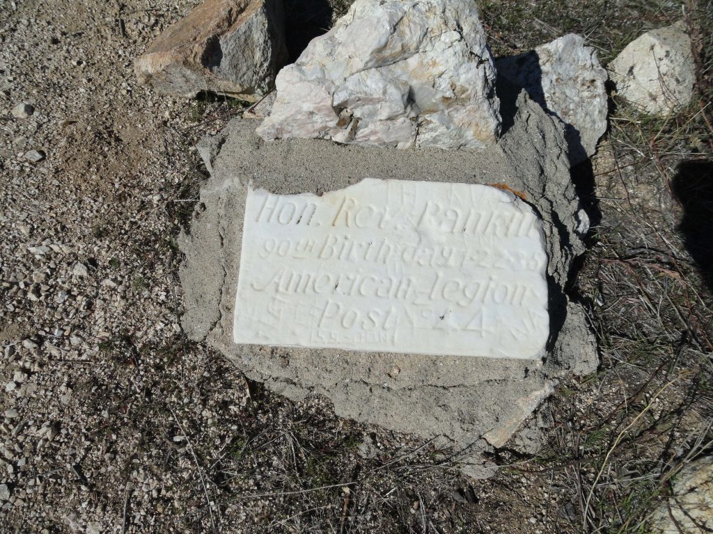
Old tombstone style marker on peak commemorating Reverend Rankin’s 90th birthday.

It was here where I turned around all those years ago.  Not this time.  I had to finish this thing once and for all.  And on I went.  There’s the descent, then a climb up an unnamed bump, followed by another descent to a saddle which is then followed by a final and steep climb to Monrovia Peak.  Finally at the top of Monrovia Peak’s 5,409′ summit.  Whew… The summit is small, like 20′ across or so, and is basically a low bump or mound above a circular track most likely created by a bulldozer many years ago.  I suppose the firebreak builders didn’t want to disturb the summit benchmark and I’m glad they didn’t.  I sat down between a small manzanita and mountain mahogany bush and, of course, went through the summit register.  There had actually been a family of three up there earlier that same day!   The sun had fallen even lower now, the shadows lengthening across the canyons.  It was time to take another good look all around.  Red Box saddle at the upper end of the West Fork of the San Gabriel River was visible in the west.  The long rambling ridge of Mounts Pacifico and Gleason framed the north horizon out toward the desert.  Devil’s Canyon and Bear Creek in the San Gabriel Wilderness filled in the scene toward the northeast, while Mounts Williamson, Throop, Baden-Powell, Pine, Dawson and finally Baldy filled the skyline toward the east high country.   And way off to the east and south, San Gorgonio, San Jacinto and Saddleback  poked up through the fine marine haze.  Not a finer view could I have expected to have had anywhere.  One more look around and the descent began.  I followed an old and very steep, rutted firebreak down toward where the Edison high-tension power lines cross over the Rincon – Red Box fire road toward the north east of the summit.   Lonesome, shaded country.   After about a half hour, I was walking down fire roads that lead toward Monrovia Canyon Park.  It’s about 11 miles of fire roads down to where I’d left the car earlier that day. The key to getting back down to Monrovia and not San Gabriel Canyon or even Duarte, is to follow the Rincon – Red Box road east to your first option on the right, which appears on the topo map as the Upper Clamshell truck trail.  Passing through a gate, take this road down through  Cold Springs Canyon traveling underneath the Edison power lines.  You’ll stay on this road for quite awhile until finally arriving at White Saddle.  At the saddle, take another right, bearing down into Saw Pit Canyon.  There’s a metal sign at this critical junction which indicates that you’ve still got another 4.8 miles to go…    By now I was walking with moonlight as well as the light coming up from the city.  Often it was possible to not have the flashlight on, unless I was under the cover of trees.  Mile after mile I hummed little songs and songs blessing  those who I had known over the years.
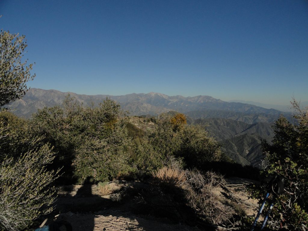
Looking east toward Mt. Baldy from Monrovia Peak’s summit.

Dropping into Deer Park, while coming around a switchback, the sound of wind could be heard.  No, that wasn’t wind, it was water!    I had a Life Straw for drinking untreated water.  Things were looking up.  Unfortunately, getting down to the stream in the darkness required going down a low cliff covered with nettles and poison oak, so on I went with aqueous dreams.  Further down near Trask Scout reservation, a tremendous chorus of frogs celebrating their watery existence could be heard, yet it appeared that uninvited visitors of the two-legged variety were not welcome on the private property, so on I walked.  Eventually passing by the Saw Pit dam, I could look down and hear the water spilling out of the base of the dam, yet no way to reach it from my great height…  By now this had become comical and my sense of thirst had almost gone away.  I walked down the Monrovia Canyon Park road along a barbed wire fence that separated me from the creek which I could hear.  It was totally hilarious!  Perhaps I was mildly dehydrated and had lost touch with my predicament.  At any rate, I finally found our car and drove straight to Chantry Flat and drank as much water as I could get from the little drinking fountain out front of the ranger station.
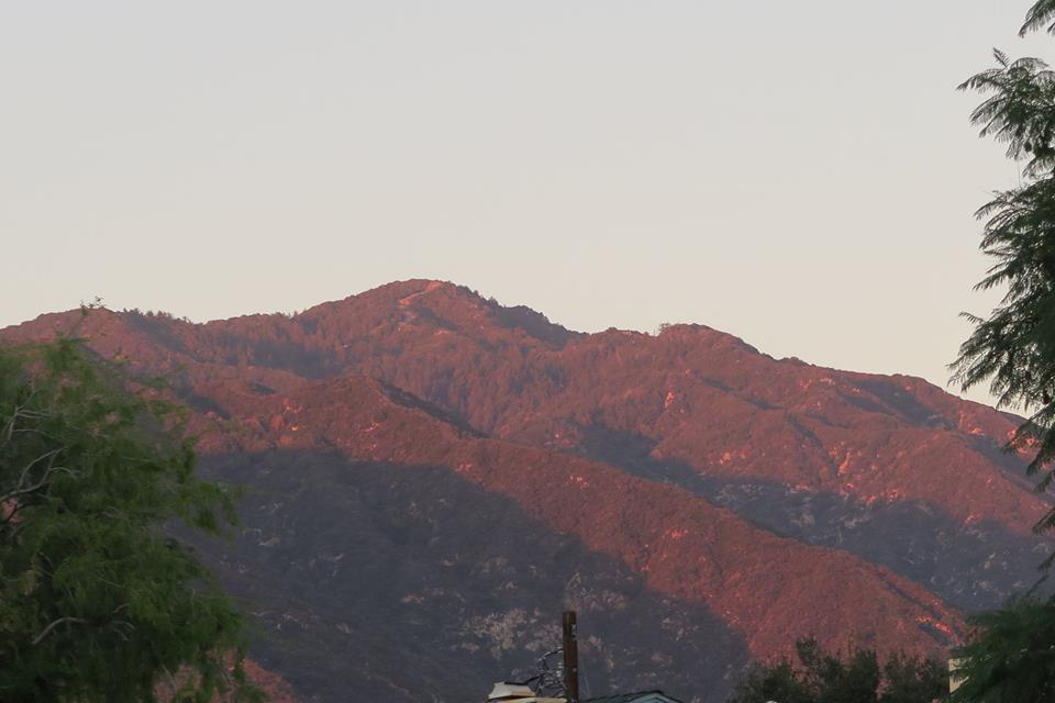
Monrovia Peak as seen from the communities of Arcadia and Monrovia. Photo taken by Dave Nickoloff at the time I was on the summit.

A short distance later, I was at our cabin telling Joanie about the great adventure.  The ice cold bottle of beer that emerged from our little gas fridge was beyond heavenly.  Glass after glass of spring water had become the chaser.  Candle light cast its’ soft, warm glow all around.  A tea light on the mantle cast its’ glow on some old framed black and whites I’d taken of my parents, brother and sister.   The sound of our little stream played in the background.  I was here and it was good to be home.
Chantry Flats Hiking Trails Updated Map

Posted on December 31, 2014 – Written by Chris Kasten

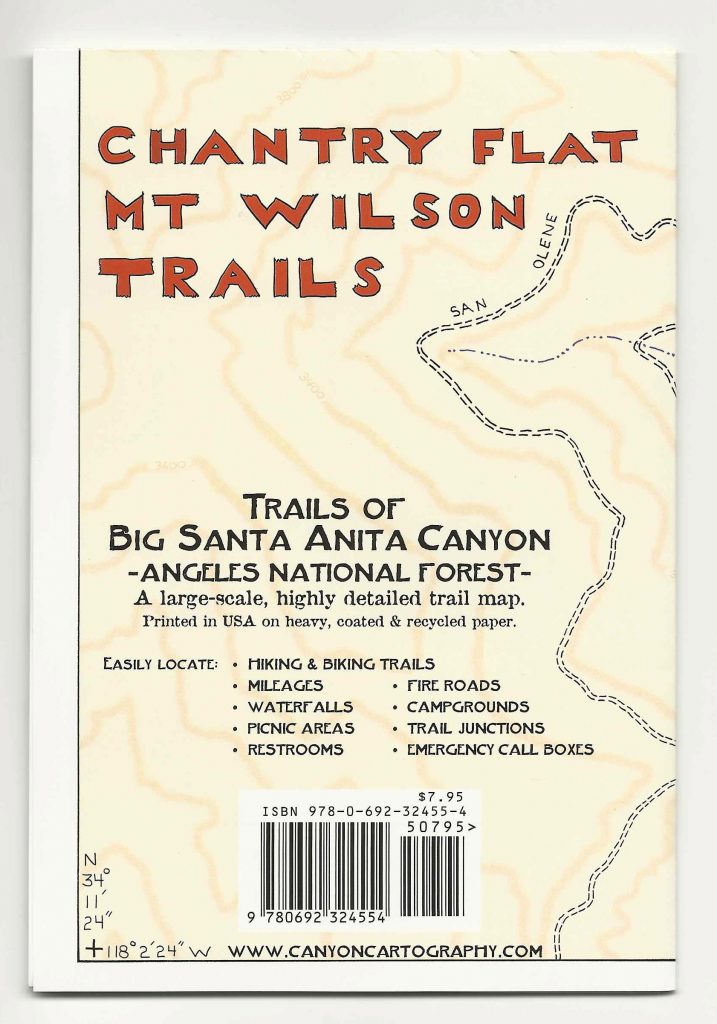
If you spend time on the trails above Arcadia and Sierra Madre, here’s the Chantry Flats hiking trails updated map that covers the area between Chantry Flats & Mt. Wilson.    It’s comes in either a weather-proof paper form with free shipping or as a downloadable pdf image through canyoncartography.com.   It is completely hand-drawn and accurate.   This two-sided map is also available at the Adams Pack Station General Store.    When you’re up at the Chantry Flats trailhead,  just head over to the Pack Station, located on the other side of the picnic area from the upper parking lot.   As of January 2020, Maggie Moran is the new owner of Adams Pack Station.     She’s made some significant improvements to the operation, such as a new deck for seating.  The Pack Station’s General Store is a great place to enjoy delicious food and a cold drink at the end of your hike!    Limited parking is also available.  The Pack Station can be reached at (626) 447-7356.    Thanks –   Chris

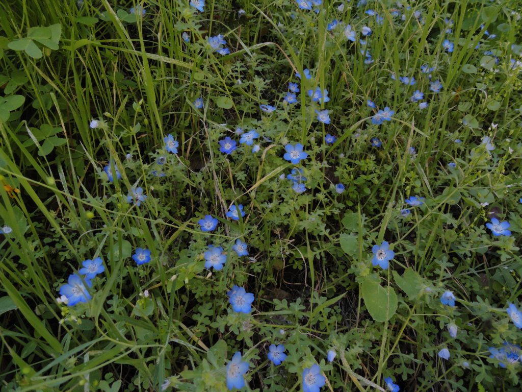
A grouping of baby blue eyes as seen in the cool, late afternoon light. Stream side trail between Roberts’ Camp and Fern Lodge Junction, Big Santa Anita Canyon.

The same map area is still depicted on the front page as the earlier versions.  Just flip the map over and continue on your trip to Mt. Wilson.  The entire Mt. Wilson Loop is found on this map, front and back.   Besides the coverage area now being nearly twice as large, index contour lines (200′ intervals) have been added to depict shape and steepness of slope.  Contours have been added at 50% opacity to prevent their competing visually with trail, stream and print detail. The Spring wildflowers are out in abundance.   Go to www.simpsoncity.com/hiking/plants/ for excellent photos with descriptions of flowering plants in the San Gabriel mountains.  You’ll see the lavender clusters of wild lilac on the Gabrielino Trail once you’re above Fern Lodge Junction.  Baby blue eyes are making their presence down alongside some of the stream banks and other moist, shaded areas.   Look for edible miners lettuce on the upslope side of the trails that are near the stream.  Dark blue and delicate larkspur can be seen on the outer edge of the steep road as you climb out of Roberts’ Camp, just before the first bench.  It’s also seen along the Upper Falls Trail in the area where you can look down at Sturtevant Falls.   With yet another year of little rain, it seems that most of the blossoming is going on about a month early this year.

updated map of Chantry Flats hiking trails, canyon cartography.com

Ascending Rush Creek, Mt. Wilson, CA

Posted on December 31, 2014 – Written by Chris Kasten

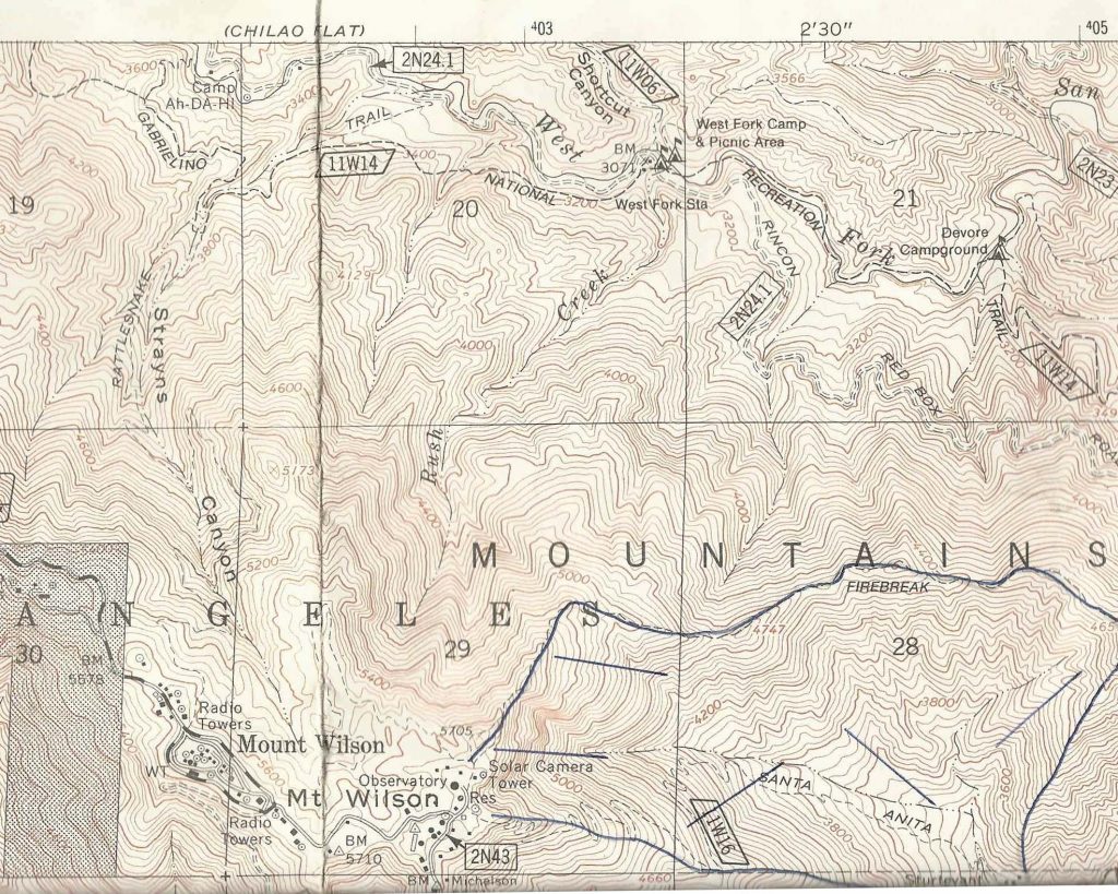
Rush Creek, Mt. Wilson, CA.  On the first day of Winter, I ascended Rush Creek, a steep and deep canyon on Mt. Wilson’s north side.  After spending the night at a completely unpeopled, chilly, yet peaceful DeVore Trail Camp, I went up upstream to West Fork Campground under steel gray skies.  That day really felt like winter, not so much in

Here’s a detail of Rush Creek, which I ascended from West Fork Campground to Mt. Wilson.

temps and winds, but in that flat gray light that’s such a part of our days in the canyons of the San Gabriels.  Lots of alders and oaks have come down across the one and a half miles of the Gabrielino Trail that crosses and re-crosses the West Fork of the San Gabriel River between these two campgrounds.  In many places, white alders seem to have broken mid way up their trunks, leaving behind shattered snags by the dozens.  Oaks have laid down, too.  Over and over, I kept on seeing the fresh, black carbon scars on the bases of trees from the Station fire of 2009.  Dams of driftwood had piled up high across the stream here and there, yet the old West Fork meandered under and through, not seeming to care at all about these very temporary nuisances in the life of a river.

West Fork of the San Gabriel River. View is looking upstream toward West Fork Campground.

My feet were already damp from all the crossings by the time I arrived at West Fork campground.  A few folks were camping here as I wandered over to the site of the first ranger station in California.  Now only a 1950′s era Daughters of the American Revolution monument marks the place where Louis Newcomb hewed his ranger cabin back in 1900.  You can still see the reassembled cabin at its’ relocated spot adjacent to the Chilao Visitor Center up Highway 2, not far from Newcomb’s Ranch.

Now the work was to begin….  Rush Creek joins the West Fork just to the east of the campground.  Wet blackberry bushes, stinging nettles and thickets of young alders marked the beginning of the canyon.  The elevation gain to the top of Mt. Wilson is close to 2,700′ in less than two miles of bouldering.

Lower Rush Creek is slow-going. Here the stream’s choked with fallen alders and berry bushes.

Rush Creek is true to its’ name!  The stream fell rapidly over a myriad of small waterfalls and cascades, punctuated occasionally by a few yards of calm and gentle descent.  The canyon bottom, like most in this part of the front country, was mostly narrow and fringed in mosses and ferns.  It seemed that most of the rock surfaces were damp and slick, which added an ice-like slickness to my challenges.  However, if you take your time carefully choosing your route up and around the small waterfalls and cascades, there’s no need for ropes or any climbing hardware.  Just take your time, which is what I did.


Tumbling Rush Creek Falls. It’s about thirty-five feet high. I climbed to the left of it.

Water falling through a slot about half way up Rush Creek.

A little better than half way up, I had to choose a canyon for my final route to the top of Mt. Wilson’s eastern end, not far from the 100” telescope dome.  Eventually I chose a fork toward the left which turned out to work out fine.  Like all x-country approaches to Mt. Wilson, the semblance of a canyon soon morphs into sandy, steep slopes pocked with rock outcrops and exposed tree roots which are great for hand holds at times.  It took from about 9:40 a.m. to 2:30 p.m. to make the trip between the mouth of the canyon to the top.  It was both exhausting and exhilarating, with grand views out toward Twin Peaks and Mt. Waterman in the back country.   The flat, gray wintery light filled me with thoughts of past Christmas-time hikes and those who I had shared them with.  Here and there in the shadows, amongst the towering Big Cone Spruce, incense cedars and sugar pines, memories of my brother Nick kept following me up Rush Creek.  At one point earlier in the day, along the West Fork between DeVore and West Fork Camp, I saw the spot where he and I had been hiking one autumn years ago and had stopped for a photo in the fallen maple leaves.  I could still see him leaning against a scraggly tree in his relaxed lean, pack still on.  Nick passed away last January 9th from complications of chronic kidney disease.  He’s a couple of years younger than me, which on a number of levels has made his early passing even harder to bear.  Somehow this canyon had become the place, so late in the year, with her peaceful greens and grays, which allowed me images of my brother, thoughts of him, to flow quietly through my being.  A calm healing had been seeping into me throughout the ascent of Rush Creek, one like I had not experienced until now.
This thought kept tumbling through my head, “our time here on this earth is brief under the best of circumstances.”   Just keep on climbing and you’ll be at the summit and so will he.  So, the rest of my ascent had become a pattern of short scrambles, searching for stable footholds, letting my heartbeat slow down and starting, again.

Peering out at Twin Peaks from upper Rush Creek. Here the forest is lush, green and healthy.

Eventually I topped out into a forest of scrub oaks, following a gentle ridge to a lonesome picnic table along the Rim Trail.  My eyes were damp.  Like most of my x-country hikes, I found myself wondering where this canyon had been all my life.  Soon, my soaked shirt had begun to turn to chill, so I changed into a dry top, had a little cheese and pita bread sandwich and kept on walking in the dimming light.

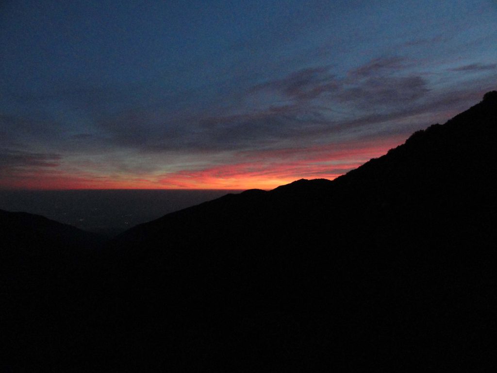
The return back to the little cabin in the Big Santa Anita was by way of the superbly scenic Rim Trail which parallels the ridge dividing the watersheds of the West Fork of the San Gabriel and the upper Big Santa Anita Canyon.   The distance from Mt. Wilson to Newcomb Pass is a relaxing descent of 3 1/2 miles if you take this route back toward Chantry Flats.  The sunset was stunning and soon I had the

flashlight out for the rest of the trip back to Fern Lodge in the Big Santa Anita Canyon.  Soon I began to pick up the pace, trying to beat the impending darkness.  A calm peace ran through my bones as I headed toward Newcomb Pass and then down toward Sturtevant’s Camp.  You know, the fantastic way you feel when you’ve gotten in miles and miles of canyons and ridge tops, before you arrive where you can take off your boots and stay awhile.  My old friend Bohdan greeted me in the dark near Falling Sign Junction and we hiked together back to Joanie and the warm, lit cabin with dinner on the stove.  This day was more than good.

Sunset from the Rim Trail between Mt. Wilson and Newcomb Pass.

Trail Work Takes Place in Big Santa Anita Canyon

Posted on December 18, 2014 – Written by Chris Kasten

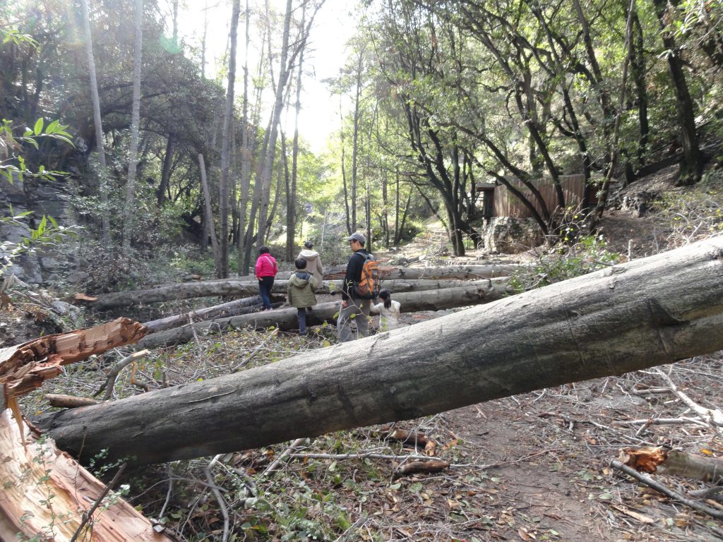
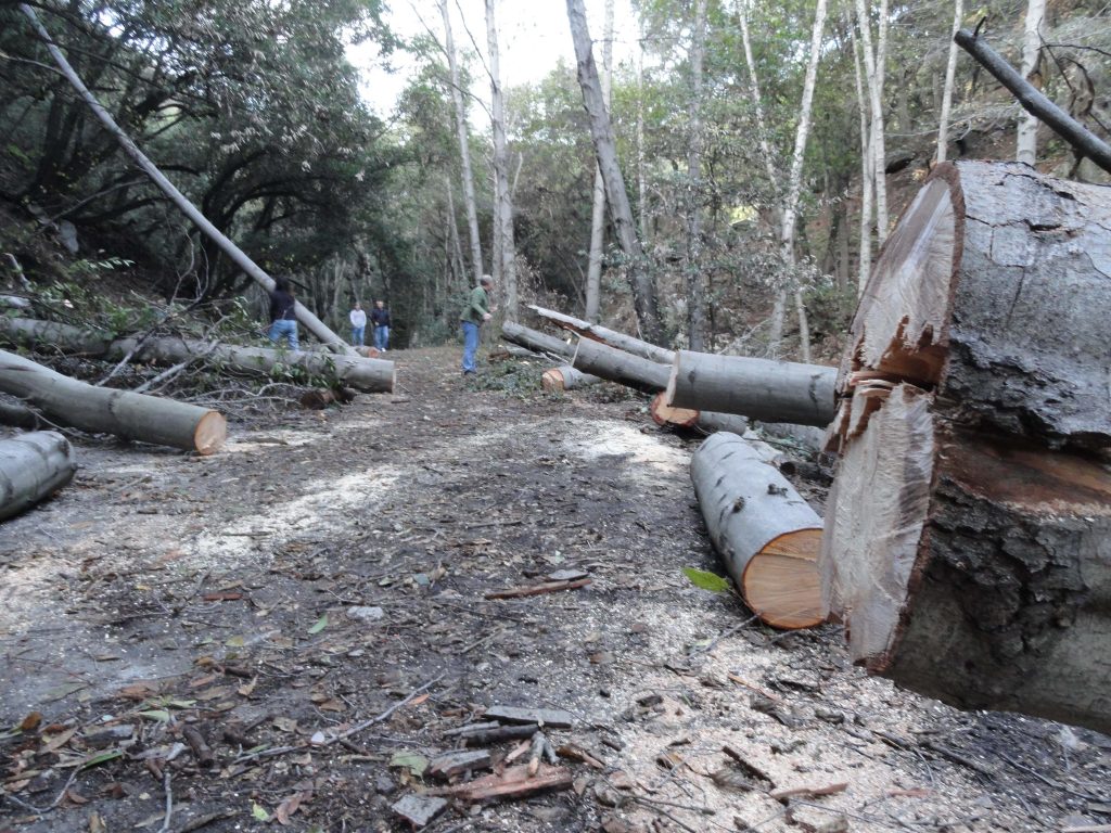
A group of white alder trees blew down across the trail in last week’s storm between Roberts’ Camp and Fern Lodge, Big Santa Anita Canyon.

The Pacific storm that rolled in late last week brought much needed rain to the Big Santa Anita Canyon and the rest of the San Gabriel mountains.   Along with the rain came high winds that raked canyons and ridge tops, blowing down lots of drought stressed trees.  My wife and I were hiking in this last Friday evening when we stumbled across five fallen alders, all parallel to one another and completely blocking the trail.  The location is the stream side wide spot of the Gabrielino Trail between Roberts’ Camp and Fern Lodge Junction, right where the dirt road ends at cabin#26.

All the hiking trails that radiate out of Chantry Flats are for the most part maintained by volunteers, with the exception of the occasional U.S. Forest Service fire crew.   These trees were cut out of the way by local cabin owners and Forest Service volunteers.    Hopefully, more storms are on their way.  We received 2.78″ of rain at Fern Lodge, bringing the canyon up to nearly 6 inches of rain for December.

The Gabrielino Trail between Roberts’ Camp and Fern Lodge Junction has just been cleared of fallen white alders.

Water’s Up A Little in the Big Santa Anita Canyon Creek

Posted on November 22, 2014 – Written by Chris Kasten

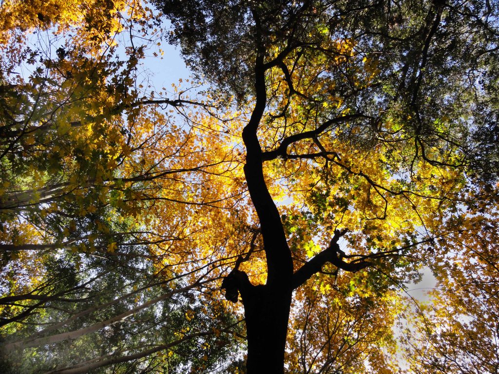
Big Leaf Canyon Maple leaves blaze in this vertical view of tree canopy. Winter Creek, between Fern Lodge and Hoegees Campground.

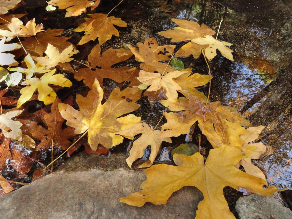
We received nearly an inch of much-needed rain on Halloween in our parched Big Santa Anita Canyon and Winter Creek.   Yet, it didn’t really do much to increase the Big Santa Anita Canyon creek flow.  To date, it’s been rainless for all of November, yet the autumn beauty is as good as about any year.  Poison oak has been reddening for months and the Big Leaf Canyon maples have been gradually changing color.  Yellows and golds abound in many of the tree canopies as well as fallen leaves on boulders, slopes and in the stream beds.  The scent of leaves and damp soils is really noticeable right now, especially right along the streams.  Crickets chirp throughout the day in many of the shadowy pockets to be found along the hiking trails.  With the sun dropping so far to the south on these shortening days,  the light is angled to the point that perpetual shade can be found along the north and east facing slopes of the canyons.  The days are so short now, many of us find ourselves hiking the last couple of miles back out to the trailhead in the dark.

Big Leaf Maple leaves have come to rest in Winter Creek pool.

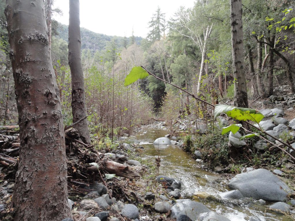
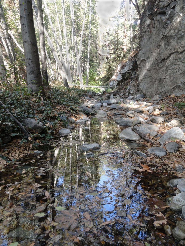
Another trait one might notice is the slight increase in the Big Santa Anita Canyon creek flow.  Despite no real precipitation to speak of since the end of October, there’s this phenomenon that takes place throughout much of the southern and central California canyons.   With the leaves falling from so many of the white alders and maples that grow along the canyon stream courses, these trees have nearly stopped transpiring moisture into the atmosphere.  They’re dormancy has begun and water that would have been drawn up through the roots is continuing to stay in the streams.   This really gives you an idea

Big Santa Anita Canyon’s stream has come up, albeit slightly. Photo taken between Roberts’ Camp and Fern Lodge.

of how much water it takes to sustain these deciduous trees.  So, even with out the rain, there’s now just a bit more stream sound than a couple of weeks ago.   What a great time to get out for a hike and take in the beauty and peace of our San Gabriel mountains.