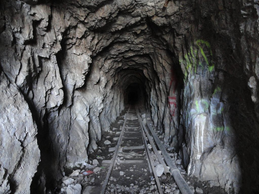
This is a view looking into the Big Horn Mine’s upper adit. Note that the narrow ore car track is still fairly intact.
A new Big Horn Mine trail map is now available through Canyon Cartography’s website with free shipping. Also, a number of retailers in Wrightwood carry the map as well. Mountain Hardware, Wrightwood Market, Jensen’s Market and the Grizzly Cafe are some some of the locations where you can pick up a trail map on your way to the
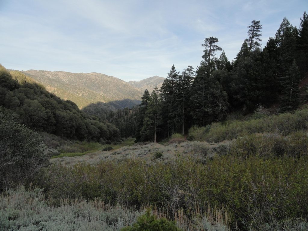
The view down into Vincent Gulch taken late in the day. Photo taken near the Vincent Gap trail head. The mountain, back center skyline, is Pine Mountain (elevation 9,648′).
trailhead. The approach to the Big Horn Mine from Vincent Gap is depicted on the Wrightwood – Big Pines Trails map. Getting to the mine is straight forward, your path being an abandoned dirt road skirting the east slope of Mt. Baden-Powell. The distance, one way, is 1.8 miles with 250′ of elevation
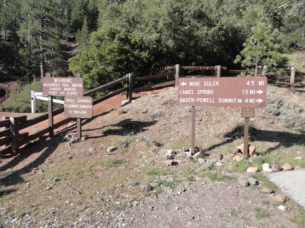
The trail head at Vincent Gap. Note the white fire road gate on left. You’ll want to follow the red dirt road that continues past the locked gate. This road will soon narrow to single track, reemerge as a road only to once, again, become narrow single track. This is your route to the Big Horn Mine. The trail sign on the right directs hikers to Mt. Baden-Powell via the Pacific Crest Trail (PCT).
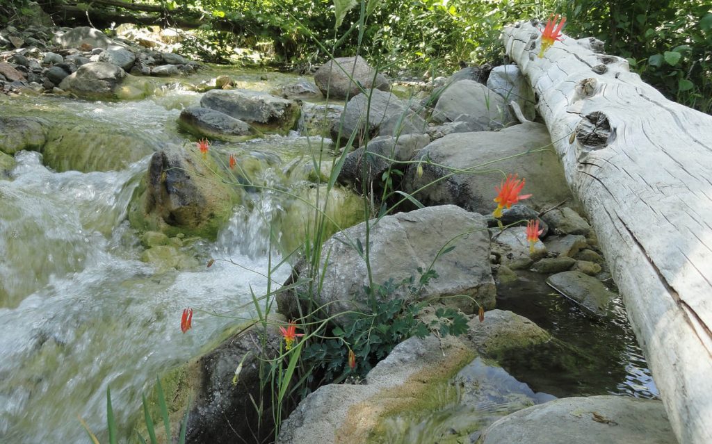
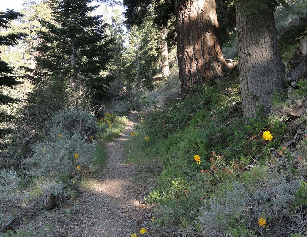
gain between the Vincent Gap trailhead and the Big Horn Mine. Your route passes amongst healthy stands of white fir, sugar pine, jeffrey pine, incense cedar and other conifers in this high country setting. Occasionally, the terrain takes on a stark and arid feel amongst the fractured rock. Along the way, you’re afforded spacious views of the eastern high country peaks. Pine Mountain, Dawson Peak, Mt. Baldy and remote Iron Mountain make up a big section of the skyline. The sky on most days is deep blue up here, with the deep and wild gorge of the East Fork of the San Gabriel River giving you a sense of depth and steepness below the path. The main area you’re looking out toward is the Sheep Mountain Wilderness. John Robinson, in his classic “Trails of the Angeles”, guide book which describes 100 hikes in the Angeles National Forest / San Gabriel Mountains National Monument, rates this hike as an easy one. When you arrive at the Vincent Gap trailhead, notice the reddish soil, a unique and scenic feature in the San Gabriel mountains. There’s ample parking at this 6,593′ high saddle, a major
A view looking back down at the stamp mill from the upper adit. Note: dilapidated wooden ladder – not recommended for supporting your weight – avoid it!
watershed divide between the East Fork of the San Gabriel River to the south and Big Rock Creek to the north. The Vincent Gap trailhead is less than seven miles west of the scenic mountain village of Wrightwood.
Mining in the San Gabriel mountains is an extensive and colorful part of the history of man’s
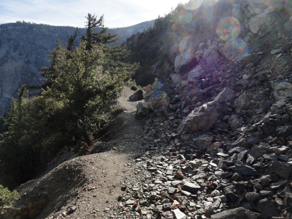
Remnant road to the Big Horn Mine is now a single-track hiking trail due to numerous landslides on the slopes of Mt. Baden-Powell.
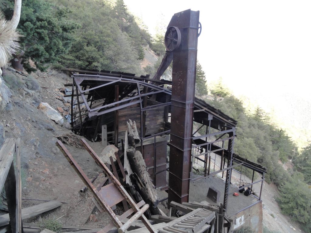
forays into these rugged canyons and mountainsides. Most of the gold that’s ever been taken out of the “hard rock” types of mines in these mountains is to be found in quartz veins, known as “gold bearing quartz.” The Big Horn mine was no exception to the rule. Charles Tom Vincent discovered a gold bearing vein back in 1895 while hunting big horn sheep on the steep, raw slopes of Mt. Baden Powell. Hence the name of the mine was created. Back then, Mt. Baden-Powell was known as “North Baldy.” Back in these early days of the mountains, there was no Angeles Crest Highway, no easy drive to this part of Southern California. It took days of hiking from the valley towns, such as Azusa, Sierra Madre and Altadena to reach these haunts. Miner Vincent would have trekked up the long and sinuous San Gabriel River from Azusa. Approaching from the north, he would have ascended Big Rock Creek from distant desert locales such as Pearblossom, Victorville or the Cajon Pass to the east. Most belongings were packed in on men’s backs or possibly mules. Miner Vincent did not possess the resources to bore tunnels and erect a stamp mill on the precarious mountainside. Eventually, over the decades, a number of companies played their hand at extracting the elusive gold deep within the mountain. The usual pattern of “bonanza!” followed by heavy investment, hard work, diminishing returns and finally abandonment, took place at the Big Horn as it has in all the other hard rock mines of the San Gabriels. Today the approach to the mine is being reclaimed by the mountains. The skeletal remains of the stamp mill still remain adjacent to the adits (horizontal mine shafts) in this alpine
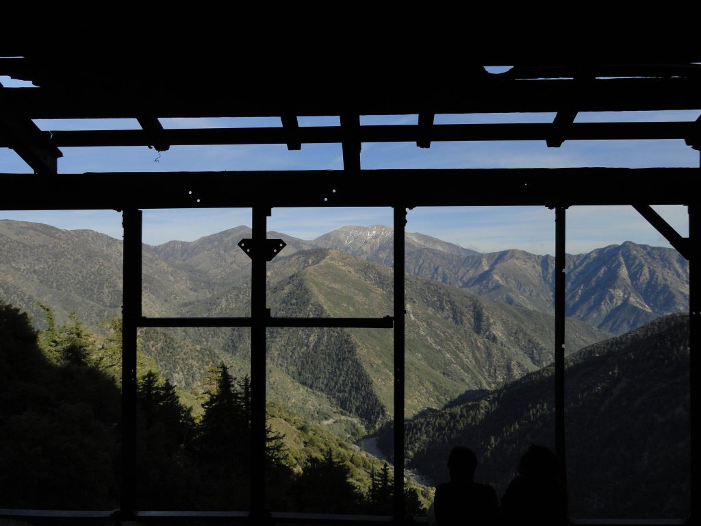
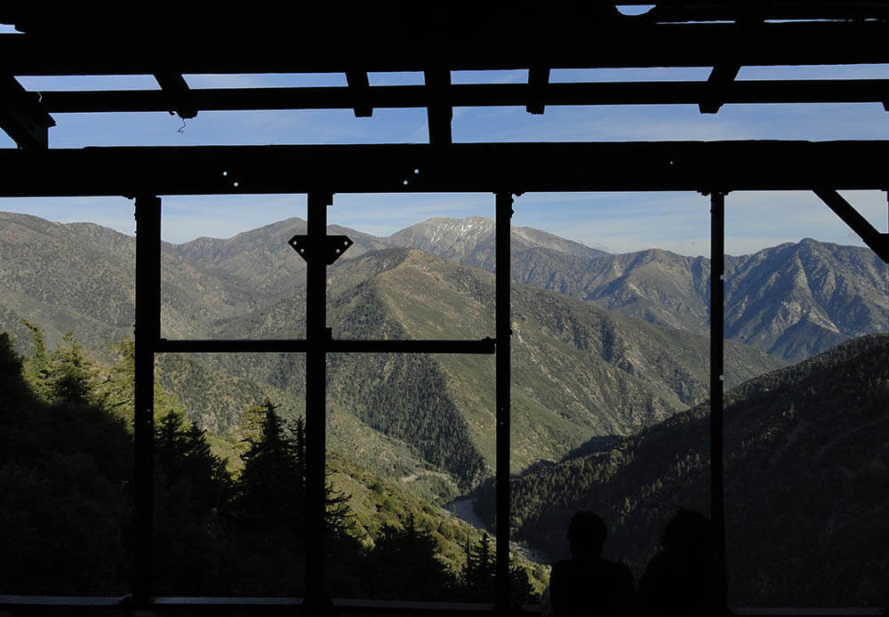
The high country peaks of Pine Mountain, Mt. Baldy and Iron Mountain are framed within this view looking out from the Big Horn Mine’s stamp mill.
setting. Take care exploring what’s left of the Big Horn. The slopes are extremely steep and exposed. This is a great hike to take in a sense of what mining in the early days of the San Gabriels must have been like. It’s also a wonderful place to take in the grandeur of the wilderness all around you.
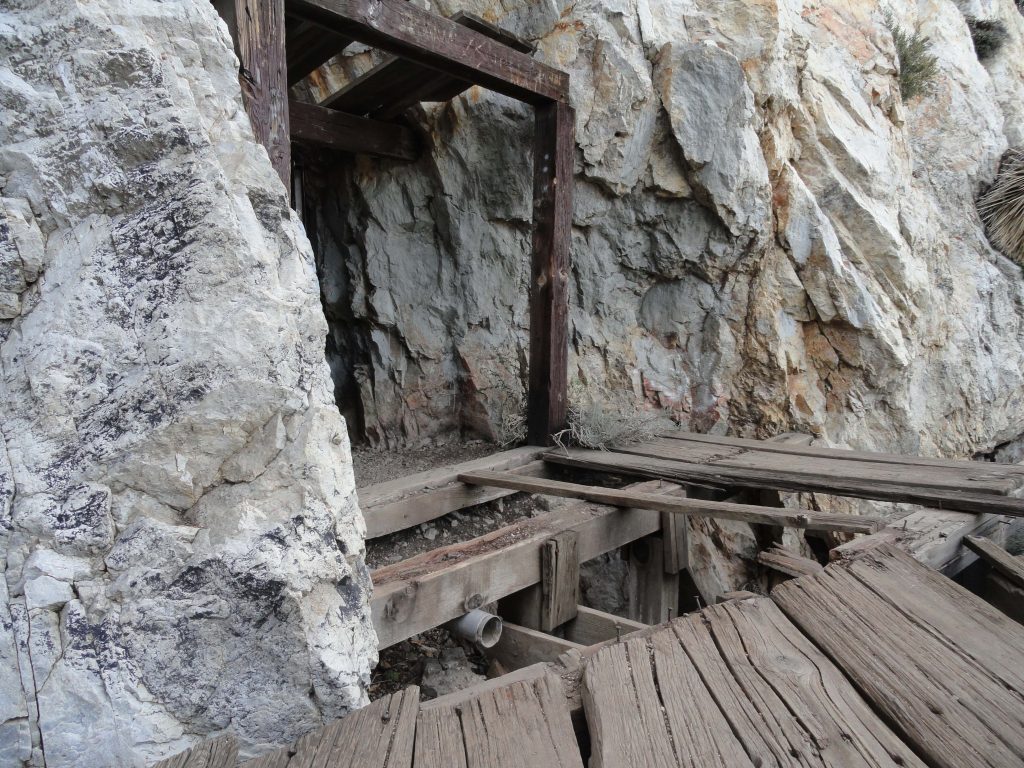
Remnant platform emerges from the upper adit of the Big Horn Mine. This spot is located just upslope from the stamp mill.