
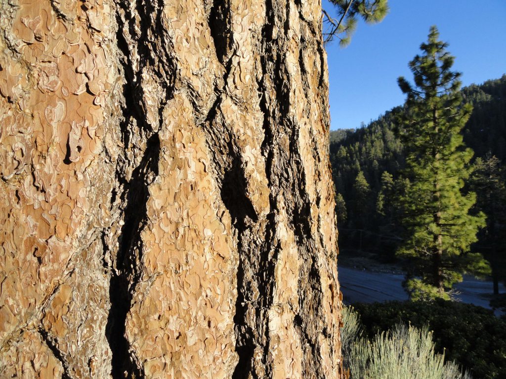
Close up of plate-like tree bark on Ponderosa Pine. The Big Pines Nature Trail travels among mature stands of Jeffrey and Ponderosa pines. The north-facing forested slope of Blue Ridge is off to the right.
Just went up to the Big Pines Nature Trail last week. It was late in the day and thick, gold light was drifting down through the pines and slopes. Located just three miles west of Wrightwood, this is a convenient spot to walk a gentle, half-mile loop up amongst some
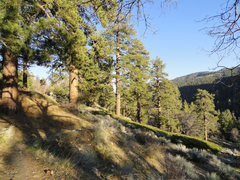
Looking out at Wright Mountain on the far east end of Blue Ridge. Mature stands of Ponderosa and Jeffrey pine are in the foreground.
really large pines along with fine views of thickly forested Blue Ridge. The trail starts next to the old Big Pines Lodge. Look for a little parking lot on the north side of Highway 2, just before passing the old Big Pines Lodge. You start your loop hike by walking up a flight of beautiful stone stairs built back when Big Pines was developed as the jewel of the Los Angeles County parks. These stairs were tread upon by visitors to this mountain wonderland of four seasons. Not only was there a lodge here for dances, movies, plays and replete with fireplaces, but there were housekeeping cabins, a place to dine, sled runs, ice skating, camping, swimming and even a little zoo. Back then, the Angeles Crest Highway had not yet been finished, so one drove here from
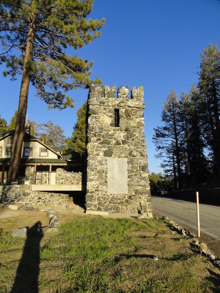
North Tower. This is what remains of Davidson Arch, built back in 1926. The arch spanned the highway, providing a pedestrian overpass for the many visitors to Big Pines. The arch was torn down in 1950 to accommodate the widening of the highway.
the desert side on County Route
N4 or up from Cajon Canyon by way of Lone Pine Canyon Road through Wrightwood. No freeways. The San Gabriel Mountains have always held an allure for people seeking beauty and peace. It’s no different today, and although the times and works of man pass slowly by, the beauty of these mountains remains. An easy walk for all ages, this self-guided nature trail does about a hundred feet of gain in just over a half mile before returning back down to its’ beginning. There are signs along the path that point out the native plants along the way. The slope you travel is south-facing and receives good light
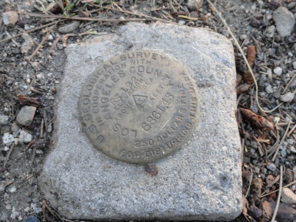
This benchmark, placed next to where the north tower of Davidson Arch is located, marks your elevation at 6,861 feet above sea level. As you can see, it was placed here 93 years ago by the surveyors!
and even in the winter and early spring can still be comfortably warm while snow still clings to the north slopes of Blue Ridge. Because of this slope’s southerly aspect, you’ll find sun loving plants such as Yerba Santa, Parry’s Manzanita and Fremontia (flannel bush) to name a few. Yet, you’ll still enjoy the welcome shade of Ponderosa, Jeffrey pine and leafy black oaks (Kellogg). There are some good spots to sit down and rest awhile and think about nothing. Upon your return, don’t forget to poke your head into the door of the visitor center, located on far right side of the porch of the old Big Pines Lodge. Presently, the center is staffed by the U.S. Forest Service Friday through Tuesday, providing information on local places to visit and hike.