PDF Image of Trails of Big Santa Anita Canyon Map is Available

Posted on November 7, 2012 – Written by Chris Kasten
Late in the day on a summery afternoon at Sturtevant Falls in Big Santa Anita Canyon.

The pdf of the Trails of Big Santa Anita Canyon Map can now be downloaded from canyon cartography.com!  This image has a resolution of 300 dpi.  It sells for $1.99 and is compatible with all Apple IOS  phones and I Pads.  This is a great time to get out and experience the beauty of our front country canyons. Both Sturtevant and Hermit Falls continue to flow amidst the autumn colors of canyon maples.  If you’re looking at hiking, running or biking up at Chantry Flats, this map will provide you with an uncluttered, easy-to-follow image that contains local place names, trail junctions, distances, elevations,  locations of restrooms, campgrounds and more.

If you’re looking for a paper map, this same map sells for $4.95 + tax and ships to you for free.

Please remember to see the HIKES page at www.canyoncartography.com.   This map, whether in the paper or pdf form is designed to be viewed in conjunction with the HIKES page.

Cool and Damp, Micro Climates Abound In Big Santa Anita Canyon

Posted on November 3, 2012 – Written by Chris Kasten

During the autumn months, just feel the rapidly alternating damp coolness and warm dryness, literally within seconds of one another,  as you’re hiking along the trail.  The other night while we were hiking into the canyon under the dark canopy of white alder, laurel bay and canyon live oak, the nearly full moon followed us.  Milky, white pools of moonlight settled into hollows ringed by the inkiness of canyon bottom darkness.  The pondering of my fleeting mortality surfaces, as it always does.  It is always as if there’s this mystery of visual intent, that something’s to be footnoted deep inside by this ghostly light that arrests our forward progress.  Maybe just stopping and fixing our gaze in a direction that we’ve never taken the time for is meant to happen right now and right here.  We’ll never see this, again, so drink it in.  The term beauty seems to fall way short for description.  All language fails to grasp it.

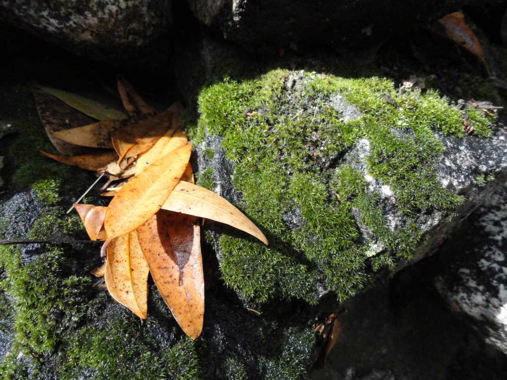
Fallen bay leaves amongst moss covered rocks. Big Santa Anita Canyon.
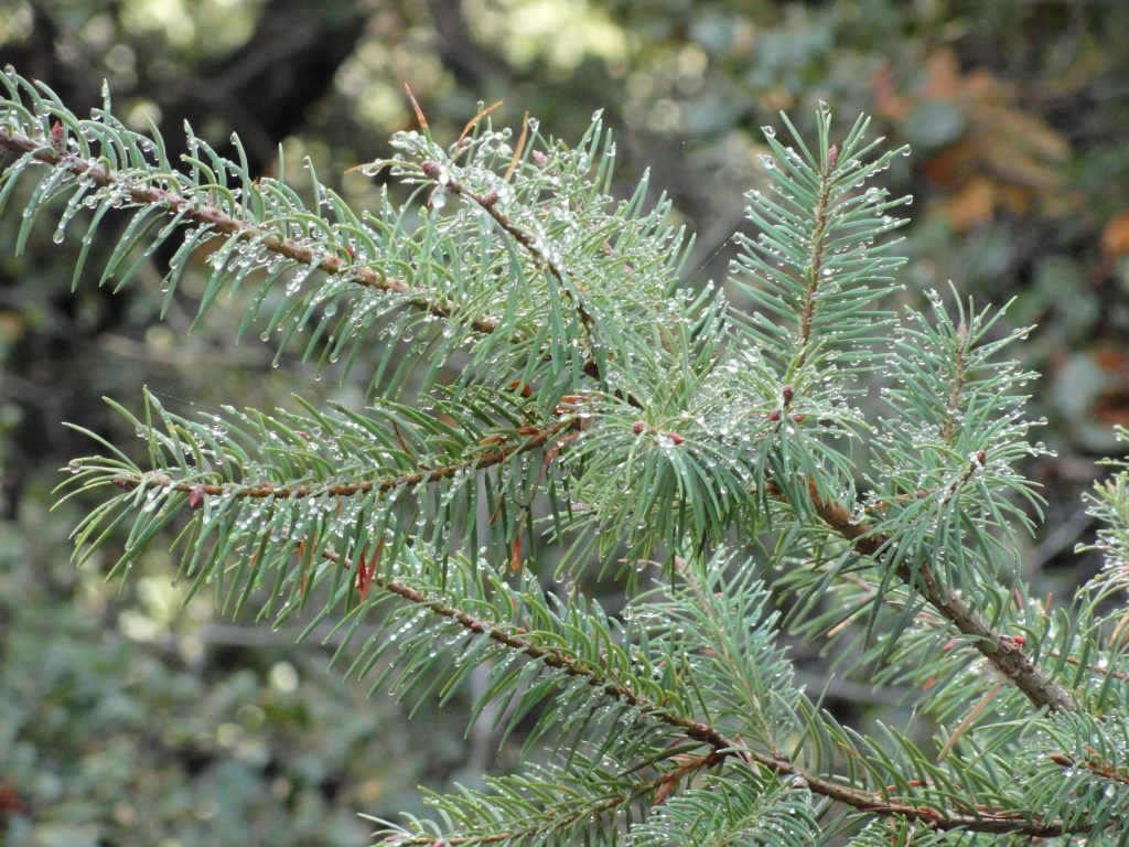
Last night’s rain still clings to delicate needles on this Big Cone Spruce bough. Upper Falls Trail, Big Santa Anita Canyon.

Also, there’s the temperature side of these hikes that is so distinctly felt this time of year…  Whether day or night, each little piece of the canyon has its’ microclimate.   The cool dampness of side canyons such as San Olene, Bear Trap, Fern or Step-On-My-Toe bring their enveloping chill all around us at once.  A moment later, you’re out on south-facing slopes and the dry heat mixed with scents of chaparral take you to another place.  Not much longer up the canyon and you’re in the shady, moist recesses of Falling Sign Junction or beginning your descent into Cascade Picnic Area.  That damp, spicy scent of bay leaves blending with grainy soils takes you one way and the dry blends of white sage and chamise take you another.  This back and forth is no different than the pull and push of the ocean’s surf, bringing her gifts to you and then taking them back out.  It’s as natural as breathing.  While out in our front country canyons, the cool and warmth, over and over, again –  instill their magic in us no less than the visual beauty of changing leaves.

On Your Next Hike Out of Chantry Flats, Think About This….Adapting to Our Biology – The 2000% Rule and How Hiking Helps

Posted on October 19, 2012 – Written by Chris Kasten

Following mountain paths at the speed of walking or running is not only good for your head and your overall health, but may also be a way of reconnecting you to your natural pace and view of the world.  As I mentioned in the last blog, I had read “In Praise of Slowness – Challenging the Cult of Speed” by Carl Honore.  Not long after this reading, it dawned on me during one of my “commute hikes” to Sturtevant Camp, just how frequently we travel in our cars at 60 to 70 miles per hour without thinking a thing about it.  After arriving at Chantry Flats and heading into the Canyon, we’ve now dropped our speed down to a safe and sane 2 to 3 miles per hour.  If you’re running, then double or or even triple the speed.  In any case, the difference in percentage terms between driving and getting yourself around on foot is startling.  I chose 3 mph as an average walking speed for most of the trails that cover our front country canyons of the San Gabriel mountains.  If I’m driving a conservative 60 mph or so (better be in the slow lane), then I’ve increased my travel speed 2000% or greater!  Now, I’m not even talking about the speed of flying in airplanes or jets, which would bump this percentage increase to 10,000% or greater….  All this change is just land-based travel.

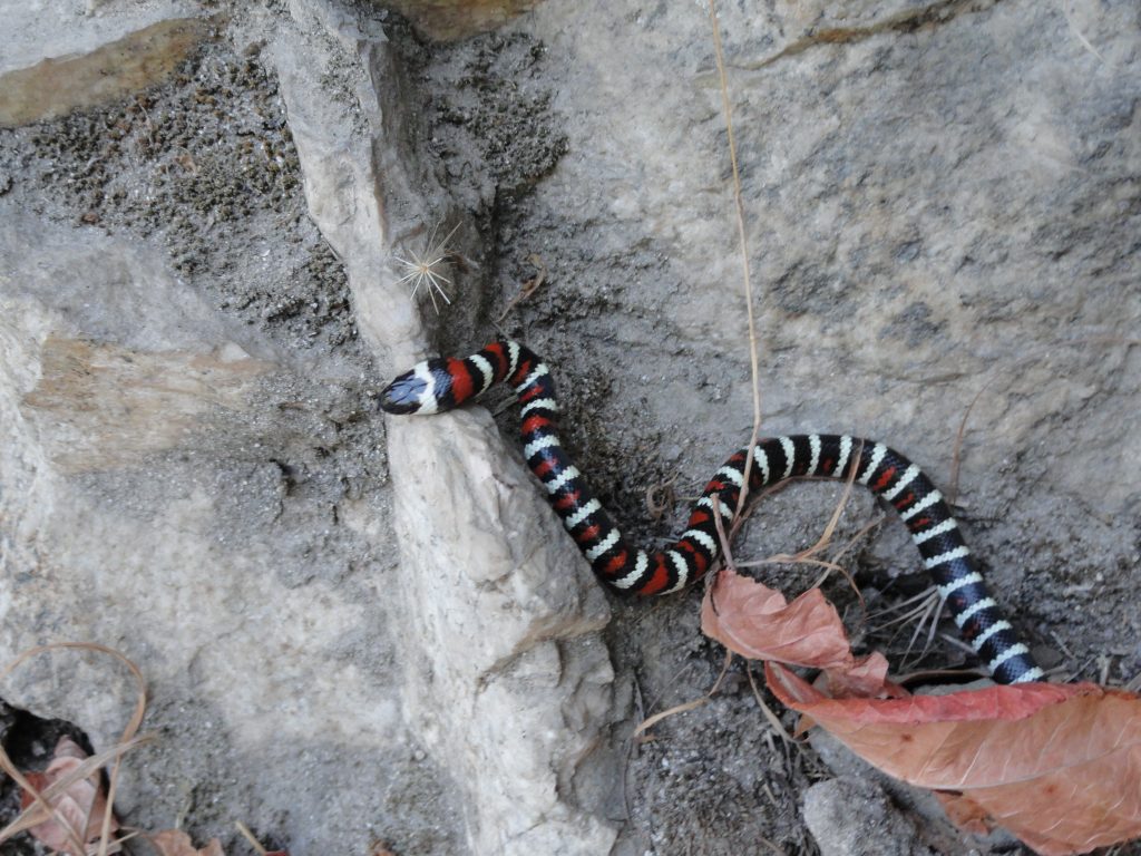
A Coral Mountain King snake makes her way along the Upper Falls Trail, Big Santa Anita Canyon. Those reddish fallen leaves are poison oak.

We’ve been driving mass-produced cars for just over a century now.  Henry Ford came out with his Model T for the masses in 1908 which isn’t all that long ago – really.   And the freeway / highway system as we understand it today in the United States didn’t exist until the Interstate Highway Act of 1956.  Prior to that, many good roads existed under their own numbering system, yet did not connect to any grand scheme for the cross-country traveler.  So, driving 60 mph or greater, was not a long distance assumption that could be made in the lower 48 states.  Even though I use the 60 mph speed as a benchmark of what we do all the time without really thinking.

Looking back over the development of humans as a species (Homo sapiens), the best we have to go on as of this writing is that our species evolved into “anatomical modernity approximately” 200,000 years ago.  This “Out of Africa” theory is widely supported and dates back to Charles Darwin’s book, “Descent of Man” from 1871.  DNA analysis now corroborates this theory.  Looking at our “behavioral modernity”, the current take on this is approximately 50,000 years ago.  See Stephen Oppenheimer’s “Out of Eden” for an elaboration on the development of music, religion and other human developments.  Wikipedia is a good place to start on both these themes of human origin.

Let’s say we take the 50,000 B.C. benchmark as the beginning of human development and social tradition.  That’s a good long time to discover and develop our view of the planet’s surface with all its’ variations in terrain and climate.  It’s also a good period of time for the development of certain forms of muscle development, navigational skills and memory for covering different landscapes and all the textures that come with it.  You could say that our collective DNA, a redundancy in definition, has compiled all these traits and skills as they relate to our relationship within the context of walking, climbing, running and swimming.  This is a collective conscience that we all carry and continue to develop.

Finally, all this takes us to another facet of the 2000% rule…..  Most humans, in developed nations, such as the United States – live approximately 72-78 years on average.  Pushing that number to 80 years, there are about 625 human lifetimes, back-to-back, in 50,000 years of time.  On average, human generations are about 20-22 years ion length (see:  Strauss & Howe’s “Generations – the Generational Diagonal”)  if you look at American generational theory for the last 500 years.  Therefore, in numbers of generations, that figure jumps to nearly 2,500 generations experiencing this earth and its’ myriad opportunities and challenges in 50,000 years.  For nearly all this time, we’ve been living at 2 to 3 mph on land, with the exception of running.

That said, we’ve increased our daily speed 2000% in 0.2% (1/500th) of the time we’ve developed into modernity!  There is no curve, just straight up.

This increase in daily speed is beyond striking, perhaps even challenging to the biology of a person.  Not that we can’t adapt, most of the time we have, however, it isn’t without its’ shadow.  It’s hard to stay present to the earth as our ancestral selves remember it when we’re ramping up our speeds routinely and our biology lagging far behind in the grand scheme of things.  We’re not even considering the effects of instantaneous forms of communication that we take for granted!   Hiking, walking or running, however you do it, pulls us back to the rhythm and pace that we’ve adapted to over the tens of thousands of years.  Spend part of your day on the trails up and down our canyons to reconnect to the expansive part of you that these modern times have yet to earn.  As the adage goes:  A person sees more in a mile of walking than 100 miles of driving.  You might just remember and enjoy more of it, too!

Autumn Splendor at First Water and the Winter Creek, Chantry Flats’ Trails

Posted on October 11, 2012 – Written by Chris Kasten

Autumn is a great time to get out and hike the trails out of Chantry Flats.  With the recent cooling temperatures and even a little rain on the way, this coming week should feel refreshingly fall-like.   The dust of the trails should be laying down and the spicy scent of fallen bay leaves will awaken you.  This last week I photographed a couple of the accompany scenes that evoked a sense of returning to my favorite time of year.

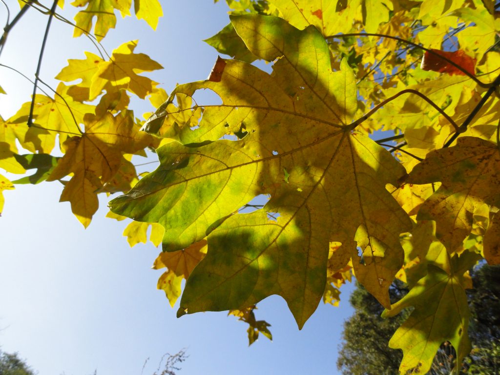
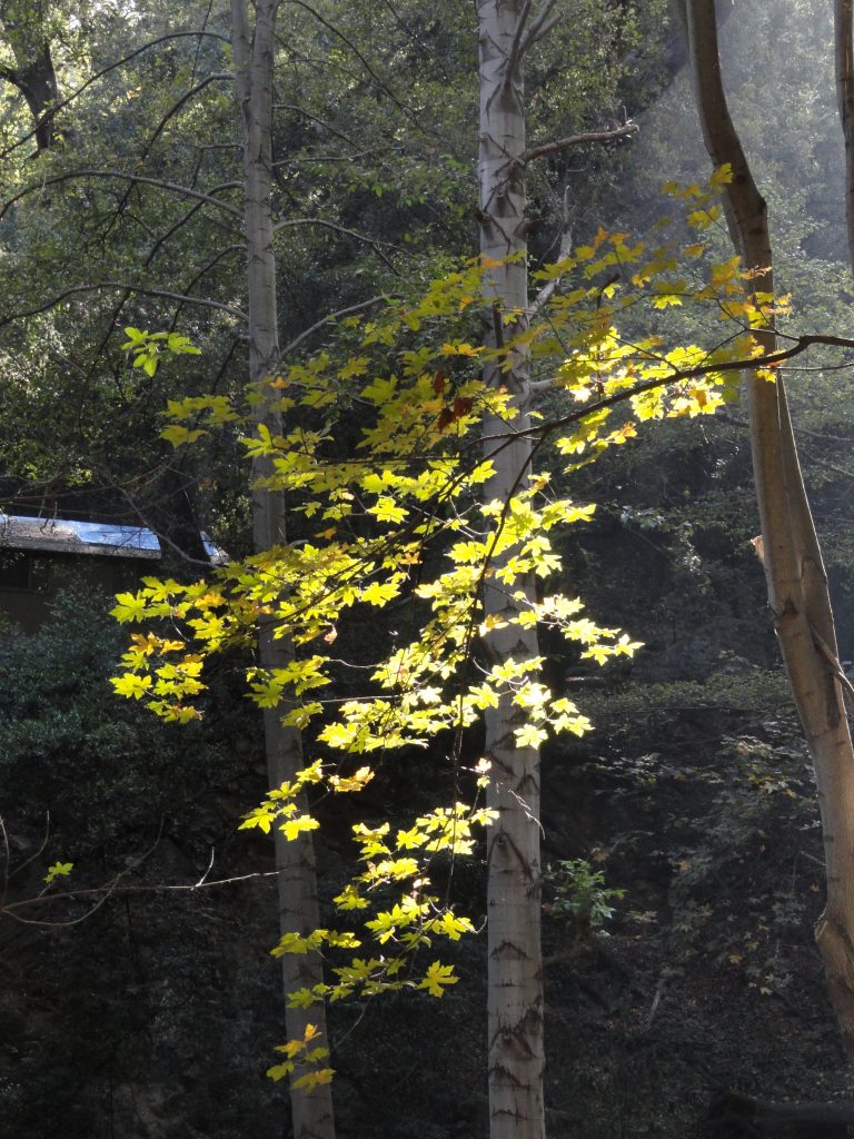
Looking skyward through a canopy of Big Leaf Canyon maples. Big Santa Anita Canyon.

Big leaf canyon maples, once referred to as “water maples” (see “The Southern Sierra”, Charles Francis Saunders)  are plentiful along stream courses in most of the front country canyons of the Angeles.  Occasionally, if you look high up the slopes, well above any stream bed, you might spot one of these trees that’s gotten a toe hold in a fold or shady nook that provides just enough water to eke out its’ existence.  Maples are deciduous, meaning that they drop their leaves and remain dormant until spring makes her return.  The maples you’ll see in the Big Santa Anita and Winter Creek canyons are all of the same species (Acer macrophyllum), are capable of producing really large leaves and produce shade throughout most of the year.  In the fall, their leaves begin to produce tinges of yellow in the margins, gradually becoming mostly yellow-gold by the time we’re approaching late October to early November.  By mid-December, most of their leaves have fallen to the ground, their smooth gray trunks often contrasting vividly against the dark green-blues of canyon slopes.

Big Leaf Canyon maple is backlit in the Winter Creek. Big Santa Anita Canyon.

One of the memorable sides to fall in our canyons is the wonderful, earthy scent of the maple leaves mingling with the damp soils.  Like so many of our long-term memories, scent is a trigger for reliving events and places.  There’s this eternal aspect to every year’s return to autumn.  Over the years, I’m drawn back to some place deep inside.  It’s as if hiking back to the same haunts that I visited when still a child continue to call me with the same longing, yet at a later time in life.  Is there any way of merging with this scene?  Will I ever consummate this relationship, dissolving once and for all the illusion of the duality of myself and the outdoor world?  Traveling throughout our canyons in the fall, regardless of how you do it, may be some kind of a timeless redux at wholeness and merging with this earth.  However, it takes time.  For things to stick, it may take both time and stillness.  A chance to absorb what’s going on between us and the scene.   A time to come home.

This makes me think of a book that I picked up years ago at Christmas time that I’ve continued to return to, again and again.  It’s entitled “In Praise of Slowness – Challenging the Cult of Speed, by Carl Honore.  Here there are great insights into the habit of occasionally slowing down our fast-paced lives in favor of becoming present to what is right around us, right now.  The fall season may be just that, a reminder to not only go inside ourselves, but to be present to this moment before us.  That somehow, being present to all this day is miracle enough.

Fall Is On Her Way In the Big Santa Anita Canyon

Posted on October 3, 2012 – Written by Chris Kasten

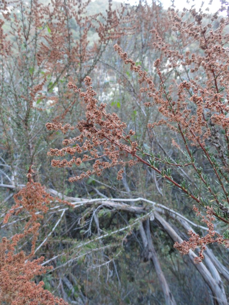
Dried flower stalks of Chamise, a fire indicator species found throughout much of the chaparral plant community.

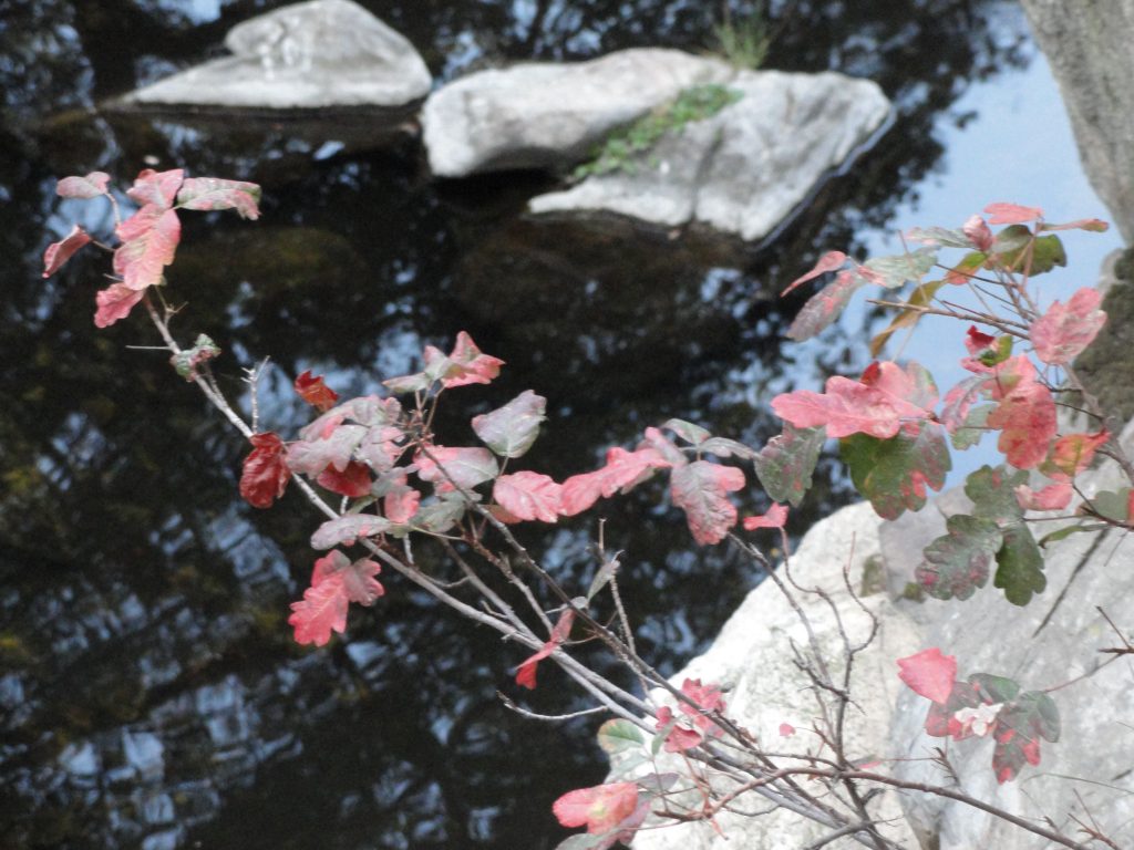
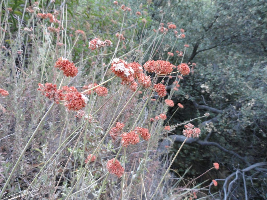
We’re only about two weeks into the autumn season and the Big Santa Anita Canyon is giving us all kinds of hints of change.  When you hike by cabin #23, just above Roberts’ Camp, you’ll see an expanse of yellow-tan bay leaves all around the place.  If it’s later in the day, the scene seems to create a warm glow of its’ own.  Many maple leaves are on the ground as well, due especially to the extreme dryness of the soils.  Many of the plants here are members of the chaparral plant community, drought tolerant to say the least.  Just go a short distance upslope from any stream bottom and you’re quickly in a world of prolonged heat and dryness, especially on south and west facing slopes.  Pictured here are three examples of plants commonly found along our trails that radiate out of Chantry Flats.  Chamise, poison oak and buckwheat have been transitioning into their fall colors for a month or more.  If you’re bouldering down among the lower reaches of Big Santa Anita’s East Fork, the stream channel is choked with the delicate, crisp leaves where water hasn’t ran in months.  When a tree squirrel runs and jumps through this scene, it can startle you with thoughts of bears and deer ambling along.

The water flowing over Slider Rock is a narrow, slick thread of stream.  The creeks that still flow are only a whisper of their former selves.  Hiking along, even in the evenings, there’s hardly any stream sound at all.  Once in awhile you’ll hear a deep gurgling of water in nocturnal hollows, reminding you that our stream’s well and alive.  That this has happened before, perhaps thousands and thousands of autumns past.

Poison oak leaves turning crimson in the fall.
Buckwheat flower stalks. Soon, these flowers will turn to a rusty red color for the duration of autumn and winter.

In the weekend mornings, as droves of hikers and mountain bikers make their way up and down the main canyon, watch the talc-like dust hang in the sunlit air above and about the trail.  Motes of thick gold light illuminate and hold still in your mind the hanging dust particles that surround the hikers moving past.  Ivy leaves and blackberry bushes are covered in the dull patina of trail dust.  There’s only one solution for this scene…. and it’s coming soon I hope.  I gave up long ago forecasting the likelihood of a dry or wet winter on its’ way.  Big acorns, little acorns or no acorns at all make no difference to me.  So, no guesses here.  Yet, I can hope for the quenching drink of early winter rains.   There’s even room for the dreams of thick snows blanketing the dark, hidden slopes of the upper reaches of the Winter Creek and Big Santa Anita Canyons.

There are no Santa Ana winds gusting quite, yet….  They’re on their way.  For now, we’ll live in the still hush, the holding pattern, until the winds and rains come.


Chantry Flats Crank Telephone System

Posted on September 14, 2012 – Written by Chris Kasten

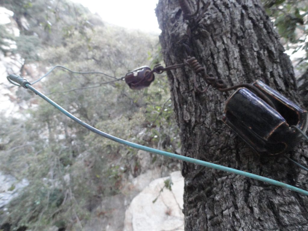
Phone line and insulator detail of crank telephone system. This location is at the top of Sturtevant Falls on the Upper Falls Trail.

Have you ever wondered what that green wire is running from tree to tree along the trails at Chantry Flats?  That green wire is part of the Chantry Flats crank telephone system over six miles in length.  This remnant phone system goes back to a much earlier time in the Angeles National Forest’s history; a time when the Angeles Crest Highway had yet to be built and trail resorts were thriving during the “Great Hiking Era.”  It was a time when much of southern California was still agricultural and hikers often took the Pacific Electric red cars (trolleys) to trailheads before embarking upon the multitude of paths in the San Gabriel mountains.

The crank telephone system connected most of the old trail resorts, such as Hoegees, Sturtevant’s, Roberts’, Fern Lodge and First Water Camps in the Big Santa Anita Canyon.  Many of the private cabins were also connected to the phone system, not to mention Guard Stations manned by the U.S. Forest Service.  The phone line also ran into the “backcountry” to places like the West Fork of the San Gabriel River and Coldwater Canyon near Strawberry Peak.  It went to Mts. Wilson and Lowe, up and down the Arroyo Seco Canyon and other canyons too numerous to include here.  In short, the crank telephone system was a vibrant, reliable form of communication for a time gone by.
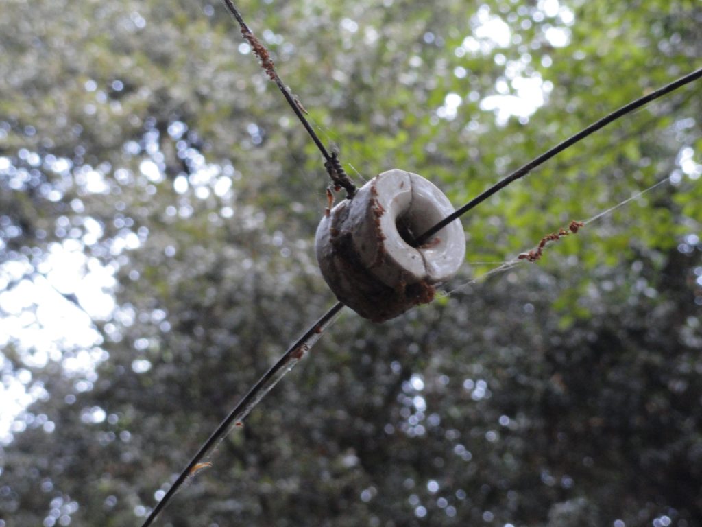
Split ceramic insulator carrying the 12 gauge phone line. Upper Falls Trail, Big Santa Anita Canyon.

Nowadays, in canyons other than the Big Santa Anita and Winter Creek,  you’d never know where to look for evidence of this historical technology in the Angeles’ early days.  If you’re hiking up the Sturtevant Trail toward Mt. Wilson, look for a number of remnant split ceramic insulators still dangling on rusted wire from the oak trees not far up canyon from Sturtevant’s Camp.  In some cases, you can see where the white, round insulators that used to be nailed directly into tree trunks are now being consumed by the still growing trees.  Just a nubbin of an insulator still protrudes from trunks of oak and spruce, sort of appearing the way a white spool of thread might appear if you looked  at it “on end.”  It’s center attachment nail long corroded and missing.

The phone line in the Big Santa Anita currently travels between the Adams Pack Station at Chantry Flats down to First Water and  then up stream to Sturtevant’s Camp four miles north and west of there.  Another section of line branches off from Roberts’ Camp, which is where the hikers’ footbridge is located.  From there, the line goes up the Winter Creek to a spot just up stream from Hoegees Campground.  The line travels from tree to tree, supported by ceramic insulators.  The line itself is 12 gauge and uninsulated, its’ core being made of steel for strength with a surrounding jacket of copper for conductivity.  Connections between sections of wire are made with “butt-in” style connectors made of brass which are crimped into place.  These connectors look like narrow little barrels that the line slides into before it’s crimped half way in.  The next section of line is slid into the other half of the barrel and crimped as well for an airtight and, hopefully corrosion-free seal.
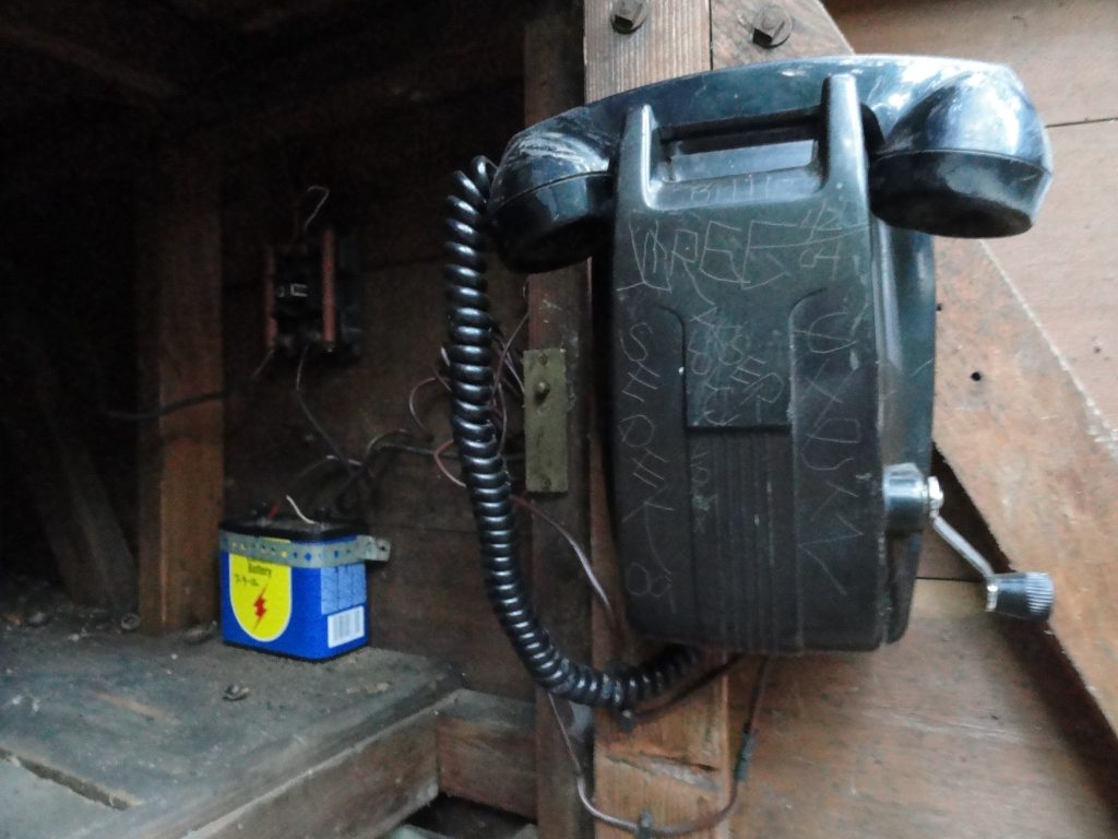
Crank telephone and battery in call box #8, Upper Falls Trail, Big Santa Anita Canyon.

There are currently nine call boxes located alongside the trails with crank telephones and batteries in them.  These call boxes are for emergency use, such as the reporting of fires or medical emergencies.  The locations of these call boxes appear on the Big Santa Anita Canyon Trails Map by canyon cartography.com.   A fair number of the cabins that you see along the trail also have crank telephones as well.  You might be wondering just how one makes a call from one of these antique phones.  Since there’s no dial at any phone, what you do is send a pattern of “rings” from your location that will tell the recipient of your call if the message is for them or not.  For example, the Pack Station is “one ring”, Sturtevant Camp is “two rings” and any private cabin would be “three rings.”  This is known as a party line and was quite common in rural areas of the United States up until the 1950′s and early 60′s.  A ring is created when the crank handle located on the phone is turned rapidly as possible to generate voltage.  (the crank handle is connected to a 2, 3, 4 or 5 bar magneto)  So, say you’re calling a private cabin owner, you’d crank the handle vigorously several turns, pause…., then crank several turns, pause…, then several more turns.  Now, stop cranking and just listen.  Be patient.  Chill out and wait a good minute for your party to pick up on the other end.
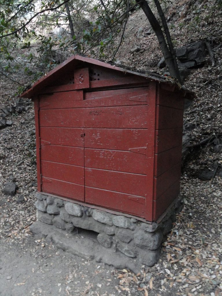
Call box #8, Upper Falls Trail, Big Santa Anita Canyon.

On a crank telephone, your voice is carried by battery power.   There’s no need to keep cranking a phone when speaking – only to ring someone.  Each phone is protected by a carbon block lightning protector.  You’ll notice that the call boxes along the trail also have a 6 volt lantern battery attached to the phone.  Originally, the phones were intended to operate on 3 volts, not 6.  The batteries were cylindrical, dry cell 1 volt types in series.   It seems that for decades now, we’ve been using the lantern batteries without damage to the phones.   Also another detail in regard to this type of system is that there’s only one wire traveling from tree to tree.  All phone systems have a circuit that must be completed, thus the wire pair we’re all so used to seeing.  So, where’s the other half of the wire pair?  It’s the earth.  Each phone or call box must be grounded some how.  Sometimes there’s a ground rod driven into the earth for this purpose, other times there’s a bare wire going into the stream or a ground wire’s attached to a cold water pipe.  Good grounding’s important if you’re going to have a clear pathway for your phone to work and to be easily heard.

The call boxes that you see along the trails were built by the U.S. Forest Service back in the 1940′s, just after World War II.  Each call box not only had a phone, but a water pump with a suction strainer and fire hose.  There were also McClouds, shovels and other fire fighting tools.  Back in the 40′s, 50′s and 60′s, it was expected that members of the recreating public be willing and able to fight wildfire if the need arose.  The Forest Service also maintained the phones and phone line, climbing trees and restringing wire as necessary.  Unfortunately, with budget cutbacks constantly hacking away at the Angeles’ operating costs, phone repair fell by the wayside.
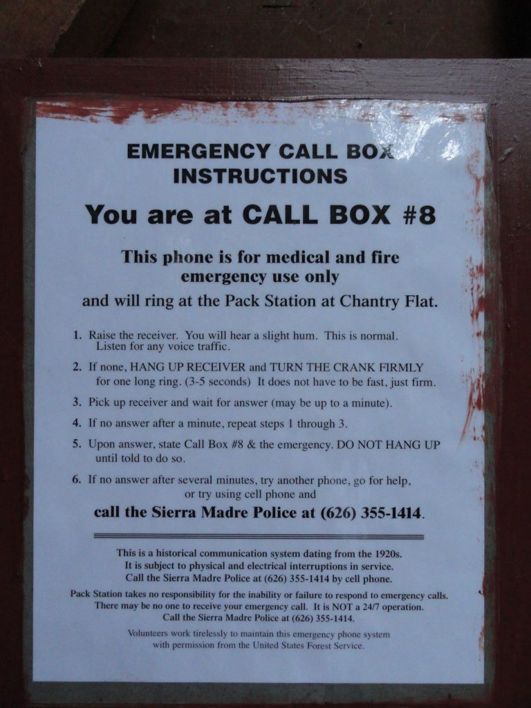
Operating instructions for the Chantry Flats crank telephone system. Call box #8.

Fortunately, the Big Santa Anita Canyon Permittees Association, comprised of concerned cabin owners, took over the maintenance of the crank telephone system.   This rural phone system is truly a last remnant of an earlier time in Southern California’s San Gabriel mountains.
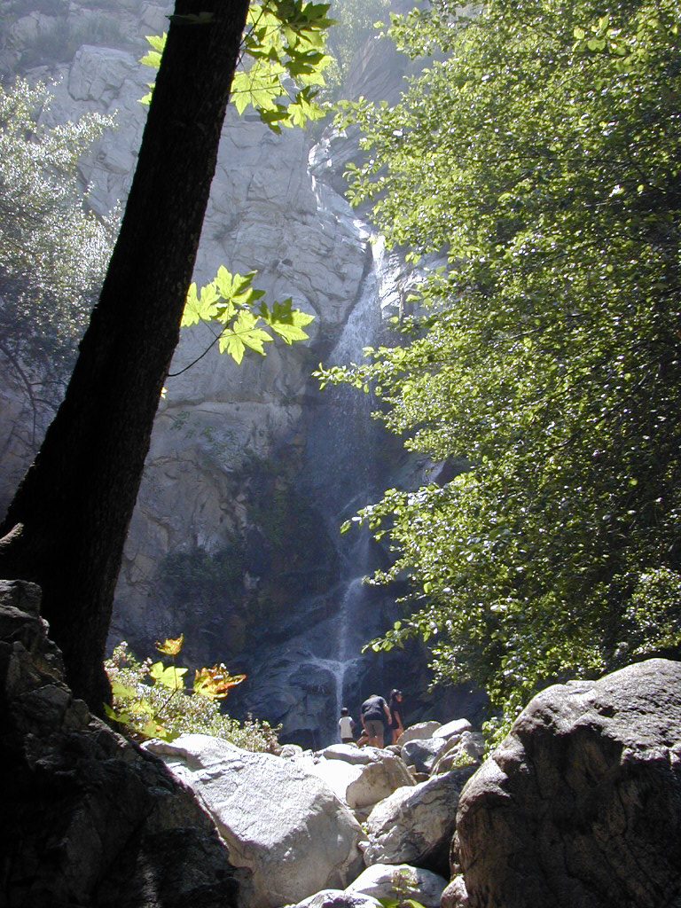
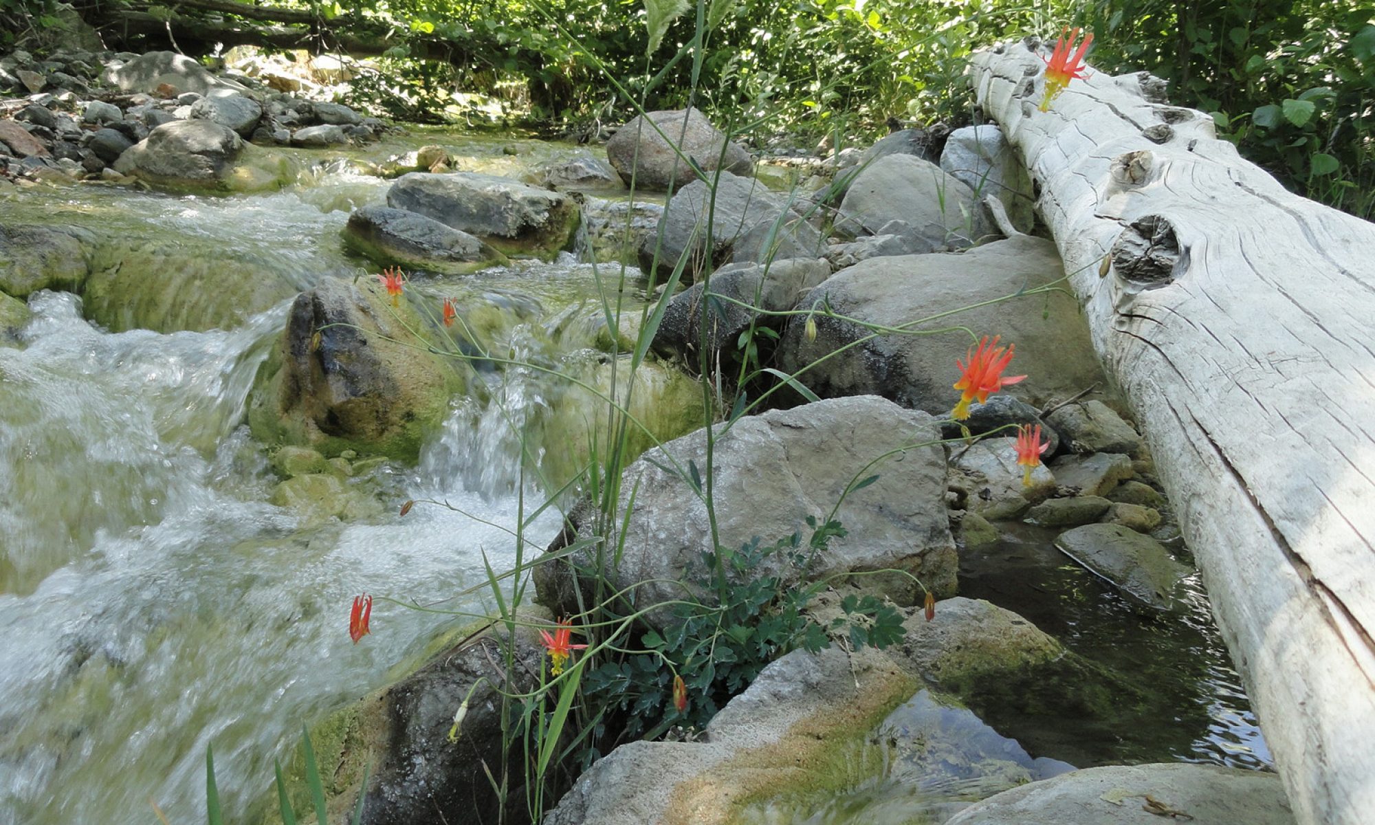
Monkey Flowers in Bloom along the Upper Winter Creek

Posted on August 30, 2012 – Written by Chris Kasten
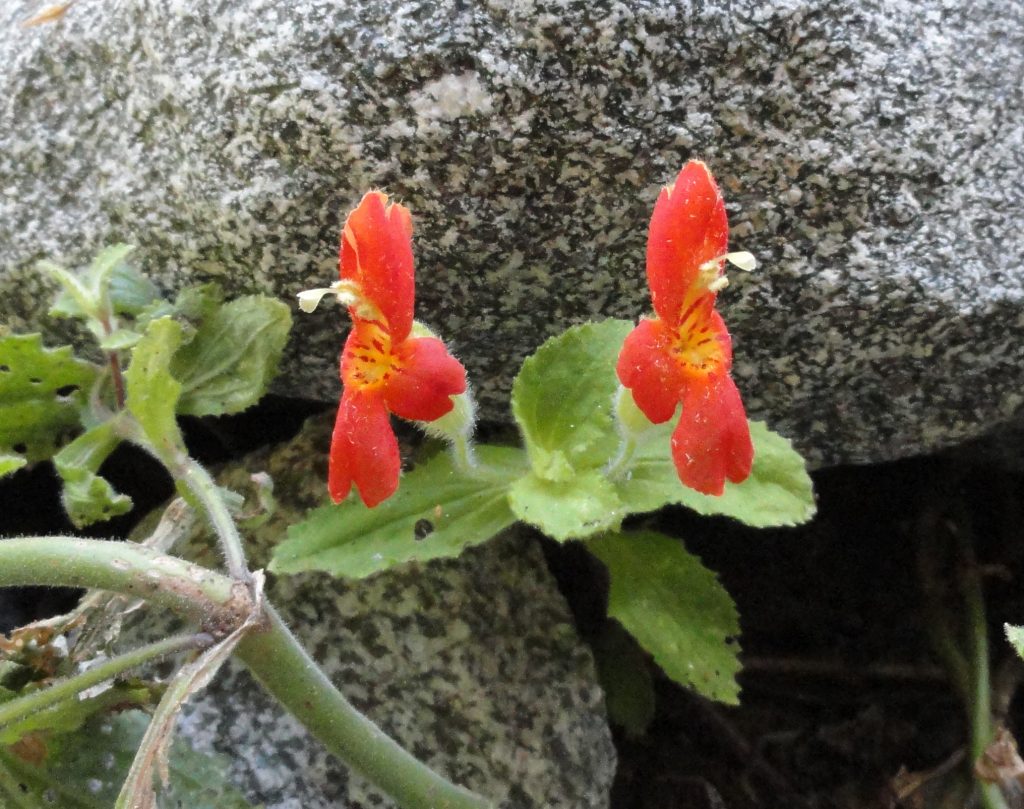
Scarlet Monkey Flower, Upper Winter Creek.
Monkey Flower as seen between Hoegees and Mt. Wilson in the Winter Creek.

These two photos were taken recently along the Winter Creek, between cabin #139 and Mt. Wilson’s summit.  Scarlet monkey flower (Mimulus cardinalis) and Common monkey flower (Mimulus guttatus) can be seen growing in moist sands along the stream bed, especially above 3,000′ in elevation.  These colorful flowers add a splashy beauty to the speckled granite boulders and light sandy stream sands.


Humboldt Tiger Lilies are in Full Bloom Along Chantry Flats’ Stream Side Trails

Posted on June 6, 2012 – Written by Chris Kasten

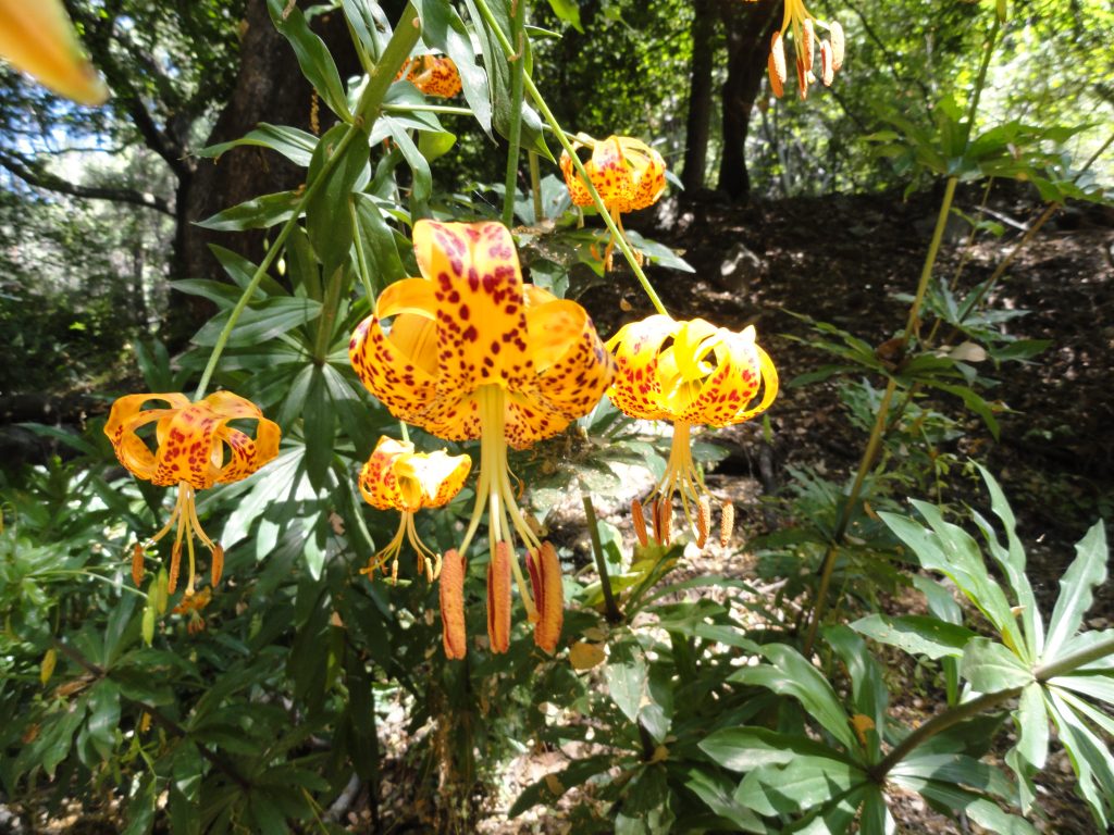
Hiking on the trails that originate out of the Chantry Flats trailhead, you are bound to see the magnificent Humboldt Tiger Lilly (Lilium humboldtii) in all its’ splendor .     This bloom was photographed on the Lower Winter Creek trail this last Saturday.  This tiger lilly  can be found growing along moist canyon stream beds throughout the front country of the Angeles National Forest.     Late May through the month of June tends to be the time for these beautiful flowers to make their annual appearance.  This native can be enjoyed on your next hike at Chantry Flats, whether it be the Big Santa Anita Canyon or in this case, the Winter Creek.

Humboldt Tiger Lillies, Lower Winter Creek Trail. Winter Creek, Big Santa Anita Canyon.

Sturtevant Trail of Big Santa Anita Canyon – A Steep Path Through Both Rugged and Gentle Beauty

Posted on May 26, 2012 – Written by Chris Kasten

I recently descended the Sturtevant Trail off the east side of Mt. Wilson, one of steepest of the Santa Anita Canyon trails.  This was the second reconnaissance trip of trails on and around Mt. Wilson’s summit for the creation of the companion map to Big Santa Anita Canyon Trails Map.  The Sturtevant Trail was the original way into Sturtevant’s Camp.  Wilbur Sturtevant built the trail into his camp in the early 1890′s.  Sturtevant Camp’s first season of hosting guests was way back in 1893.

Sturtevant’s Camp was to be the first of five resorts to be built in the Big Santa Anita Canyon and the Winter Creek.  To this day, the camp continues to host groups, making it the longest lasting trail camp from the resort days during the Great Hiking Era.

The Sturtevant Trail is identified in the Angeles National Forest’s trail catalogue as 11W16.  It is approximately 2.8 miles in length and has a total elevation gain or loss of 2,500 feet between Sturtevant Camp and Mt. Wilson.  Most of the slope that the trail follows is north and northeast facing, thus is for the most part shaded.  Be ready for two great attributes to be found along this trail.  First, while still above the Halfway Rest, enjoy views out toward the High Country of the San Gabriel mountains.  You’ll see Mt. Waterman, Twin Peaks, Throop Peak, Mt. Islip and even Old Baldy (Mt. San Antonio).  In the areas just south of Mt. Waterman and Twin Peaks, you’ll see the San Gabriel Wilderness drainage of Devil’s Canyon.  All of this is visible just above the north rim of the Big Santa Anita Canyon.  The second, and much closer treat, is the realization that you’re hiking amidst and under the canopies of very large Big Cone Spruce.  The area in and around the Halfway Rest is a particularly beautiful example of a mature forest of big cone spruce, canyon live oak and big leaf canyon maple.  There’s a park like expansiveness to be found on this slope in the extreme upper end of Big Santa Anita Canyon.
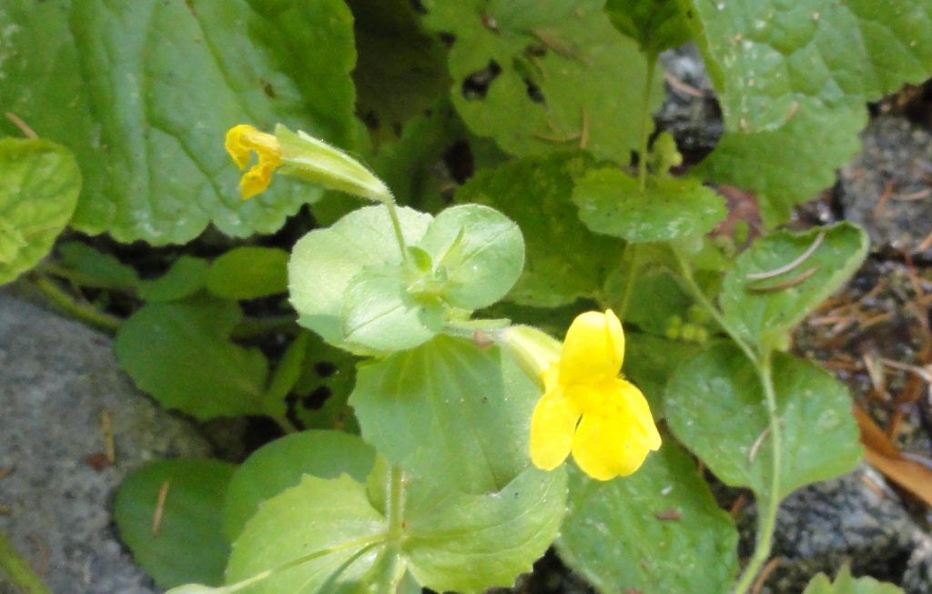
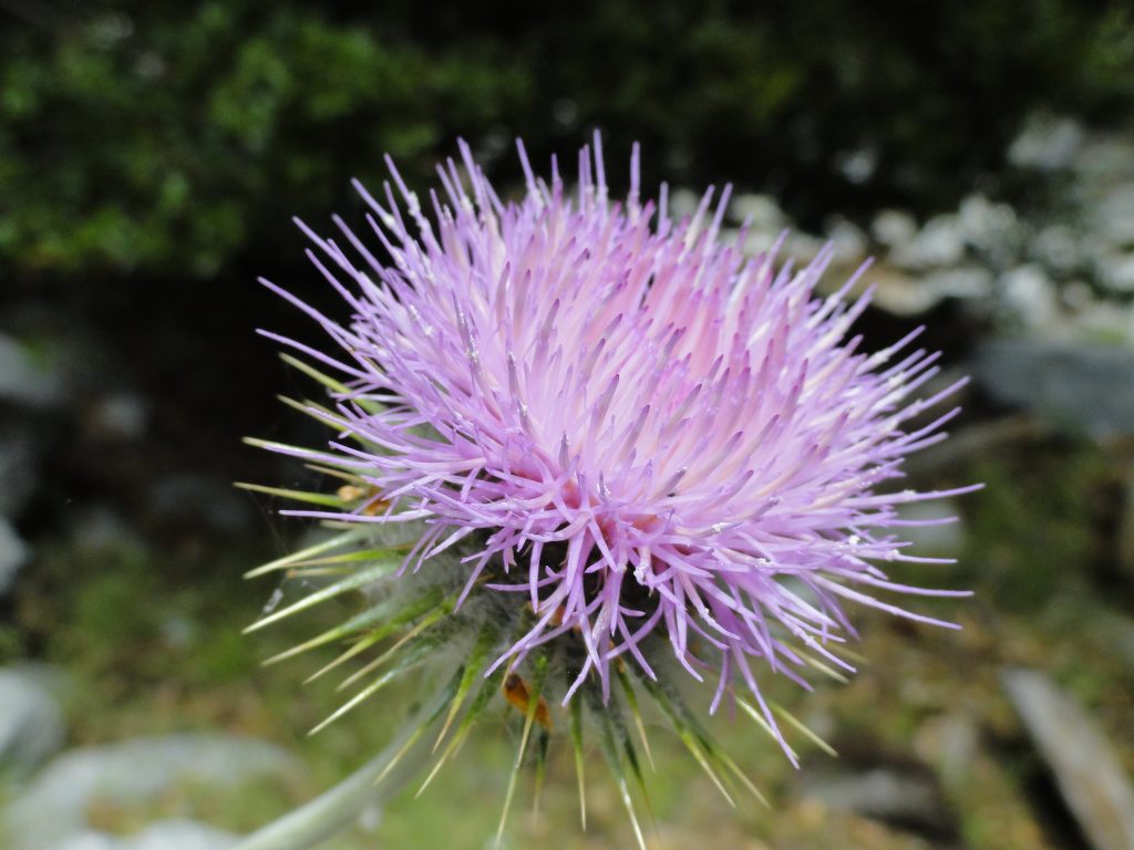
Thistle in full bloom along the Sturtevant Trail. Photo taken not too far up canyon from Sturtevant Camp.

The day I did my round trip down and back on the Sturtevant Trail, I stopped for lunch along a wild and untouched section of the stream bed just up from Sturtevant Camp.  I found this thistle just above the dry sandy and bouldery bed.

Consider Bringing Just a Little Extra on Your Next Hike….

Posted on April 13, 2012 – Written by Chris Kasten

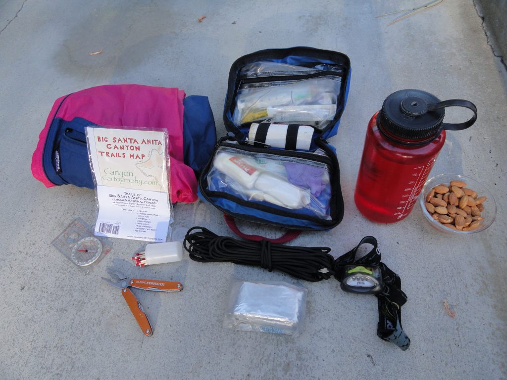
The 10 essentials

When out hiking or biking the beautifully rugged canyons of the San Gabriels, it’s tempting to just go without any extras.  No pack, nothing in our hands, nada.  Yet, here’s something to consider.

The Big Santa Anita Canyon, like many front-country canyons, is tantalizingly close to the the urban expanses of pavements, cars and cell phone reception.  In no time, well maybe 20 minutes, you’re at the trailhead and onto single-track foot trails or perhaps ambling x-country up a steep canyon.  The mindset of urban and suburban thoughts barely have the time to shift to the contemplative, natural thought processes of traveling in relatively open and wild places.  Your body’s muscle memory hasn’t quite caught up either.  It’s all happening so fast.

What a gift this is to have such quick access to the canyons, ridge lines and slopes that are so dear to our hearts.  More and more people each year are discovering the same miracle of this unique geography.  And although we continue to spontaneously take off for the mountains from our suburban springboards, doing that mental and physical shift over and over, again can be met with surprises at any stage in our lives.

Eventually we all get caught out in the dark without a flashlight during those autumn days when the amber light dwindles rapidly to long nights.  We run out of water on a hot and exposed ridge line in mid-summer.  We end up soaked to the bone on a frigid winter day that started out sunny and all too quickly became windy and rainy before returning to the trailhead.  We thought that the trail certainly should have peeled off the ridge by now or that we may have missed the junction just below the campground that we really need to find before starting dinner and getting the tent set up.  If I’d brought a detailed map of the area along with a compass, maybe I’d already be there and fed. On and on it goes.  Rarely does nature bail us out of our mistakes.  And …. maybe, if you’re lucky, you’ll run into someone who is prepared for being out here.  I hope they get here fast!

Instead of depending on someone else to help you out of the unforeseen, consider being a guiding light to someone else who just might need you!  By carrying a small number of essential items, you may just end up being a blessing to a complete stranger in an entirely unpredictable situation that might have ended tragically had you not been there.  You just never know.

So, what should you have on you, regardless of the time of year?  Here’s a short list.

A well-stocked first aid kit, with the knowledge of how to use it.  Add a Sawyer Extractor kit to your first aid kit.

Flash light or headlamp with fresh batteries.

At least a liter of water for each person travelling.  Two liters if the weather’s hot.

A detailed map of the area where you’ll be travelling.  Review your map prior to leaving the trailhead!

An orienteering compass with transparent base plate.  If you have a GPS device, still bring a reliable compass.

Light jacket.  PolarTec or another type of synthetic fiber is a good idea in case you get wet.

Space blanket.  This is a very tightly folded, silvery coated sheet that you could wrap yourself into if you had to spend the night unexpectedly .  Once you take it out and unfold it,  you’ll never get it back in the original package!

Lightweight poncho or rain gear.

50′ of parachute cord or equivalent.

Waterproof matches and/or butane lighter.

Cell phone.  If you’re in a spot where you might have reception, you’d be able to keep the panic level down at home, while letting them know that you’re just late and o.k.  If you need Search & Rescue, you can reach them as well.