
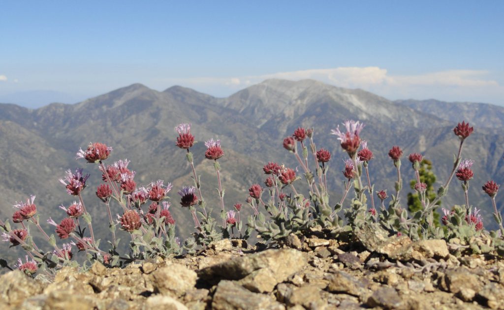
Looking east across the Sheep Mountain Wilderness. The three peaks that make up the skyline are from left to right, Pine Mountain, Dawson Peak and Mount Baldy. This photo was taken from the Pacific Crest Trail just before arriving at summit of Mount Baden-Powell.
The Trails of Wrightwood – Big Pines hiking map is now available! This is a large-scale, hand-drawn, trail map created on weatherproof / tear-proof paper and measures 19″ x 28″. Folded dimension is 4.75″ x 7″. A banner listing of 20 trail hikes for the Wrightwood – Big Pines area is located at the top of the map. Distances along with elevation gain and loss is provided for trails that range from short, easy to follow nature walks to more challenging hikes. Check out Mountain Hardware’s Great Outdoors Page for a look at some of the trips to be taken. Go to: http://mtnhardware.com/outdoor-report/category/hiking-wrightwood/
Contour lines have been purposely omitted, providing clarity and a sense of open space between the trails, roads, points of interest, as well as natural features such as streams and summits. This is a map intended for the use in traveling hiking trails, fire roads and local roadways. If you’re planning on hiking cross-country (off trail) in this map’s area, it’s recommended that you travel with topographic maps and are skilled in the use of land navigation.
This map is hand drawn using rapidograph technical pens. Trails and streams are hand lettered. The base cartography was provided by using four, 7.5 minute topographic maps of the eastern San Gabriel mountains. The maps used are: Mount San Antonio, Crystal Lake, Valyermo and Mescal Creek. The coordinates for the southwest corner are 34 19′ 32″ N 117 46′ 9″ W Coordinates for the northeast corner are 34 23′ 38″ N 117 37′ 38″ W. Projection: NAD 27 CONUS.
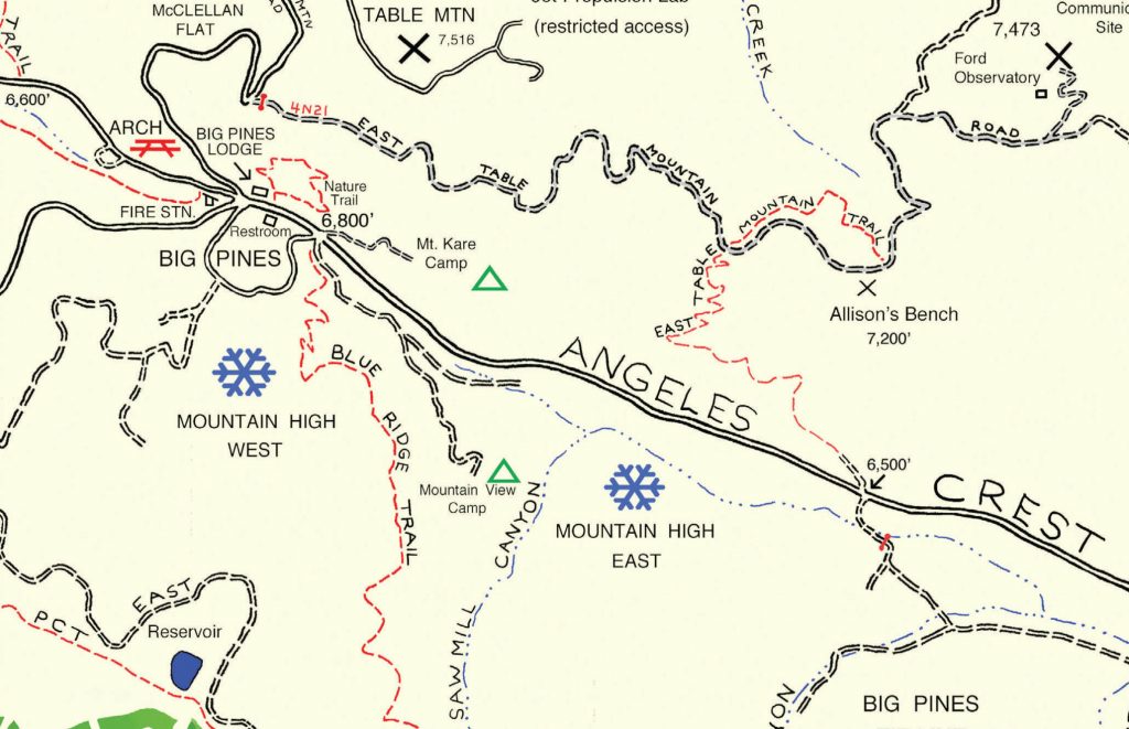
Detail of trails near Big Pines, four miles west of Wrightwood, CA. (sample image taken from Trails of Wrightwood – Big Pines map)
In the spring of 2015, I began doing the field work for this project. It began with the hike down into the East Fork of the San Gabriel River from Vincent Gap on the Mine Gulch Trail. Week after week, with clipboard in hand, another trail section would be followed within the mapping area, making corrections for trail realignments, washouts and places where bouldering and route choosing becomes necessary, such as downstream from Mine Gulch Campground or the lower Prairie Fork. Much of the trail sections shown on the base topo maps appeared to be accurate, while a number of trails on the topo maps were now nonexistent. Using an orienteering compass, I would site on landmarks using intersection technique to
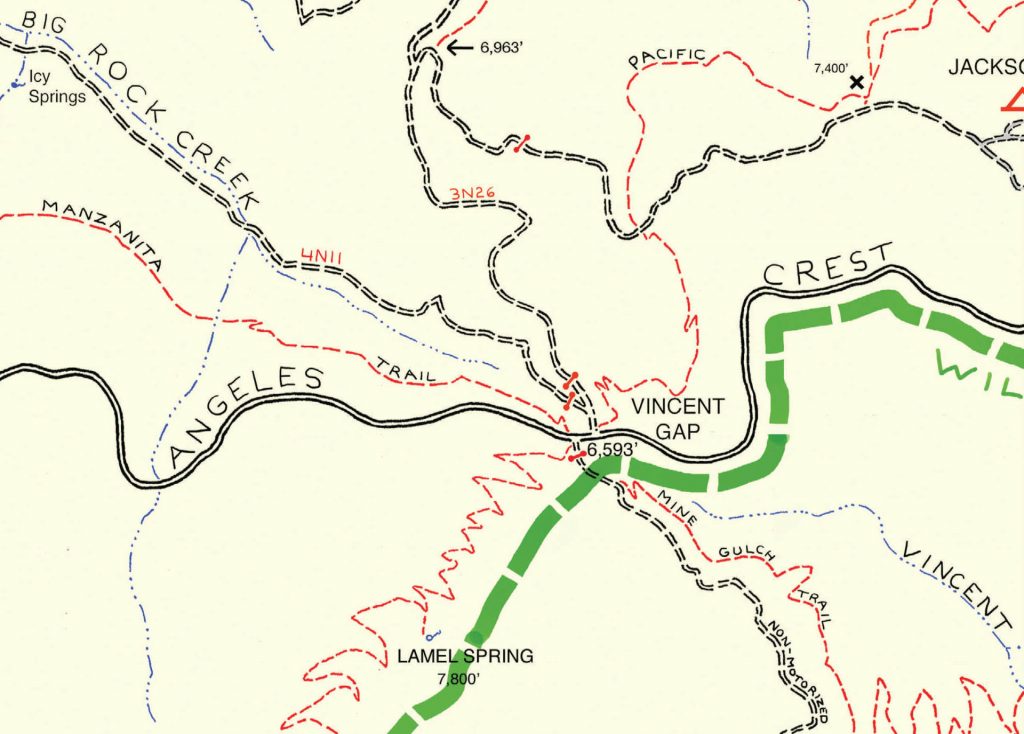
Detail of trails near Vincent Gap on Highway 2 near Mt. Baden-Powell. (sample image taken from Trails of Wrightwood – Big Pines map)
locate and confirm my location at many points along the various trails and then “draw in” what was actually out there. With the changes that can occur within years and years in steep mountainous terrain, trails and roads can often literally disappear or be significantly re-routed around natural obstacles. Even campgrounds can return back to nature, such as in the case of Cabin Flat, which can no longer be driven into from Lupine Campground. It has now become a trail camp since the road was closed to motorized use.
The heart of this mapping project was doing the field checks and then drawing in the changes on the trails located throughout the map’s neat line. Once back at home, I would transpose the field drawings onto a 30″ x 40″ sheet of drawing paper in pencil. A grid was drawn on both the topo maps as well as the working copy at home. This grid technique is quite a time-proven way of preventing distortion and mechanically increasing the size of the map being created. Finally, once I was satisfied with the accuracy of the penciled in trails and other map features, the line work was inked in. The entire drawing was then scanned at 300 dpi on a roller scanner and converted into a jpeg file, making it compatible for editing and colorizing with PhotoShop. From start to finish, this mapping project took just over seven months, providing an overview of the trails bounded by Wright Mountain (East), Mount Baden-Powell (West), Jackson Lake (North) and the East Fork of the San Gabriel River (South).