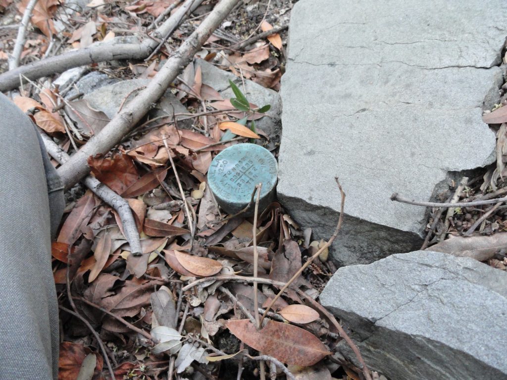
Here’s the benchmark for the corner section that appears just within feet of the old Monrovia Peak Trail. This corner section benchmark (monument) is attached to the end of a pipe. Richard Loe and I found this 1927 benchmark entirely by accident, when sunlight happened to be shining on it at just the right moment!

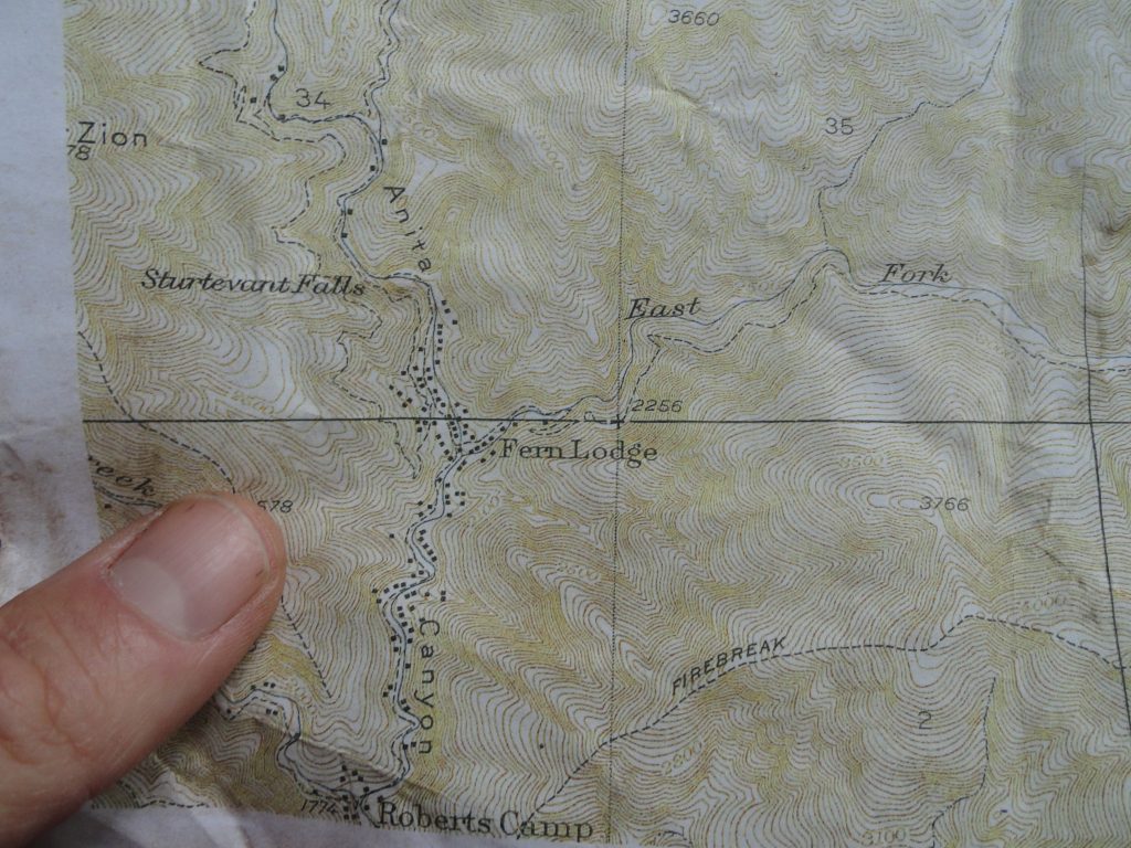
Here’s an old topographic map of the Big Santa Anita Canyon showing lots and lots of cabins that were still here before the great flood of 1938 and the Monrovia Peak Fire of 1953. Where those lines cross, to the upper right of my thumb, is the range and township monument (benchmark) that Richard and I found. Look how close it is to the old Monrovia Peak Trail heading up the East Fork tributary canyon.
A rare find – 1927 benchmark found near Chantry Flat. Check out what was found while traveling up the old East Fork Trail, which once ran from Fern Lodge in the Big Santa Anita Canyon to Spring Camp near Monrovia Peak. This benchmark is dated 1927. While x-country hiking with Richard Loe, we found this oxidized brass range and township marker located just below the old East Fork trail about 80-100′ up from the stream bed. If you look closely, it’s possible to see that it was installed by the U.S. General Land Office surveyors. See the location of this marker on the old topographic map, lower image. If the light cast on the mountainside hadn’t been just right…. and if I hadn’t looked in just the exact location at that moment, it would have been quite likely we would have just hiked right on by! It’s amazing to me that rockslides and the movement of soils over the last 85 years hadn’t just buried this cartographer’s treasure from the past. Upon closer inspection, it was discovered that the benchmark “cap” was affixed to a galvanized steel pipe driven into the mountainside. There are undoubtedly other markers to be found by those hiking cross-country in the front-country canyons of the San Gabriel mountains.
