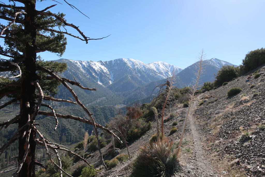
Mt. Baldy and Dawson Peak as seen from the PCT. This view is looking across upper Lytle Creek and still some miles below East Blue Ridge.
Vincent Gap trailhead is once, again, open to vehicles coming in through Wrightwood. Highway 2 continues to be gated to any driving west of the trailhead. If you’re looking to hike up to Mt. Baden Powell or drop down into the East Fork, all this is possible now and through the summer and autumn months.
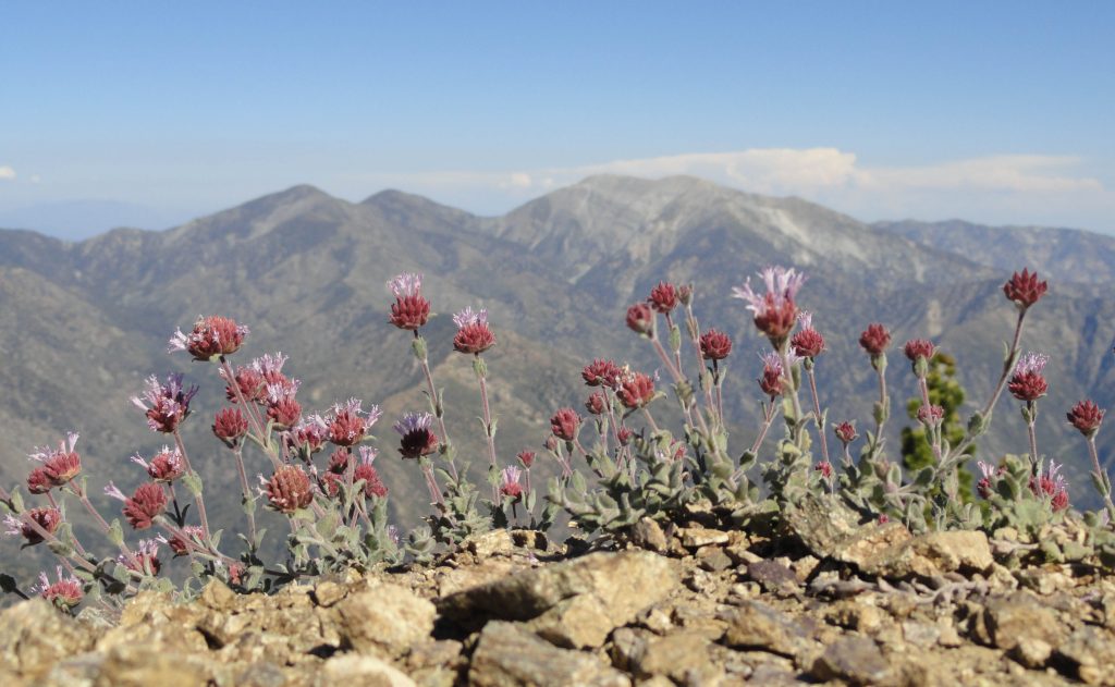
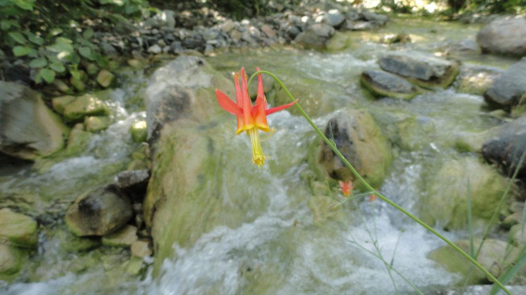
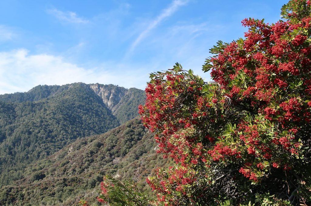
Looking out across the East Fork of the San Gabriel River to Pine Mountain, Dawson Peak and Mt. Baldy. This view is from a spur ridge just below summit of Mt. Baden-Powell. A native Columbine graces the East Fork just downstream from Mine Gulch Campsite .
Late winter through spring is a really good time to hike up to Mt. Wilson. Even as Chantry Flat in the Big Santa Anita Canyon continues to heal from the Bobcat Fire of 2020, don’t feel like there’s no good way up to Mt. Wilson. If you’ve never done it, hiking up the Old Mount Wilson Trail from scenic Sierra Madre, is not a bad way to go. The canyon you’ll travel through on your way up toward Manzanita Ridge is known as the Little Santa Anita Canyon. This is the original way up to “Wilson’s Peak”, named after Don Benito Wilson. The trail dates back to the 1860’s
A view of Mt. Baldy from Manzanita Ridge.
Manzanita Ridge, sections of it quite true to its’ name, makes up the watershed divide between the Winter Creek (to the north) and Little Santa Anita Canyon on the south. Following the ridge line up toward the Old Mount Wilson Toll Road, views out into the High Country of the San Gabriels abound. Once up on the Toll Road, you’ll continue to walk along refrigerator-sized boulders that have dropped off the near vertical slopes of Mt. Harvard.
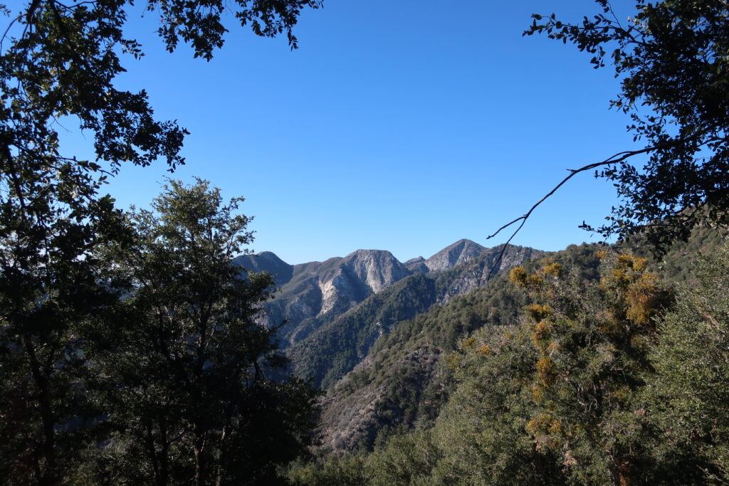
Once you reach Martin’s Saddle, the site of a once popular trail resort of the late 19th Century, views out toward the west are to be had. You’re now contouring the slopes of Upper Eaton Canyon, a beautifully rugged wilderness in its’ own right. Looking out across the steep and deep tributary canyons, there is from left to right, Mt. Lowe, Mt. Markham (flat-topped) and San Gabriel Peak. When the air is clear, this scene is spectacular.
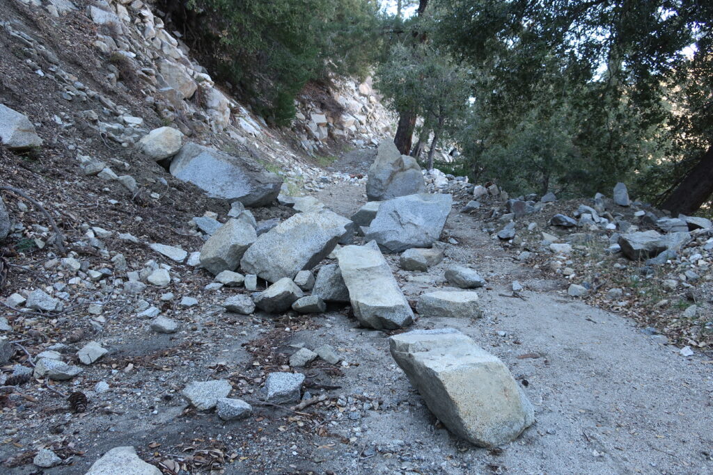
Boulders accumulate on the Mt. Wilson Toll Road in the aftermath of winter storms. A view across Upper Eaton Canyon
Once up at the top, I found a picnic bench in the open air pavilion and soaked in the sunlight for sometime before heading back down. The Pacific reflected back at me like an amber platter just to the north of the Palos Verdes peninsula. What a beautiful place to be hiking. what a beautiful place to be alive.
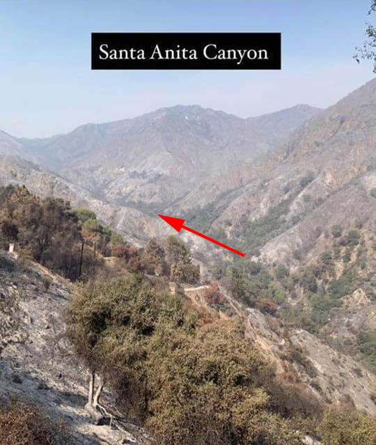
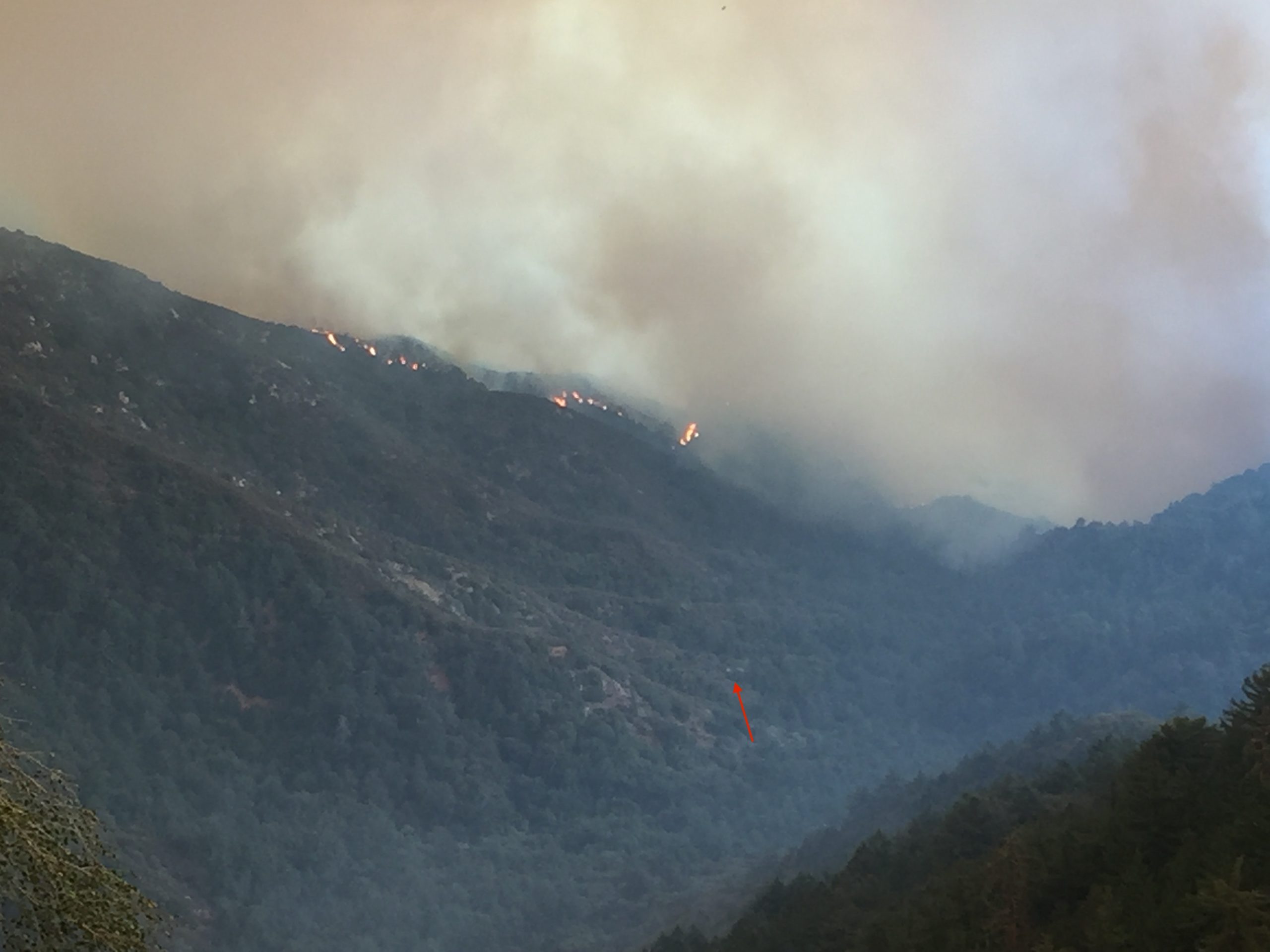
This photo was taken just a couple of days ago by an unnamed fire fighter and posted on Instagram. Photo was taken near Chantry Flat and is looking north up toward Sturtevant Falls. The arrow tip is in the Fern Lodge area of the main canyon, where the Upper Falls Trail and Gabrielino Trail leave the canyon bottom, continuing up and past Sturtevant Falls toward Cascade Picnic Area and Spruce Grove trail camp. It appears that much of the canyon bottom tree canopy is still intact after the Bobcat Fire !
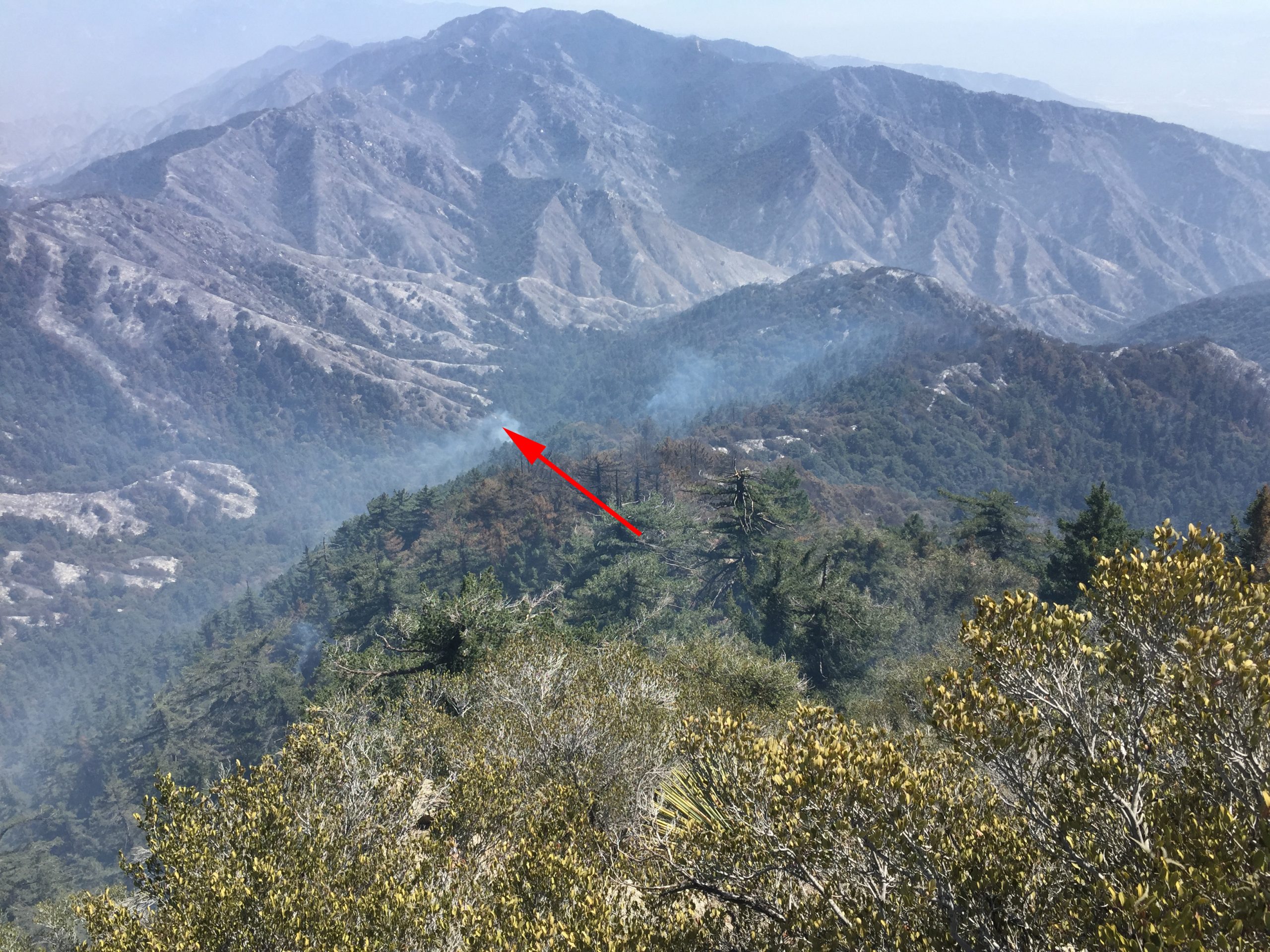
Attached are two photos taken of Big Santa Anita Canyon in the aftermath of the Bobcat Fire. There’s a third photo here, too. It is of the flames dropping into the upper Big Santa Anita Canyon during the fire’s early stages of development. The first photo was taken a couple of days ago. Here you’re looking up the canyon from a point near the trailhead at Chantry Flats. The second photo was taken by Larry Webster of Mt. Wilson just a day ago. The view is from the east end of the summit looking down toward Sturtevant Camp. Note the smoke still curling up from either the camp or adjacent to it. It’s still too early to know what the damage actually was to the camp or the nearly eighty private cabins up and down the Big Santa Anita Canyon and Winter Creek. Updates to follow as they come in.
This photo was taken after the fire passed through, by Larry Webster of Mt. Wilson, CA. That’s Monrovia Peak, highest point in center horizon of photo. At the tip of arrow is Sturtevant Camp. As of this writing, it’s unknown how the camp fared in the Bobcat Fire.
This photo was taken before the Bobcat Fire reached Mt. Wilson. Sturtevant Camp’s heliport is marked by the small red arrow. Coincidentally, the camp itself, is located at the bottom, or start, of the arrow’s shaft.
The Bobcat Fire dropping down into upper Big Santa Anita Canyon. At the end of the little red arrow is the heliport at Sturtevant Camp. Photo taken from Mt. Wilson by Larry Webster.
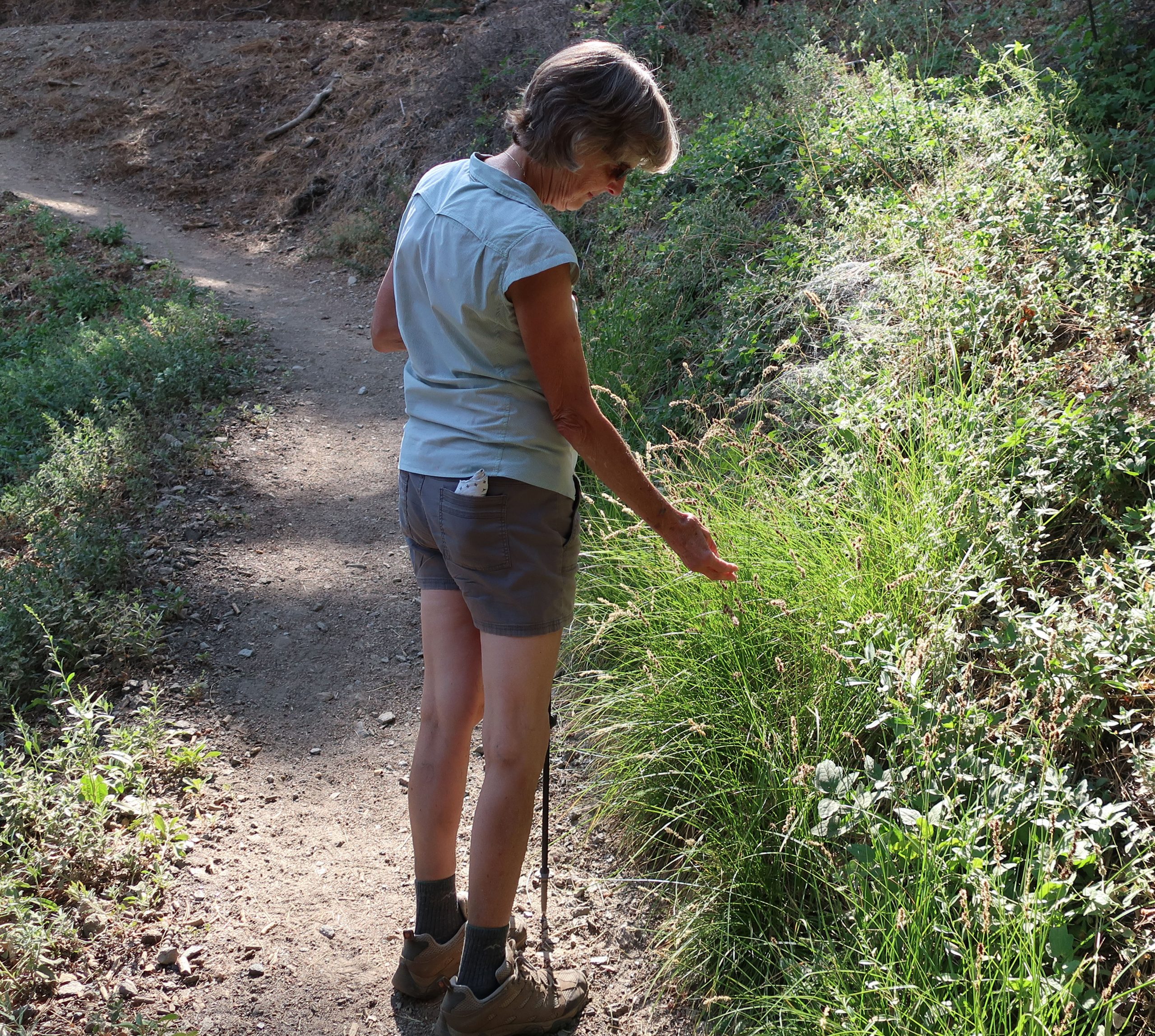
Joanie pauses alongside the Blue Ridge Trail to check out some dried flower stalks of grass in the fading light.
Wrightwood’s Blue Ridge Trail hike, located just three miles west of this scenic mountain village, is a good place to get some shade and maybe even a little cooler weather, this time of year. The trail runs between Big Pines and Blue Ridge Campground, traversing richly forested mountainsides. Total elevation gain is only 1,100′ in the two miles spent under the canopy of expansive white fir, black oaks, Jeffrey, ponderosa and sugar pine. Starting at 6,800′ , the trailhead is located just across Highway 2 from the old Big Pines Lodge. There’s also a U.S. Forest Service information station here, which incidentally, is closed for the meantime due to Covid cutbacks throughout the Forest Service. Park in the paved lot adjacent to the restrooms. Walk down a worn trail through the brush that’ll cross the Mountain High West parking lot’s exit road. Look for the brown painted trail sign.
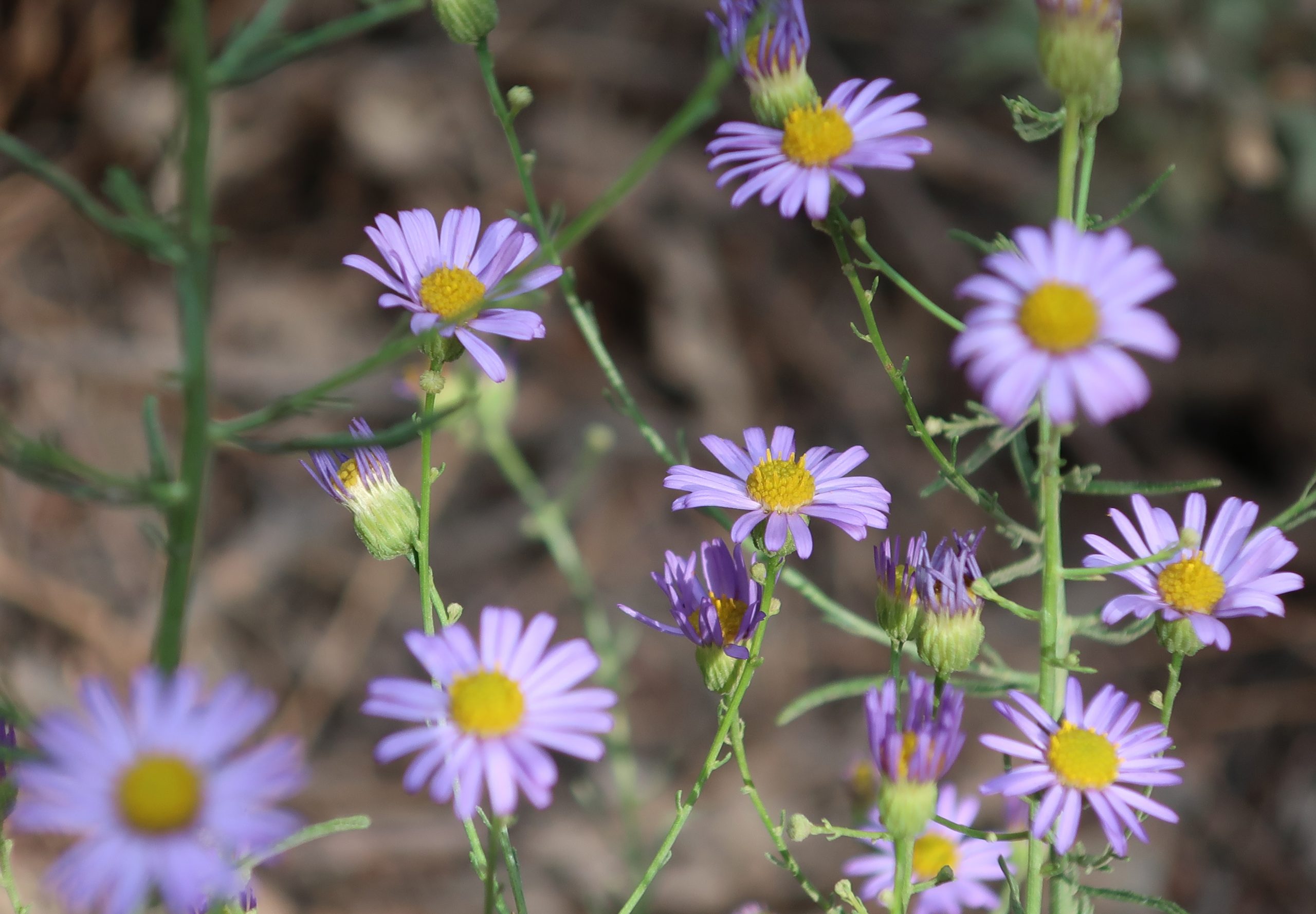
Clusters of asters are found growing along much of the Blue Ridge Trail, Wrightwood, CA. Also, look for them along the Lightning Ridge Trail as well as the Pacific Crest Trail where it runs along both East and West Blue Ridge.
Halfway up the trail is, true to its’ name, the Half Way rest. It’s a nice log bench indicating that you’re only a mile from Blue Ridge Campground and a mile from where you began. You’ll pass by some gentle draws along the mountainside where glades of gentle green squaw currant, dogwood and willow grow lushly. There’s the smell of moist plants and earth dropping down from these quiet places. The terrain is gentle, especially for the San Gabriel mountains. Take the time to breathe all this beauty in. Return the way you came.
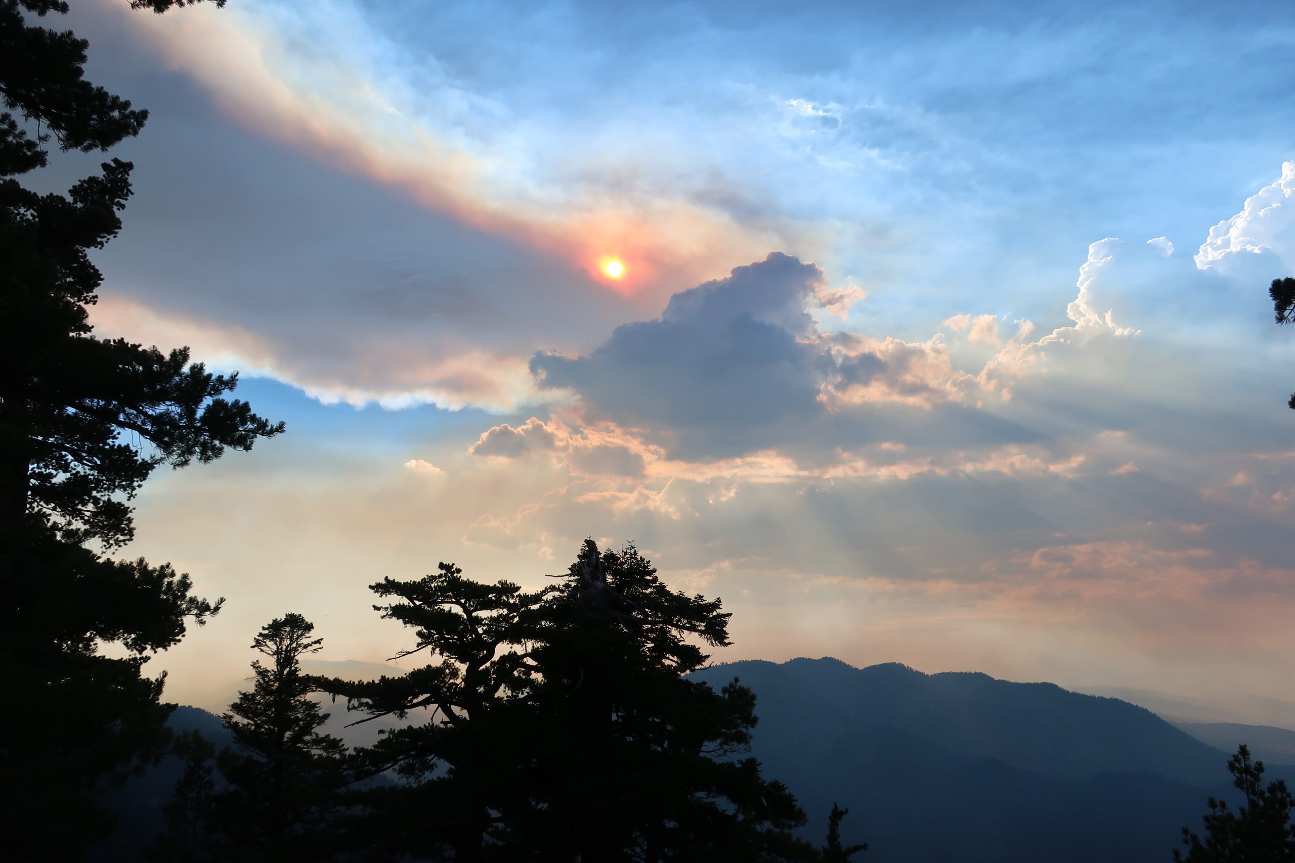
Late afternoon sun works its’ way through layers of smoke and cumulus clouds while the Ranch Fire burns way down below in the mouth of San Gabriel Canyon. That’s Mt. Williamson in the background, just right of center.
Hike the Dawson Saddle Trail for cooler temps and beautiful views of canyons and desert. A few days ago, Joanie and I drove up to Dawson Saddle for a late afternoon hike. Located approximately 13 miles west of Wrightwood, Dawson Saddle is the highest spot along the Angeles Crest Highway. At an elevation of 7,901′ , this trailhead starts you out at about the coolest temps possible this time of year. While the Front Country of the San Gabriel mountains smolders during the occasional heat waves of summer, high country hikes, or walks, are well worth considering for a refreshing getaway.
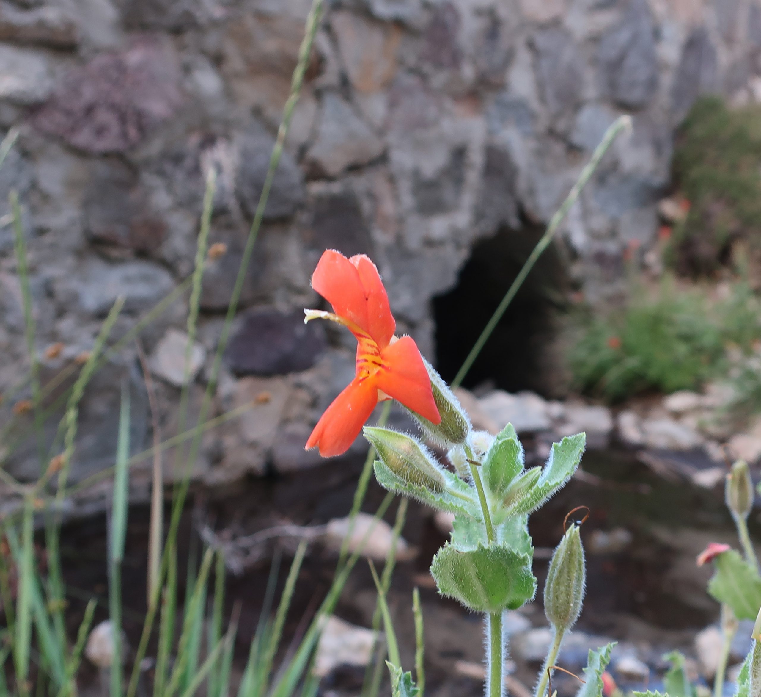
Scarlet monkey flowers are in full bloom along this small unnamed stream flowing off of Mt. Burnham. The location of the photo was taken along Highway 2 (Angeles Crest Highway) just east of Dawson Saddle. In the background is a culvert running underneath and through the old rock work of the highway.
About a mile up the trail, while heading toward Throop Peak, we caught this scene of smoke and cumulus clouds out over San Gabriel Canyon. The Ranch Fire II was still out of control a short distance up Highway 39 near Azusa. Up above 8,000′ , the breeze coming in from the Pacific was cooling, yet tinged with the acrid scent of burning chaparral from miles away. Our light was beginning to fade and we turned back around for the trailhead. While driving back home, we stopped at a spot alongside the highway, where an unnamed stream flowed down the north slope of Mt. Burnham and then under the road. Clusters of Crimson Monkey Flower and Columbine graced the stream bed. Scooping up the icy water and splashing our faces and arms under a darkening summer sky revived us for the twilight drive back.
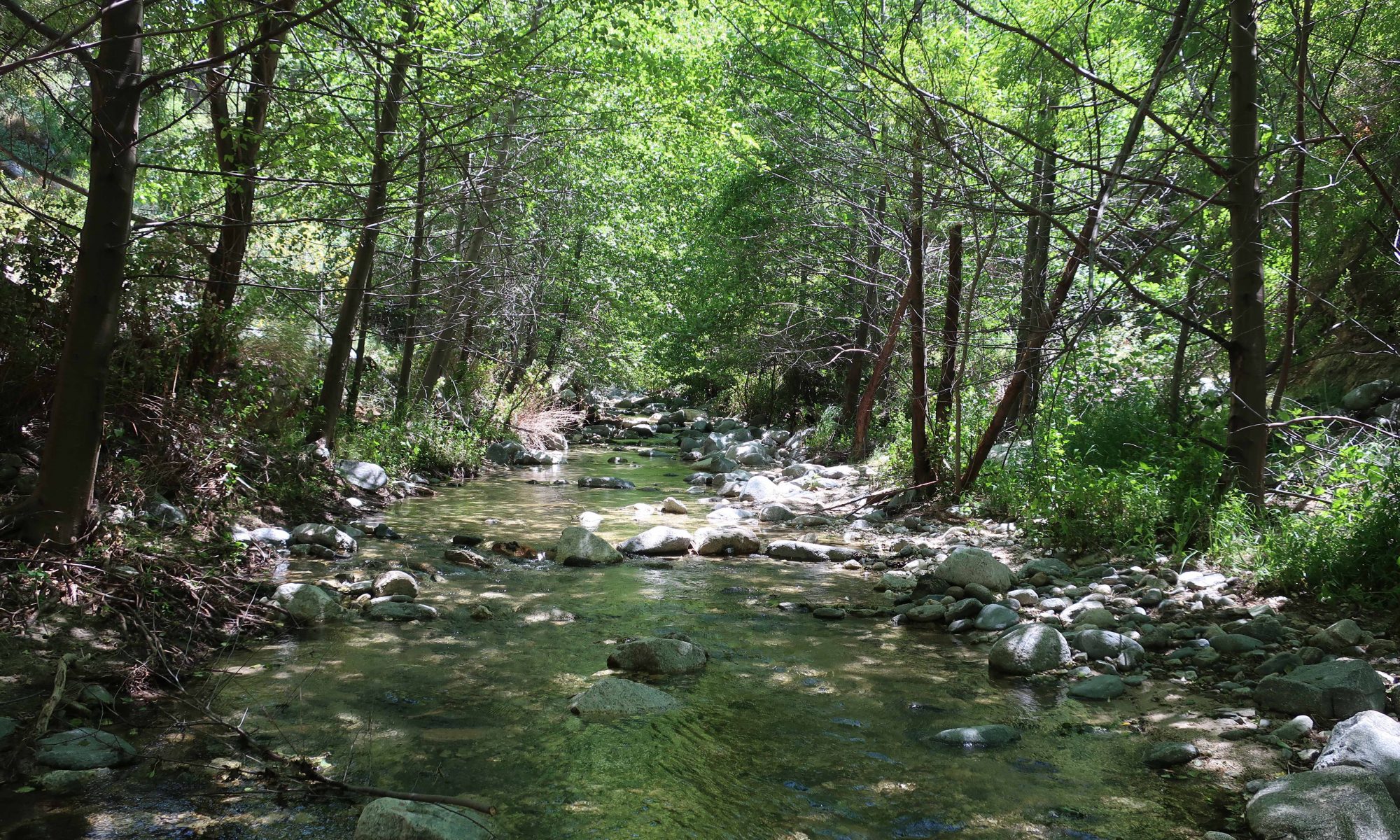
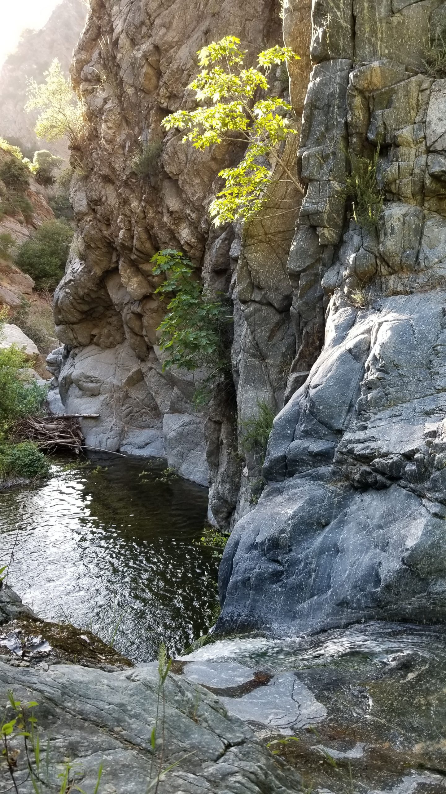
The Arroyo Seco’s Royal Gorge is a beautifully rugged, wild and trail less portion of the well-known canyon whose headwaters begin way up at Red Box and eventually emerges from the mountains near JPL in Altadena. This hike samples a variety of landscapes. The route requires hours and hours to complete, best done during the warmer months when days are their longest. We actually spent 14 hours doing this trip, allowing enough time to take it all in. If you’re looking to experience a bit of the old San Gabriels, a time before trails and roads left their imprint on the mountains, this deep canyon’s tranquil light and scenic pools will delight.
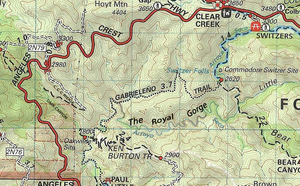
A portion of Tom Harrison’s Angeles Front Country map depicting the hike up the Royal Gorge portion of the Arroyo Seco. Park along the Angeles Crest Highway at elevation 2,980 near the gated fire road that goes out along CCC Ridge. This is your starting point. Leave a vehicle to return to on the highway at the entrance to Switzer’s picnic area. The Royal Gorge is that super squiggly blue line. You can see where the Gabrielino Trail departs the stream (near the letter “G” in Gabrieleno. The x-country portion of the Gorge draws to a close when you intersect the Bear Canyon Trail as both it and its’ canyon namesake enter the Arroyo Seco.
Total length, one way = approx. 7 miles
Elevation loss and gain = 1,180′ initial loss from CCC Ridge to Arroyo Seco via Dark Canyon. 1,500′ of gain from confluence of Dark Canyon and Arroyo Seco at the site of Oakwilde to Switzer’s picnic area.
It’s highly recommended that you bring water shoes for the long slog up the stream bed of the Royal Gorge. Also, I was glad to have brought trekking poles to help with balance in the gorge. The rocks, even the ones underwater, often have a slime coat that’s slick as ice. Take a dry pair of boots / shoes for the trail sections.
All that we found at the former Oakwilde C.G. site. Silt from storms that followed the Station Fire of 2009 have covered much of a remaining picnic table and Klamath stove.
WARNING: Your only real obstacle is a low waterfall in the Gorge. There’s a slime coating on polished granite next to handholds and footholds. This spot is technically class #3 bouldering, however, with the slime coat, you may want to consider carrying rope and bringing a hiking partner.
Start your hike by walking around the white pipe gate located where the CCC fire road comes out at the Angeles Crest Highway. The hot, exposed road soon peters out and turns to single track as soon as you leave the ridge top. The trail soon reaches the green canopy and watered bottom of Dark Canyon. You’ll pass by some old cabin ruins with some really nice rock work that still stands.
The instigator! Bohdan Porendowsky leads us up the Gabrielino Trail. Here we’re just upstream from Oakwilde C.G. (site).
Passing by black berry bushes and under a canopy of white alder, the trail stays with the little side canyon until reaching the broad sandy wash of the Arroyo Seco’s main canyon. While here, it’s worth poking around the site of a former U.S. Forest Service campground – Oakwilde. Once a thriving resort from the “Great Hiking Era,” the site became a backpacking campground, which I first spent the night at back when I was twelve years old. Not much remains now, especially after the Station Fire of 2009 and subsequent flooding and debris flows.
A narrow slot pool fringed with willows. Pristine and quiet.
From here, cross over the stream, picking up the Gabrielino National Recreation Trail. Continue up canyon, the trail following the stream amongst willows and mammoth overhanging canyon live oaks. You’ll find a solitary pipe frame from a picnic table that burned back in 2009. This is the little site of Red Shangraw’s Rest Area. Red was a U.S. Forest Service fire patrol officer who roamed much of the Angeles front country back in the late 1940’s to early 1970’s. In a little while the Gabrielino will make a stream crossing. It’s here where you’ll stay with the stream, allowing the Gabrielino to do it’s climb up and through the hot chaparral cloaked slopes, detouring around the Royal Gorge.
Here I am sporting Salomon water shoes. Much of the trip, especially with the good winter behind us, looks like this. Lots of wading under the high cliffs in the Royal Gorge.
Stay with the stream. As of this writing, the water’s nice and high. In most cases, you’ll find it easiest to just stick to wading up the stream bed itself, avoiding the inevitable thrashing through willows and brush. Cliffs, many a couple of hundred feet high, drop dramatically down to the twisting narrow stream. Once you’re in, this section of the canyon has you until emerging at the sight of the Bear Canyon Trail which’ll be off to your right after miles of wading and bouldering.
Here’s the most prominent obstacle throughout the Royal Gorge. Climb up and around to the right hand side. Be very cautious of the dark slime patches exuding from cracks in the polished granite!
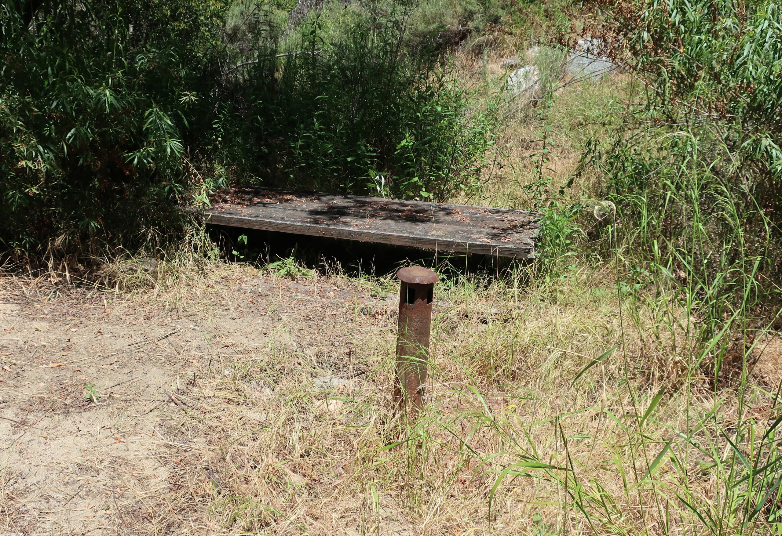
Bohdan and I actually ran out of light in the Royal Gorge, having to use our headlamps for nearly the last hour before tying in with the trail. Stick with trail which’ll now take you up and along the pools of the Arroyo. Eventually, you’ll come to the junction where folks head up to the base of Switzer Falls. This turnoff is well signed, directing you up to the Gabrielino Trail and onto Switzer’s campground above the Falls. At the spot where you finally meet back up with the Gabrielino, it’s a dry and exposed, quite high above the Arroyo. Now you’re only a couple miles back up to your car. It’s amazing how steep and cliffy the terrain downslope from the trail really is. One misstep in a number of spots and that would be it. Take your time, since you’ll most likely be a little tired by now. Pass by Switzer’s C.G., continuing upstream as the canyon takes on a gentler nature. You’ll walk along long gone stretches of a single lane road and retaining walls that nature’s reclaimed to herself as a hiking trail. You’ll finally come to the end of your time with the Arroyo as you cross a substantial wooden footbridge at Switzer’s picnic area. Since we’re still experiencing much of the Angeles N.F. camps and picnic areas closed due to the Corona virus pandemic, walk steeply up the paved, switchbacking road past the empty parking lots to the Angeles Crest Highway.
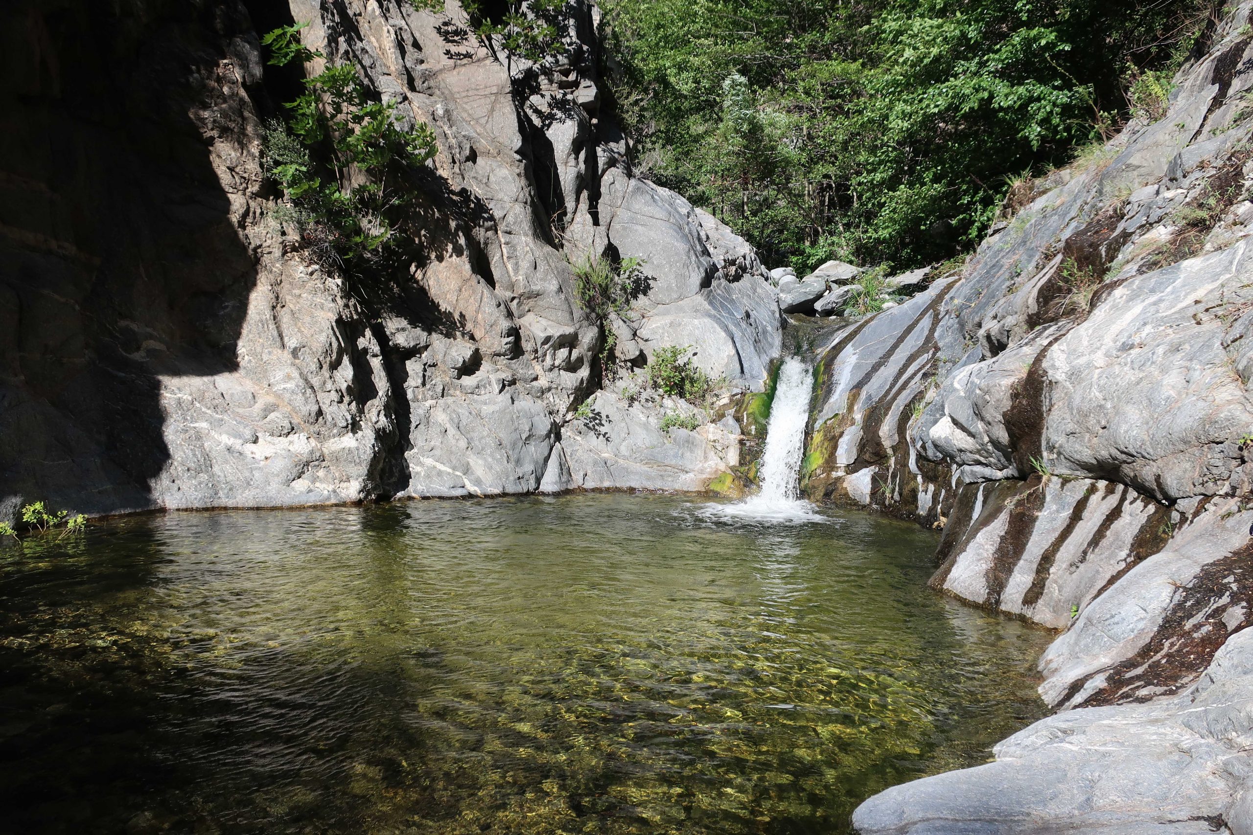
Photo looking back on pool below the Royal Gorge Falls. Note the large pile of driftwood on far end of pool. A testimony of our recent big winter.
After this hike, you’ll always know another part of the Arroyo Seco that many will never see.
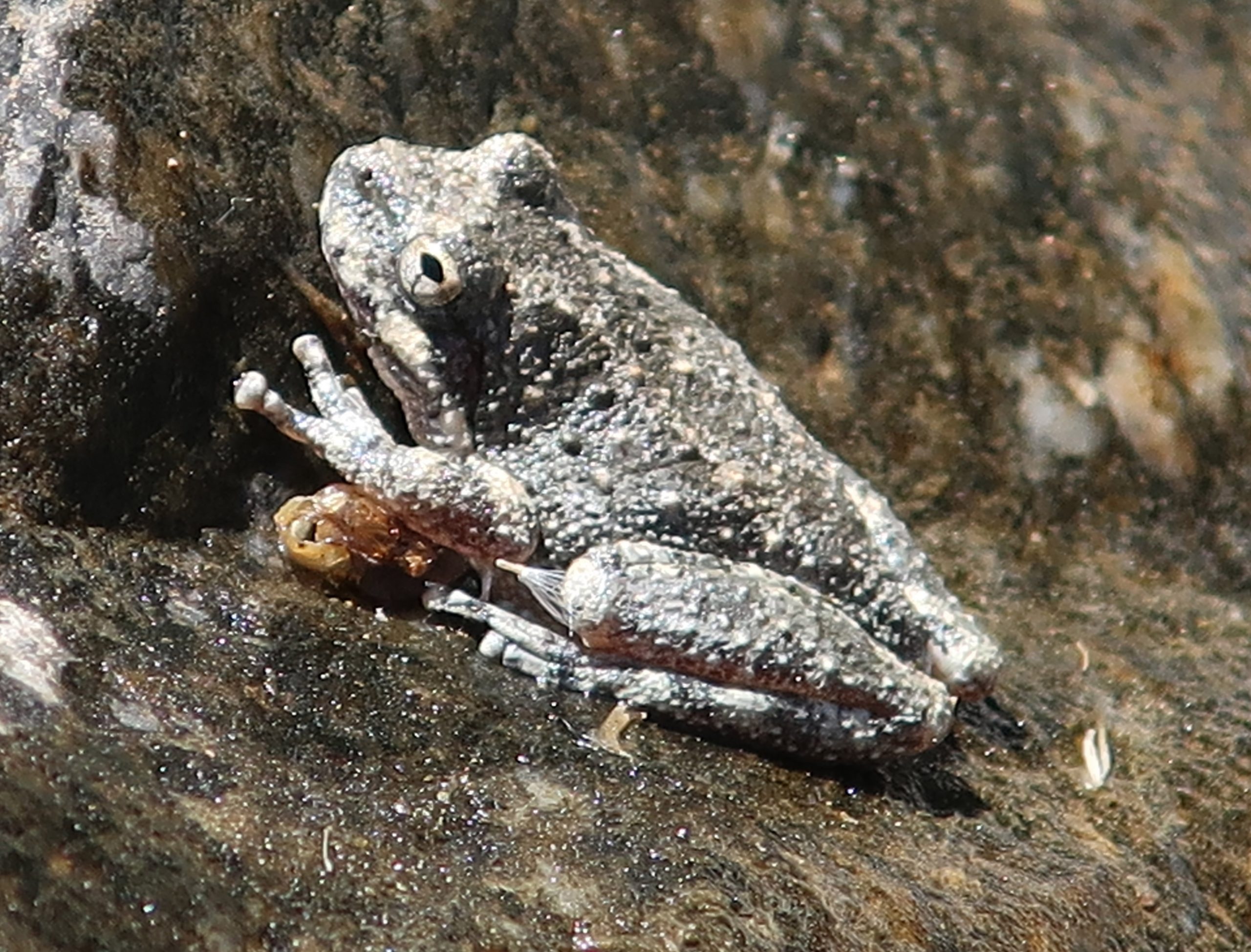
This little frog blends in with the surrounding rock above a pool in the Royal Gorge. Quite often as we moved amongst the smooth boulders, frogs would jump off and away at the last moment.
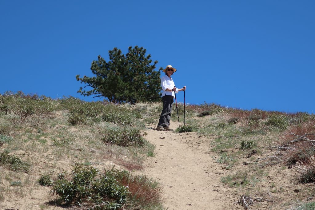
Hike Circle Mountain without having to leave Wrightwood! If you live in or near Wrightwood, this local mountain is in just about everyone’s skyline on any given day. The view along the way, not to mention at the summit, is a superb 360 degree panorama. In less than a mile, you’ll climb about 800′ to the top. Some parts of the trail are hard-packed sand and super steep. It’s easy to slip, especially on the descent, so I highly recommend bringing trekking poles.
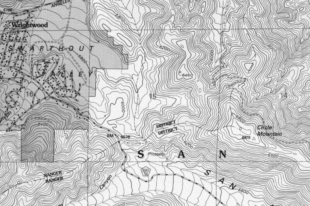
Excerpt of U.S.G.S. 7.5′ quadrangle showing the terrain from the east end of Wrightwood up to Circle Mountain. The ranger district boundary line from Lone Pine Canyon Road (BM 6,078) to the summit (6,875) is the hiking route to the top.
The route starts at a shiny white, heavy duty Forest Service fire road gate, at the crest of Lone Pine Canyon. If you live in Wrightwood, it’s that gate on your right hand side when you reach the very top of Lone Pine Canyon Road before coming back into the village from the freeway. You might even know the area at the fire road gate as “Helicopter Hill.”
Joanie stops to wait for me on the steep, sandy path. The summit is still a ways off.
Just walk around the gate and follow the fire road eastward for a few minutes before reaching a barricade of boulders, marking the drivable end of the world’s shortest fire road. From here, the little sandy path drops down a little and continues along the exposed the ridge top before your climb begins in earnest. After the initial steep climb, the trail levels out a bit before you begin the second pitch. The Blue Cut Fire really burned off a lot of brush, including scrub oak and a number of pines. Despite this, plants are coming back. There are hardly any places to duck out of the bright sun, so bring a good sun hat and plenty of water. You’ll pass by clumps of Poodle Dog Bush, recognized by its’ ragged leaf margins and pungent scent. Also, look for Fremontia (flannel bush), chamise, yuccas and buckwheat. The chaparral that grows here is subjected to day after day of intense sunlight.
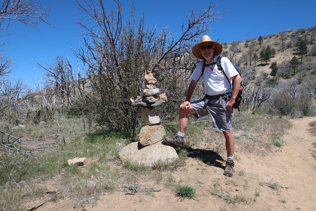
Chris pauses by a trail cairn of “balancing rocks” on the way up Circle Mountain. The burnt thickets of branches are from the Blue Cut Fire. Scrub oaks are slowly making a come back in the scorching sun.
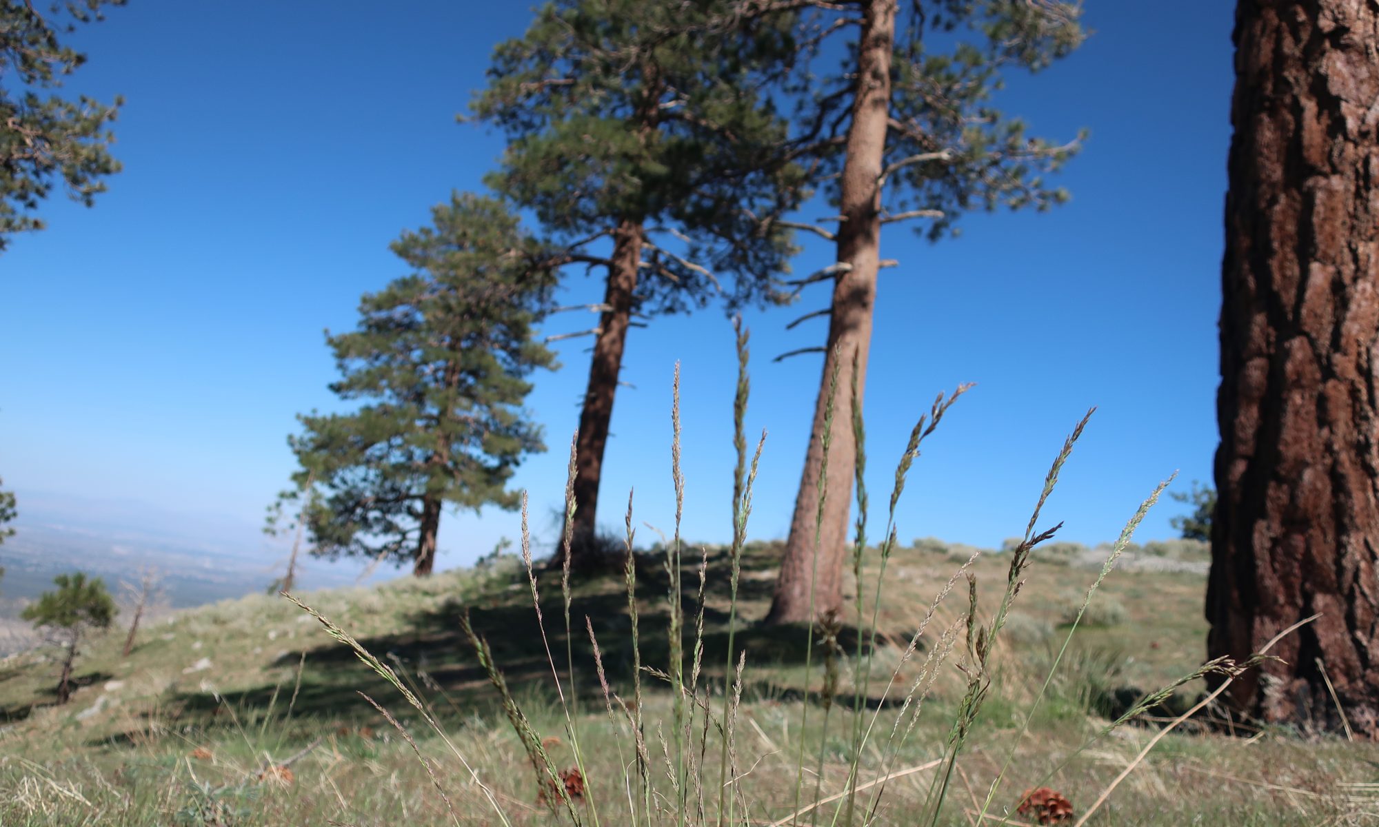
Here and there, as you climb, you’ll spot Jeffrey and Ponderosa pines with fire scars at their bases, yet their crowns blaze deeply green against the cobalt blue sky that only the high elevation can provide.
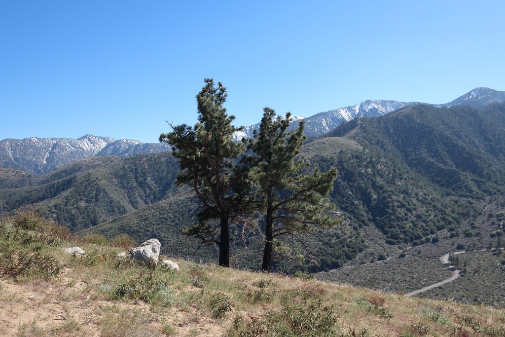
This view toward the southwest highlights some of the highest peaks in the eastern San Gabriels. From right to left: Pine Mountain, Dawson Peak and Mount San Antonio (Mt. Baldy) obscured by the pine trees. That’s Lone Pine Canyon Road in the right hand foreground.
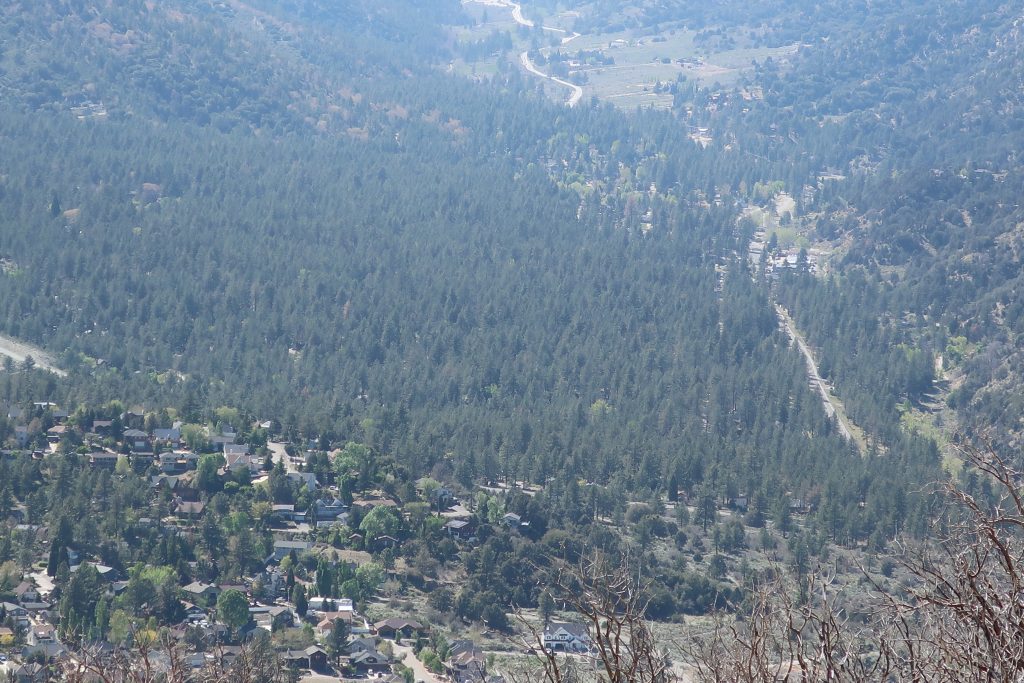
Looking back up the Swarthout Valley toward Big Pines. The eastern portion of Wrightwood is in the immediate foreground. The main road heading straight through the pine forested landscape is Highway 2, the Angeles Crest Highway.
Something to know about Circle Mountain, is that its listed on the Sierra Club’s Hundred Peaks Section “peak list.” The list was created by Weldon Heald back in 1941. Throughout the decades, those attempting to bag all 100 summits, make a visit to our backyard mountain.
After reaching the summit, Joanie and had our lunch in a little glade of grasses amongst a grouping of tall pines on the north side of the mountain. From there we looked off into the hazy distance of the Mojave. The gentle summery breeze combed through the green boughs above. A little bit of heaven just minutes from the start. As we descended, the treat of one of the most unique views of Wrightwood and its’ Swarthout Valley was laid out before us. This little hike, though steep, is one worth making the time for.
Joanie Kasten signs in at the summit register. Look for a U.S. Forest Service pre-attack marker and this little cairn of rocks while up on the broad summit.
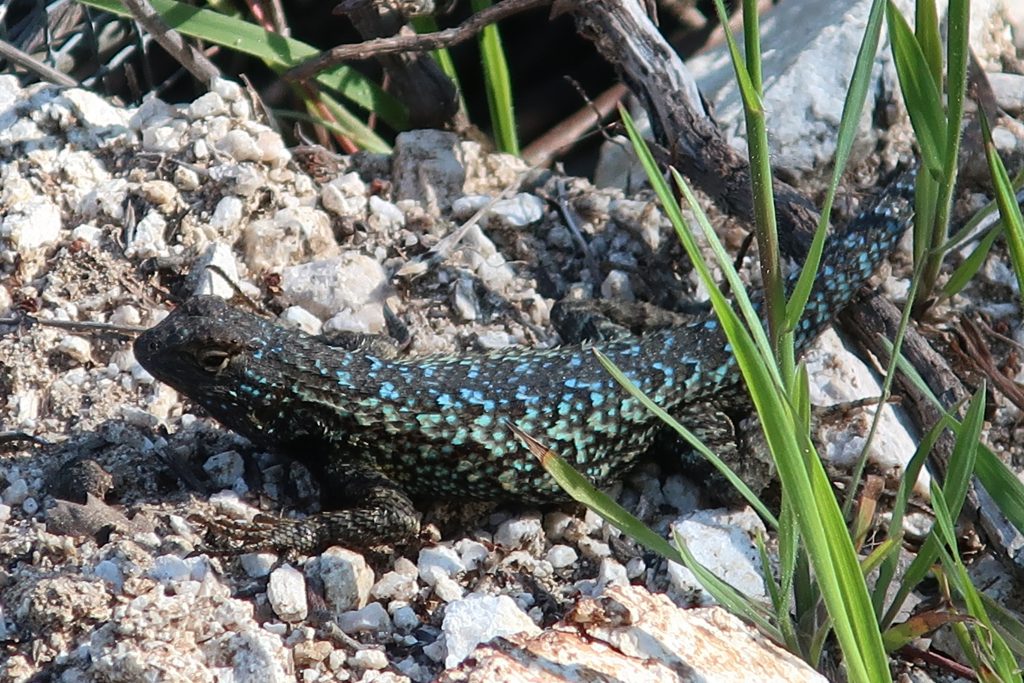
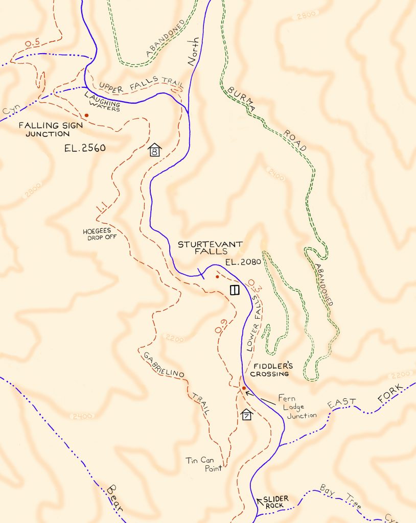
This turquoise colored fence lizard (Sceloporus occidentalis) was seen out in the warmth of early Spring at Tin Can Point. Tin Can Point is just up from Fern Lodge Junction on the Gabrielino Trail. It’s the first switchback you’d encounter after the trail passes through the canyon live oak forest and then enters the chaparral, just a few minutes up from the trail junction.
A beautiful fence lizard basks in the gentle warmth of early Spring at Tin Can Point. See inset of the Chantry Flat – Mt. Wilson Trails map, below, to see where this point is. As of this writing, a cold wet pacific storm is dropping nearly six days of chilly rain and snow in much of the San Gabriel mountains. Big Santa Anita Canyon dam has received over 5 1/2″ of rain in the last week. Something I just learned recently about these Western Fence lizards is that their populations have the effect of reducing the incidence of Lyme’s disease in the ticks that live in the chaparral, such as found covering much of the slopes of the Big Santa Anita Canyon! Apparently, a protein in the lizard’s blood kills the bacterium in the tick’s gut, which is good news for hikers and even their dogs during the spring and autumn months.
Like most reptiles, Western Fence lizards hibernate, at least for a little while each winter throughout their habitats which are wide-spread throughout California. As for food, these lizards eat spiders and various insects such as mosquitos, beetles and grasshoppers. The females lay several small clutches of eggs (3-17) in the spring, the young emerging in the summer.
Detail of Gabrielino Trail section, Chantry Flat – Mt. Wilson Trails map.
On your next hike out from Chantry Flats, watch for for lizards flitting about on the trails and sunning themselves on the myriad stretches of rock. As for the various types of reptiles to be found in the Big Santa Anita, Western Fence lizards are abundant and deserve a place in the sun!
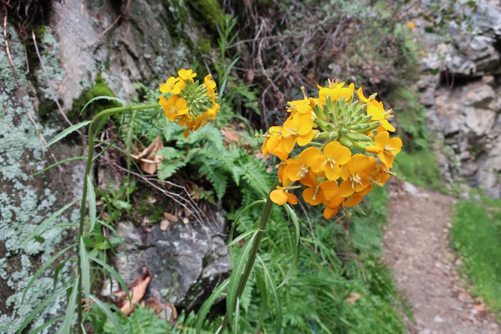
Here’s a Douglas Wallflower alongside the Upper Falls Trail as seen this last Monday while hiking up the Big Santa Anita Canyon under cloudy skies. Our series of much-needed rain storms have brought back thick green grasses and the start to what’ll most likely be a colorful Spring of other wildflowers as well. Joanie and I hiked the two mile Falling Sign Loop that originates out of Fern Lodge.
These Douglas Wallflowers (Erysimum capitatum) popped out at us just downstream from the double slot pools on the Upper Falls Trail. There’s also a nice grouping of wallflowers near the second bench up the road from Roberts’ Camp in San Olene Canyon.
Sturtevant Falls was tumbling down nicely. The scent of white sage peppered the cool air and the background surf-like sound of the stream followed us the whole way. We brought along an old shovel, cleaning off small slides here and there. Wild lilacs (buck brush) are still sending their mild lavender scent into the canyon breezes while the bright red orange of Indian paintbrush pokes up from the damp earth near Hoegee’s Drop-Off. And overarching along most of the route, the Laurel bay blossoms still cling to the dark green canopies. Look for the tender dark reddish purple leaves of the canyon big-leaf maples as their foliage begins to fill back in for a new season. Even the white alders are pushing out a myriad of their bright green leaflets, replacing that smokey look of dormancy with new life.
View looking east up into the East Fork of Big Santa Anita Canyon from Gabrielino Trail. Note the Toyon in the foreground, still hanging onto some of its’ red berries. That’s Rankin and Monrovia peaks in the most distant background. Clamshell Peak is barely captured on the right hand side of photo.
Looking east from the Rim Trail just before reaching Mt. Wilson. On the horizon, far left, can be seen Twin Peaks. Mt. Baldy is in the center distance. Big Santa Anita Canyon is below and off to the right.
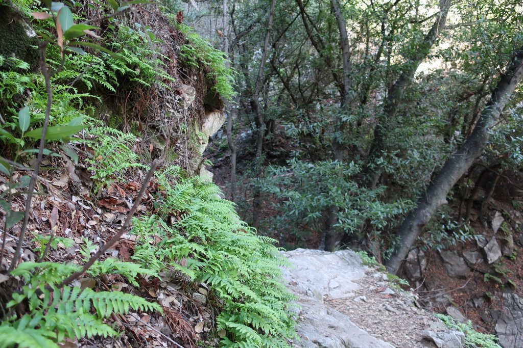
Hike Chantry Flat to Mt. Wilson by way of the Rim Trail during these bright, crisp winter months. This last weekend, I made my way up Big Santa Anita Canyon’s Upper Falls Trail from Fern Lodge Junction. Our rain gauge has recorded nearly 12″ of rain from the two previous storms of late November through December, so lots of bracken fern beds are at their height of deep and bright greens as they perch high on their cliffy ledges above the bubbling creek. Although we’re off to a dry start to the new year, the plants are responding to the generous rains and even snow in the higher elevations. This is also a good time to still catch the deep orangy red of the Toyon berries in their showy clumps that still feel reminiscent of Christmas time.
Trip Details:
Total roundtrip distance: 16.9 miles
Elevation gain / loss: 440′ initial loss to Roberts’ Camp. 3950′ gain to Mt. Wilson’s Echo Rock.
Take Gabrielino Trail up Big Santa Anita Canyon to junction below Sturtevant Camp. Continue on toward Newcomb Pass. From there, follow RimTrail west to Mt. Wilson’s Echo Rock. Return toChantry down Sturtevant Trail and continue back on Gabrielino to the trailhead.
Mt. Wilson as seen from the Newcomb Pass Trail (Gabrielino) about a mile and a half up from Sturtevant Camp. Some healthy looking toyon is seen here in the foreground.
So, on I went past the songs of canyon wrens, their descending, laughing tones evoking that eternal longing for Winter becoming Spring. As always, leaving behind Sturtevant Falls, the crowds dropped off, too. Save for an occasional small group of hikers, I saw few people between the top of the Falls and Spruce Grove Campground. Once on the section of the Gabrielino that heads off for Newcomb Pass, there’d be no one, with the exception of squirrels, birds and gnats until reaching the top of Mt. Wilson. Solitude.
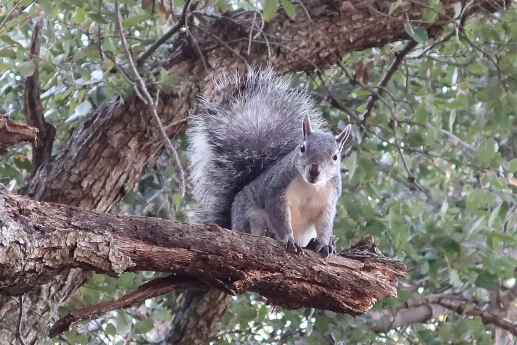
A curious tree squirrel peers down at Newcomb Pass.
At the trail junction just below Sturtevant Camp, I peel off for Newcomb Pass and the quietness envelopes me. The trail was a bit overgrown and more noticeably there was a fair number of trees and shrubs over the trail. No problem, just took my time climbing down or up and around on the dark, loamy soil with winter’s dampness. Once out in the chaparral, on came the sunglasses and the great joy of warm winter days that only Southern California can bestow upon the mountains. The most prominent scene that kept repeating itself was the red display of Toyon against the background of varied greens. Pretty soon the backcountry opened itself up, first Twin Peaks, then the Mt. Baldy massif. Snow, blue sky and chaparral all seemed to merge as I neared Newcomb Pass.
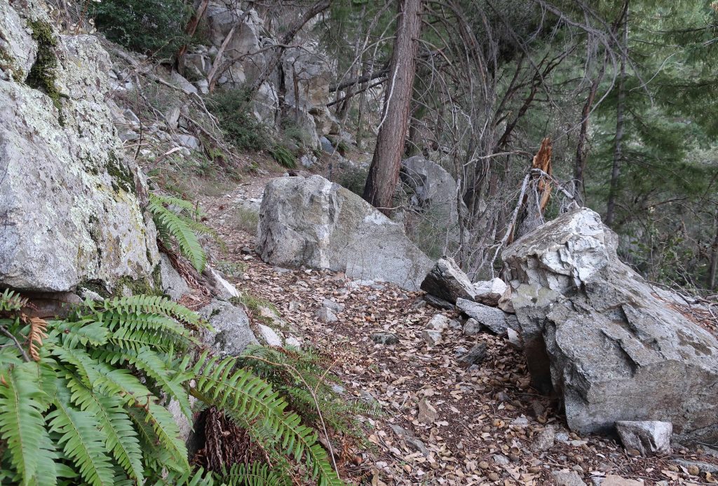
Bracken ferns along the Gabrielino Trail. Photo just up canyon from Falling Sign Junction, Big Santa Anita Canyon.
Once at Newcomb’s, I found a sunny picnic table and finished off my sandwich. Ever since the Station Fire of 2009, the debris of cut down trees for re- establishing a firebreak has taken away the charm of the place. Coupled with that, some hair brain scheme had taken place, erecting T-posts with orange web fencing at the bottom of the man-made swaths. Sort of like what CalTrans might do along a highway construction site. The old Newcomb Pass sign lay forlornly off to the side, a casualty of yet another oak that has fallen. I got so depressed by the memory of what once was and what was now that only a few minutes elapsed before taking off on the Rim Trail.
A gentle stretch of the Rim Trail about a mile west of Newcomb Pass.
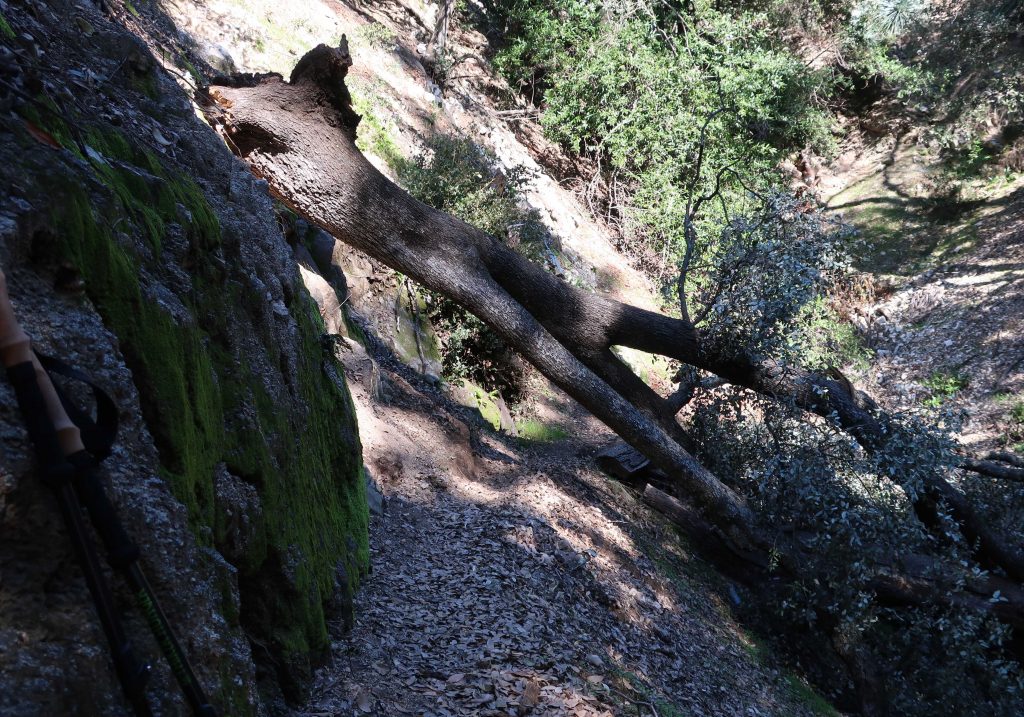
The first 1/2 mile along the Rim Trail was fraught with downed oaks, lots of them. The tracks of those before were clearly etched in the soft, moist soil as they worked out ways to get over, under, up and around thickets of branches tangled up with thick cords of poison oak. Aside from this, most of the going was pleasant, indeed beautiful as this area truly is. If you love being under oaks and amongst ferns and spruce, this is a good place to be. Also, you’re regaled with scenic views down into the West Fork of the San Gabriel River and out across to places as far west as Mt. Pacifico and eastward to Mt. Baldy and beyond. Fire scars from the Station Fire are still seen at the base of many big cone spruce along the trail. These are healthy scars only running a short distance up from the ground, leaving a really healthy evergreen forest. It’s peaceful country. Toward the top, you begin to encounter places where the trail is whittled out of rock. Old dry stack walls, the good work of trail builders from another century, still hold the trail into the mountainside. Eventually you make your way up and through a gentle twisting and turning through forested hillsides along the summit to the asphalt maintenance road near the Cosmic Cafe’s Pavilion. Turn left here, following signs toward the Sturtevant Trail. Pass by the Astronomical Museum, the Solar Camera and eventually the 100″ and 60″ telescope domes before dropping down to Echo Rock and the beginning of the Sturtevant Trail.
Here was one of the first trees that I encountered on the way up to Newcomb Pass. This spot is about a quarter mile up from Sturtevant Camp. Most of the downed trees along my hike were canyon live oaks.
Take the time to look off of Echo Rock before your descent back into the Big Santa Anita Canyon. The view is superb and you really can get a good echo if you set your mind to it. Yell toward the cliff straight across from you!
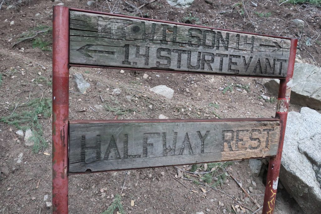
Get ready for a steep drop down from Echo Rock. I’m big on trekking poles for preventing slips and saving your knees on descent. Years ago when my wife and I ran Sturtevant Camp, we starting using the poles when we had a winter (2005) that had washed out the Chantry Road, necessitating getting to the camp by way of this very trail. Pass by the “Halfway Rest” and on down further into the upper canyon. This is timbered and wild country between the top and Sturtevant’s Camp. Savor the views and more solitude.
Here’s the sign you’ll find halfway between Sturtevant Camp and Mt. Wilson’s Echo Rock. There’s 2,500′ of elevation difference between the places in only 2.8 miles!
When you pass by Sturtevant Camp and then walk across the check dam to the side of the camp, you’ll drop down to the junction where you were earlier in the day, having just completed your loop. Head back to Chantry the way you came.