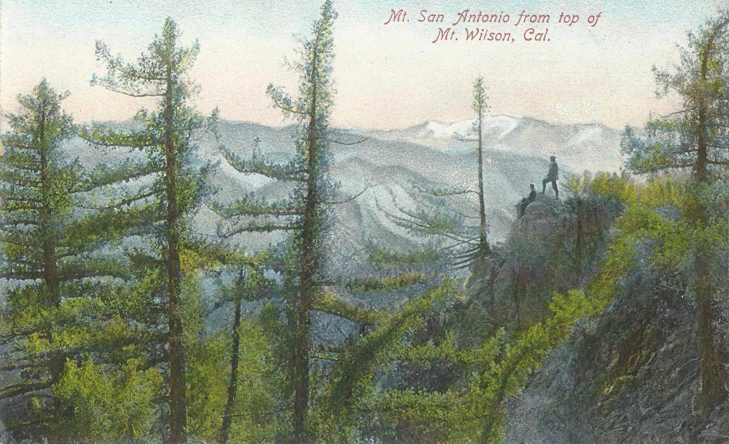
A friend of ours gave us this vintage postcard a number of years ago. The artwork depicts a scene that may have been intended as having taken place on the east end of the summit, perhaps near Echo Rock. The image somehow seems timeless, evoking that magical pull that the San Gabriels have had on generations past and those to come.
Whichever canyon you choose, getting out on our local trails is a great way to get a good start on the new year. I’m especially fond of the trails that make their way up to Mt. Wilson. One route that I’ll be doing in the next couple of weeks will be to head on up the Gabrielino Trail from Chantry Flat to Newcomb Pass. From there, take the Rim Trail to Wilson’s summit. Return by way of the Sturtevant Trail.
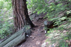
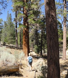
Here’s a trail scene taken just below the “Halfway Rest” The forest is healthy and vibrant here in the upper Big Santa Anita Canyon.
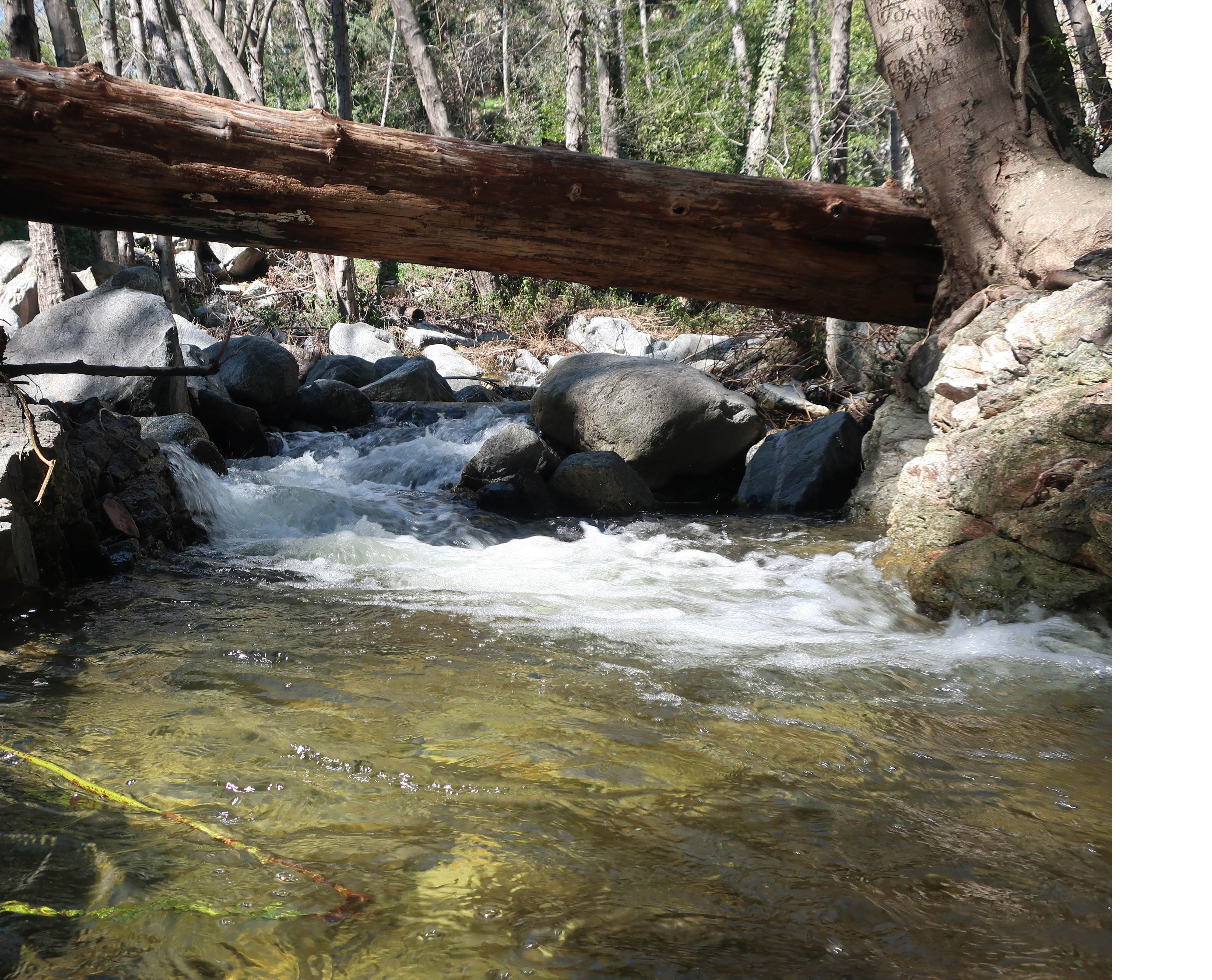
This is a great trip to get some good winter sun while climbing up and through the warm chaparral before getting under the oaks and pines on the north side of the Rim Trail’s watershed divide. The stream’s flowing really nicely right now, especially with the good start to winter storms that we’ve had from Thanksgiving through Christmas. Wrightwood, alone, has received nearly an average year’s worth of snow accumulation within about a month at the end of 2019. So, get out and enjoy the flowing streams, the bright green fern beds and the scent of damp soils and leaves. A word of caution, though…
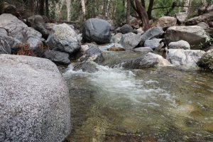
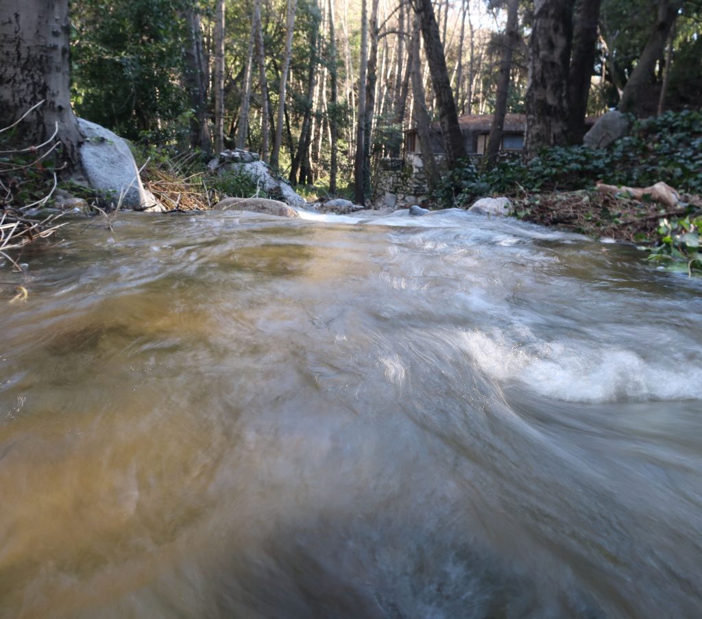
The bubbling Big Santa Anita Creek near Bear Trap Canyon on the Gabrielino Trail.
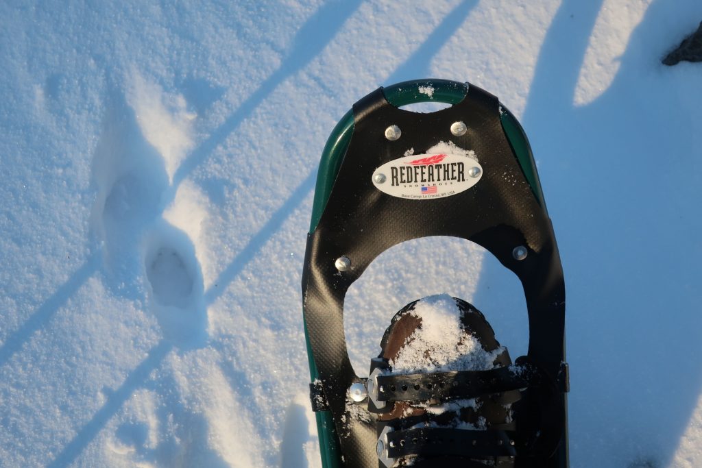
Make sure to be cautious of ice in the some of the higher elevations as you approach Mt. Wilson from Newcomb Pass. Also, while traveling back down the Sturtevant Trail, watch for an ice chute within a half mile of the summit. This time of year, it’s a good idea to at least carry a pair of MicroSpikes or a similar traction device that you can add to your shoes. Take your time and savor the front country of the San Gabriels in the winter.
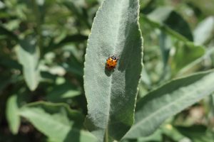
A lady bug rests here in the sun on a white sage leaf. This photo was taken on the Upper Falls Trail, Big Santa Anita Canyon.
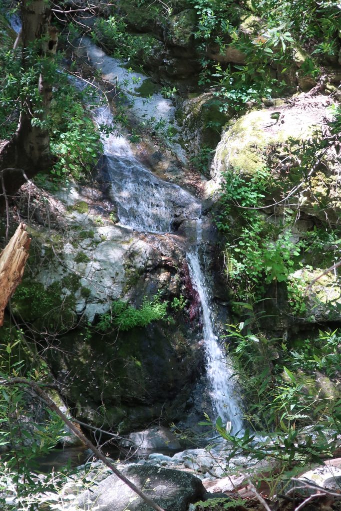
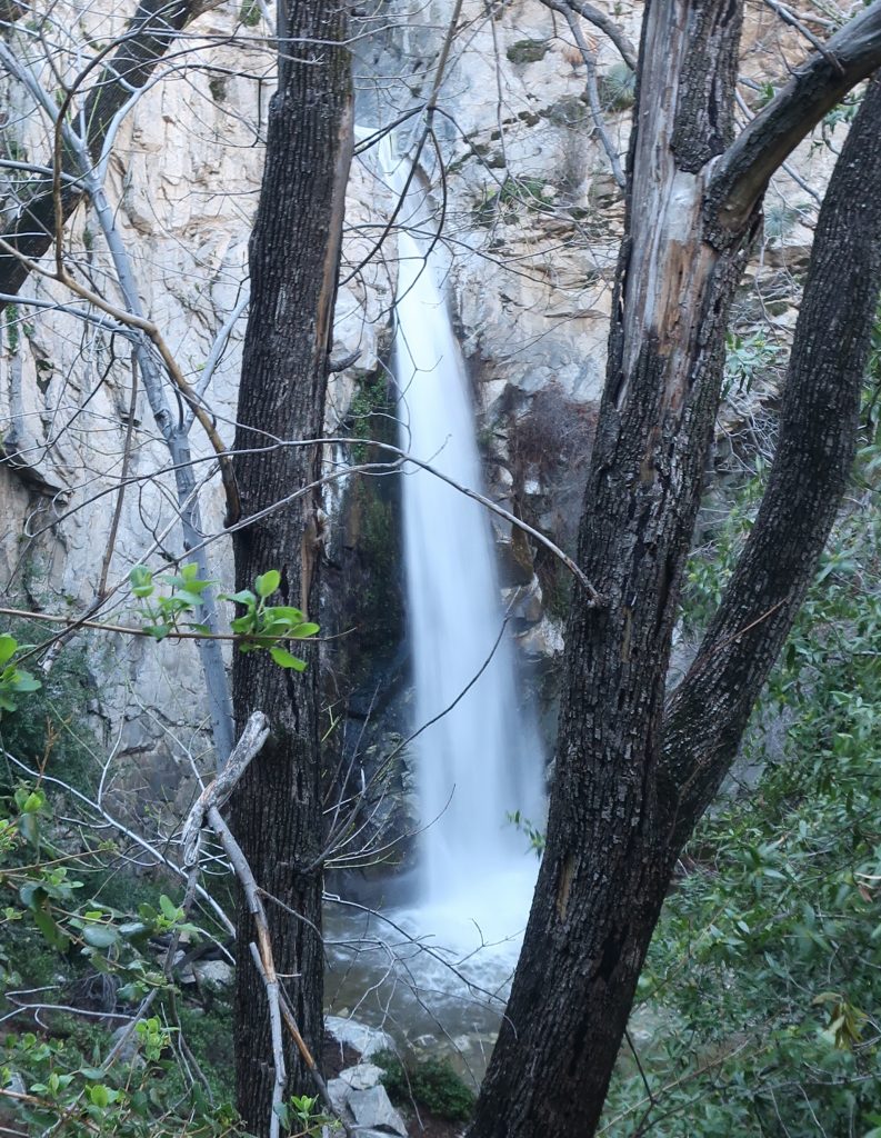
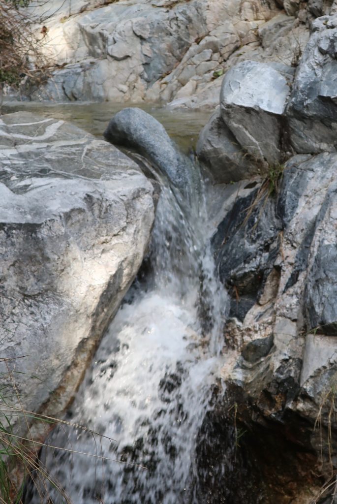
This photo was taken this last week, June 20th, looking downstream in the West Fork of the San Gabriel River at DeVore Trail Camp. We had such an amazing winter throughout the mountains of the western U.S. The San Gabriels were no exception! Right now the West Fork is flowing full and clear.This little waterfall is seen here dropping into the West Fork of the San Gabriel River. The location is about midway between West Fork Campground and DeVore Trail Camp.
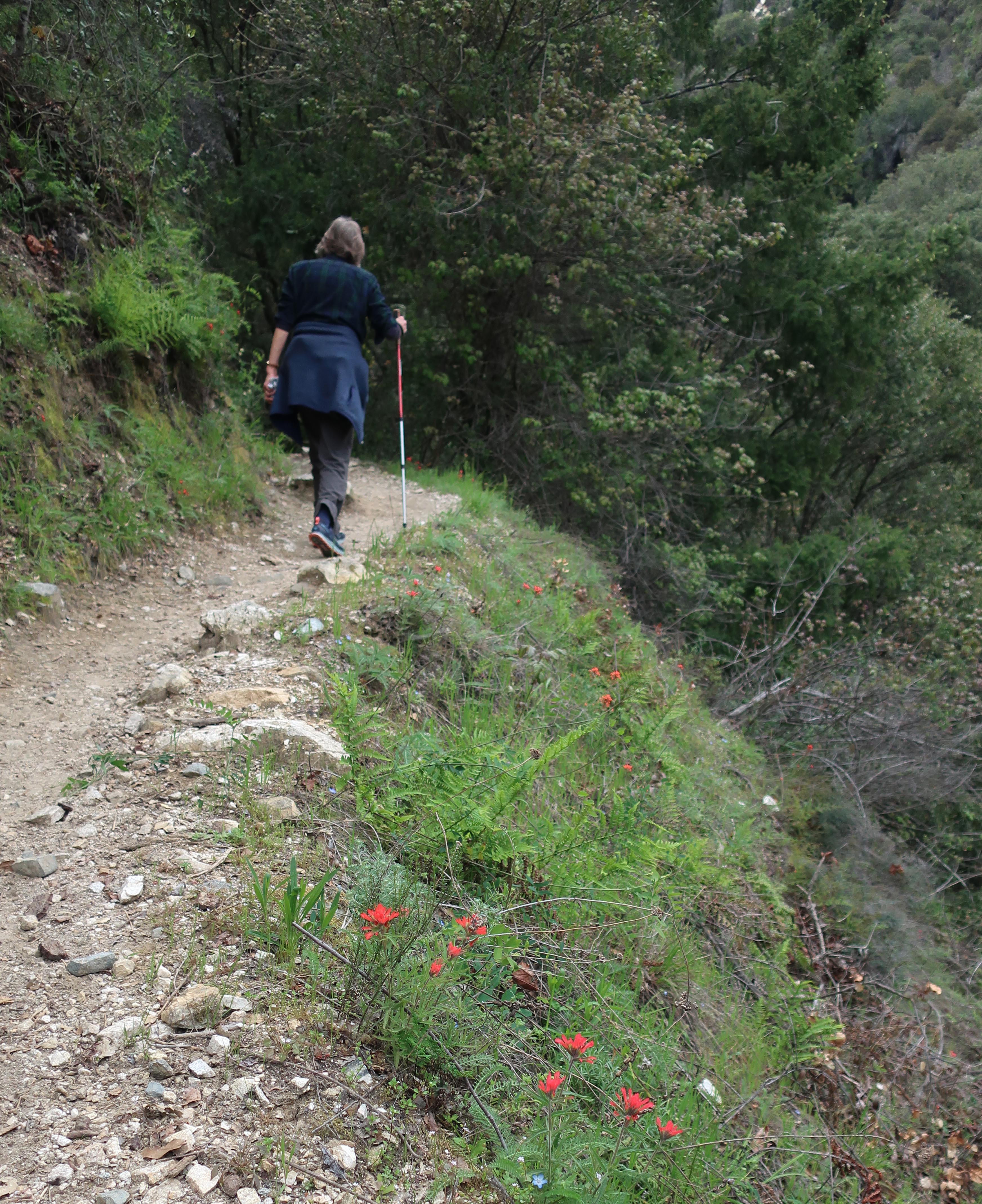
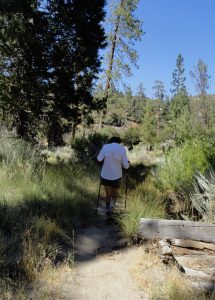
Joanie hiking up the Gabrielino just prior to Hoegee’s Drop Off. That’s Indian paintbrush popping through the green. This spot is between Fern Lodge Junction and Falling Sign Junction.
Hike Chantry’s Gabrielino for wildflowers when you get a chance. Try to do this sooner than later! This well trod trail is also known by many Boy Scouts as the Silver Moccasin up until you arrive at Shortcut Canyon in the West Fork of the San Gabriel River, where the two trails go their separate ways.
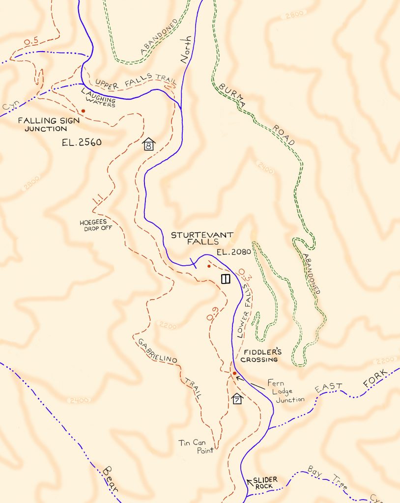
Detail of Gabrielino Trail section, Chantry Flat – Mt. Wilson Trails map.
Look at hiking this trail section these last days of April and the next couple of weeks in May. Recently my wife and I did the Falling Sign Loop, starting out from Fern Lodge Junction, heading up the Gabrielino (aka Stock Trail) to Falling Sign Junction. We returned back down the Upper Falls Trail to Fern Lodge. The loop’s only a couple of miles in length, yet that one mile section of the Gabrielino between Fern Lodge and Falling Sign Junction will offer you not only wildflowers, but vibrant green fern beds, lush green grasses and the ever-present views over the Big Santa Anita and its’ countless little side canyons.
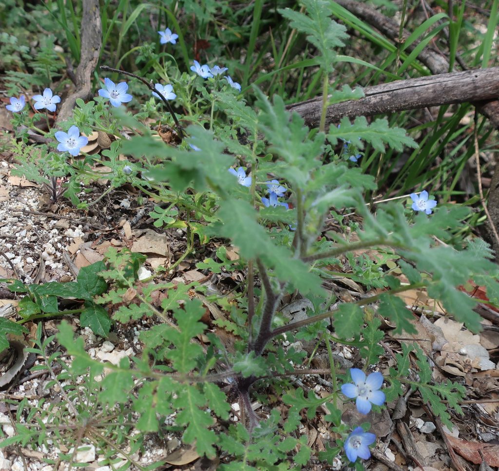
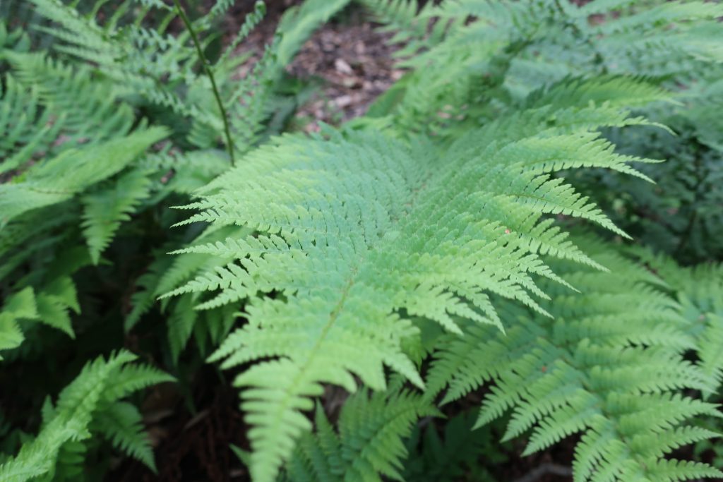
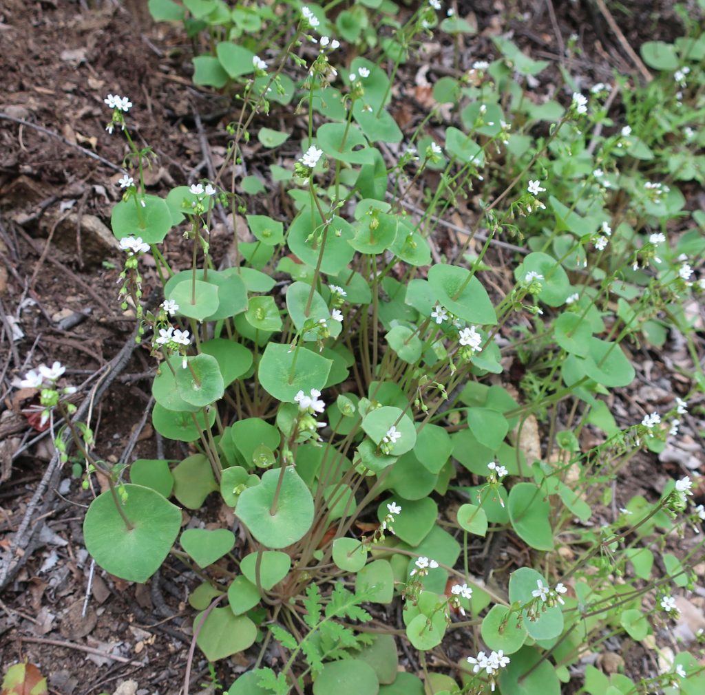
Springtime in the front country of the San Gabriel mountains wouldn’t be complete without Baby Blue Eyes. These delicate, low-lying beauties can be found during the Spring Easter season.Close up of Bracken Fern taken along the Gabrielino Trail. Shady slopes and cliff faces are covered with the fresh, deep green fern beds.Edible Miner’s lettuce grows in clumps along the moister sections of the front country canyons.
This photo was taken of Big Santa Anita’s Creek just upstream from Roberts’ Camp. This spot is close to cabin #23, on an outside turn of the creek. As of this writing, Chantry Flats’ rain total is at 42 1/2″ for season. Good flow and good sound throughout the canyon!
Distance and elevation gain / loss: Approximately one mile (one way) with 400′ of elevation gain.
Follow the gated dirt road that runs atop levee on north side of Heath Creek stream bed.
Hike begins on Thrush Rd, just east of the tee intersection with Victorville St. Walk up the dirt road just west of Heath Creek bridge. There’s a silver colored pipe gate just a short distance above Thrush.
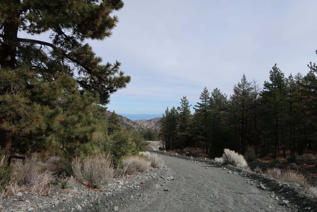
Looking toward the desert on the levee road. This spot is about half-way between the lower and upper pipe gates.
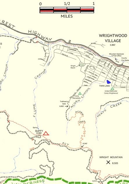
One of the major canyons dropping into Wrightwood’s Swarthout Valley is Heath Creek. It’s the canyon that begins as the large, conspicuous slide on Wright Mountain’s north side. The slide, dropping straight down from the summit is especially prominent from downtown Wrightwood. If you’re outside the post office or Mountain Hardware and looking southward, there’s a really good view of the slide, with Wright Mountain’s pine covered summit just to the left of it (elev. 8,505′). The canyon is named after Harry Heath who homesteaded the east end of the Swarthout Valley, near present day Pacific Crest Estates, back in 1886. Back then, Heath Ranch (circa 1900-1919) had a dairy, as well as boasting an orchard of apple and pear trees irrigated with water conveyed from a stream intake in the watercourse that today bears his name.
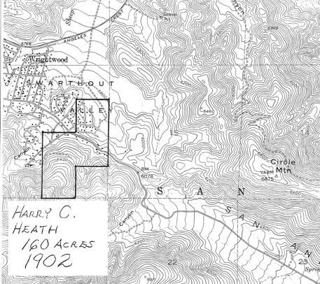
Outline of the former Heath Ranch. Purchased from Sumner Wright in 1902, Harry Heath received his deed for the land in 1910. You can see that some of Heath’s most suitable ranch land was in the area now known as Pacific Crest Estates. Oddly, his 160 acres do not extend to the watershed that bears his name. Map image courtesy of Wrightwood Historical Society.
Pat Krig, a long-time Wrightwood pioneer and historian, wrote down some notes about the Heath Ranch which she visited on horseback as a young girl. The Wrightwood Historical Society generously provided me a copy of her notes from 2006 which portrays what little is known of Harry Heath’s ranch. Unfortunately, there were no photos of either Heath or his ranch. One paragraph in Pat’s reminiscences that in particular stood out to me, was this: “A few of the gnarled apple trees still stand, bearing fruit and bringing memories of hot apple pies for tired travelers, and offers of a pitcher of fresh milk, thick cream for coffee, and butter to spread on warm, fragrant bread then slathered with pumpkin butter.” Pat wrote this back in 2006. Sadly, Pat passed away just this last year, taking with her memories of an earlier time in the mountains that we can only faintly imagine.
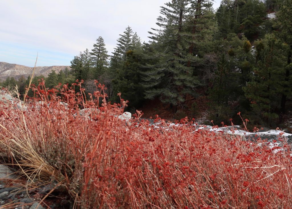
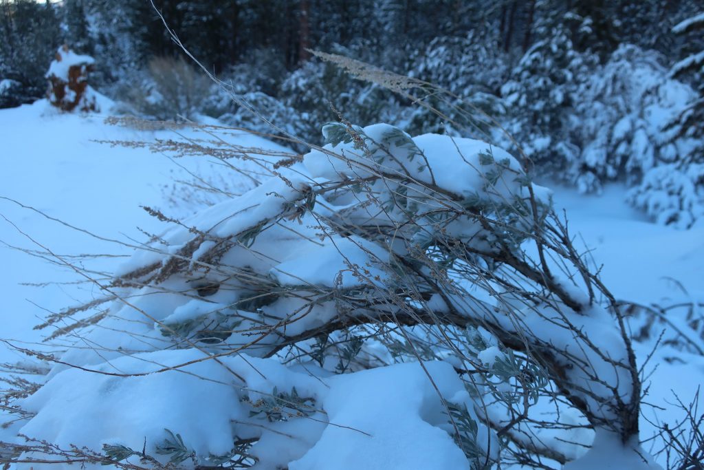
Last year’s dried flower stalks still draw your attention to clumps of buckwheat growing along Heath Creek.
Pearl Comfort Fisher, who wrote “The Mountaineers” back in 1972, provides a brief glimpse into a cowboy’s visit to the Heath Ranch back in 1907. The cowboy was Harvey Cheesman, hired to round up stray cattle from the nearby Lovejoy Springs Ranch. “So it happened that as I came over the divide from Lone Pine Canyon one cold February late afternoon I found the ranch or homestead of Harry Heath at the head of Sheep Creek. Upon knocking at the door I was met by a lady with a small baby in her arms. It was Mrs. Heath. She said, “‘My, am I glad to see some one. A mountain lion has been prowling around here for three nights and my husband is away working, and I am afraid the lion will get some of our pigs and chickens. “No lion showed up that night and I had to go on my way the next day.”
Today, it’s hard to imagine Wrightwood as wild and isolated as it must have been 112 years ago. The upper half of this hike will give you a taste of a quieter more forested Swarthout Valley.
Here’s a small section of the Wrightwood – Big Pines map depicting part of Heath Creek. Access this hike by taking the dirt road that departs south, climbing upslope from Thrush Rd. between Victorville Street and Heath Creek Rd.
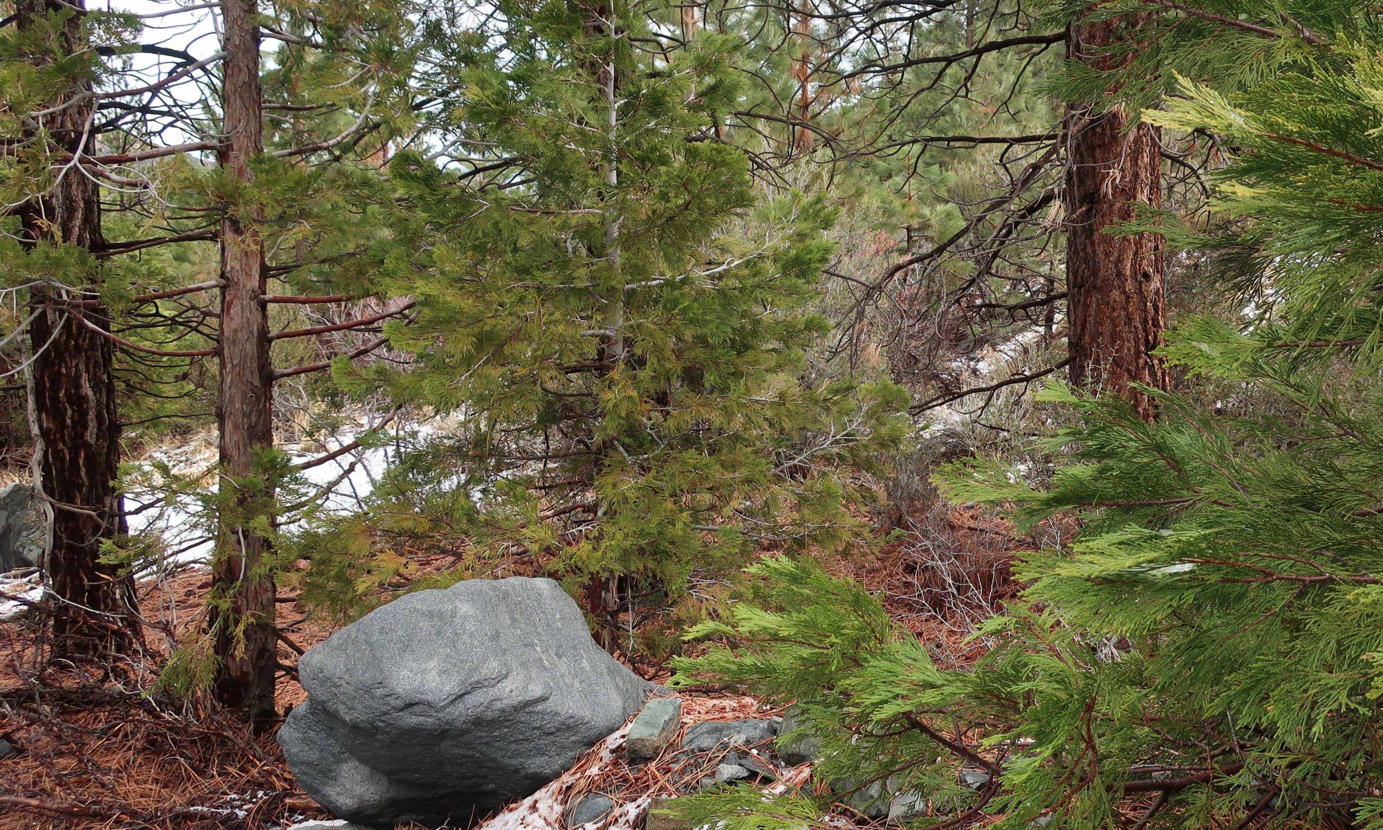
This walk is a great one if you just have a little time, say less than an hour and you’d like to get some hill climbing in, too. You’re walking on a flood control levee road. The beginning of your trip is a bit exposed to the sun and completely devoid of trees, much of the landscape down in the wash to your left has a sterile, bleak look due to constant grading from county bulldozers. Not that great at first. . . Hang in there, the bleakness soon ends. Your route soon encounters black oaks, Jeffrey and Ponderosa pines on both sides of the levee road. An enticing flat makes its’ presence across the stream on your left. On your right is a gentle, expansive alluvial slope covered in a healthy pine forest. Mostly private, undeveloped land, this terrain gives you a sense of what Wrightwood must have been like in the 19th century. On a warm day, the air is fragrant with pine and amazingly quiet, save the occasional song bird or acorn woodpecker tapping high above the forest floor.
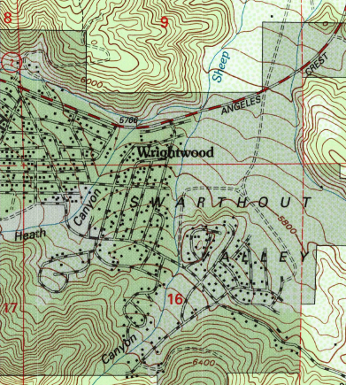
Trailhead for the Heath Creek hike is where Thrush crosses Heath Canyon. Thrush is the straight, east-west trending road just above (north) the “n” in Canyon. Notice that this U.S.G.S. topographic map section still shows Lone Pine Canyon Road crossing Heath Canyon, as it once did prior to the 1969 flood.
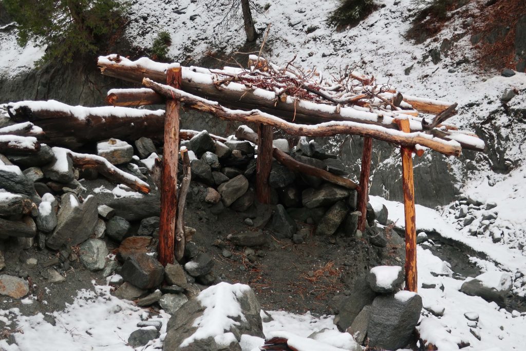
After a mile, you’ll encounter another silver painted pipe gate. This is your turnaround point. If you have the time, continue further up along the road to a set of four wooden benches set in a square configuration. Walk on past this gathering area, bearing left and staying with the canyon bottom. Follow a deeply eroded trace of a former jeep road. Essentially now a trail, continue on up the canyon for another 400′ feet of elevation to the trail’s end on a rocky berm above the stream bed. You will also see a little frame structure made from lashed together cedar trunks and limbs.
9,399′ high Mt. Baden-Powell’s massif dominates the southwest skyline from Table Mountain.
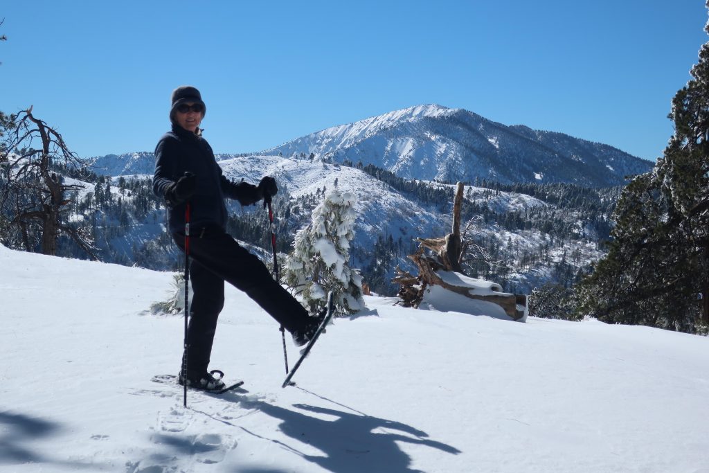
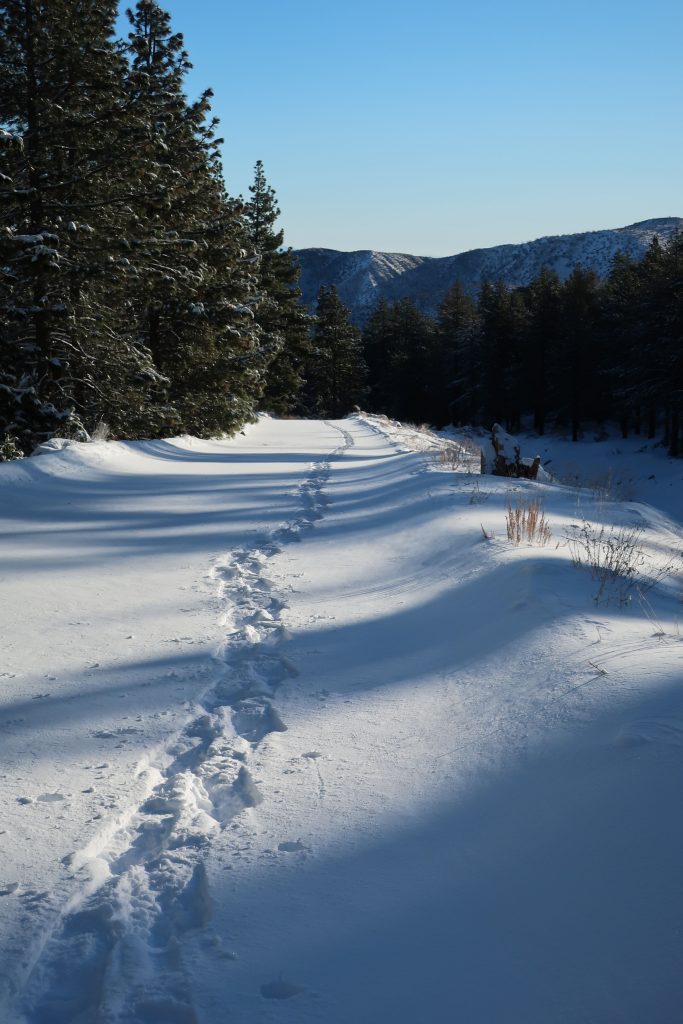
Joanie and I got out for a great afternoon of snowshoeing up on Wrightwood’s Table Mountain about a week and a half ago. Since then, more storms have dropped even more of the precious powder on our local mountains. Whether you like to cross-country ski or snowshoe, it’s a fantastic time to be out amongst our high country peaks, canyons and forests!
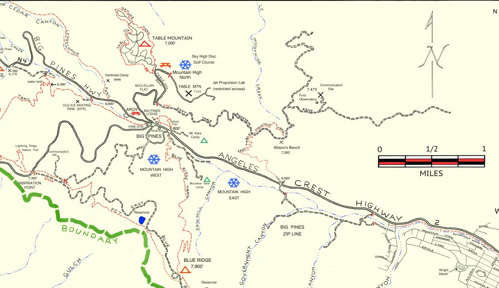
Inset of the Trails of Wrightwood – Big Pines map. The area we went snowshoeing is depicted as Table Mountain (with campground symbol) at an elevation of 7,200′. The west end of Wrightwood appears in the lower right corner of image.
Table Mountain is 7,516′ high and super easy to get to from Wrightwood. Just drive. You’re only looking at four miles from our village center. Make sure to turn off to the right on Table Mountain Road when you arrive at the three way split in the roads at Big Pines. Table Mountain Campground is where we did our snowshoeing on a quiet Friday, where we seemed to have the place to ourselves. The wind had sculpted the snow into pristine dunes along the gently sloping ridge top that the extensive campground straddles.
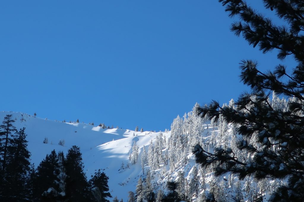
Joanie seems to almost float atop the powder on the sunny slopes of Table Mountain!
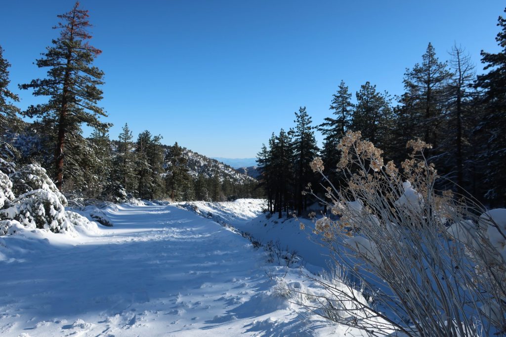
All the campsites were, of course, hidden under the snowy mantle, with just the picnic tabletops presenting themselves as a bit of a depth gauge. Most of the time, snow depth was around 24″ and in places well over three feet. The windward sides of the mammoth white fir and Ponderosas were coated in sparkling icicles that fell like shards of glass in the wind gusts that came out of the southwest. Mt. Baden-Powell kept constant watch over us from across the great gulf of the East Fork of the San Gabriel River. The Mojave Desert off to the north was a mosaic of tans, yellow sands and the right-angled patchwork of green winter crops scattered here and there. It looked and felt warmer down there. And high up on Table Mountain, that day was to be one of cobalt blue skies, bright white snows, wind and evergreens.
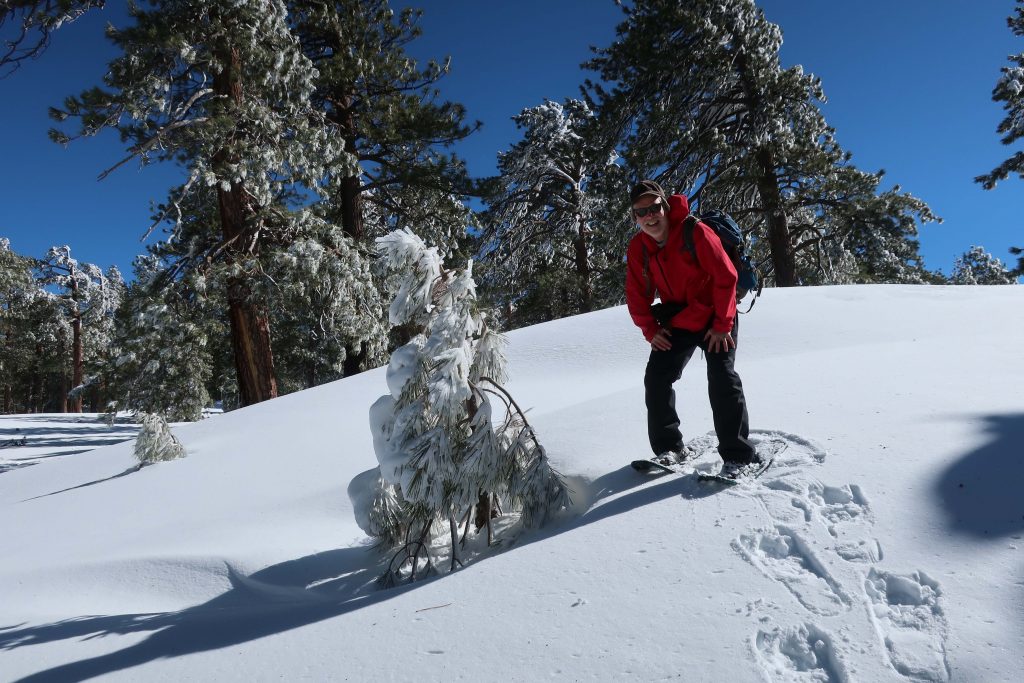
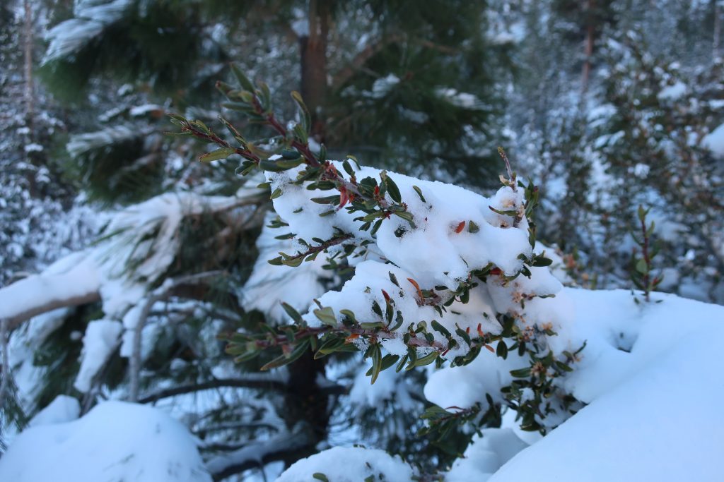
A small wind-bent snowy pine and Chris have a little visit amongst Table Mountain’s frozen forest.
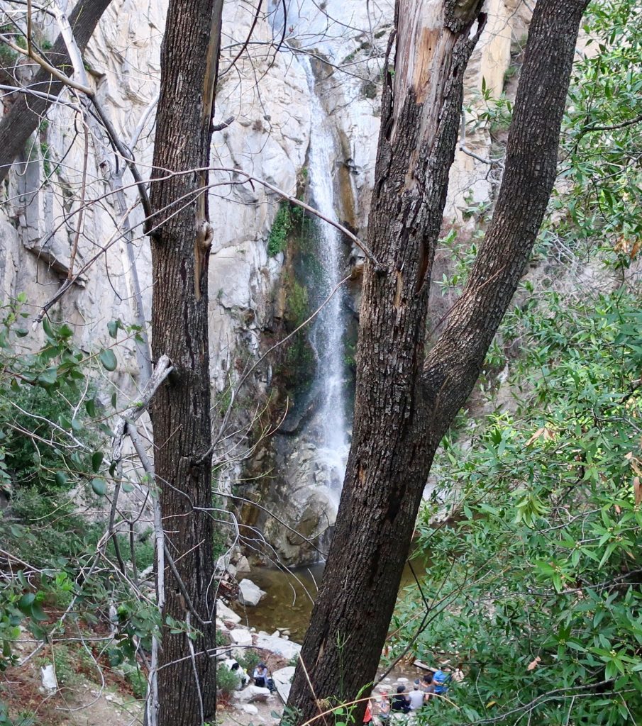
A view of 55′ high Sturtevant Falls as taken from the Upper Falls Trail this last Saturday. The stream crossings are so high right now that wading seems the best way to get across.
Our epic winter continues, with Sturtevant Falls looking more beautiful than ever. Last weekend our rain gauge had overflowed from the accumulation of a couple more storms before we could hike back in and check it. The gauge holds 12″ of rain before it overflows, so this tells something about the rains this month.
Looking downstream at Fern Lodge Junction. The stream is swollen, cold and flowing with energy.
Looking across at Sturtevant Falls and plunge pool from the Upper Falls Trail.
Big Santa Anita Creek comes alive after recent storms. 55′ high Sturtevant Falls is back in its’ former glory as well! As we all know, years of drought have taken their toll throughout the southwest, especially in the myriad of canyons throughout the mountains of Southern California.
Joanie and I discovered 9.57″ of rain in our gauge at Fern Lodge on January 18th. Several storms, back to back, have made a huge difference in the appearance of not only the Big Santa Anita creek, but all the rest of the front country streams in the Angeles. A week later, we hiked up and past Sturtevant Falls where we took these two photos.
This view taken just above Sturtevant Falls. This is at the top of the slot pools.
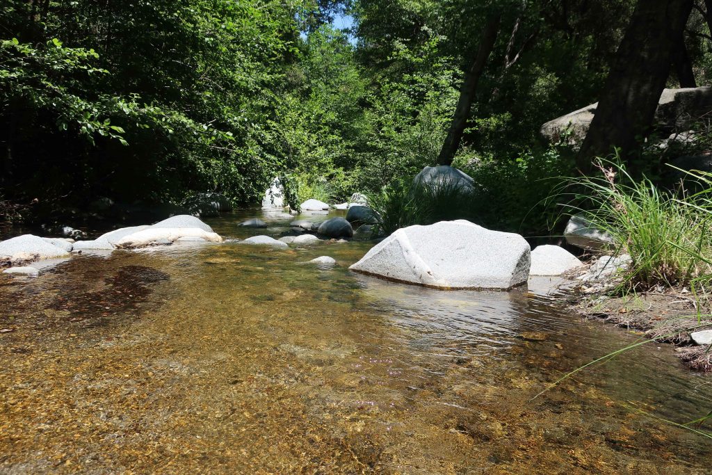
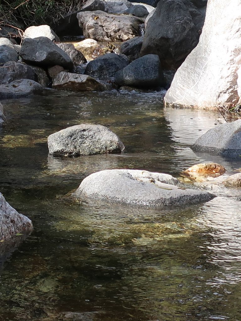
As of today, February 10th, a lot more rain has fallen. The stream beds have been scoured of the dark organic mat that’s built up for years. This has left bright, colorful sands and rocks under the clear waters. Beautiful.
A tranquil stretch of the Big Santa Anita Creek in the Fern Lodge area of the canyon. This spot is near the little cabin village where the Upper Falls and Gabrielino trails depart the canyon bottom.
Yesterday, I headed up Heath Creek and got a quick snowshoe in to the upper gate. Only went about a mile up from Thrush Rd. However, it’s about 460′ of gain. It’s been so long since we’ve had this kind of snow. Forgot how much of a chug it would be with snowshoes on – ha! Good times.
Here’s a small section of the Wrightwood – Big Pines map depicting part of Heath Creek. Access this hike by taking the dirt road that departs south, climbing upslope from Thrush Rd. between Victorville Street and Heath Creek Rd.
Elevation Gain / Loss:
From the lower gate (just above Thrush Rd.) to upper gate = 460′. The elevation on Thrush Rd. at spot where you walk up the beginning of levee road is 5,840′. This gain takes place in approximately one mile along the levee road located on west side of Heath Creek. Elevation of upper gate is 6,300′.
If you have time, keep on going past the upper gate. Soon you’ll encounter some sawn log benches placed in a square configuration. Keep going further up along the stream bed on the old, steeply rutted jeep road which is in places barely a trace. It’s steeper going now than it was on the levee road between the two gates.
From upper gate to top end of old jeep road (abandoned) =400′. The top end of old road is where two canyons come together. There’s a forested canyon on the left side and small stream running between jagged walls on the right. The elevation here is 6,700′. Look for the little framework of limbs that have been lashed to some upright hand-hewn cedar poles.
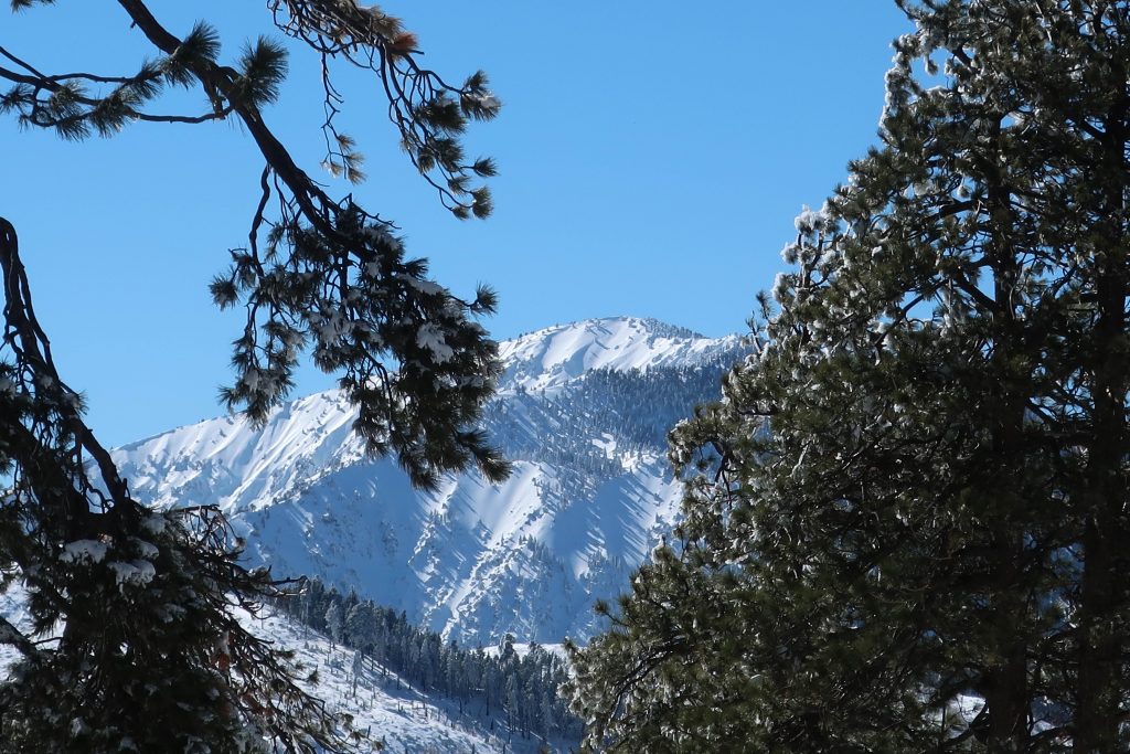
Looking directly up Wright Mountain’s slide from the canyon bottom. This is the same slide you can view toward the south from the Wrightwood Post Office. Wright Mountain’s summit is at top of ridge on far left of photo at an elevation of 8,500′. Photo was taken at elevation of 6,300′ near upper gate.Today, finally dragged out the dusty snow shoes!Looking over my shoulder, this is all that’s being left behind.Heath Creek, looking down canyon. That’s the Mojave Desert on the distant skyline.Snow covered mountain mahogany, Heath Creek.Snow bent Great Basin Sagebrush about a mile up Heath Canyon from Thrush Rd.This little structure of lashed together branches and poles is up at the end of the hike. It’s up above the rocky stream bed at confluence of the two canyons.
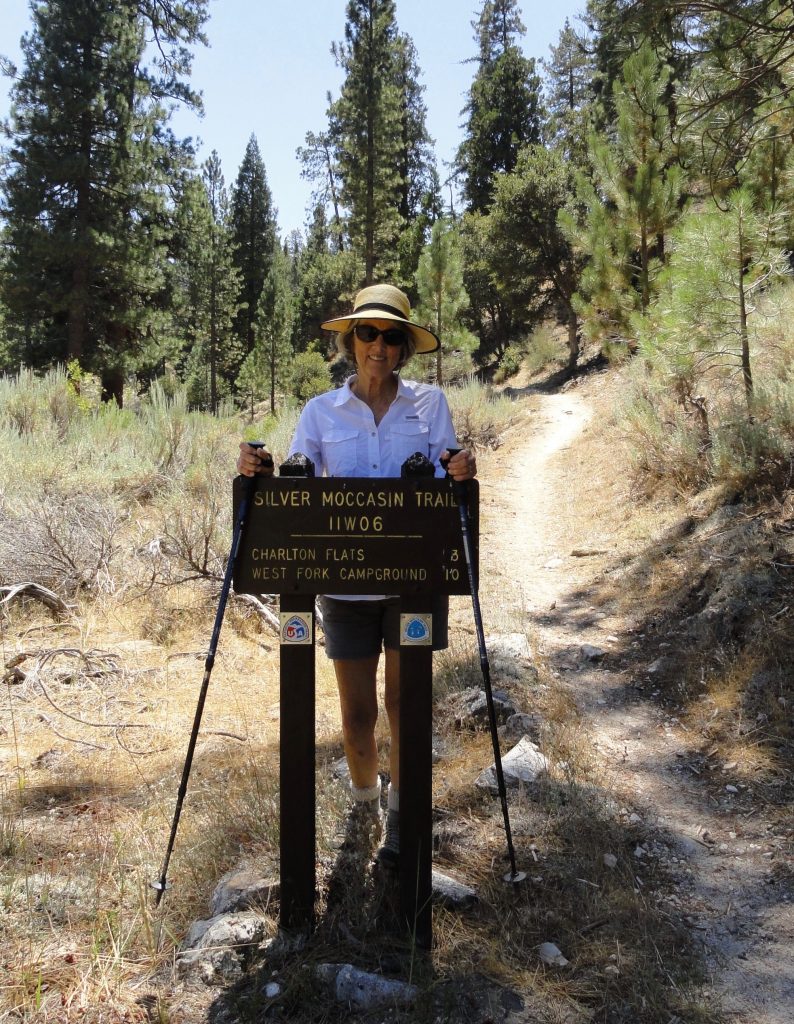
Joanie graces the Silver Moccasin Trail sign at Chilao. This is the view looking south back toward Chantry Flats.
Last Wednesday, my wife Joanie and I headed west for 33 miles on Highway 2 from our home in Wrightwood to Chilao. Also known as Chilao Flat, this gently rolling terrain of forest trees is located about midway between La Canada and Wrightwood on the scenic and diverse Angeles Crest Highway 2. Chilao has a U.S. Forest Service fire station that is home to the Chilao Hot Shot firefighters. There is a beautiful visitor center staffed by volunteers (usually open on the weekends) along with the carefully relocated and restored West Fork Guard Station built by the turn-of-the-century ranger Louis Newcomb in 1900. There are scores of places to car camp, both for groups as well as individual campsites available on a “first come – first serve” basis. Many of the campsites, such as those of the Little Pines Loop, have piped water as well. If you’re looking for a place to have a meal, a cold beer or just to rub elbows with lots, and I mean lots of motorcycle riders and sports cars owners, make sure to stop at Newcomb’s Ranch Inn, just a few hundred yards up Highway 2 from the upper Chilao entrance. The experience is the opposite of hiking, yet worth experiencing if you have the time.
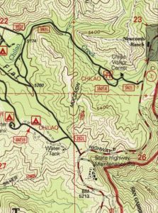
Detail of the U.S.G.S. Chilao Flat quadrangle, 1995 edition. Our route from Chilao Creek to Little Pines Loop via the Silver Moccasin Trail. Little Pines Loop is in the spot on map labeled as “Water Tank” just to left, northwest, of Highway 2.
Joanie and I had come to Chilao to hike a small section of the Silver Moccasin Trail. We parked about 3/4 of a mile down the quiet paved lane from the visitor center at a point where the trail crosses the road. In the sun, it was pretty hot, yet under the canopies of the tall incense cedars, Ponderosa and Jeffrey pines, a gentle breeze kept us cool and comfortable. We decided to head south, toward the Little Pines Campground Loop about a mile away. Our friend Kevin, the ranger at Chantry Flats had written us the good news that there was still water at Little Pines, a fact that would make things extremely convenient for a backpack trip I was about to go on with a couple of friends in mid September. We’re going to be hiking from Sierra Madre to Wrightwood, with much of the route on the Silver Moccasin (established in 1942 by the Boy Scouts of America) and also the Pacific Crest Trail (PCT) over the course of six days. Little Pines will be the second night out on the trail. This time of year, there are days on the hike where you can expect up to ten miles between any water at all. Joanie and I wanted to see how the trail approached and left the campground. Also, it was just a great excuse for hiking through the gently sloping and forested terrain of Chilao Flat in the middle of the
Stopping to admire one of the stately incense cedars found at Chilao. Silver Moccasin Trail.
San Gabriel mountains.
We immediately crossed the sandy wash of Chilao Creek wading our way through wild grasses, following the trail through glades of pine, cedar and sage. Eventually, we climbed up a small draw in the hillside, passing under Big Cone Spruce and alongside remnant burned trees from the 2009 Station Fire. We made our way up and over a ridge top that was baking out in the sun. Hills in the distance still held onto the upright skeletons of burned out pines and spruce from that enormous conflagration from nine years ago. In the distance it still looked bleak. Poodle dog bush and other chaparral plants filled in the rest of the scenery under the relentless August sunshine. Soon we made our way down another draw and into the pine covered coolness just outside Little Pines Campground. We found a spigot out in the hot sun, still attached to a burned post at one of the campsites. I turned the handle and the blessed liquid gold poured forth. Beyond good.
Joanie approaching Chilao Creek on the Silver Moccasin Trail.
Shade was the thing we needed right now! After a quick look at some of the campsites, we found a spot out from the sun, eating and drinking while sitting on wood chip covered ground. We walked back the way we had come. The air was quiet and peppered with the scent of pines, cedar and sage. Peace and tranquility reigned. Once, again, the mountains had delivered.