Posted on January 18, 2013 – Written by Chris Kasten
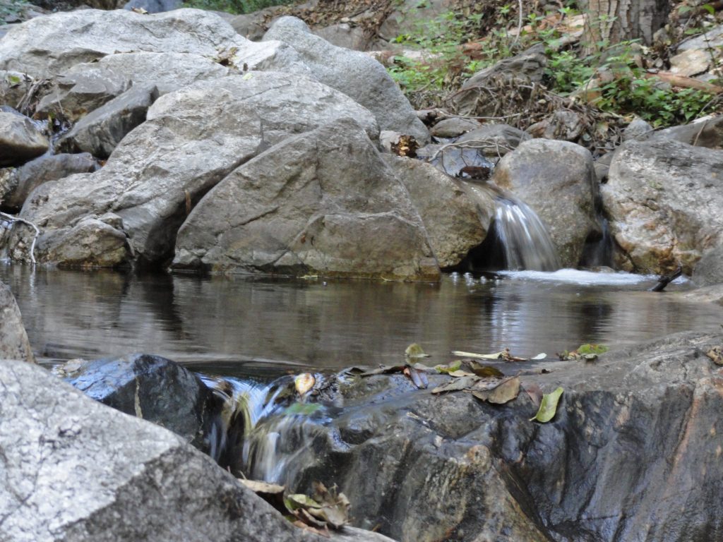
A tranquil pool just upstream from Sturtevant Falls, Big Santa Anita Canyon.
A series of recent rain storms, albeit gentle ones, are helping to bring the Big Santa Anita Canyon and Winter Creeks back up a bit. As of mid-January, we still haven’t seen any big storm systems hit the San Gabriels. Generally, a larger storm for the Chantry Flats area and most of the front-country, would be anywhere from 6 to 12 inches of rain…. or more. Back when I worked at Sturtevant’s Camp, there was an old L.A. County Flood Control rain gauge out at the heliport. It was a great spot for getting accurate reads of storms since there were no overhanging branches from the dense trees to throw off the true amount of water coming down from the sky. I had a chance to record 20 years of rainfall totals, and it was interesting to say the least!
The driest years were in the neighborhood of 11 (2002)to 20 inches total at Sturtevant Camp’s 3,200′ elevation. The wettest ones broke the 90 inch mark (2004-2005). Average years tended to be somewhere between 40 to 55 inches of accumulation. The snow level in the Big Santa Anita and Winter Creek Canyons tends to around 4,000′ up. So, at Sturtevant’s, while snow did occasionally fall, mostly what I experienced was cold, hard rain. It’s rain and snow, percolating down through the fractured and porous aquifer, that sustains our year-round stream. Although many side canyons only flow seasonally, the Big Santa Anita and Winter Creek flow throughout the driest of years. The watershed below Mt. Wilson is made up of myriads of steep, twisting canyons and all aspects of slope. This steep and tumbling country, heavily wooded, has an extensive surface area that can collect moisture and store it for years. A number of Angeles Forest trail maps that depict the routes up and around Mt. Wilson are available online, at outdoor retailers and the Adams Pack Station. It’s a good time to get out and explore this beautiful mountain.
Hopefully, some big storms are on their way! We’ll be glad this coming summer if it’s to be…
Posted on December 21, 2012 – Written by Chris Kasten
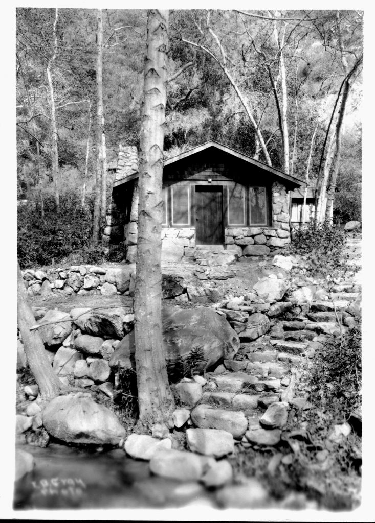
Cabin #64, Big Santa Anita Tract. This photo dates back to sometime prior to the great 1938 flood.
It’s Winter Solstice, today, December 21st. Joanie & I are hiking into the cabin today. The sun will go over the south ridge by 2:45 p.m. or so. Then the flat and diminishing twilight until the first twinkling stars appear. Sound of tumbling stream and chirping canyon wrens abound. The leaves have mostly fallen from the alders that huddle along the Big Santa Anita. Look up and see the fine, lacy branchlets that radiate out from the white-gray trunks.
As we approach Christmas and the day light is brief, I find this poem written long ago. Consider this:
“Old friends, dear friends,
As years go on and heads get gray
How fast the guests will go
Touch hands with those who stay.
Strong hands to weak, old hands to young
Around the Christmas board
Touch hands, touch hands.
The false, forget. The foe, forgive.
For every guest will go and every fire burn low
And cabins, empty, stand.
Forget. Forgive.
For who may say that Christmas Day
May ever come to host our guests again.
Touch hands. Touch hands.”
— W. H. H. Murray, December 25, 1897
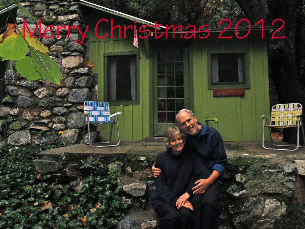
Joanie and Chris Kasten at cabin #63. Christmas 2012.
Take some peaceful time this Advent Season for yourself or with a close friend and hike up the Winter Creek, the Big Santa Anita, Manzanita Ridge, the Rim Trail to Mount Wilson, or out into the West Fork. It’s all good.
Posted on December 6, 2012 – Written by Chris Kasten
“Rather the flying bird, leaving no trace, than the going beast marking the earth.”
– Fernando Pessoa
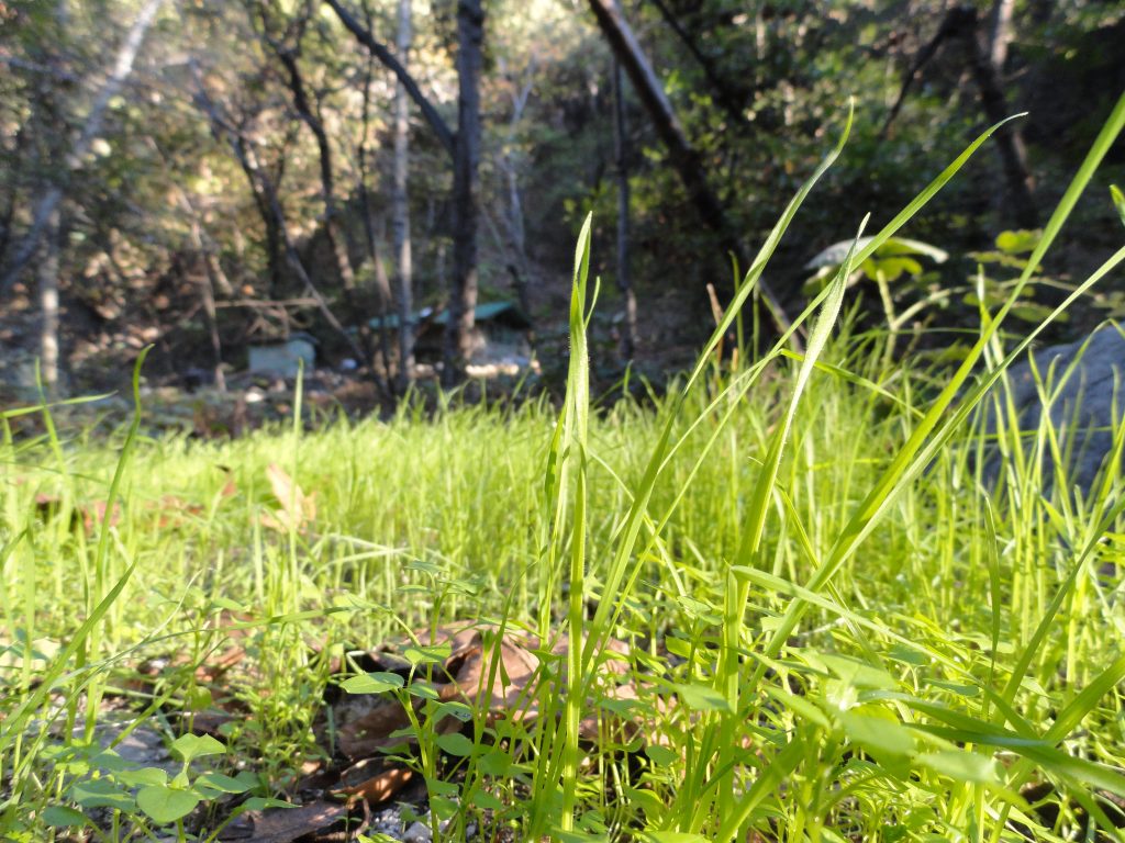
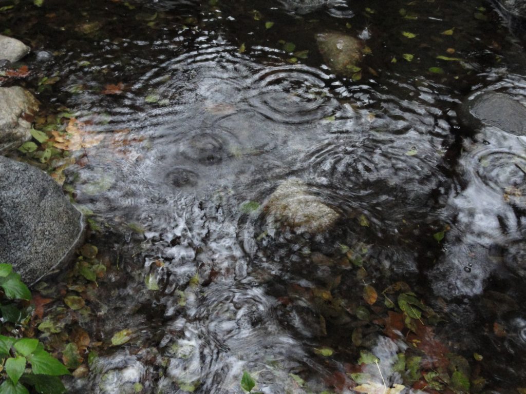
Early winter grass in the late afternoon sunlight. East Fork of Big Santa Anita Canyon.Concentric circles from rain drops. Fern Lodge, Big Santa Anita Canyon.
I am only hiking through these Santa Anita Canyon Trails. Watery, green and dusky in slowly fading light. My energy is concentric and light, gently touching all that is around. Yours is also reaching all around that place known as here and now. Bounce, yeah’ that’s it! Your circle touches mine and then they vanish. Maybe, just maybe…. it’s all circle energy bumping up against other circles… endlessly. Let our circles gently merge this day, this day which will never quite be the same ever, again.
The circle of the sun sends it’s warmth and visible light to our roundish earth, turning and turning in the circles of days. Our time in the canyons, that sacred time, albeit brief – comes back to us in circles of memories that connect us to this earth – our only home. Today I’ll feel this place, this place within and this place without. The two merge and are no longer two. The illusion of the you and I, that and this, then and now blending to one whole. The daylight grows shorter, just a bit, each day as we approach winter solstice. May the light and darkness help me to find my way home.
Posted on November 16, 2012 – Written by Chris Kasten
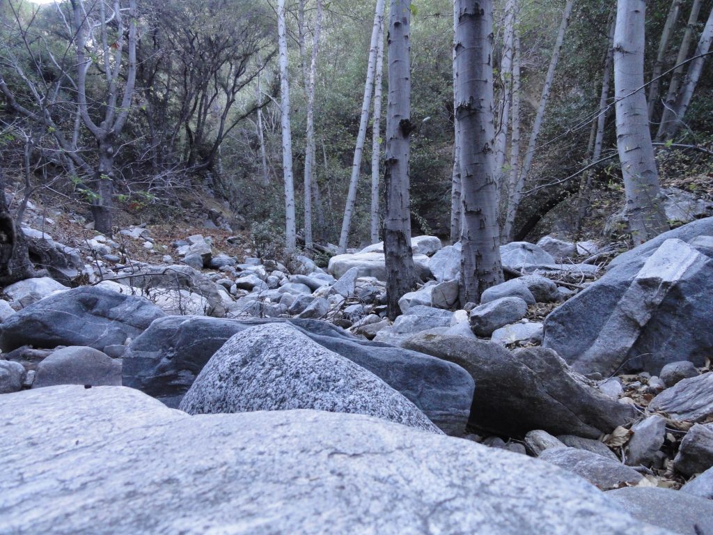
Bouldery stream bed, East Fork of Big Santa Anita Canyon
I was poking around up in the Big Santa Anita Canyon’s East Fork the other day. It was morning and a flat, gray light lay all around me. Jumping from boulder to boulder in a stream bed of dry leaves and sand. Completely quiet all around – and cool. It felt as if this time of year was still holding its’ breath for the storms to blow in and fill our canyons with roiling waters.
So, I hung out on a smoothy polished boulder about the size of a Volkswagen Beetle and just did nothing. The more nothing I did, the more that came into view and the more that became audible. Within a few moments, the soft hush of a down canyon breeze filtered through the boughs of some big cone spruce trees clinging to the steep slope above. The tangle of leaves, downed trees and rock began to take on increasing detail and clarity. The subtle variations of color in fallen leaves went from one to over half a dozen shades that my eyes could make out. In the beginning of my stillness, my mind was doing its’ constant thinking thing with non-stop episodes of images and thoughts in words. After a little while, the thoughts slowed down and my images were more about where I was and less about where I’d been. The most significant part of all this is when the perceived – and I mean perceived – duality of I and Thou, me and you, self and scene….. begins to fade. Being here right in the present for a short time.
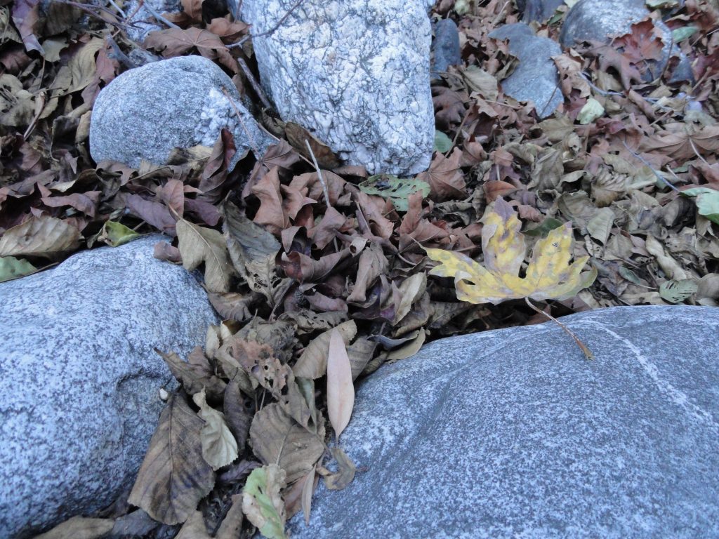
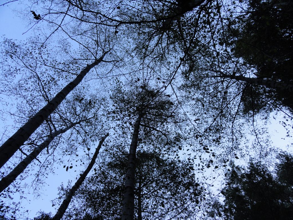
Gray morning light on cobbles and dry alder / maple leaves. East Fork, Big Santa Anita Canyon.Looking up into a canopy of dormant white alders. East Fork, Big Santa Anita Canyon.
The East Fork is such a wild place. No check dams here and no maintained trails. The breezes move up and down canyon just as they have for centuries. Fish and salamanders linger in the deeper, perennial pools. Rattlesnakes linger under shady ledges during summery months while deer and mountain lions traverse the higher slopes on ancient paths created by hooves and paws. The stream dries up in places as fall progresses and then becomes its’ naturally wet and turbulent self once, again. Over and over. Every pattern here is in the form of a circle. One can count on the return of the next season. This canyon is only what it is and has been. Just wild and free.
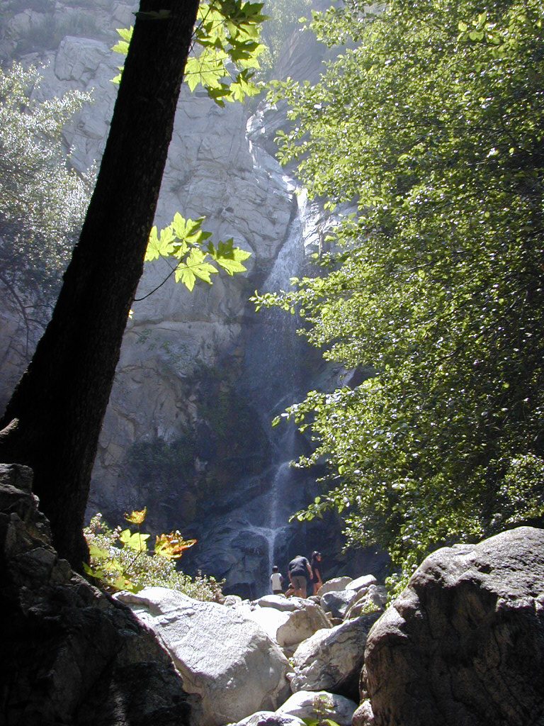
Posted on November 7, 2012 – Written by Chris Kasten
Late in the day on a summery afternoon at Sturtevant Falls in Big Santa Anita Canyon.
The pdf of the Trails of Big Santa Anita Canyon Map can now be downloaded from canyon cartography.com! This image has a resolution of 300 dpi. It sells for $1.99 and is compatible with all Apple IOS phones and I Pads. This is a great time to get out and experience the beauty of our front country canyons. Both Sturtevant and Hermit Falls continue to flow amidst the autumn colors of canyon maples. If you’re looking at hiking, running or biking up at Chantry Flats, this map will provide you with an uncluttered, easy-to-follow image that contains local place names, trail junctions, distances, elevations, locations of restrooms, campgrounds and more.
If you’re looking for a paper map, this same map sells for $4.95 + tax and ships to you for free.
Please remember to see the HIKES page at www.canyoncartography.com. This map, whether in the paper or pdf form is designed to be viewed in conjunction with the HIKES page.
Posted on November 3, 2012 – Written by Chris Kasten
During the autumn months, just feel the rapidly alternating damp coolness and warm dryness, literally within seconds of one another, as you’re hiking along the trail. The other night while we were hiking into the canyon under the dark canopy of white alder, laurel bay and canyon live oak, the nearly full moon followed us. Milky, white pools of moonlight settled into hollows ringed by the inkiness of canyon bottom darkness. The pondering of my fleeting mortality surfaces, as it always does. It is always as if there’s this mystery of visual intent, that something’s to be footnoted deep inside by this ghostly light that arrests our forward progress. Maybe just stopping and fixing our gaze in a direction that we’ve never taken the time for is meant to happen right now and right here. We’ll never see this, again, so drink it in. The term beauty seems to fall way short for description. All language fails to grasp it.
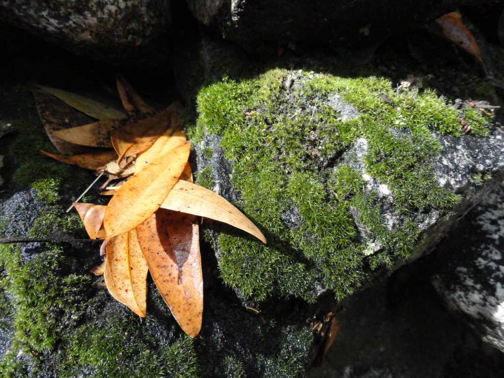
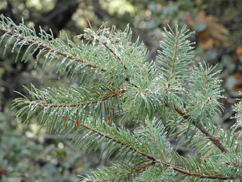
Fallen bay leaves amongst moss covered rocks. Big Santa Anita Canyon.Last night’s rain still clings to delicate needles on this Big Cone Spruce bough. Upper Falls Trail, Big Santa Anita Canyon.
Also, there’s the temperature side of these hikes that is so distinctly felt this time of year… Whether day or night, each little piece of the canyon has its’ microclimate. The cool dampness of side canyons such as San Olene, Bear Trap, Fern or Step-On-My-Toe bring their enveloping chill all around us at once. A moment later, you’re out on south-facing slopes and the dry heat mixed with scents of chaparral take you to another place. Not much longer up the canyon and you’re in the shady, moist recesses of Falling Sign Junction or beginning your descent into Cascade Picnic Area. That damp, spicy scent of bay leaves blending with grainy soils takes you one way and the dry blends of white sage and chamise take you another. This back and forth is no different than the pull and push of the ocean’s surf, bringing her gifts to you and then taking them back out. It’s as natural as breathing. While out in our front country canyons, the cool and warmth, over and over, again – instill their magic in us no less than the visual beauty of changing leaves.
Posted on October 27, 2012 – Written by Chris Kasten
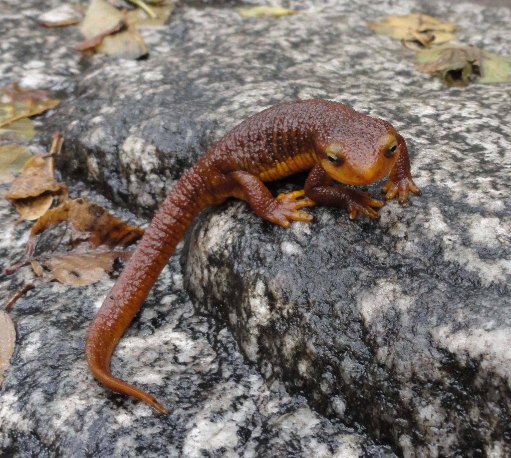
Coast Range Newt, Fern Lodge, Big Santa Anita Canyon.
“I’m digging this place! Look at me and you’re looking back, way back.”
This Coast Range Newt (Taricha torosa torosa), also commonly known as a salamander, is loving the moisture from our recent rains this last weekend. Look for these fascinating creatures along the streams during the wet months of the year, October through April. Try to keep an eye out while hiking and biking just after storms, since they’ll often be crossing the trails and tend to blend in with the soils around them.
Posted on October 19, 2012 – Written by Chris Kasten
Following mountain paths at the speed of walking or running is not only good for your head and your overall health, but may also be a way of reconnecting you to your natural pace and view of the world. As I mentioned in the last blog, I had read “In Praise of Slowness – Challenging the Cult of Speed” by Carl Honore. Not long after this reading, it dawned on me during one of my “commute hikes” to Sturtevant Camp, just how frequently we travel in our cars at 60 to 70 miles per hour without thinking a thing about it. After arriving at Chantry Flats and heading into the Canyon, we’ve now dropped our speed down to a safe and sane 2 to 3 miles per hour. If you’re running, then double or or even triple the speed. In any case, the difference in percentage terms between driving and getting yourself around on foot is startling. I chose 3 mph as an average walking speed for most of the trails that cover our front country canyons of the San Gabriel mountains. If I’m driving a conservative 60 mph or so (better be in the slow lane), then I’ve increased my travel speed 2000% or greater! Now, I’m not even talking about the speed of flying in airplanes or jets, which would bump this percentage increase to 10,000% or greater…. All this change is just land-based travel.
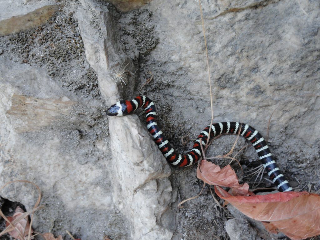
A Coral Mountain King snake makes her way along the Upper Falls Trail, Big Santa Anita Canyon. Those reddish fallen leaves are poison oak.
We’ve been driving mass-produced cars for just over a century now. Henry Ford came out with his Model T for the masses in 1908 which isn’t all that long ago – really. And the freeway / highway system as we understand it today in the United States didn’t exist until the Interstate Highway Act of 1956. Prior to that, many good roads existed under their own numbering system, yet did not connect to any grand scheme for the cross-country traveler. So, driving 60 mph or greater, was not a long distance assumption that could be made in the lower 48 states. Even though I use the 60 mph speed as a benchmark of what we do all the time without really thinking.
Looking back over the development of humans as a species (Homo sapiens), the best we have to go on as of this writing is that our species evolved into “anatomical modernity approximately” 200,000 years ago. This “Out of Africa” theory is widely supported and dates back to Charles Darwin’s book, “Descent of Man” from 1871. DNA analysis now corroborates this theory. Looking at our “behavioral modernity”, the current take on this is approximately 50,000 years ago. See Stephen Oppenheimer’s “Out of Eden” for an elaboration on the development of music, religion and other human developments. Wikipedia is a good place to start on both these themes of human origin.
Let’s say we take the 50,000 B.C. benchmark as the beginning of human development and social tradition. That’s a good long time to discover and develop our view of the planet’s surface with all its’ variations in terrain and climate. It’s also a good period of time for the development of certain forms of muscle development, navigational skills and memory for covering different landscapes and all the textures that come with it. You could say that our collective DNA, a redundancy in definition, has compiled all these traits and skills as they relate to our relationship within the context of walking, climbing, running and swimming. This is a collective conscience that we all carry and continue to develop.
Finally, all this takes us to another facet of the 2000% rule….. Most humans, in developed nations, such as the United States – live approximately 72-78 years on average. Pushing that number to 80 years, there are about 625 human lifetimes, back-to-back, in 50,000 years of time. On average, human generations are about 20-22 years ion length (see: Strauss & Howe’s “Generations – the Generational Diagonal”) if you look at American generational theory for the last 500 years. Therefore, in numbers of generations, that figure jumps to nearly 2,500 generations experiencing this earth and its’ myriad opportunities and challenges in 50,000 years. For nearly all this time, we’ve been living at 2 to 3 mph on land, with the exception of running.
That said, we’ve increased our daily speed 2000% in 0.2% (1/500th) of the time we’ve developed into modernity! There is no curve, just straight up.
This increase in daily speed is beyond striking, perhaps even challenging to the biology of a person. Not that we can’t adapt, most of the time we have, however, it isn’t without its’ shadow. It’s hard to stay present to the earth as our ancestral selves remember it when we’re ramping up our speeds routinely and our biology lagging far behind in the grand scheme of things. We’re not even considering the effects of instantaneous forms of communication that we take for granted! Hiking, walking or running, however you do it, pulls us back to the rhythm and pace that we’ve adapted to over the tens of thousands of years. Spend part of your day on the trails up and down our canyons to reconnect to the expansive part of you that these modern times have yet to earn. As the adage goes: A person sees more in a mile of walking than 100 miles of driving. You might just remember and enjoy more of it, too!
Posted on October 11, 2012 – Written by Chris Kasten
Autumn is a great time to get out and hike the trails out of Chantry Flats. With the recent cooling temperatures and even a little rain on the way, this coming week should feel refreshingly fall-like. The dust of the trails should be laying down and the spicy scent of fallen bay leaves will awaken you. This last week I photographed a couple of the accompany scenes that evoked a sense of returning to my favorite time of year.
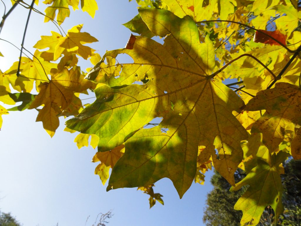
Looking skyward through a canopy of Big Leaf Canyon maples. Big Santa Anita Canyon.
Big leaf canyon maples, once referred to as “water maples” (see “The Southern Sierra”, Charles Francis Saunders) are plentiful along stream courses in most of the front country canyons of the Angeles. Occasionally, if you look high up the slopes, well above any stream bed, you might spot one of these trees that’s gotten a toe hold in a fold or shady nook that provides just enough water to eke out its’ existence. Maples are deciduous, meaning that they drop their leaves and remain dormant until spring makes her return. The maples you’ll see in the Big Santa Anita and Winter Creek canyons are all of the same species (Acer macrophyllum), are capable of producing really large leaves and produce shade throughout most of the year. In the fall, their leaves begin to produce tinges of yellow in the margins, gradually becoming mostly yellow-gold by the time we’re approaching late October to early November. By mid-December, most of their leaves have fallen to the ground, their smooth gray trunks often contrasting vividly against the dark green-blues of canyon slopes.
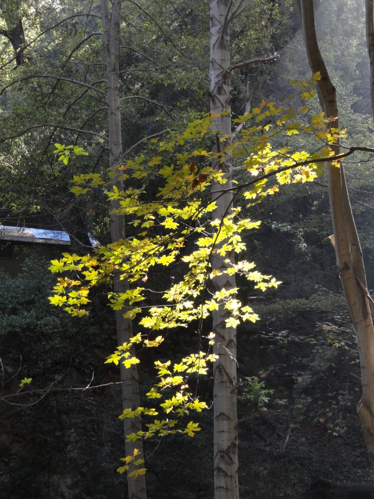
Big Leaf Canyon maple is backlit in the Winter Creek. Big Santa Anita Canyon.
One of the memorable sides to fall in our canyons is the wonderful, earthy scent of the maple leaves mingling with the damp soils. Like so many of our long-term memories, scent is a trigger for reliving events and places. There’s this eternal aspect to every year’s return to autumn. Over the years, I’m drawn back to some place deep inside. It’s as if hiking back to the same haunts that I visited when still a child continue to call me with the same longing, yet at a later time in life. Is there any way of merging with this scene? Will I ever consummate this relationship, dissolving once and for all the illusion of the duality of myself and the outdoor world? Traveling throughout our canyons in the fall, regardless of how you do it, may be some kind of a timeless redux at wholeness and merging with this earth. However, it takes time. For things to stick, it may take both time and stillness. A chance to absorb what’s going on between us and the scene. A time to come home.
This makes me think of a book that I picked up years ago at Christmas time that I’ve continued to return to, again and again. It’s entitled “In Praise of Slowness – Challenging the Cult of Speed, by Carl Honore. Here there are great insights into the habit of occasionally slowing down our fast-paced lives in favor of becoming present to what is right around us, right now. The fall season may be just that, a reminder to not only go inside ourselves, but to be present to this moment before us. That somehow, being present to all this day is miracle enough.
Posted on October 3, 2012 – Written by Chris Kasten
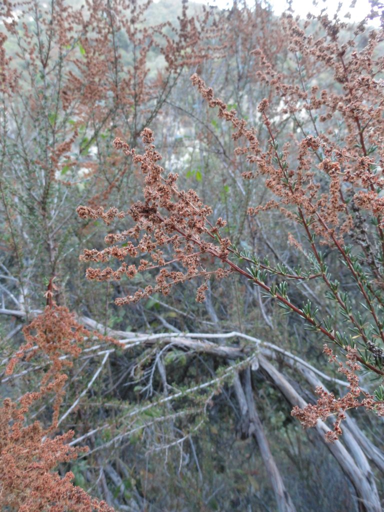
Dried flower stalks of Chamise, a fire indicator species found throughout much of the chaparral plant community.
We’re only about two weeks into the autumn season and the Big Santa Anita Canyon is giving us all kinds of hints of change. When you hike by cabin #23, just above Roberts’ Camp, you’ll see an expanse of yellow-tan bay leaves all around the place. If it’s later in the day, the scene seems to create a warm glow of its’ own. Many maple leaves are on the ground as well, due especially to the extreme dryness of the soils. Many of the plants here are members of the chaparral plant community, drought tolerant to say the least. Just go a short distance upslope from any stream bottom and you’re quickly in a world of prolonged heat and dryness, especially on south and west facing slopes. Pictured here are three examples of plants commonly found along our trails that radiate out of Chantry Flats. Chamise, poison oak and buckwheat have been transitioning into their fall colors for a month or more. If you’re bouldering down among the lower reaches of Big Santa Anita’s East Fork, the stream channel is choked with the delicate, crisp leaves where water hasn’t ran in months. When a tree squirrel runs and jumps through this scene, it can startle you with thoughts of bears and deer ambling along.
The water flowing over Slider Rock is a narrow, slick thread of stream. The creeks that still flow are only a whisper of their former selves. Hiking along, even in the evenings, there’s hardly any stream sound at all. Once in awhile you’ll hear a deep gurgling of water in nocturnal hollows, reminding you that our stream’s well and alive. That this has happened before, perhaps thousands and thousands of autumns past.
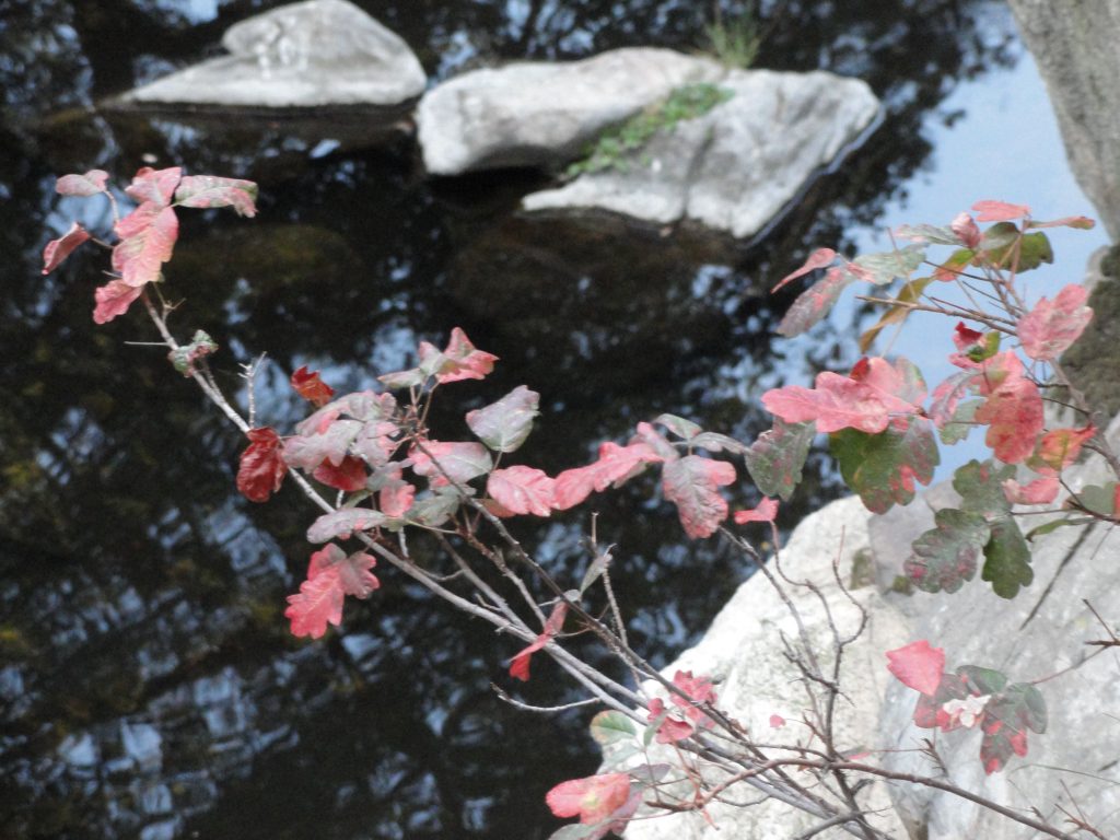
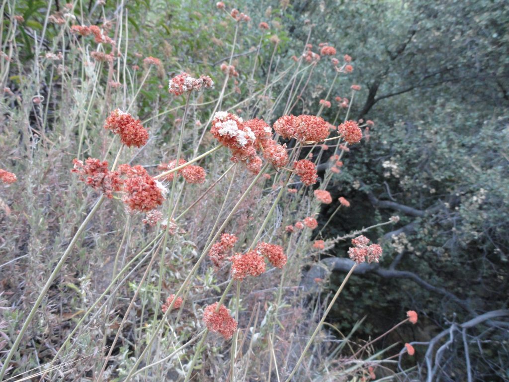
Poison oak leaves turning crimson in the fall.Buckwheat flower stalks. Soon, these flowers will turn to a rusty red color for the duration of autumn and winter.
In the weekend mornings, as droves of hikers and mountain bikers make their way up and down the main canyon, watch the talc-like dust hang in the sunlit air above and about the trail. Motes of thick gold light illuminate and hold still in your mind the hanging dust particles that surround the hikers moving past. Ivy leaves and blackberry bushes are covered in the dull patina of trail dust. There’s only one solution for this scene…. and it’s coming soon I hope. I gave up long ago forecasting the likelihood of a dry or wet winter on its’ way. Big acorns, little acorns or no acorns at all make no difference to me. So, no guesses here. Yet, I can hope for the quenching drink of early winter rains. There’s even room for the dreams of thick snows blanketing the dark, hidden slopes of the upper reaches of the Winter Creek and Big Santa Anita Canyons.
There are no Santa Ana winds gusting quite, yet…. They’re on their way. For now, we’ll live in the still hush, the holding pattern, until the winds and rains come.